Colombia – Coffee, Clouds and Condors

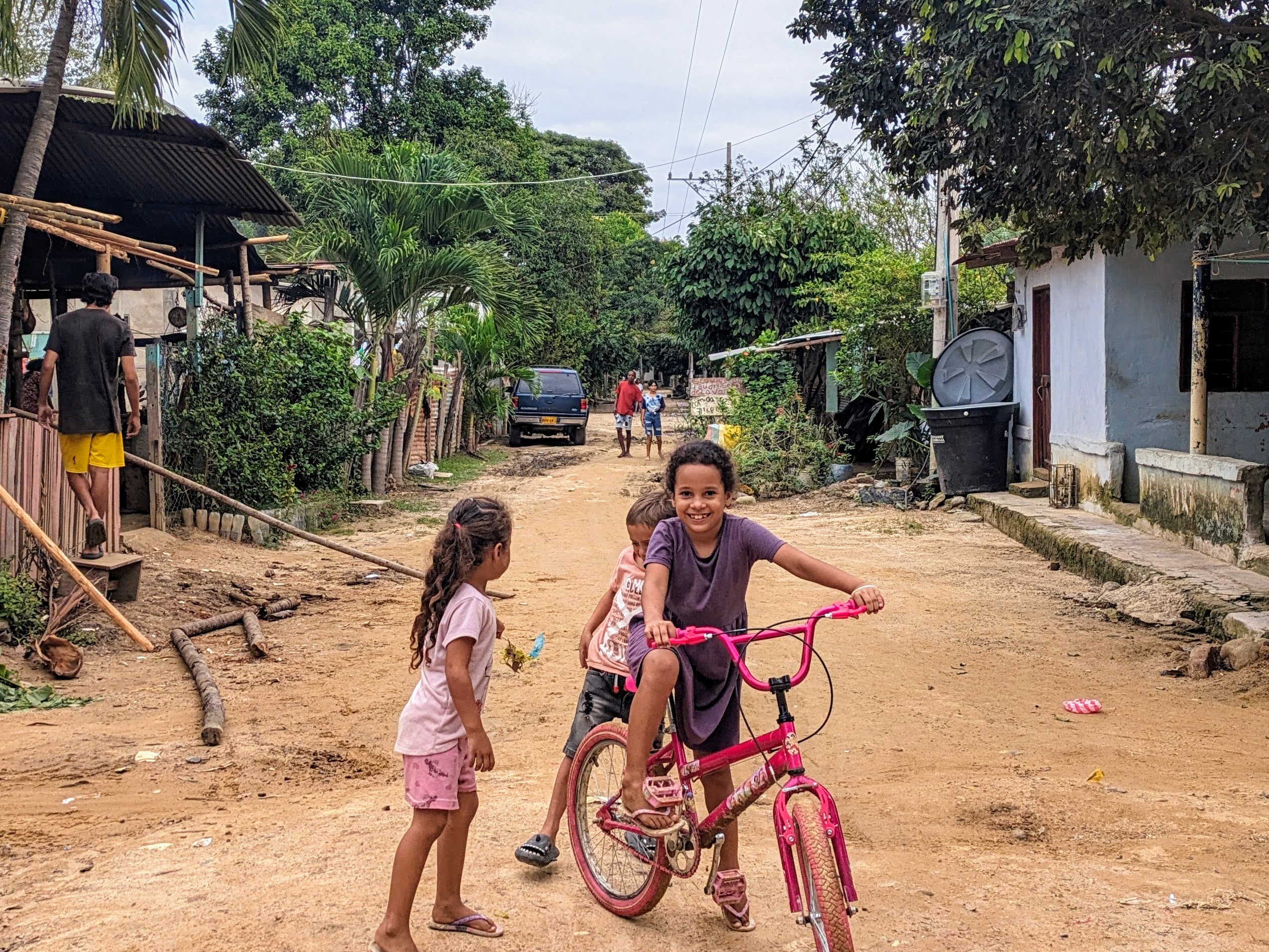
If you like to wake up and smell the coffee, then the colourful little Colombian town of Salento set amid green Andean mountains and coffee plantations may be your dream destination. Colombia has a reputation for producing excellent coffee and is the third largest grower of coffee after Brazil and Vietnam, so we were surprised to find that drinking coffee in most of the country was a real disappointment.🤨 I must admit that coffee isn’t really my cup of tea but Caoimhin, a coffee connoisseur, was disgusted with the coffee and even switched to drinking tea, water or some of the delicious fresh fruit juices. The reason for this conundrum? Apparently, all the best coffee is exported, leaving the locals with the dregs and it doesn’t help that Colombians like to stew their coffee for hours (or possibly even days) to produce a dark bitter drink called café tinto.  But not so in Salento, which has become a thriving tourist destination for coffee lovers from all over South America and further afield.

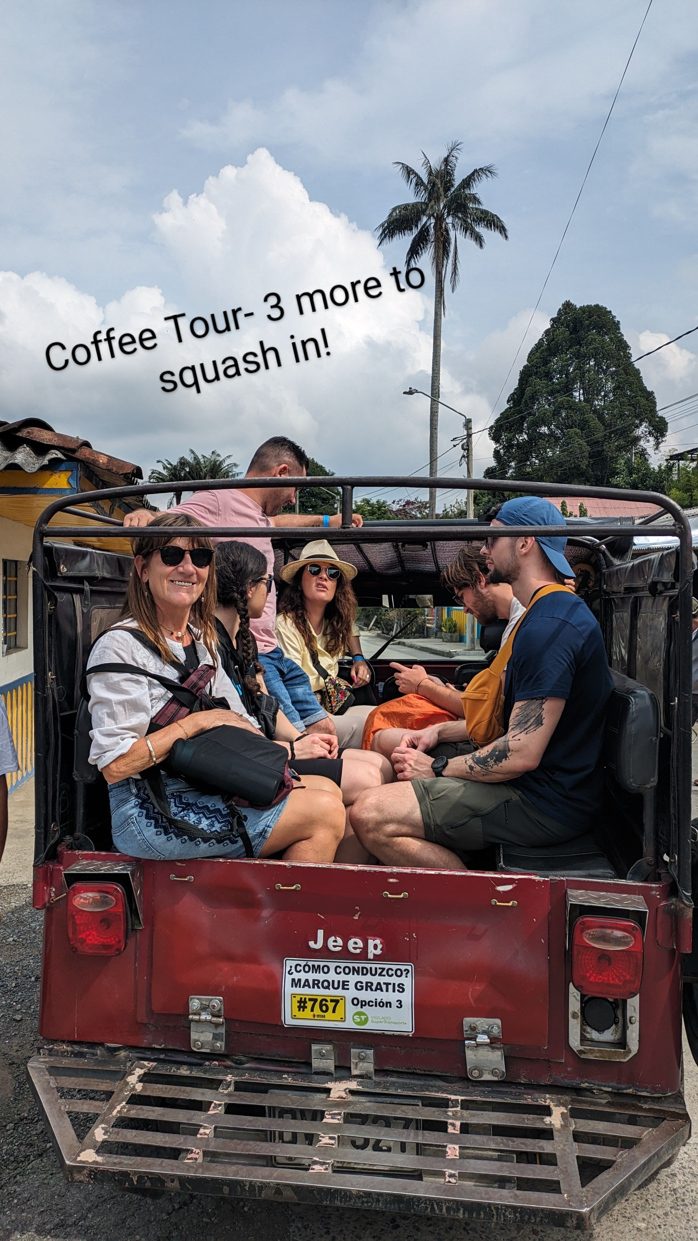
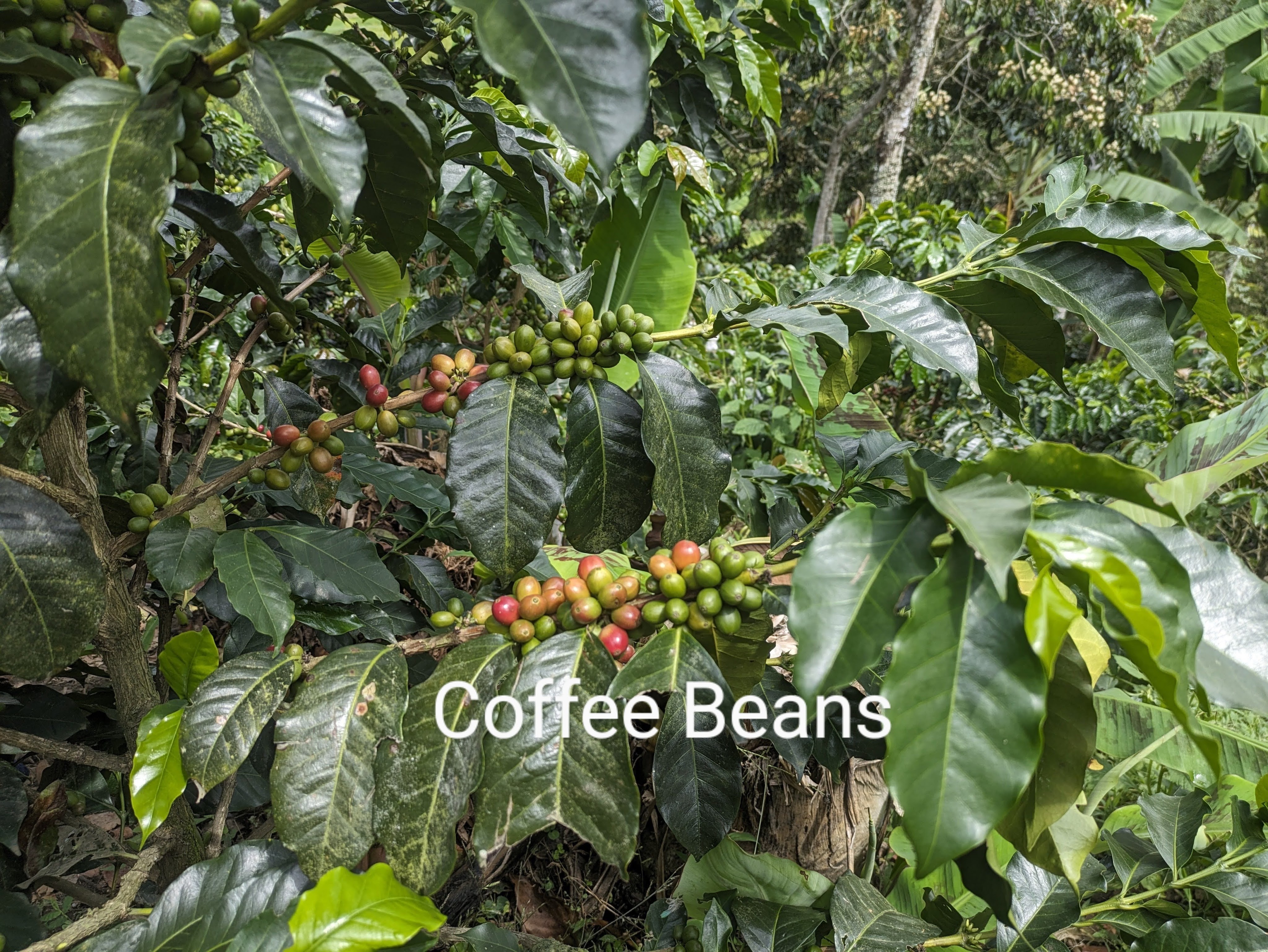
It is almost mandatory to do a coffee tour when in the town, tourists piling into dilapidated jeeps to jolt along dirt tracks to some of the numerous coffee farms doted in the picturesque hills. We opted to visit a small organic farm, Finca Don Ellias, which was both fun and educational.  All the coffee grown in Colombia is arabica, which grows at between 1000 to 2000m above sea level and gives a smooth taste while the other type of bean, robusta, grows at less than 1000m and generally produces a more bitter drink. We walked among coffee plants, their berries turning from green to ruby red, growing on a steep hillside interspersed with banana, avocado and orange trees. These other trees provide shade, absorb water, and attract flies and pests away from the coffee plants. On Don Ellios’s farm, every process was manual from composting to picking to bean separation to roasting which meant that coffee tours were as important as selling the coffee. Did you know that high roasting is often used with poorer quality bean, making coffee that it stronger and more bitter but lacking in subtle complexity? Of course, climate change is an issue here. The two harvests a year in April/May and October/November which used to be as reliable as clockwork have become problematic with changing weather conditions, the coffee berries ripening haphazardly at different times.

Grandmother’s Sock Coffee😉

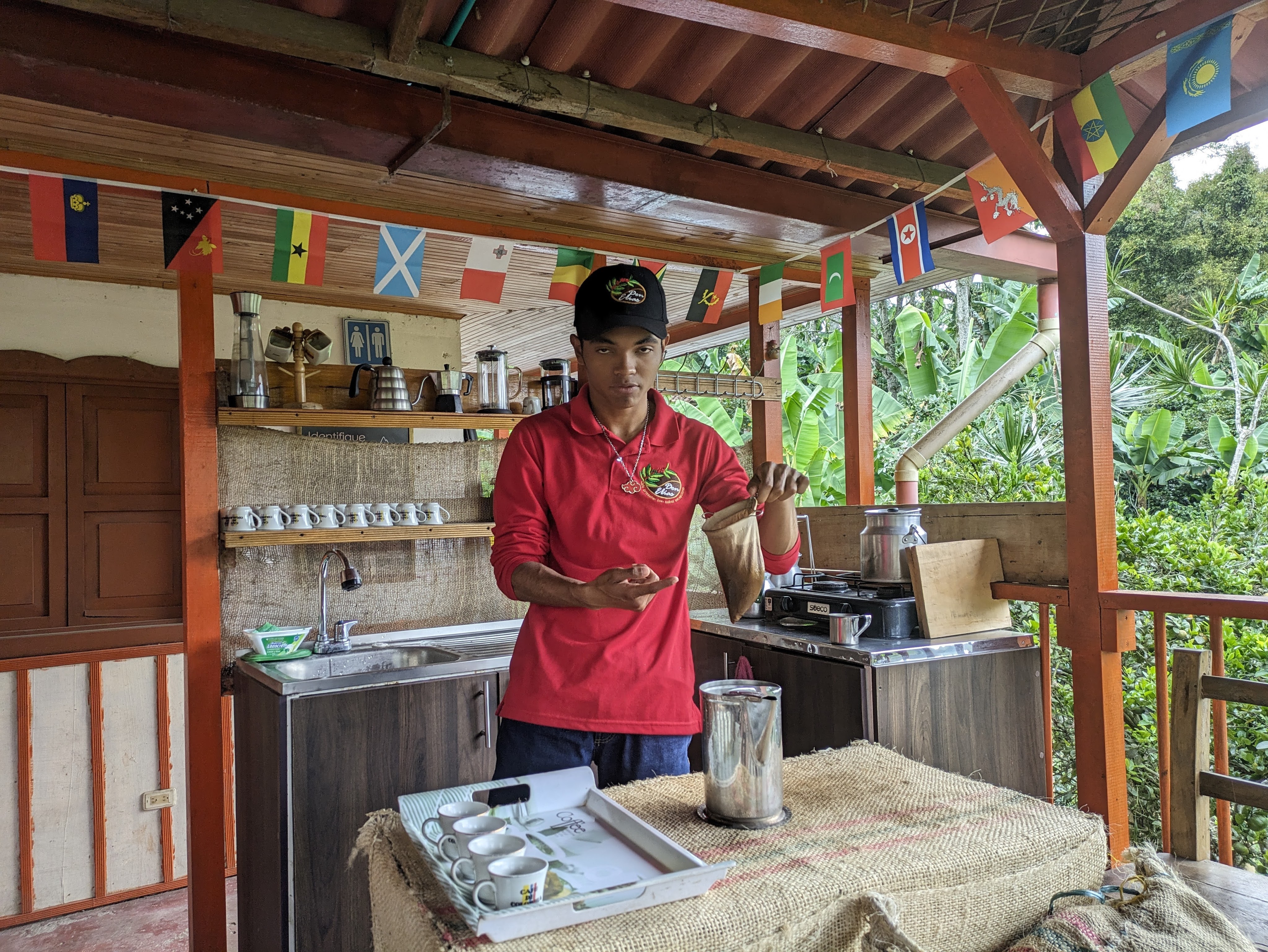
 The coffee ceremony which was part of the tour was quite elaborate involving heating cups, slowly adding water which was at 80C (never add boiling water!) to freshly ground coffee placed in a cotton filter known as ‘grandmother’s sock’. After two rounds of slow careful washing and discarding the liquid, our warm cups were filled with rich smooth coffee which smelt gorgeous and tasted pretty good even to my taste buds.

Our Guide, Fernes, and Ben and Dorien, our trekking companians (Waxed Palms in background)

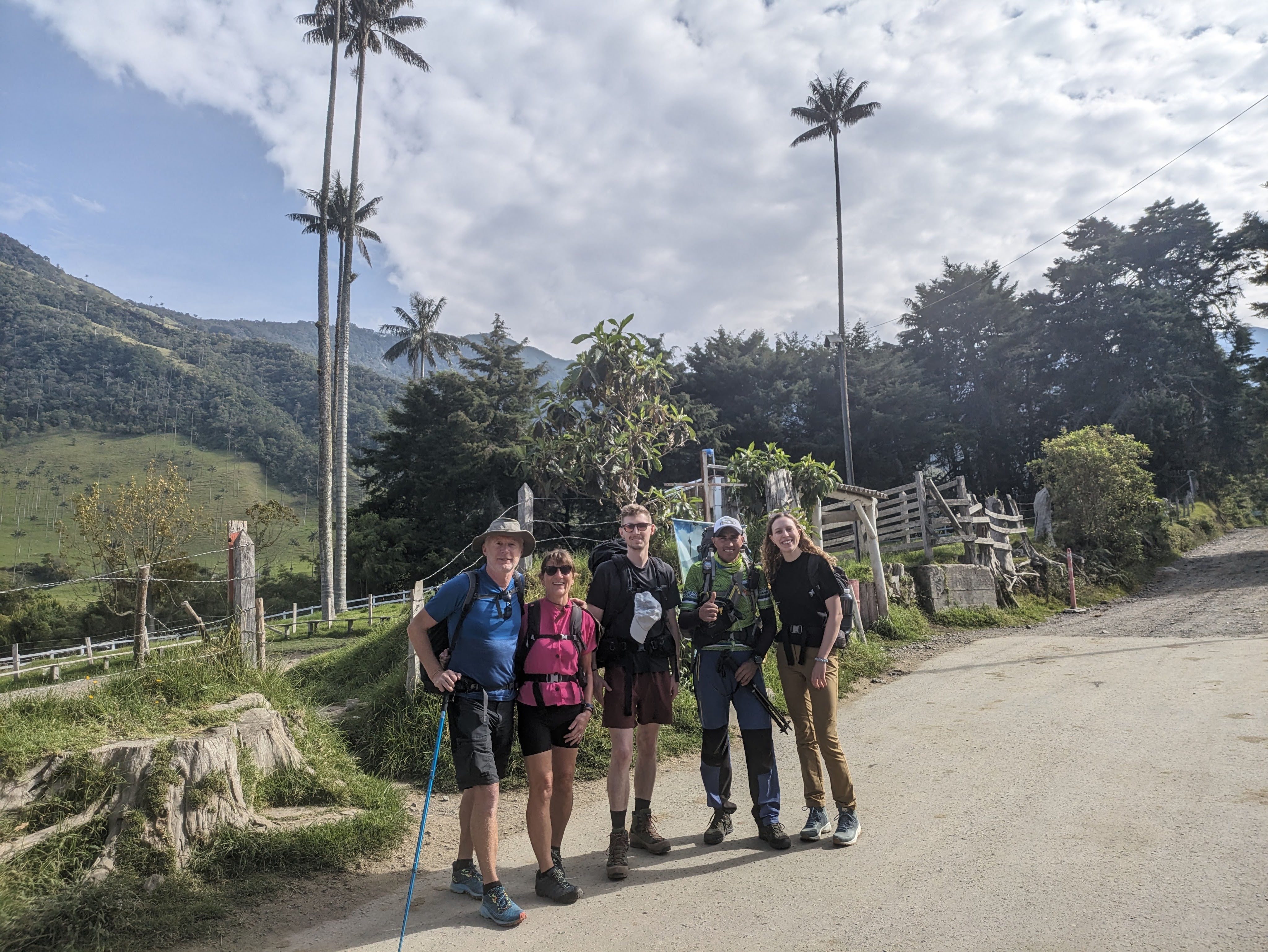
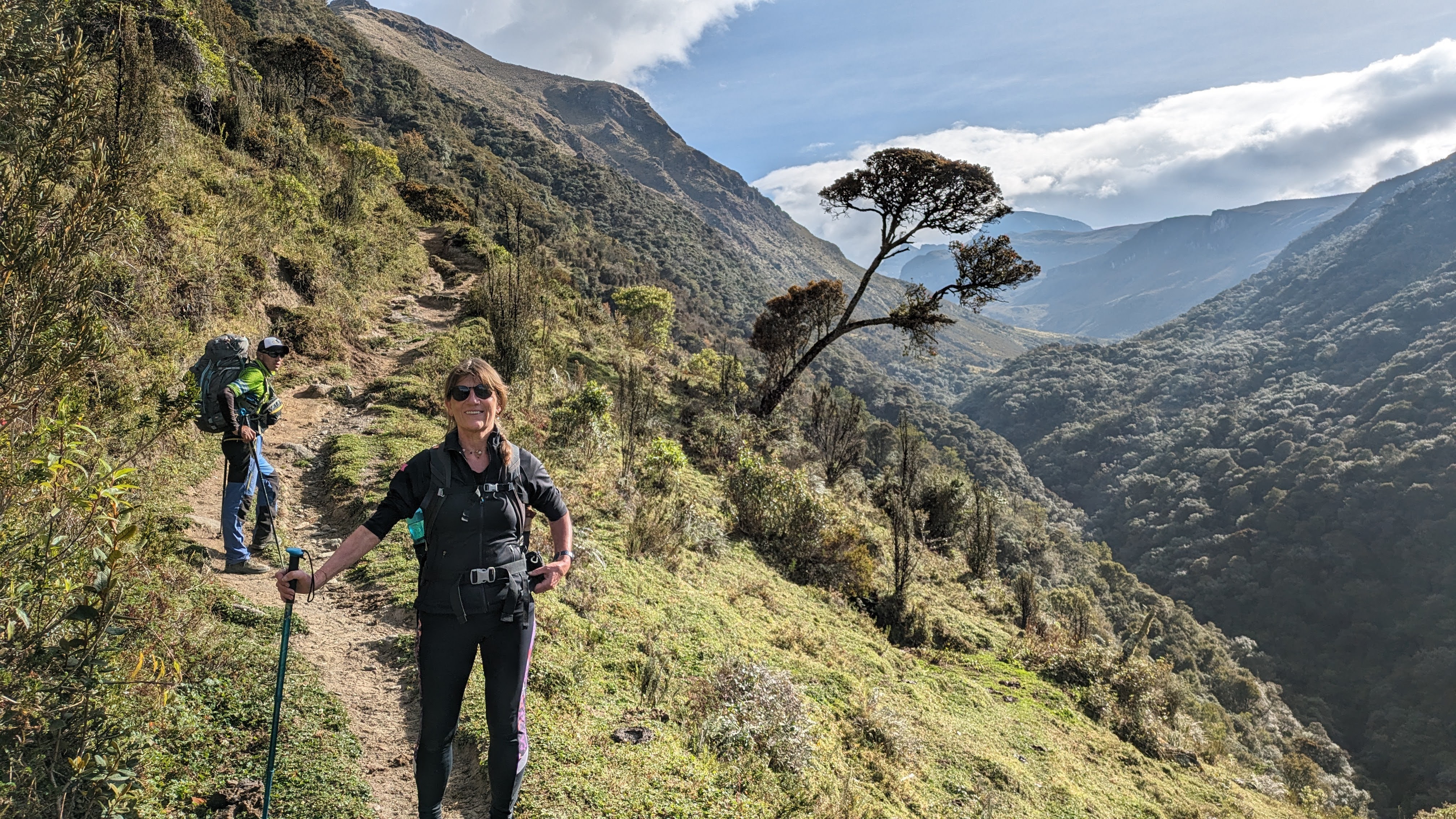
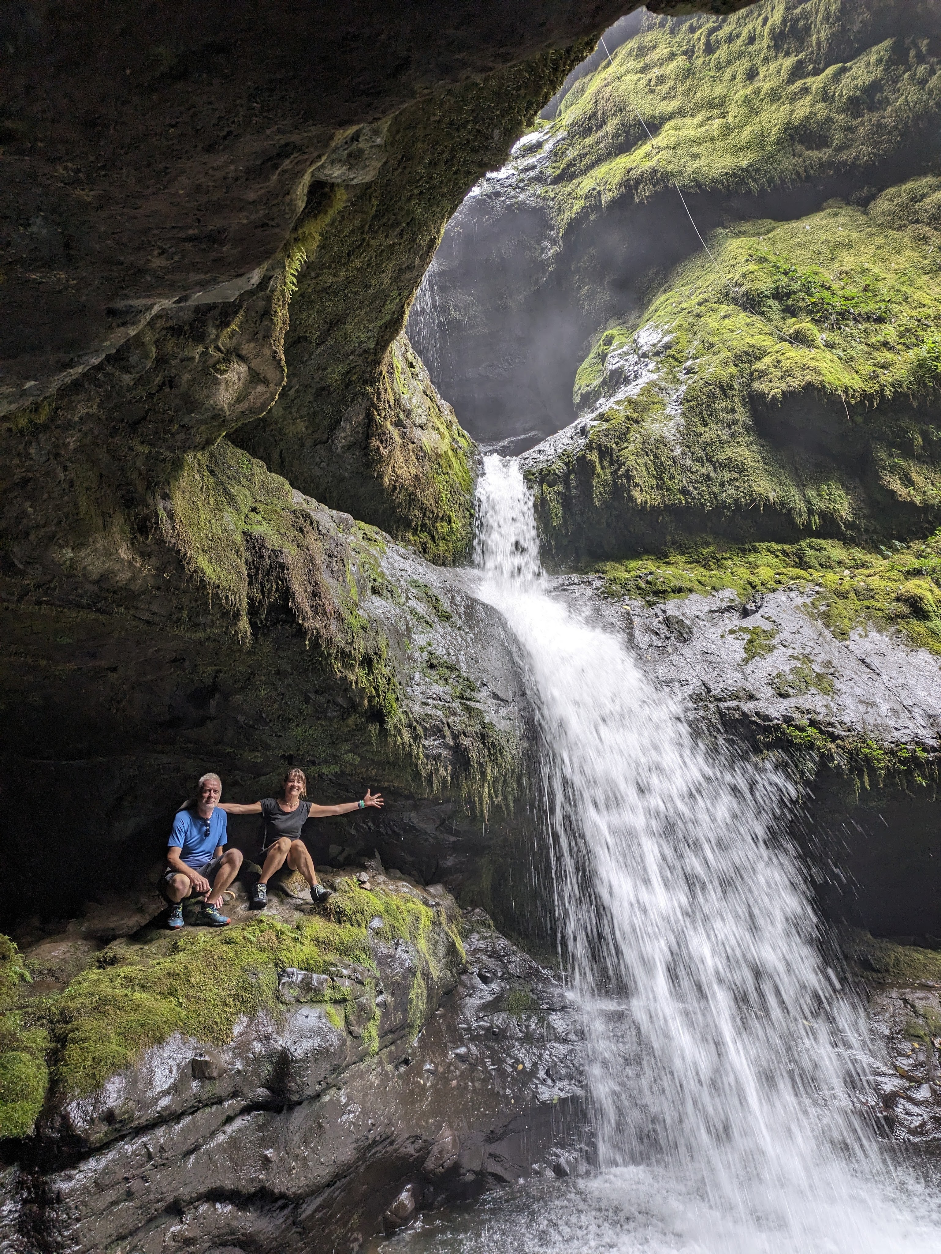
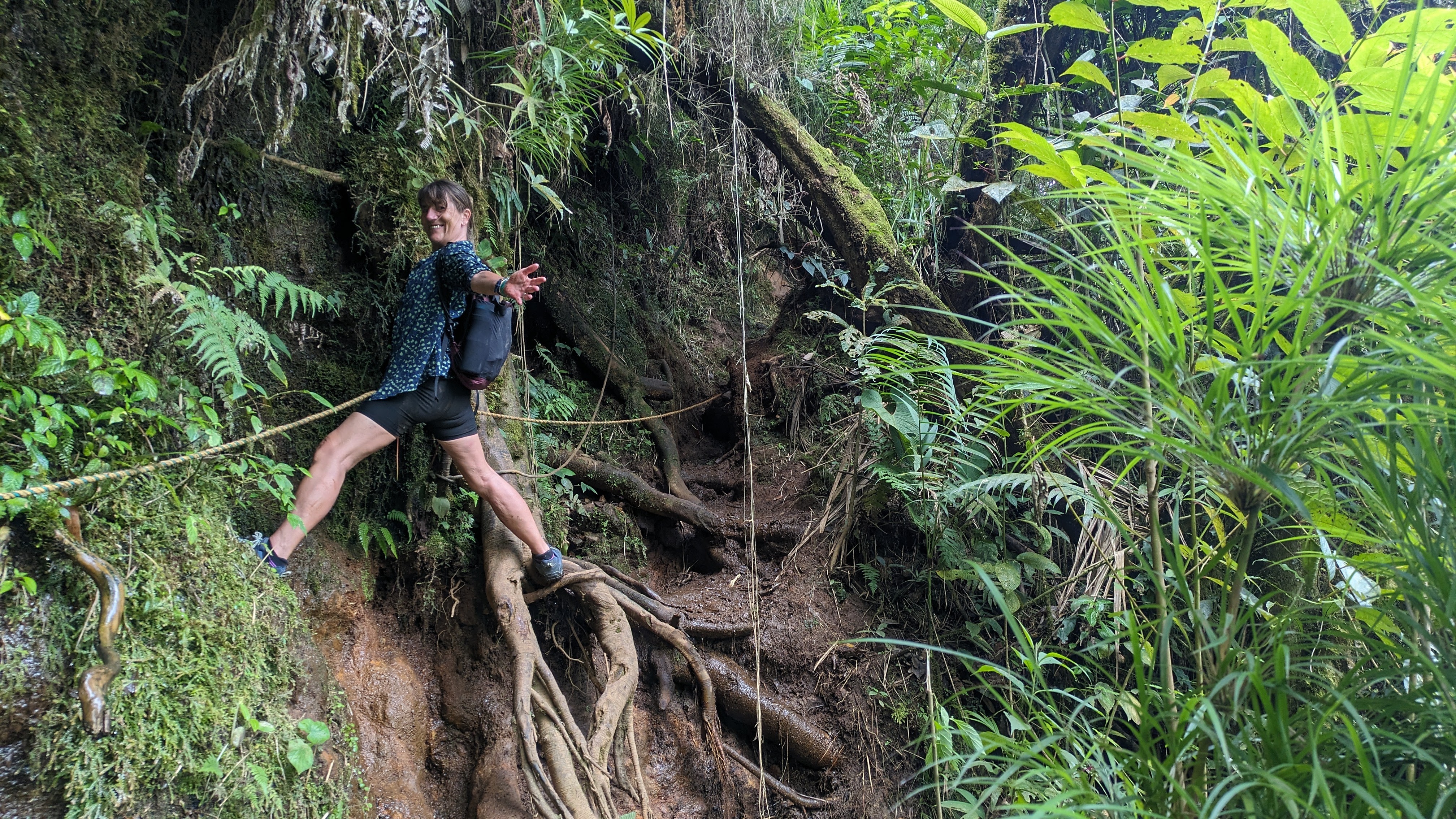
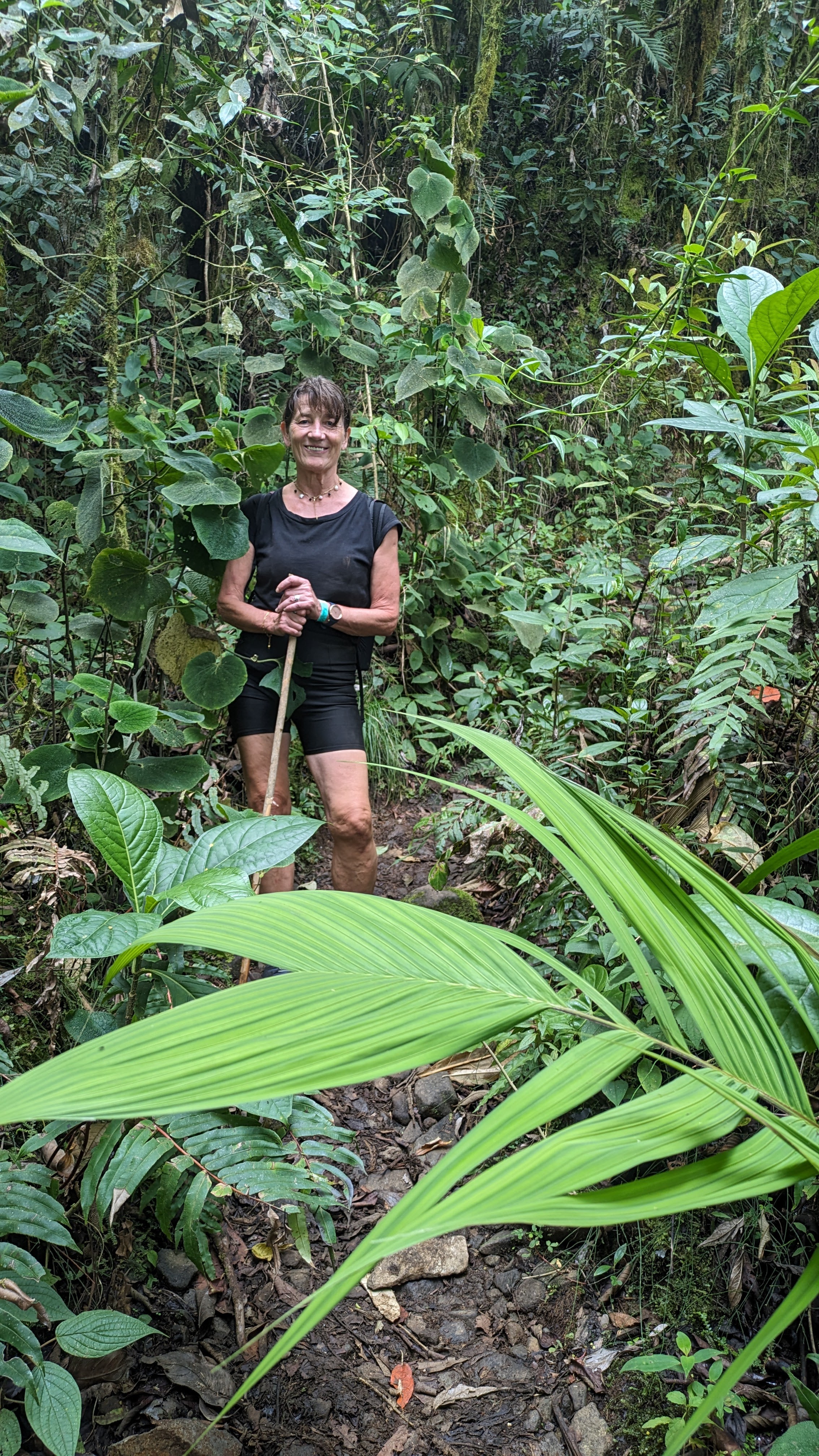
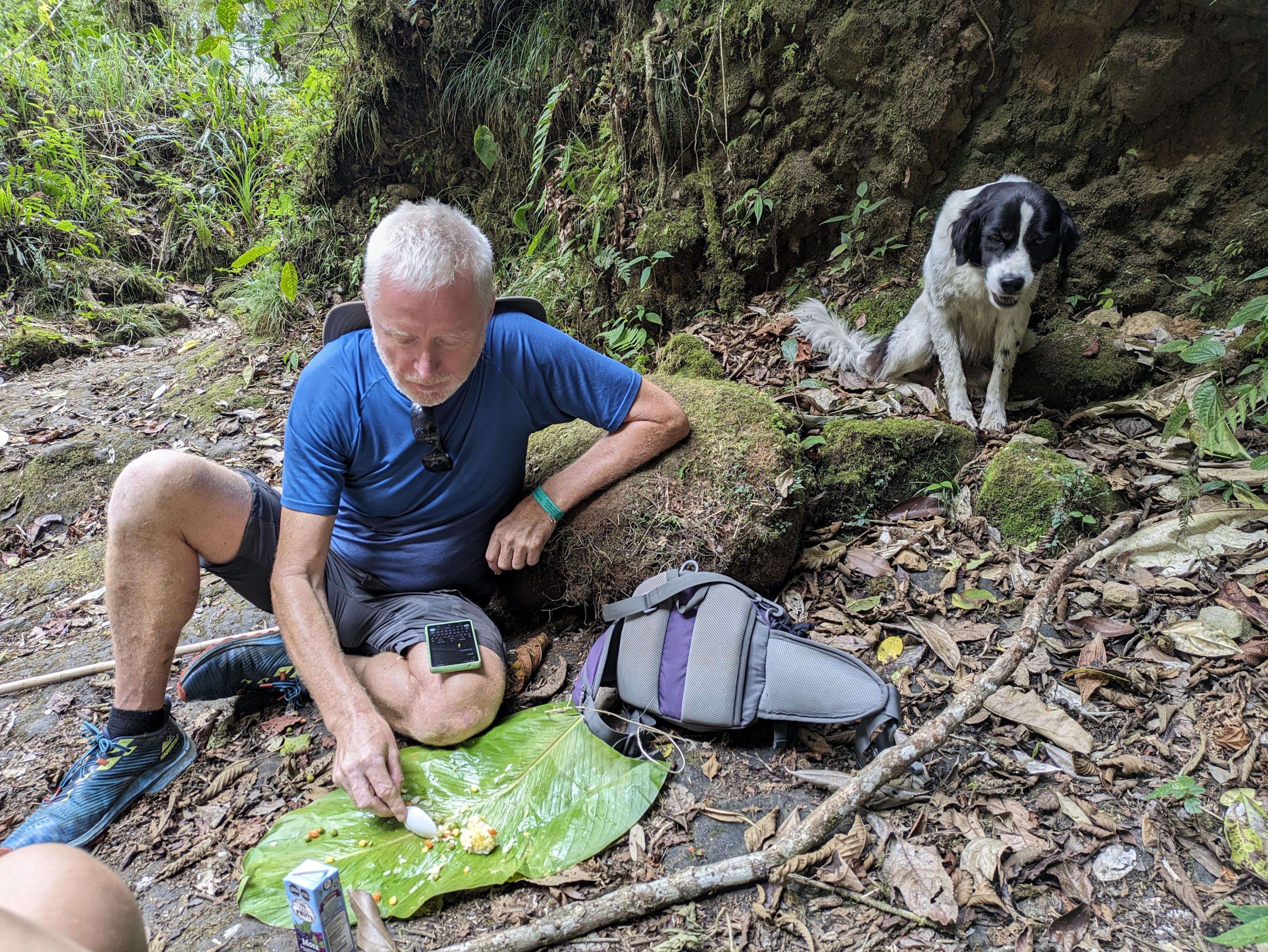
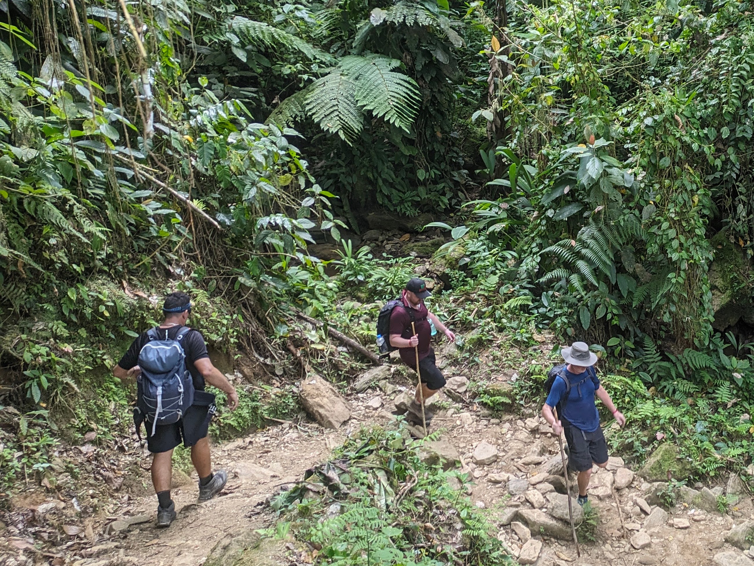
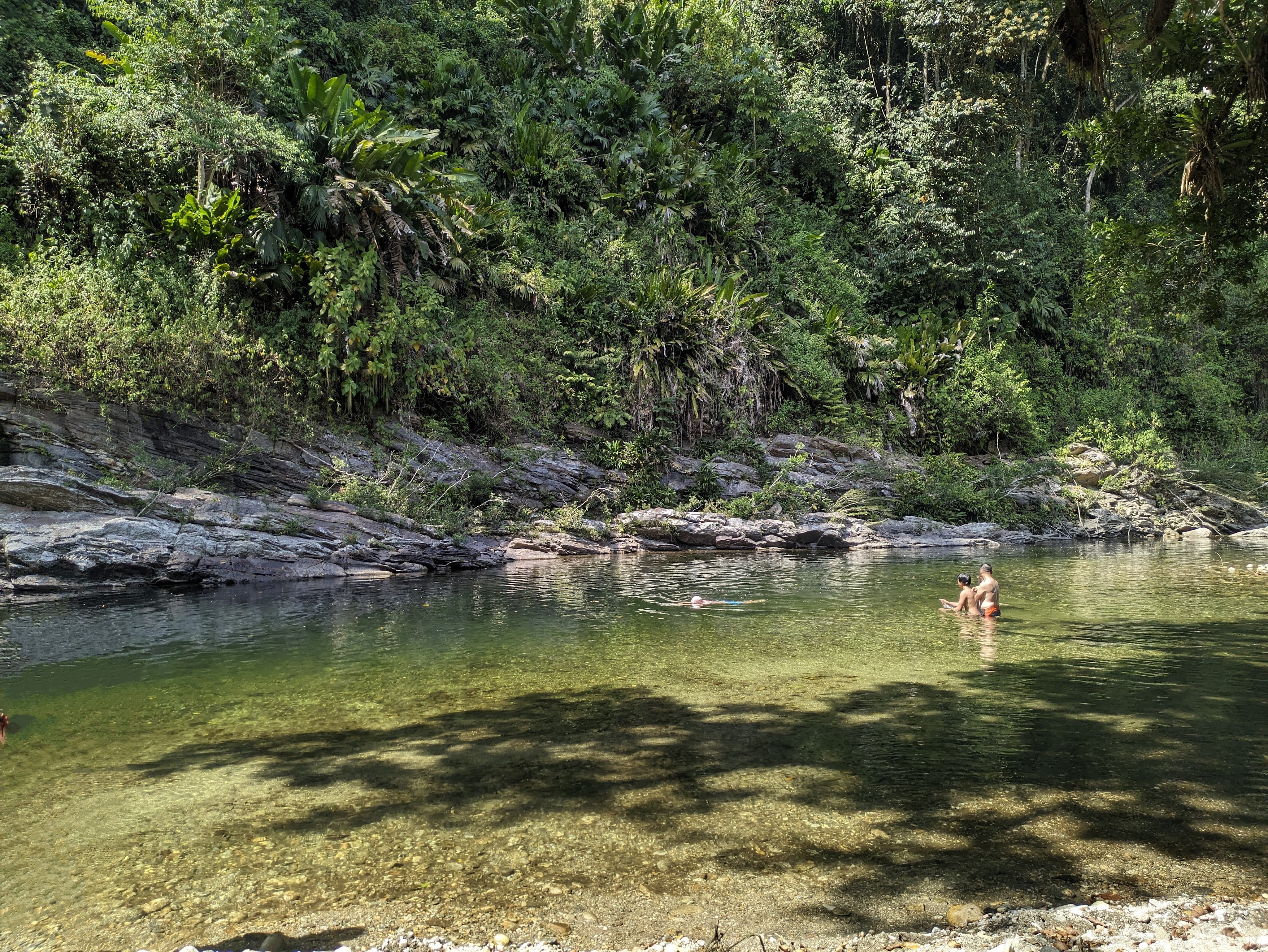
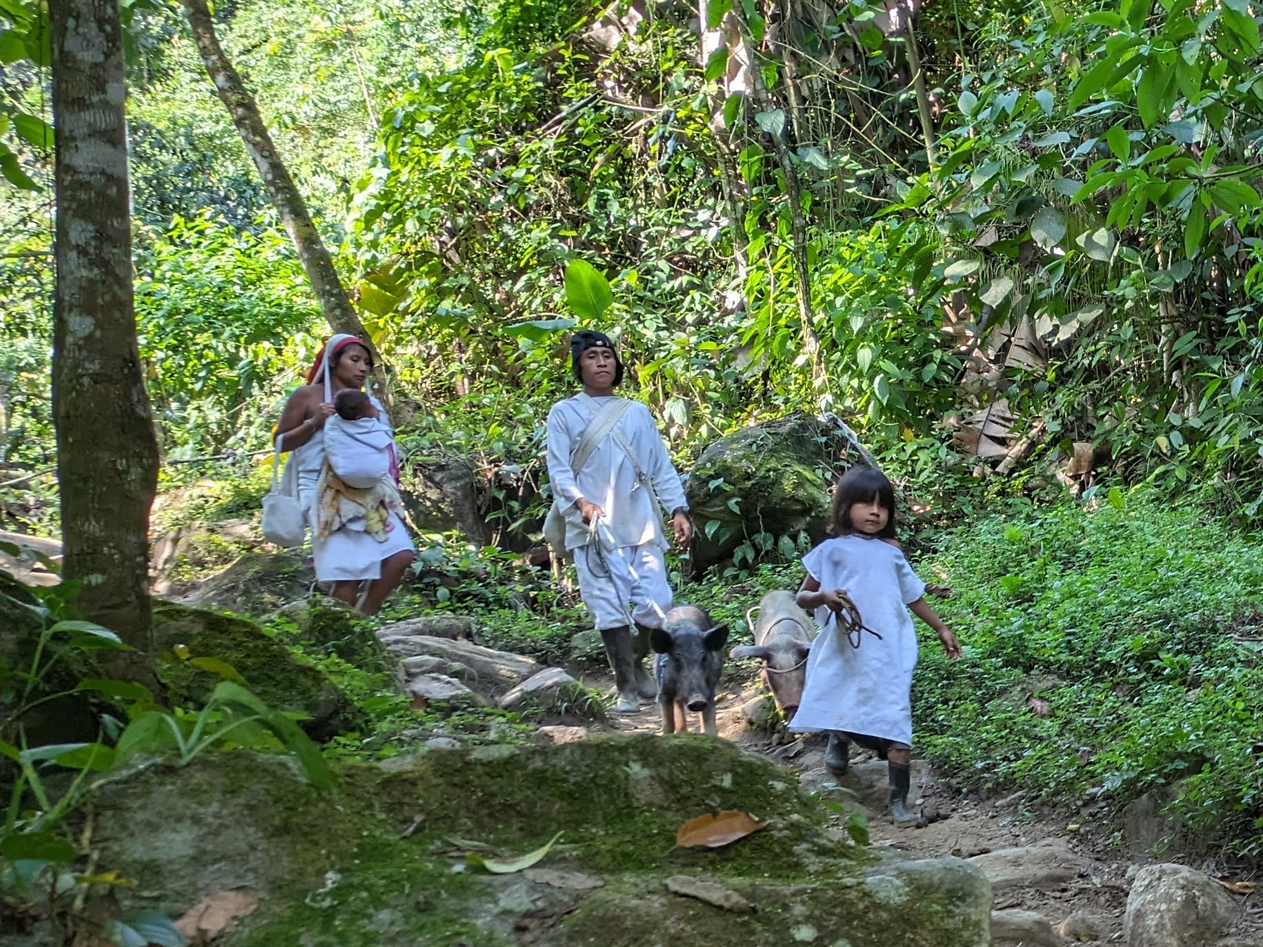
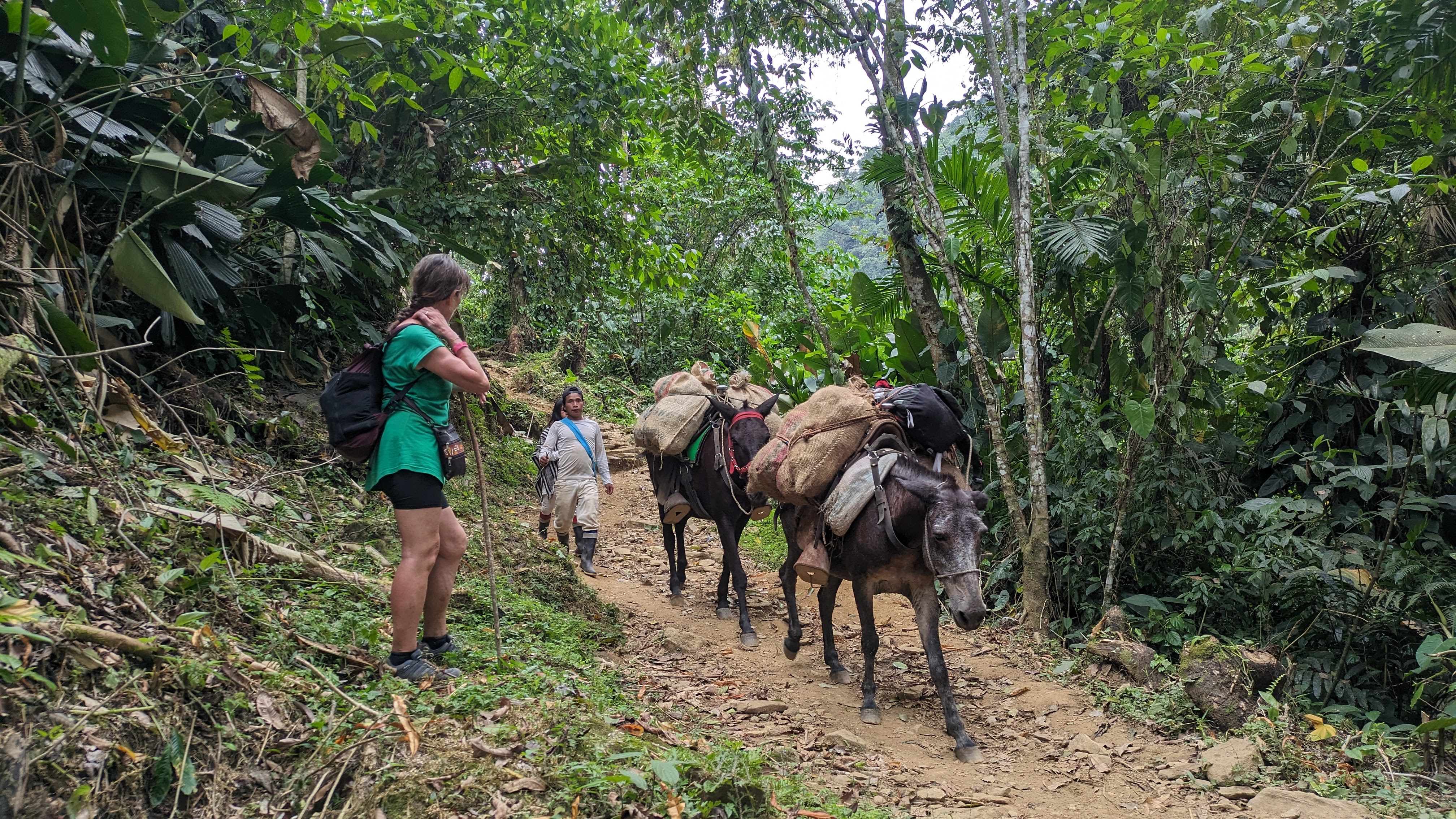
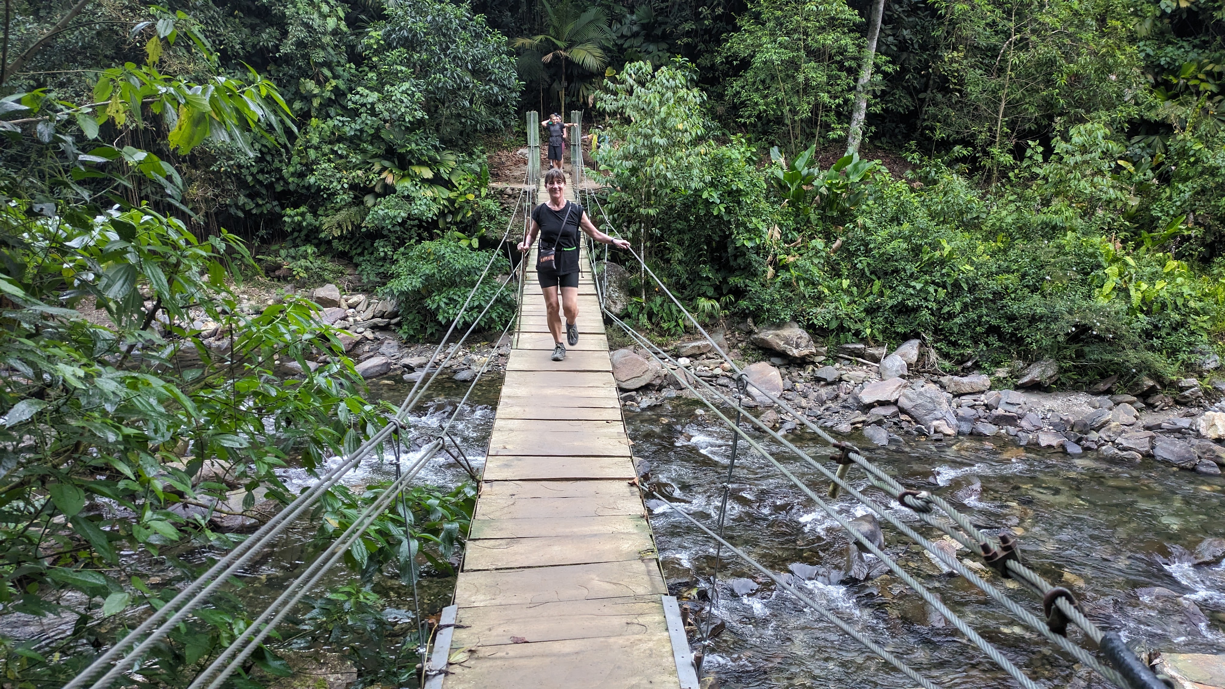
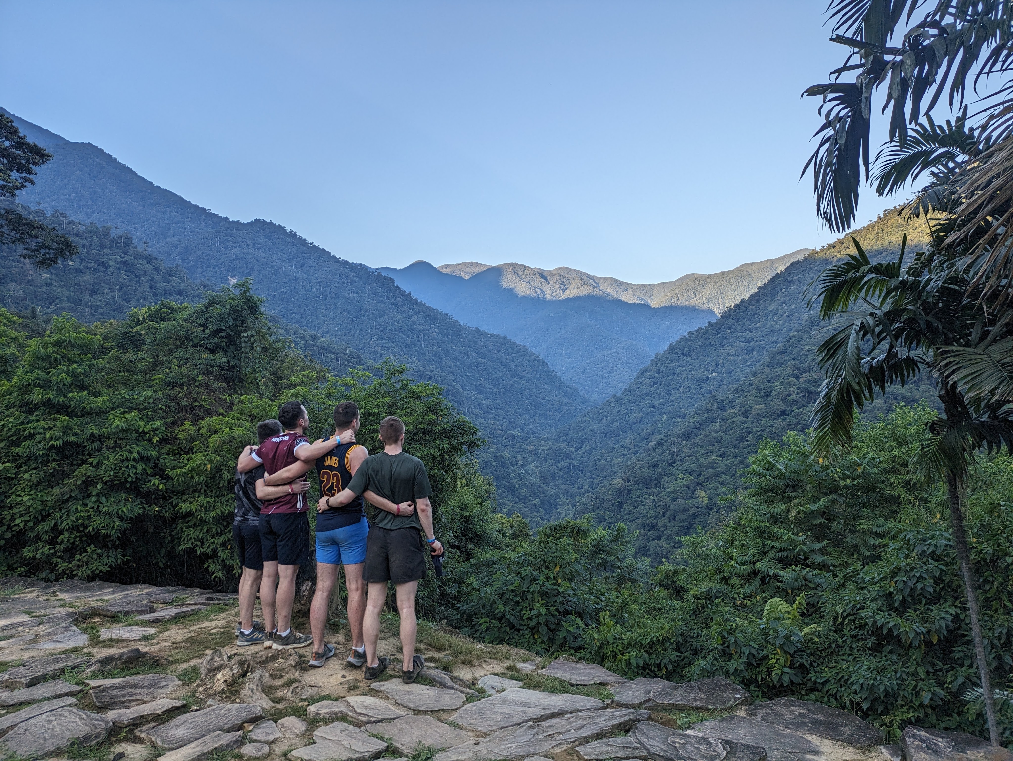
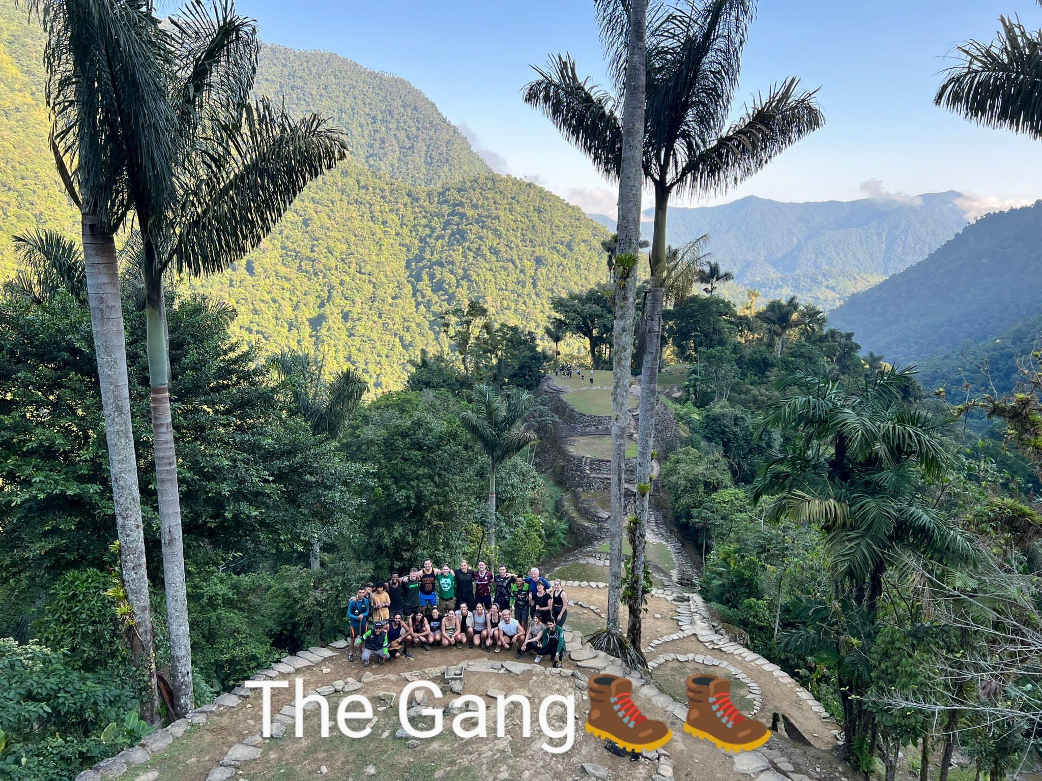
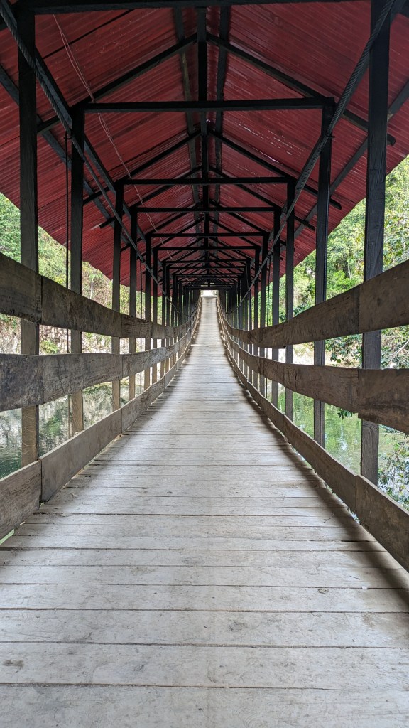
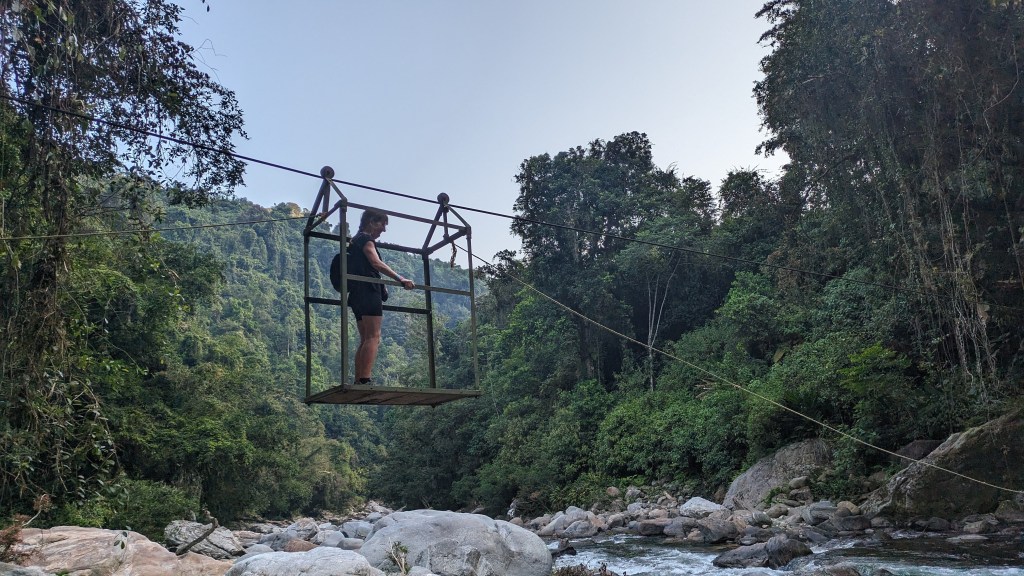
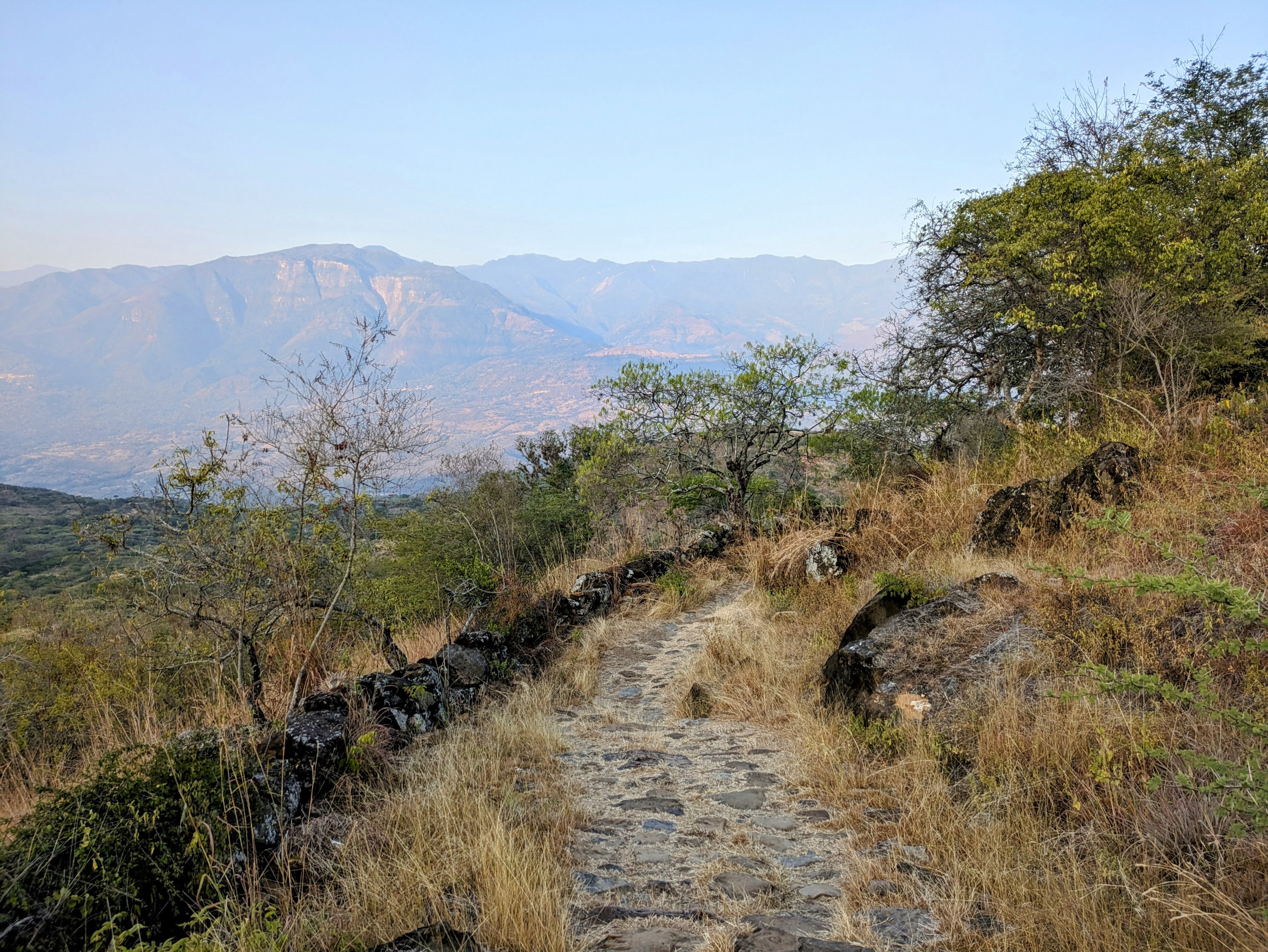
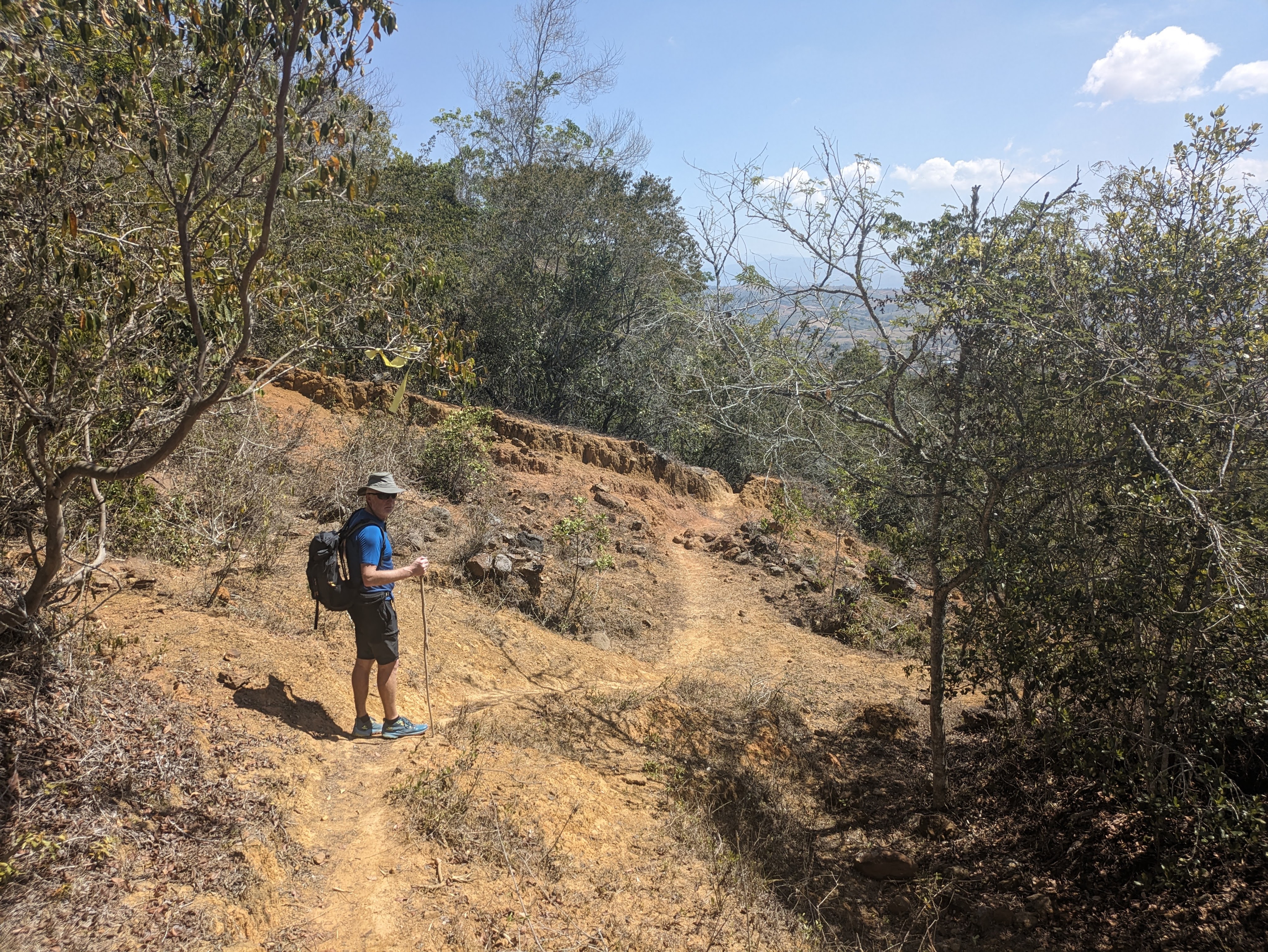
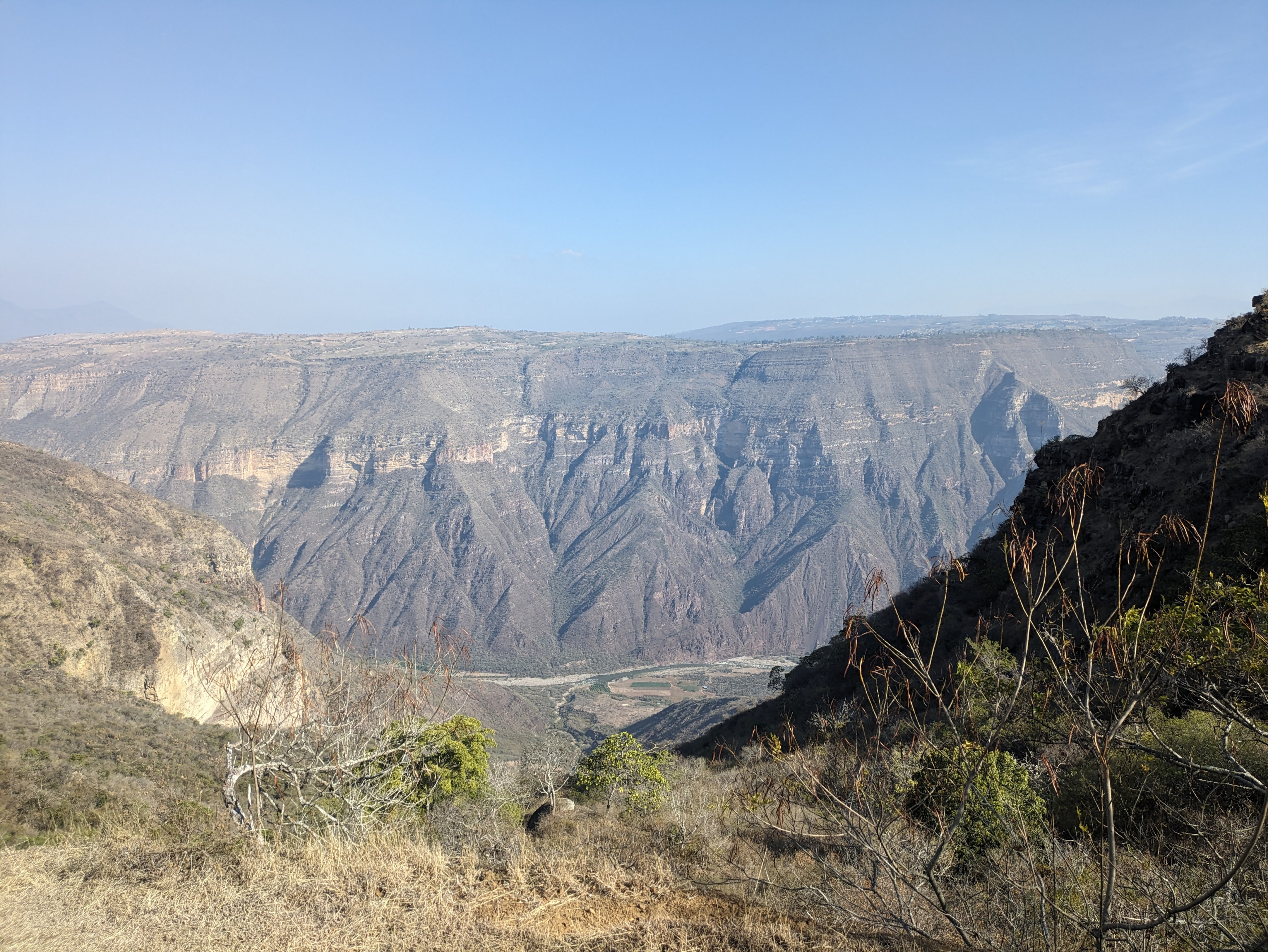
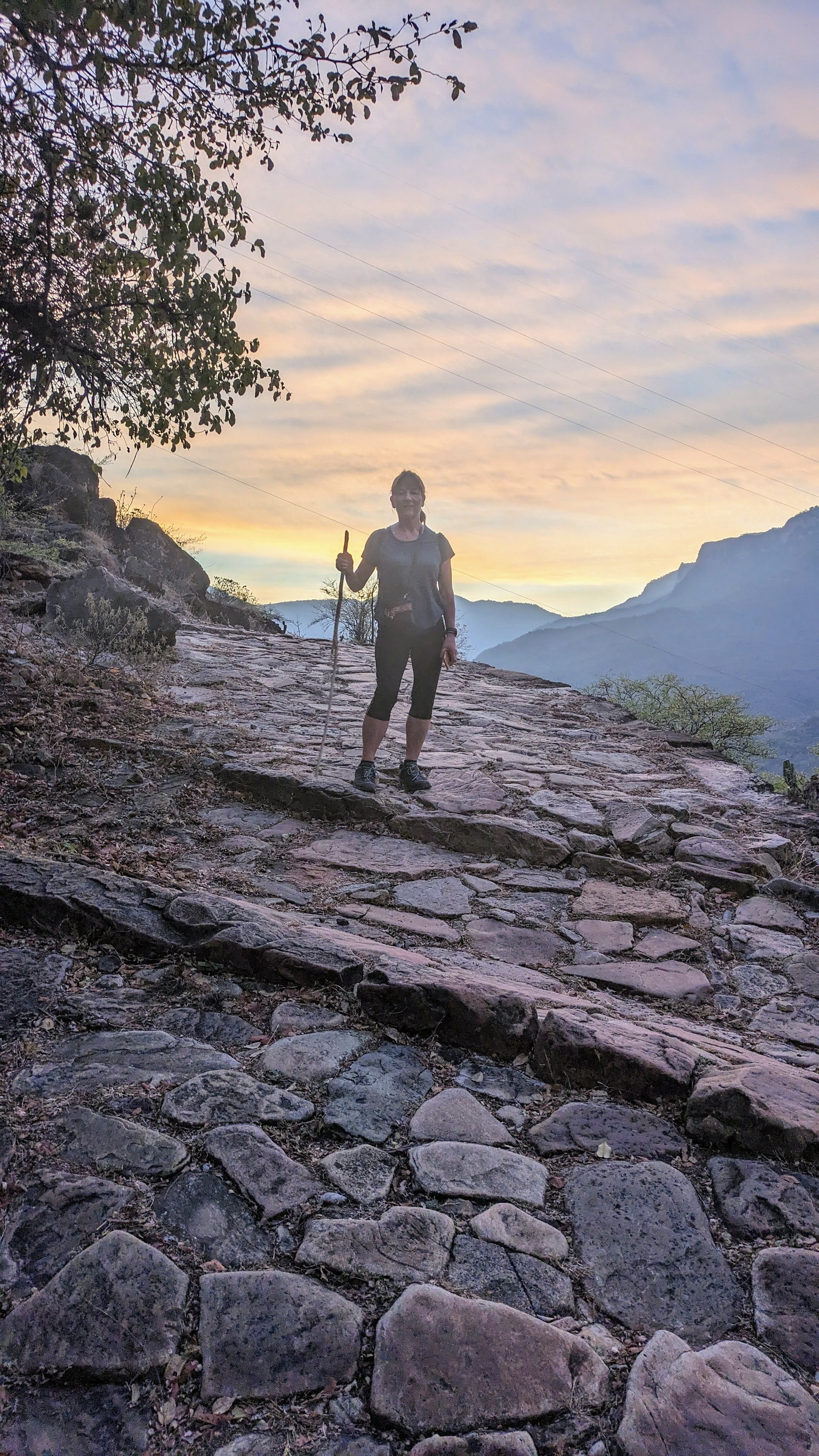
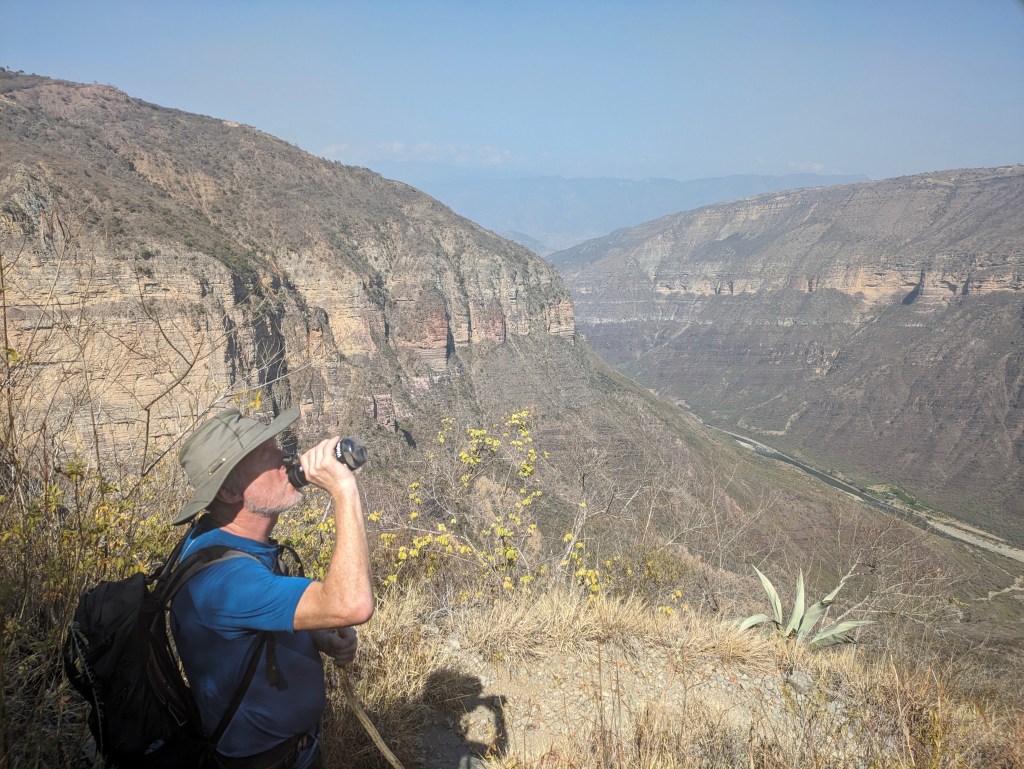
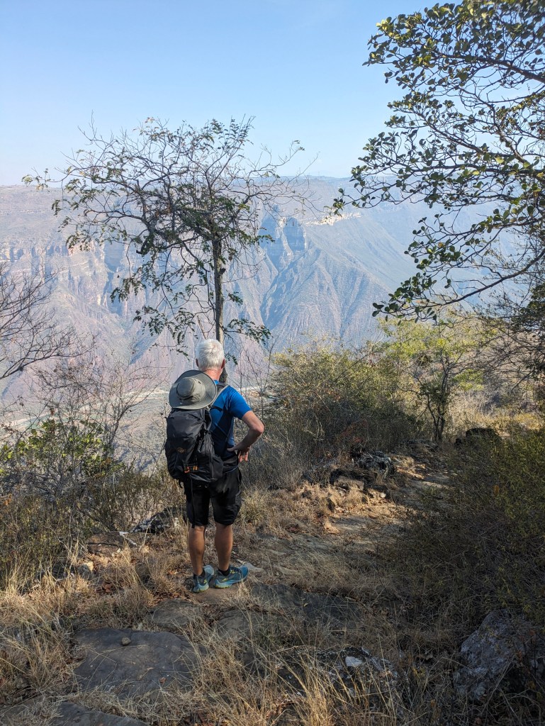
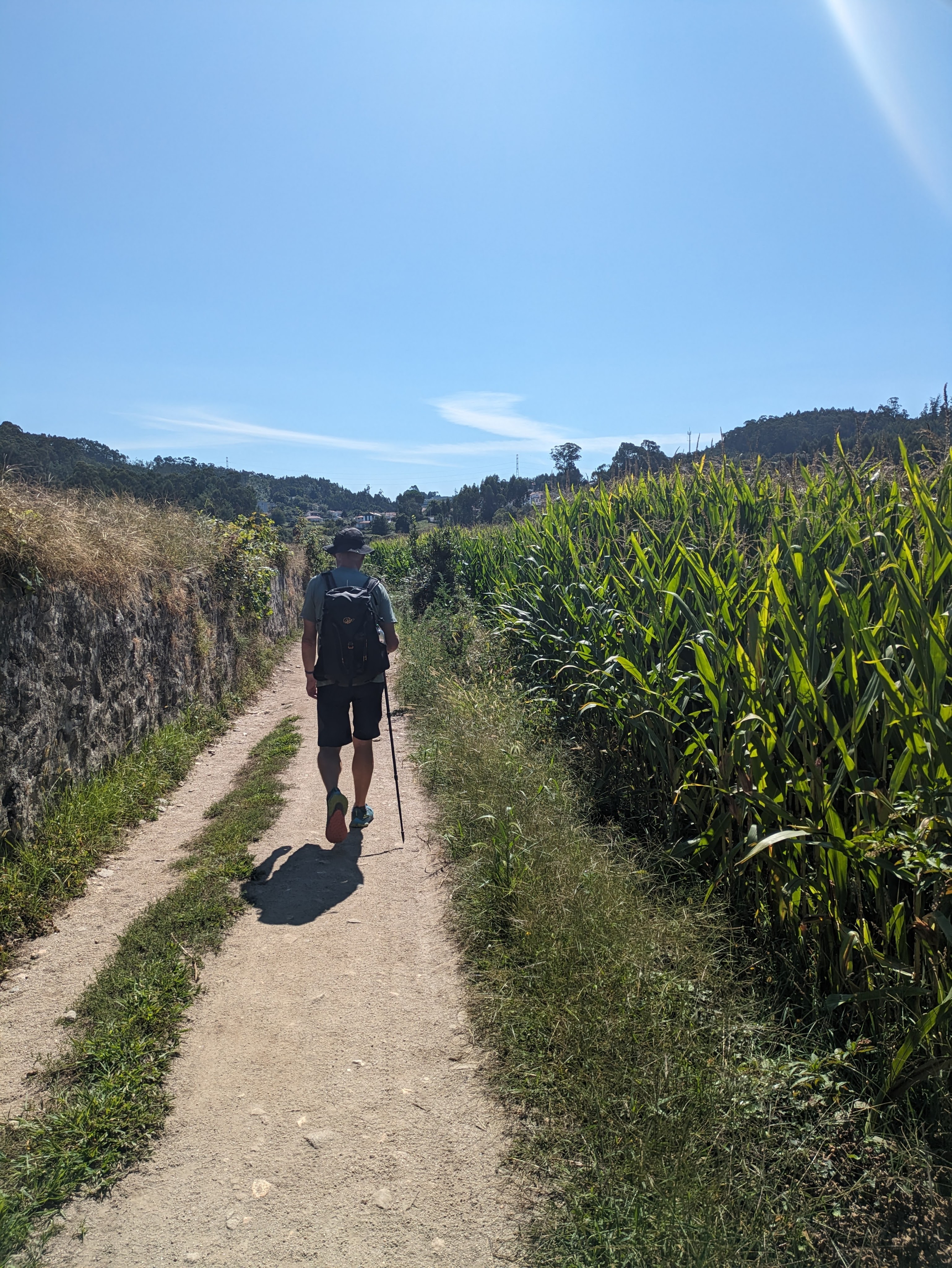
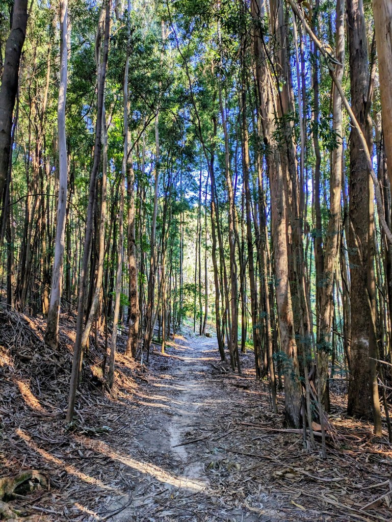
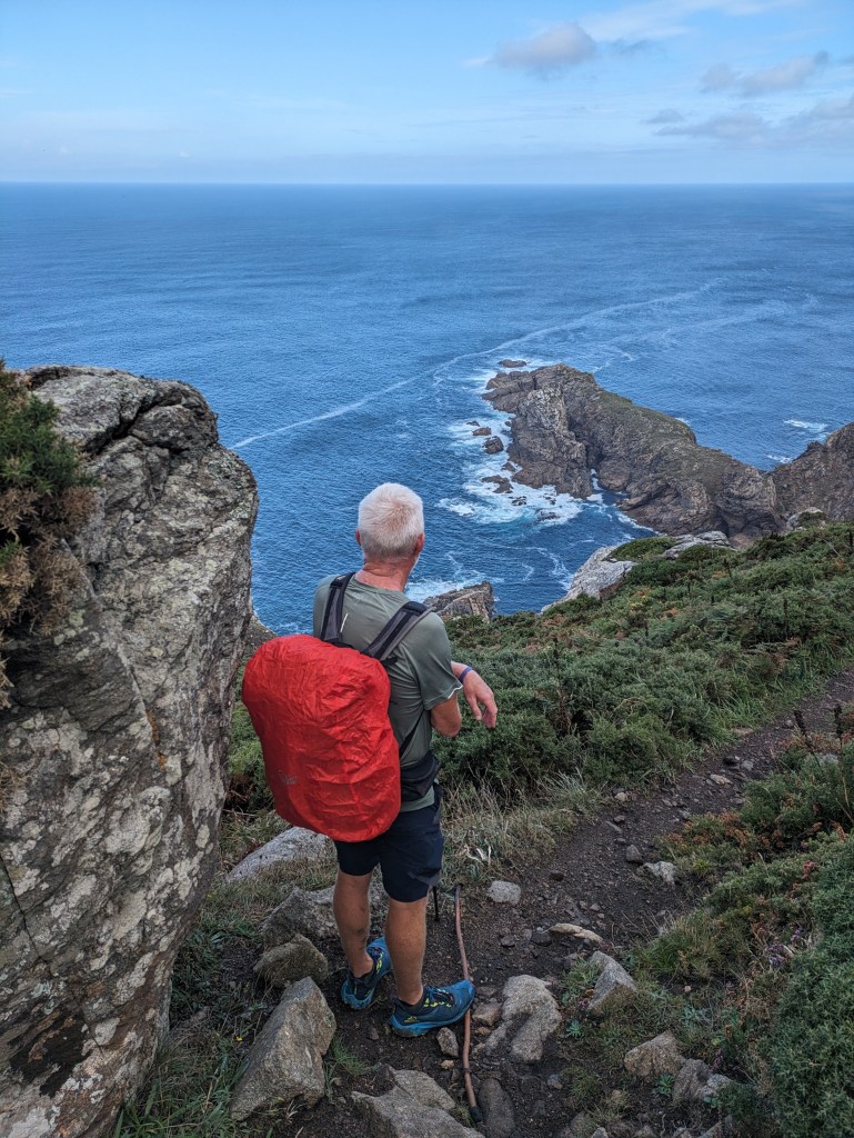
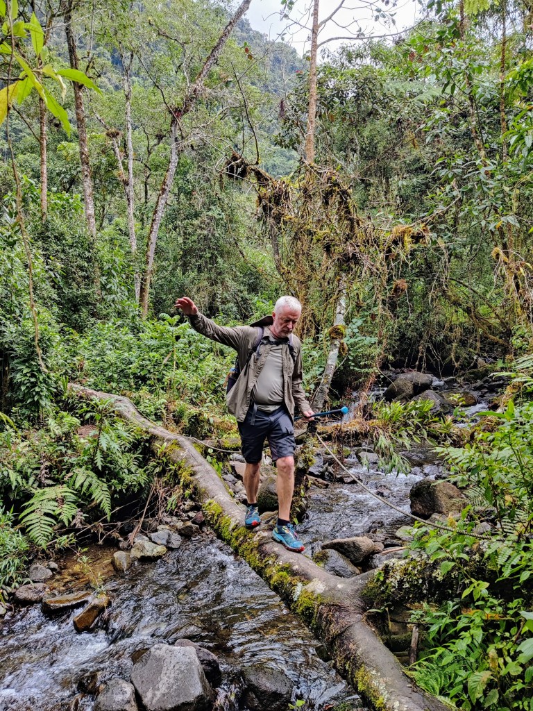
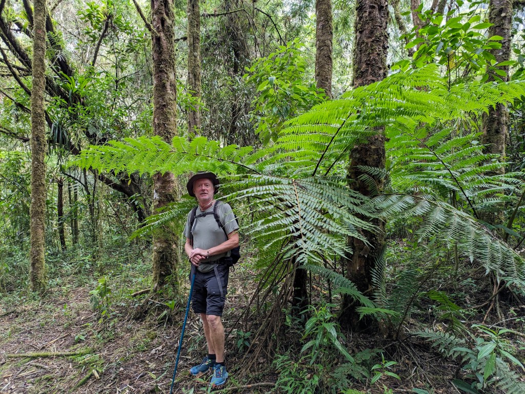
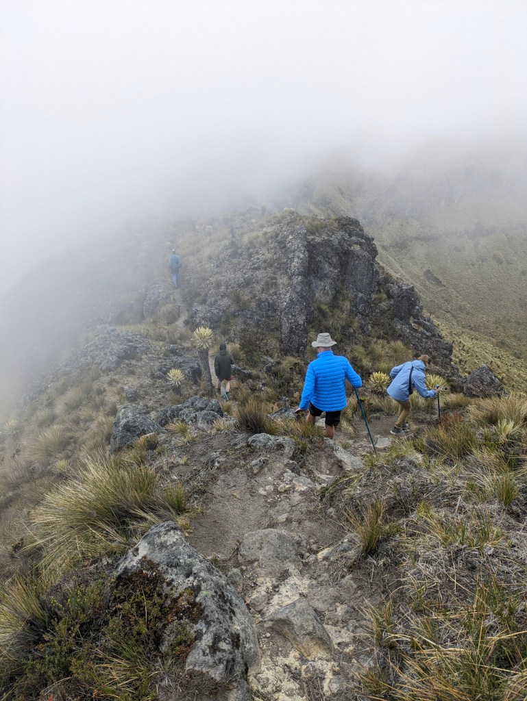
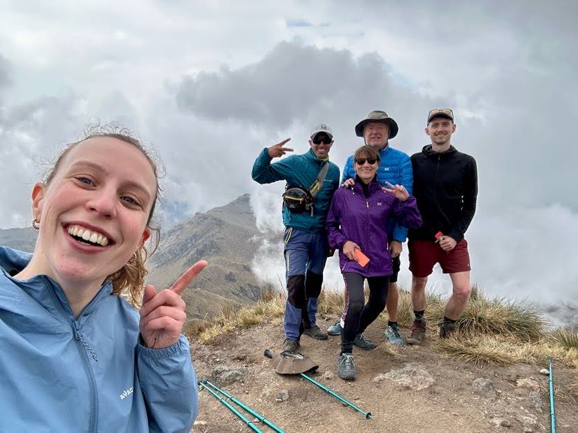
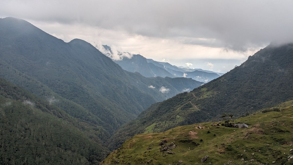
The other reason to visit Salento is to trek in the stunning Valle of Cocora and the Parque National Los Nevados. We went on a three-day hike with Salento Trekking which started in sunshine with a backdrop of spindly wax palms, the national tree of Colombia and the world’s tallest palm-they can reach sixty meters. Our hiking companions were a lovely young Belgian couple from Antwerp and our ‘English speaking’ guide, Fernes, whose grasp of English was probably worse than our Spanish.   Our path took us through jungle with flickering hummingbirds and brightly coloured woodpeckers, up into pine and eucalyptus forest, where the trees groaned and creaked above us as we walked and onwards into cloud forest. We hiked down to the Rio Quindio, and sweated up the other side, crossing and recrossing the same river three times on rickety rope bridges, just a few pieces of wood tied together with a plank or two missing to keep things interesting. Cloud and mist shifted over the mountains in an ever-changing pattern but became denser and damper every afternoon until all views were obscured.

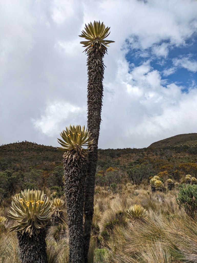
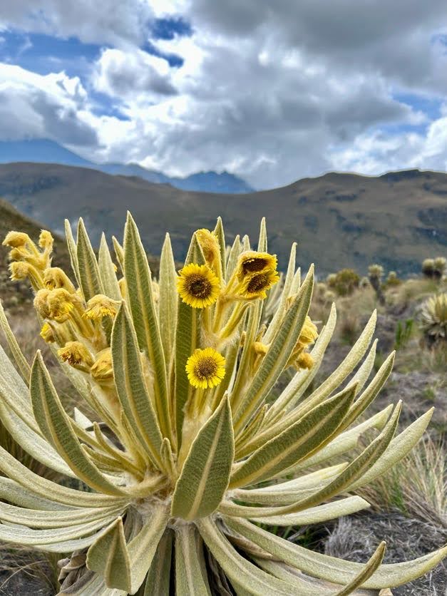
On the second day, we entered the paramo ecosystem, a wildly beautiful area of high-altitude grassland above the tree-line with a host of unique vegetation where the colour palette changed from various greens to honeyed gold. There we found the stunning Frailejones, a shrub that looks like a cactus with a flowering head of miniature sunflowers. Frailejones are extremely slow growing, about a centimeter a year and we were surrounded by plants of all ages but some were at least five hundred years old. We huffed and puffed up to the viewpoint on Cerro Chispas at 4408m and were treated to a vista of cloud and mountain. Then a majestic condor soared overhead with wings spread wide, and almost take our breath away. The beautiful bird symbolises power and grace but also has spiritual significance for the indigenous people who believe that it is the wise grandfather who watches from above, offers protection and regulates the energies of the world.

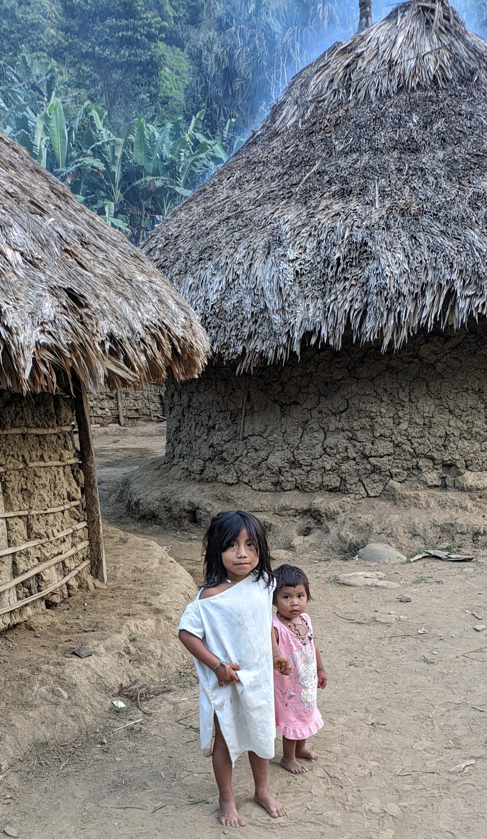
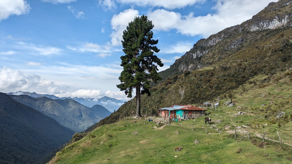
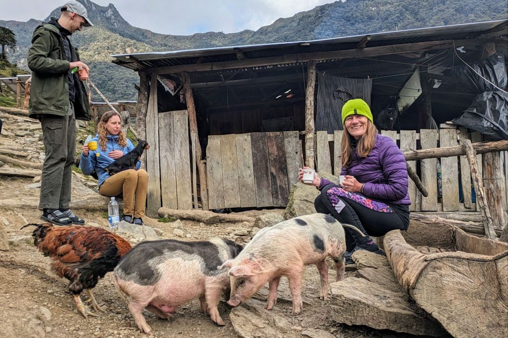
 While the scenery was gorgeous and the various ecosystems were interesting, the fascinating part of trek was staying in the homes of the local people who live in these isolated Andean mountains. On the first night we stayed on a farm at 3500m, Finca Argentina. This simple homestead was merely a few connected windowless sheds where the only light came from some sheets of clear corrugated plastic in the roof. There were horses, pigs, geese, hens and a few sheep but this was an inaccessible  place without roads where the way to get in or out was by narrow mule tracks.

Animal Farm, Finca Argentina

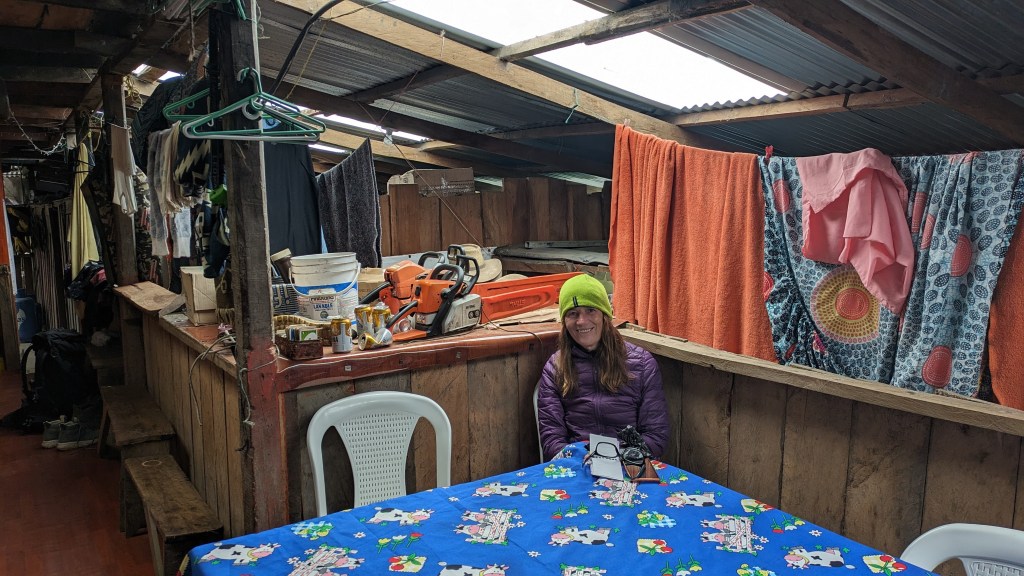
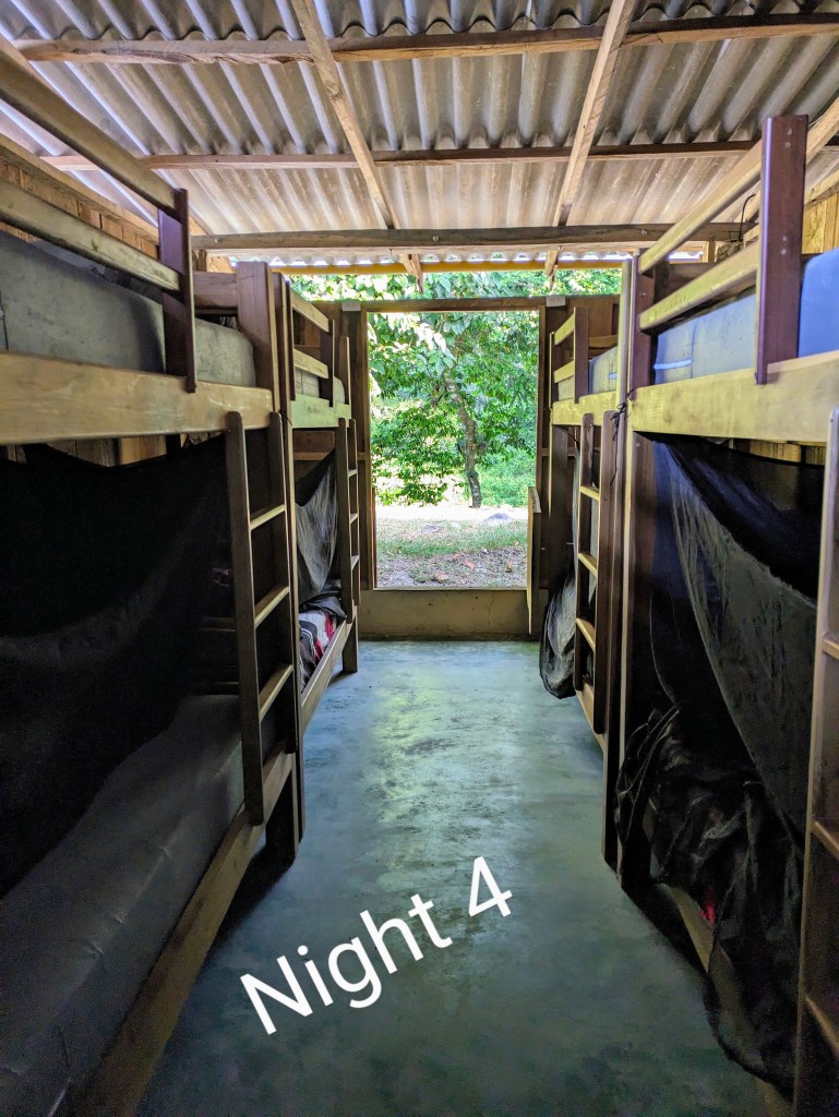
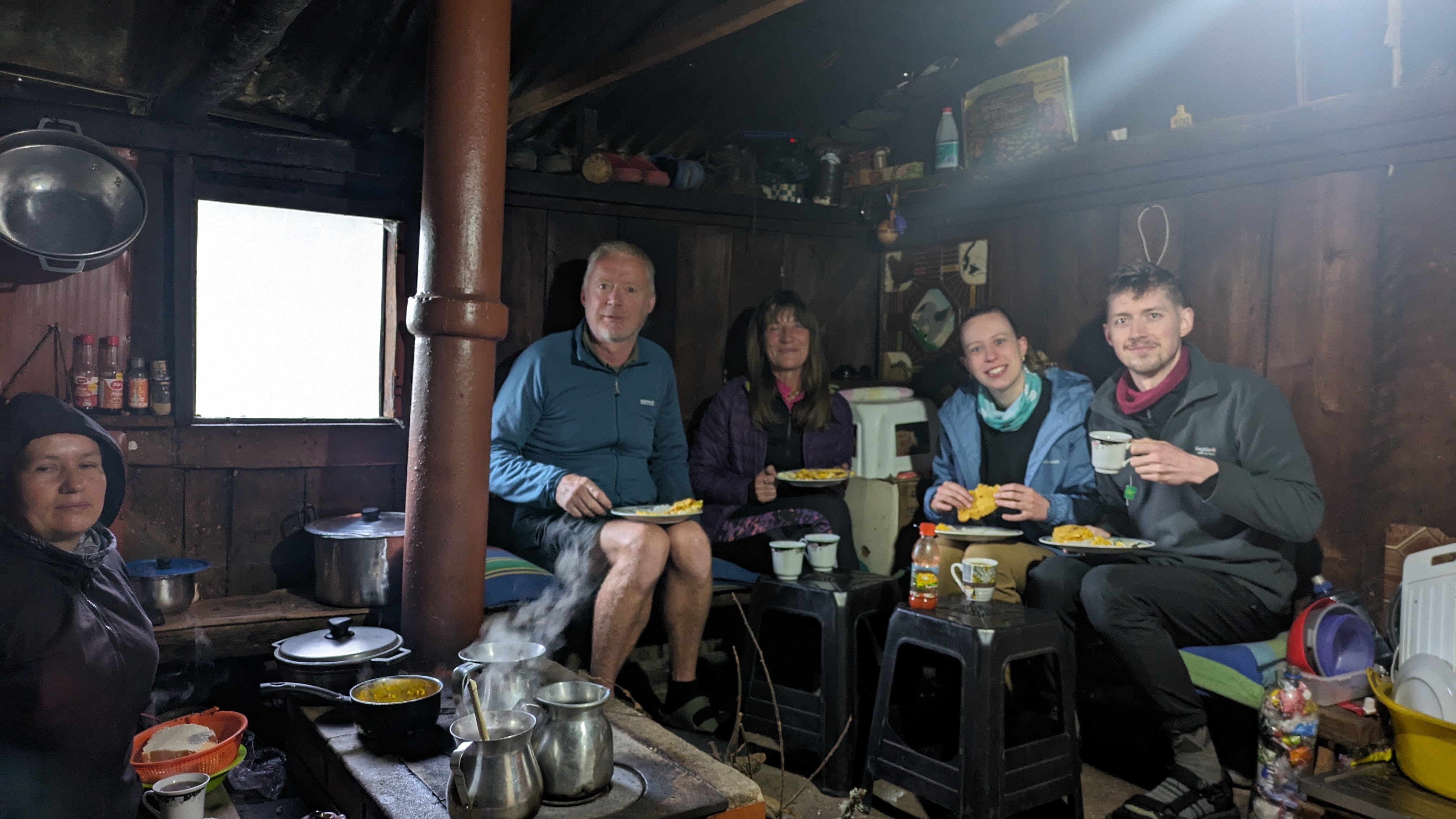
Our welcome was lukewarm, and I can honestly say that it was the coldest house I have ever been in, a virtual wind tunnel where it was warmer to sit outside with the animals, a few pigs, hens, dogs and cats. It was the first time that we were cold since our arrival in Colombia despite wearing all the layers that we had been carrying around in our backpacks for two months.  We arrived in dense fog, cold and damp, and we stayed that way for the evening although the mists cleared and the beauty of the valley revealed itself. The only warm spot was the cozy kitchen, where firewood was burning in a huge range that also served as the cooker, and music played on a radio but the trekkers were banned from there. The cramped bedroom had no electricity and three double-bed bunks which in theory could sleep twelve but our party of five were the only ones to sleep there on lumpy mattresses that night. In fairness there were plenty of thick blankets on the beds whose questionable laundry history didn’t bother us. Caoimhin, who was wearing shorts(that’s another story), took a blanket and draped it over himself in the house but was told that blankets couldn’t be taken out of the bedroom. Dinner was tasty, vegetable soup followed by rice and veg lentil stew, but portions were meager especially for appetites made ravenous by cold, exercise and mountain air. We were all tucked up in bed by 7.30pm for warmth more than tiredness. When Dorien, the Belgian girl, got up during the night to make her way through the house to the toilet using the eerie light of her phone, she found a scene of carnage outside the bedroom door, guts and feathers and a very satisfied fat cat. I was glad that I didn’t need to use the facilities during the night because I would have probably screamed the place down.

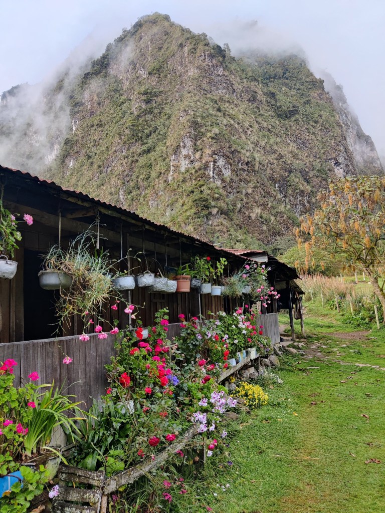
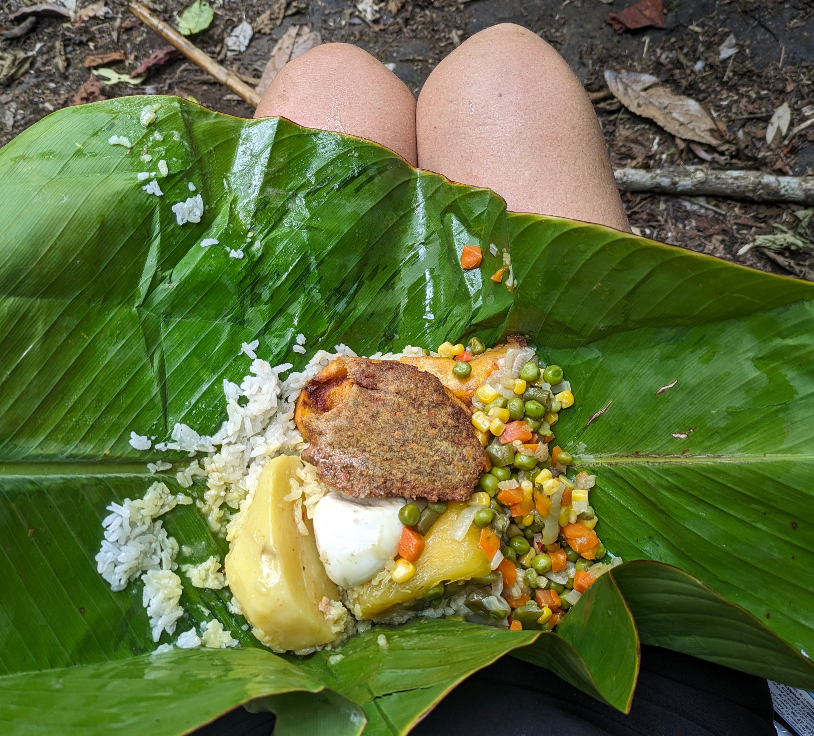
Our second night at another farm, Finca Jordan, could not have been more different. We again arrived at about 4pm in heavy fog which lifted almost immediately.  We saw that we were surrounded by mountains, steep walls of grey rock with a waterfall tumbling down and a green field with pigs and hens and an Alsatian dog called Rocky who kept chasing a chicken despite the constant shouting of the woman of the house. There was birdsong and tumbling water and a riot of flowers bedecking the simple house, agapanthus, geraniums, roses, carnations and red-hot pokers. Our quarters were a green and blue shed with an attached bathroom and a shower with hot water…luxury after the previous night.Our host invited us into her kitchen, where we sat on a raised platform with our feet level with the stove. She plied us with coffee, tea and hot chocolate and piled our plates high with more food than we could possibly eat, brimming bowls of lentil and veg soup, rice and sliced avocado and vegetables (all of us were vegetarians). She fried long slices of bananas on her stove, covered them with slabs of her own homemade salty cheese, garnished them with spring onions from the garden. Her husband came in, put on a pair of croc slippers, and helped his wife by slicing a few veg while all the time, she talked without pause. Maybe it was the isolation that made her so chatty or maybe it was just her nature. This finca could also only be accessed by mule track, a four-to-five-hour rough trek down the mountain to get a few basic supplies.

A cosy mountain kitchen, Finca Jordan

After an ample breakfast, we headed off downhill from this haven of hospitality in a truly beautiful spot. On the way, Caoimhin got a rare sighting of a puma who stopped and stared at him on the winding stony path about a hundred meters ahead before disappearing into the trees. I got a mere glimpse of eyes and movement but that was all. The hike was very rewarding but as it was billed as a Mountain Wildlife Trek and we had an English-speaking guide, we expected to learn more about the flora and fauna. Unfortunately, our guide was not very knowledgeable, or interested in nature in any language. He just wanted to get the hike over as quickly as possible while we wanted to enjoy the enchanting scenery and spend as long as possible in nature, especially on the third day which was all downhill.

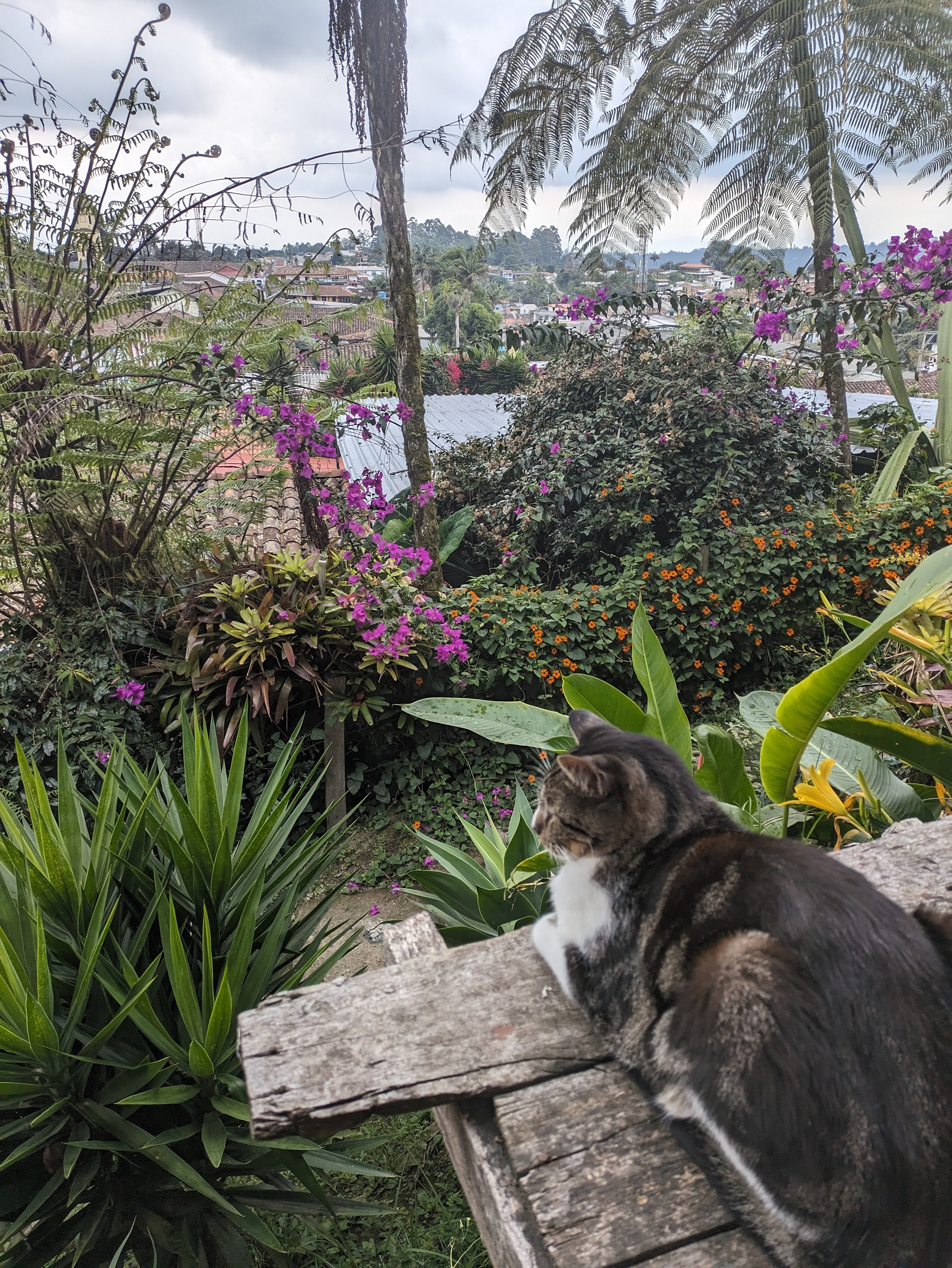
We stayed in two different places in Salento, in Hotel Natura Cocora for a few nights before the trek. This was a lovely rambling place with stunning views, a dusty kilometer and a half uphill from the town where we were welcomed and looked after by the very friendly and talkative Don Hugo, who ran the place almost single-handedly. The cleanliness was a little suspect and the bedroom with its old antique furniture was a little shabby with peeling paint but we loved the friendly atmosphere.   When we came back, we stayed in town at a fabulous hostel, Atardecer de Salento with its cats, breezy wooden balcony and proximity to restaurants and bars.

Its a cat’s life at Atardecer de Salento Hostel

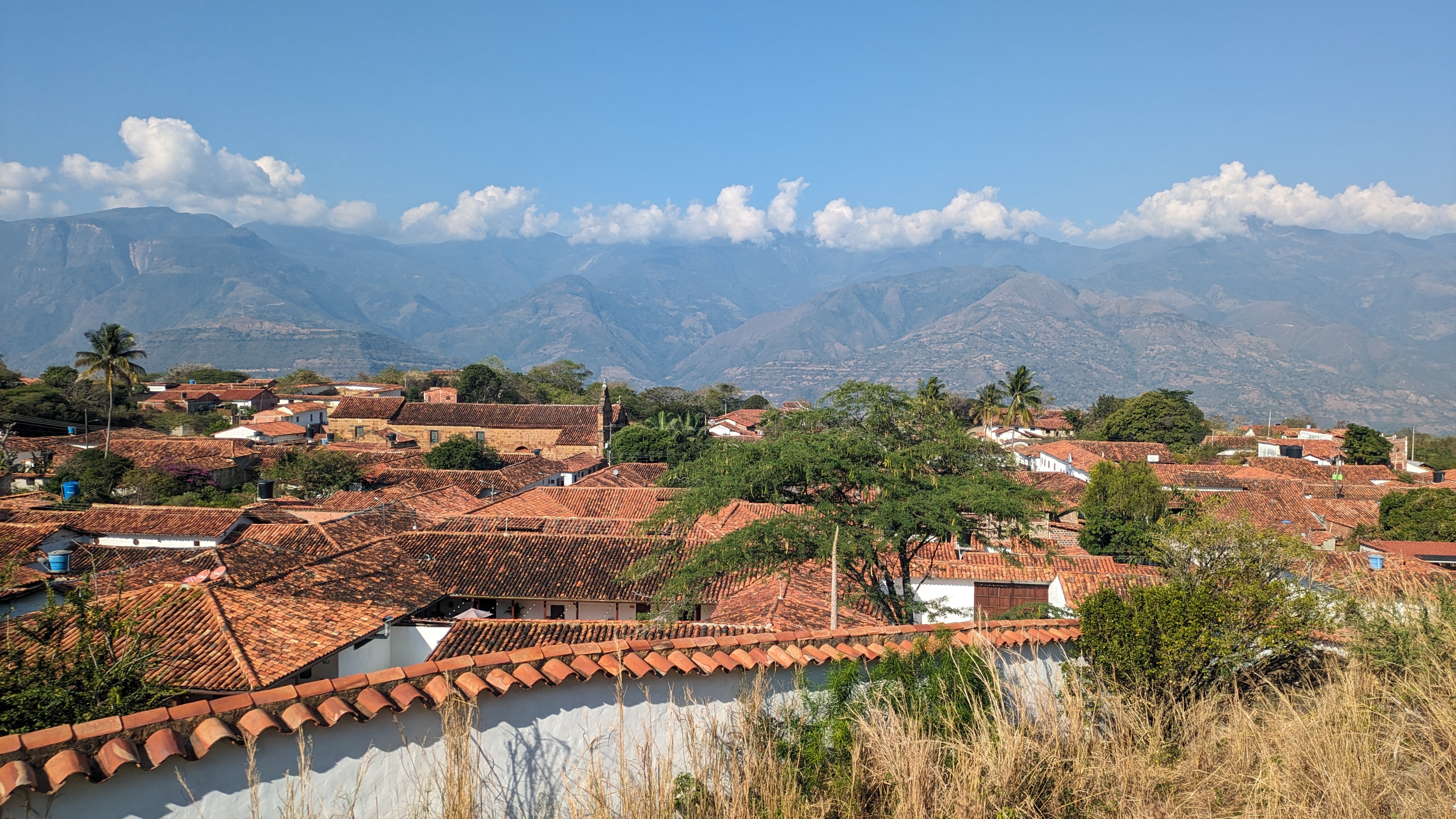
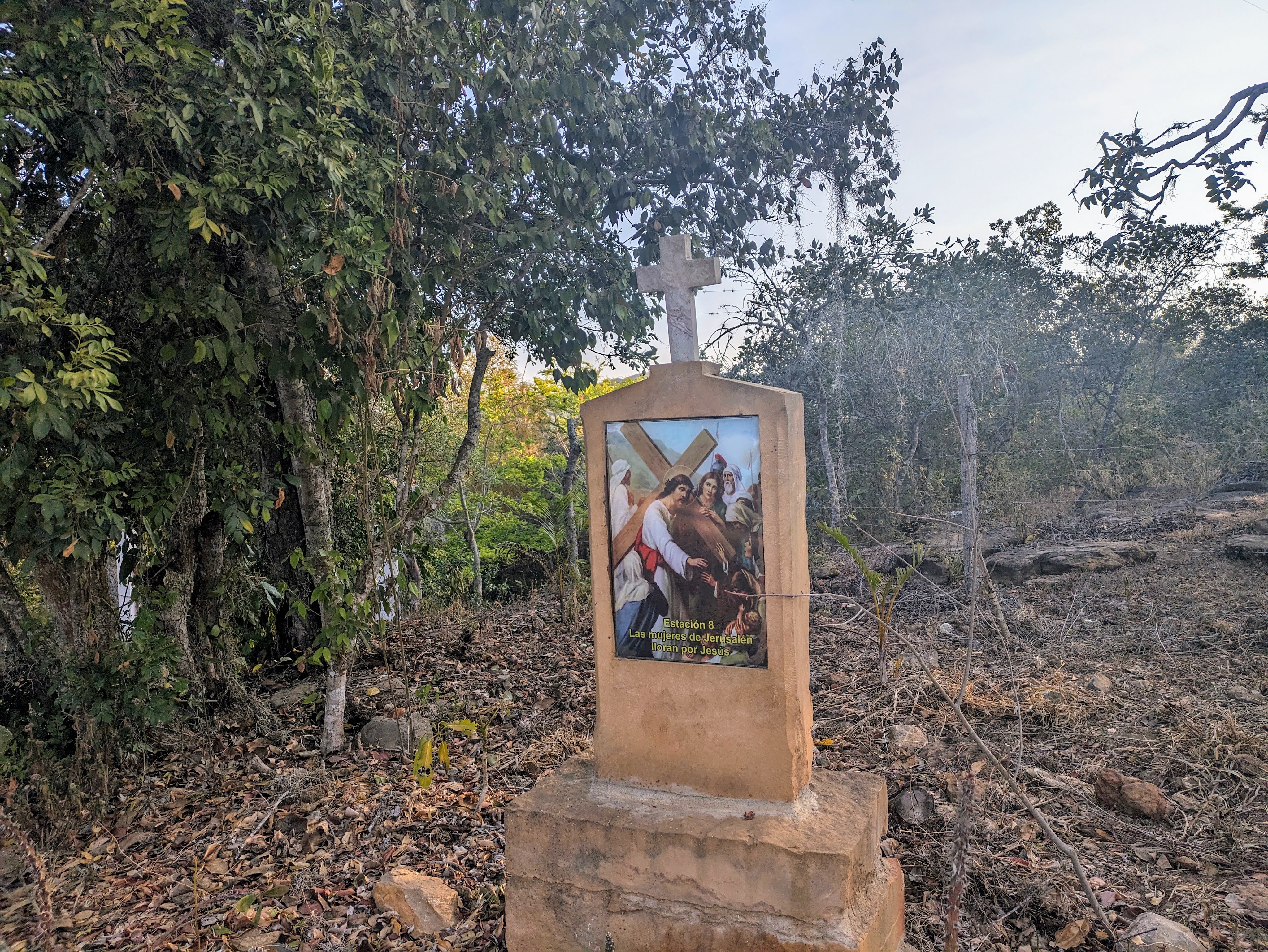
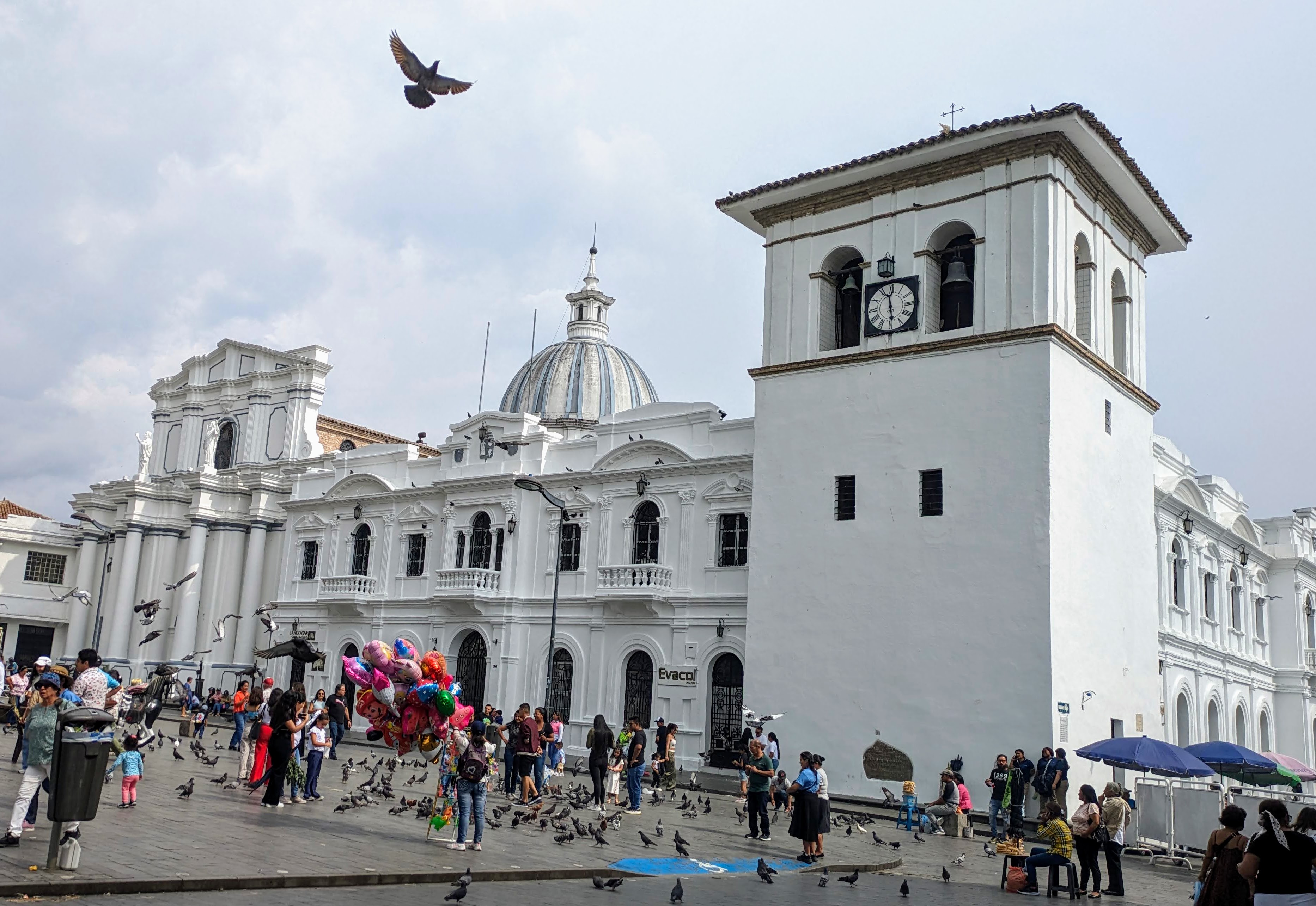
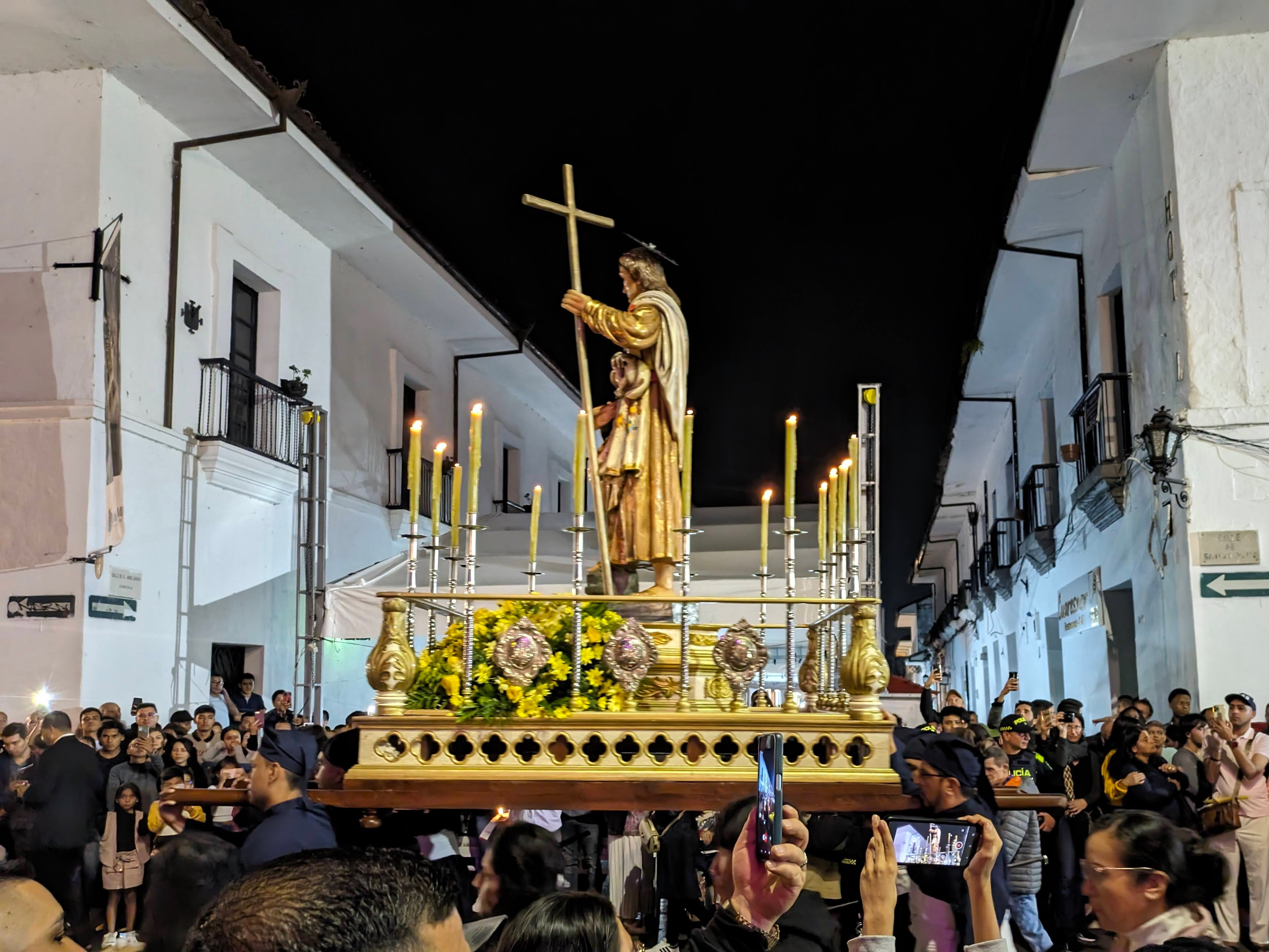
After a final coffee in Salento, we were on our way south, a seven-hour bus journey to Popayan, a colonial city of churches and white buildings. Almost as soon as we stepped off the bus in the late afternoon, we were greeted by the smell of greenery, long green palm fronds and the lingering scent of incense.  We were too late to see the Palm Sunday processions, but Popayan is very popular during Holy Week, Semana Santa. Colombians flock there for the religious ceremonies, the candle-lit possessions that occur every night during Holy Week and the market stalls that are set up on many of the lanes.  On Monday evening, we joined the crowds to watch drumming bands slow- march through the ancient streets followed by numerous wooden platforms of religious icons, carried on the shoulders of men called ‘cargueros.’ The procession was long and slow, following the same route past the many churches in a tradition that has gone on continuously since the sixteenth century. Although there were several thunderstorms in Popayan on Sunday evening and Monday afternoon, the rain held off during the nighttime procession.

Popayan. the White City, La Ciudad Blanca
Holy Monday Procession, Popayan

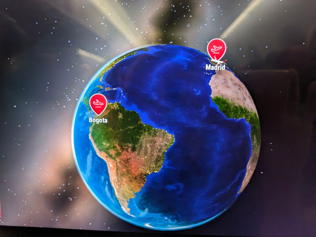
We are about to hop on another bus to take us on a partly-dirt road to San Augustin, another small town in the Andes which is close to some pre-Columbian Archaeological sites and I’m sure that we will find some more Easter traditions.

Felices Pascuas

Gracias por leer esto

Till next time……have fun xx

A Home in the Mountains – Tranquil Location, Low Maintenance, No Problem with Neighbours😁
Colombia – Coffee, Clouds and Condors

Colombia – Tragedy and Transformation

La Alpujarra Administrative Centre, Medellin – with a green planted wall to soften the exterior.

Medellin was the most fascinating and interesting city we visited in Colombia. It is also probably the most well-known Colombian city, famous for all the wrong reasons because of the popular Netflix series, Narcos, a story of corruption, violence, and Pablo Escobar.

 Two words sum up Medellin – tragedy and transformation.  It was once the most dangerous city in the world, topping the tables for the highest rate of murder and kidnappings in the 1980s and 1990’s but now it regarded as the most fashionable Colombian city and the one with the best quality of life, attracting tourists and digital nomads.  The city sprawls along a narrow valley and climbs steeply into the surrounding mountains with a near perfect climate, often called the place of Eternal Spring.

Medellin on Map

The economy of Medellin was founded on coffee, a plant that that was ideally suited to the fertile mountainous hinterland until it was dominated by another plant, the coca plant, which also thrived in the region. Coca leaves have always been grown for small scale local consumption because when the leaves are chewed or brewed into tea, it acts as a mild stimulant which suppresses hunger and fatigue and is helpful in combating altitude sickness. Coca leaves are also the raw product in cocaine production, and this is where the infamous Pablo Escobar and the Medellin Cartel enter the picture. Escobar continues to be a controversial figure to this day, loathed by many but admired by others because of his ‘generosity’ – he gave almost 400 houses to the poor in Medellin.  But he was also directly responsible for an estimated 40,000 deaths, unspeakable violence, fear and mayhem.

We did two walking tours of Medellin, one of the downtown area and one of an district, known as Comuna 13. (There are sixteen comunas, or districts in Medellin. Comuna 13 was once the most violent district in the most dangerous city in the world, a place that was off-limits even for people living in neighboring districts. It endured sustained urban warfare and was plagued by fierce battles between guerillas and paramilitaries.

Comuna 13 sprawls upwards on a sheer hillside, a rabbit warren of narrow streets, steep steps, colorful houses and graffitied walls. Now its narrow streets and alleyways are bustling with little cafes, tourists and tour guides but the past was not forgotten. We stood in a basketball court in the centre of the Comuna where many innocent locals were murdered. Our guide told us that the brown-earth area, visible like a gaping wound on the opposite hillside was reputedly a mass grave where many of the Missing from the city were buried.

Comuna 13 – notice the bare-brown hill opposite

We were entertained by the break-dancing and hip-hop routines of groups of young local men who would probably have been involved in drugs trade in the ‘bad old days’ instead of performing for tourists.  Immersion in arts, music and sport has been one of the pillars in the transformation of Medellin and of course nothing would have been achieved without the desire of the communities to break the cycle of violence.

On a wall in Comuna 13, there was a gorgeous wall mural of a giraffe which our guide said represented the strength and resilience of the people because the giraffe has the stoutest heart of any animal relative to its size.

But how did Medellin become this beacon of hope and renewal? There is no simple answer but this remarkable transformation has included the demobilization of guerilla groups, major policy changes, the addition of social programs, and serious infrastructure investments. Our guide on the walking tour of the downtown area credited social work combined with urban architecture turning negatives spaces into positive, accessible libraries and a redefinition of education.  Places that were a no-go area when he was a teenager (he was 42) have become convivial locations of relaxation and pride with tree planting, play-areas for children, lots of seating attracting coffee-drinkers, shoe-shine boys and buskers. The Parque de las Luces was once a very dangerous area but now 300 illuminated pillars stand in the space, providing shade by day and light by night. Of course, everything isn’t perfect. The lights in the Park of Light (Parque de las Luces) were turned off last year for maintenance and still haven’t been turned on😲🕯️🕯️

One of the most famous sons of Medellin (apart from the obvious one already mentioned) is the artist and sculptor, Fernando Botero, whose distinctive work is very much in evidence around the city especially in Botero Plaza where twenty- three of his sculptures are on display.

Botera Plaza, Medellin

One of the surprises about Medellin was its fantastic public transport system which made travelling around the city so easy. There was a clean efficient modern metro system that was integrated with the bus system and the tramline. There were and cable cars, a gondola lift system that traversed the steep hills called Metro-Cable.  The locals were very proud of their Metro system, the only one in Colombia. Although it was about twenty years old, it looks as pristine as the  day it was introduced with no graffiti, broken seats or even rubbish. (The lack of rubbish was especially remarkable, as Colombians in general will fling their waster with wild abandon everywhere).  We got conflicting answers when we asked about the cleanliness of the Metro, one person told us that it was civic pride that kept it in such good condition, another said it was because there were hefty fines for littering. Whether  the approach was carrot, stick or a mixture of both, it was regularly cleaned and was a pleasure to use. We spent a couple of hours one afternoon just riding up and down on  the cable-cars and getting a bird’s eye view of the city.

Cleaning the Metro
Cable Car Views

And to really complete our enjoyment of Medellin, we found a fantastic vegetarian restaurant, Saludpan, which had European standards but at Colombian prices. This was probably the best vegetarian restaurant we have ever visited anywhere.  While it was primarily vegetarian, it had vegan options and some fish and meat choices. If you ever lucky enough to find yourself in Medellin, I’d highly recommend eating at Saludpan. We ate there each evening on our three nights in the city, breaking our own rule of never returning to the same place.

The popularity of Medellin and its agreeable climate has led to a large influx of Digital Nomads which some are calling a new wave of colonization, a soft invasion by people with computers and money.  Although welcomed by most, the influx is changing the city and driving up rents for apartments in certain areas beyond the means of locals.

Emigration was a fact of life for many Colombians for many years so the problem of mass immigration, particularly of Venezuelans who have come in huge numbers because of their domestic troubles, is a new phenomenon. Ironically, many Colombians fled to Venezuela during the dark period in their own relatively recent history so there is a strong feeling of brotherhood between the two countries.   The Colombian government in 2021 introduced a 10 -year visa for Venezuelans which gives them access to education and employment.

One of the most perplexing things we heard in Medellin was that the amount of cocaine exported from Columbia last year was three times more than it was in any year during the violent eighties and nineties. We had seen the fallow fields in Northern Colombia where once coca plants were grown and thought that this was the case in the rest of Colombia but this was in indigenous land where the Elders was strong in their opposition to coca and the drug trade. The illegal growing coca is still the backbone of many rural economies in other parts, it is lucrative, easy to grow and can produce three to four crops a year. The cartels have been disbanded and the processing and distribution have moved out of Colombia, some to neighboring Ecuador which has seen an eruption of violence this year. The situation is complex but it seems that the drug trade is alive and well in Colombia.

Guatapé, a small town about two hours east of Medellin, was probably the most colorful town we have ever seen. Everything was painted in bright colours and embellished with drawings and artistic designs. The town was on the edge of a man-made lake acting as a reservoir and was overlooked by a huge dome of granite, a landmark for miles around. This rock, called the Piedra del Penol, had an inbuilt staircase of 700 steps which was well worth the puffing for the rewarding views of the surrounding countryside, green lake-water, pine-clad islands and red soil.

Guatape – where even the tuk-tuks are brightly coloured.

The days in Guatapé were warm and overcast but it rained heavily at night turning the road outside our accommodation into a sticky red mess.

A 6-hour bus-ride on two separate buses took us through the Andes with steep drops, twisty roads, trees and flowers until we arrived to the little town of Jardin. This quiet place was nestled in the mountains amid small coffee plantations, banana trees, rivers, waterfalls and grazing cattle. The town was also brightly painted with a large flower-filled plaza and an enormous neo-Gothic church. Although there were some tourists, it had a lovely laid-back feel. We stayed in a hostel, an uphill kilometer out of town where we were woken every morning by birds knocking at the mirrored glass on our balcony door.

Jardin

We wandered around the hills and spent a glorious day chasing waterfalls on the Siete Cascadas Hike (Seven Waterfalls), a loop hike with a guide. It was challenging at times with ropes required to haul ourselves up and down some of the steep slippery slopes. It was worth every second for the tranquility, the bird song and the beauty of the waterfalls that sometimes gushed and sometimes rippled over green-mossy cliffs.

Chasing Waterfalls
A Bit of a Stretch

Lunch came wrapped in a banana leaf with some twine – rice and veg, potatoes and yucca, boiled egg and a veggie patty plus some fried banana. An enormous feast that slowed us our bodies down as we so busy digesting.

Lovely lunch on a gorgeous plate.

We have our bus-tickets booked for our next journey on Monday, a seven-hour trip south through the mountains to Salento and more coffee, where we have already organized t a three-day hike. We are not usually this organized but we are conscious of our dwindling days in this fascinating country.

Muchas gracias por leer

Feliz Dia de San Patricio  Beannachtai na Feile Padraig

Enjoy Paddy’s Day ,💚☘️☘️☘️xx

A Green Colombia ☘️
Where there’s food, there’s a dog……..
Colombia – Tragedy and Transformation

Colombia- Cartagena and Beyond🏖️

Looking for a Beach

Cartagena on the Caribbean coast is the fifth largest city in Colombia with a population of two million. It is also the most touristy and considered the most expensive to visit. We had heard mixed reports before we went there but we enjoyed our visit. We stayed in Getsemani, a lively area of street art, bars and restaurants and near the old walled city.

 The big attraction for tourists is the old quarter which oozes history with gorgeous colonial houses, small shady plazas and a clock tower built in 1601which once had a drawbridge over a moat that connected Getsemani with the walled city. Gold, silver, and other treasures from the South American continent were shipped to Europe from the port of Cartagena. We strolled through a sunny plaza where slaves were once branded and sold by auction.  Cartegena’s history is littered with repeated pirate attacks because of its fabulous wealth.  Sir Francis Drake ransacked the city in 1586, burning down the original cathedral. The city was fortified after that with thick walls to prevent more attacks. We did an excellent 2- hour ‘free’ walking tour, given by a very enthusiastic Cartagenero with a Spanish name but with a mixture of cultures flowing in his veins. The people on the tour given in English were American, Australian, South African, Lebanese, French, German, English and of course, us flying the Irish flag. There was a real ethnic mixture in Cartagena, both with natives and visitors, a true melting pot.

In a small park just outside the old city walls, we saw a family of tamarin monkeys and also some three-toed sloths sleeping in the trees. This wasn’t a zoo; the animals were free to go but seemed quite content to stay, like so many others. Some of the monkeys seemed keen to be photographed and enjoyed the photo-shoot.

 There was a vibrant energy about Cartagena despite the heat with signs of expansion, an impressive high-rise skyline over the river and lots of building works. A new mayor had big plans to improve pavements and parks. Cartagena was home of the hustle. Everyone was selling something. If an unwary tourist walked about without hat or sunglasses, they were immediately mobbed by street vendors selling both.

Cartagena is relatively expensive for most things but not for cocktails🍹especially in Getsemani, where women with mobile carts served up potent mojitos in plastic glasses for the price of €5 for two. It was also a place of music and dance of every genre, of eating outside every evening to the beat of buskers and the click of heels and the passing around of a hat for tips.

Cartagena is surrounded by sea and rivers, but lack of clean water was an enormous problem. We arrived after an 8-hour bus journey from Riohache to find that there was no water in the tap or shower at our accommodation. Our landlady told us that the water had been turned off in the city because of burst pipes. It came back for a few hours the following day but was turned off again. The local shops sold out of large bottles of water, so we had to buy lots of small bottles, creating quite a mountain of plastic😲.  Just breathing in the sticky tropical climate was thirsty work. In a small environmental gesture, we drank cold beer in glass bottles whenever we could. The amount of plastic generated by the huge volume of tourists in Cartagena must be staggering.

Water continued to be an issue when we moved westwards along the Caribbean Coast to Rincon del Mar, a small fishing village without an ATM or a bus link. We had to travel the last leg on the back of motorbikes to reach it.

Transport to Rincon del Mar

We stayed in a breezy cabana with a view of the mangroves on one side and a two- minute walk to the sea on the other side. We had no water😏again for a few days until the water tank on the roof was filled. When we had water, little was wasted. A series of pipes from sink and shower collected wastewater into buckets, so-called ‘grey water’, which was used to flush toilets. When a big tanker lorry rumbled down the sandy streets of the village, the villagers ran to it with basins and buckets to fill them with precious water. There was only one tap in sinks or showers, no such thing as hot and cold taps. Often the water that came out of the tap was hot, heated by the sun but we were grateful just to have water. Maybe it was the heat (ranging from 37C during the day to 27C at night) but more than likely it was the lack of hygiene in the restaurants due to water shortages that led to both of us suffering stomach upsets (mine a particularly long lingering dose.)  

Our Cabana, Rincon del Mar
Water Delivery, Rincon

In Rincon del Mar, the village lifestyle was simple and very communal, with doors always open, children playing in the street, old people sitting in doorways chatting or playing TV bingo.  On weekend nights, boom-boom boxes were set up in the middle of the street and they blared music until five in the morning at an ear-splitting volume. These 3-metre high boxes were so loud that talking was impossible, but most people just sat around drinking beer and occasionally dancing.

Friendly Local in Rincon del Mar
Caoimhin entertaining the kids in local shop
Playtime, Rincon del Mar

The highlight of our week in Rincon del Mar, apart from the glorious sunrises over the mangroves, spectacular sunsets over the ocean and lazy days, was a sunset boat trip to swim with bioluminescent plankton. We first detoured to Bird Island, where thousands of majestic Frigate Birds circled overhead in a blush-pink sky, on their way home to roost for the night on the island. It was a magnificent sight. As darkness descended, we made our way through a labyrinth of shadowy mangroves into a secluded, almost secret, area of sea. When we jumped into the water from the boat, something magical happened. Each of our movement created a glittery solar glow of bioluminescent plankton. We were shining in the inky darkness of the water as if we were lit from within. It felt special, bobbing around in warm water at night, creating our own personal light show. The boat journey back felt long and even cold in our wet swimming togs, but we were still charmed by what we had experienced. We don’t have any photos because we know from experience that phones and salt water is not a great combination.

Boat Trip to the Islands

We also did a boat trip to the San Bernardo Islands, a group of islands about an hour offshore. Some of the boat passengers were staying on the various islands for a few days so the trip felt more like a bus service, dropping off and collecting people. But for the first time on this trip, we saw the calm clear turquoise waters, the Caribbean of tourist brochures. It has been very turbulent and murky up to then due to the strong winds at this time of year, making swimming difficult and snorkeling impossible. Now in crystal-clear waters, we donned our masks and jumped overboard in great anticipation. Unfortunately, we were dismayed by what we saw, a paltry number of pretty fish swimming around dead and broken coral. It was heartbreaking. There may be other areas which are well preserved and protected but it wasn’t the case here. We felt we were swimming in a graveyard.

We moved further along the coast to Covenas, a beach resort town with high-rise beach apartments which was very popular with Columbians. The beach was long, quiet and perfect for walking. We cooked plain food in a little apartment with running water,  which was within spitting distance of the beach. Thankfully our digestive systems began returning to normal.

Covenas, Colombia

One interesting thing about Colombia is the way that processed food is labelled. A packet of Oreo biscuits, for instance, carries three prominent warnings EXCESS Sugar, EXCESS Salt and EXCESS Fat. This isn’t news but seeing it written in black and white on the packet kills the enjoyment a bit. Maybe it’s a better way of labelling processed food.

We’re not sure where we are going next but probably inland to Medellin, a city famous for all the wrong reasons as anyone who has watched Narcos will know.

Muchas gracias por leer esto xx

A Dog called Shadow, Rincon el Mar
Colombia- Cartagena and Beyond🏖️

Colombia – Touring the Desert

The Desert meets the Ocean

La Guajira is a remote area in the extreme north-east of Colombia, bordered by  the Caribbean Sea on one side and  Venezuela on the other. It is famous for its surreal desert landscapes, beautiful beaches, giant sand dunes and remote fishing villages of the indigenous Wayuu people.  It also boasts the most northerly point in South America, Punta Gallinas.  In Riohache, the capital of the region, we signed up for a 3-day, 2 night jeep tour to explore the area although we are not generally fans of organized tours but we thought it might be restful and educational.

Although Riohache was a small town in the middle of nowhere on the edge of the desert, it was actually quite charming with vibrant murals to rival those of Bogota, a 5km beach and colourful handcraft markets along the promenade. Its climate is hot all year around. The sweet hours here are between 6 am and 8 am, when there was lots of action on the beach, soccer training and athletics, swimming classes and majestic low-flying pelicans, gliding over the water.

The jeep that picked us up at our accommodation was scratched and dented, none of the windows could be rolled down and the lock on the boot was broken. Our driver spoke no English and his t-shirt was fighting a losing battle to contain his ample belly. Our travelling companions were two Colombian couples  in their thirties who spoke only Spanish…..so we were forced to put our Spanish to the test.

We travelled north, through dusty scrub with goats nibbling whatever they could and thousands of plastic bags stuck on the  low thorny bushes like fake flowers. Riohache began to seem like the centre of the universe. Our first stop was the Salt Flats of Manuare, which produces about 70% of Colombia’s salt. The tour was given by an extremely bored girl who delivered it in a rapid Spanish monotone, It wasn’t very enlightening – we got the gist but not the specifics. Yet there was something magical about the interplay of light, sun and wind on the silver crystals of the salt flats.

Onwards we went until the roads disappeared, became vague tracks in the sand and stones. The scenery was a  colour-palette of grey,  brown and ochre. Even the green of the cacti was dimmed by a coating of dust. There were frequent road-blocks, usually a rope strung across the road and manned by children. The ‘tax’ was a small packet of biscuits or  lumps of panela (natural cane juice that is dehydrated). We had also bought bags of rice which the driver doled out, which was a more healthy alternative to sweet things. We probably stopped at forty or fifty ‘roadblocks’ and drove through as many more with the driver aggressively driving at the rope until it was dropped or snatched from their fingers. When asked why he gave to some and not to others, he said that they were the same families and had already got their share. At each roadblock, the driver had to open his door to deliver the ‘tax’ because the window couldn’t be rolled down.

Wayuu Children

 The arid harshness of the environment makes cultivating anything difficult. The people herd goats and a few cattle and there was fishing on the coast with women selling baskets of prawns and lobsters by the roadside. There were many windswept stalls selling handcrafts, particularly woven bags in bright threads and bracelets, which were a splash of colour in the brown landscape. We bought lots of bracelets (the bags were too big to fit into our little backpacks although they were gorgeous and beautifully made. Tradition says that the weaver weaves part of herself and her view of the cosmos into the bag. The wild beauty of the area was mesmerizing but the undeniable poverty of the Wayuu people and the culture of begging (which is essentially what these road blocks are about) was very uncomfortable. It was distressing hearing the kids asking for drinking water. Water has always been a scarce and precious resource here even when the sparse rains were reliable and predictable. Prolonged drought over the past few years has greatly exacerbated the problem as well as the damming of a river in another area and the diversion of water for coal-mining. Then of course, there is the problem of smuggling in this wild frontier area on the edge of the South American continent.

Selling Mochillas

After a long day of sun drenched beaches without shade,  a sunset at Punto Cabo de la Velo and a dinner of fish and rice, we were ready for bed.  Caoimhin and I slept to the sound of the ocean  in hammocks, strung up in a breezy open-sided structure. I found it really comfortable and loved the novelty of it, out in the open-air but  wrapped up like a bug or hibernating crystalis. The wind blew strongly, swinging the hammocks and there was a desert chill at around 2am but no biting insects(the advantage of such a dry arid environment).

The second day was all about reaching Punta Gallinas, the northernmost point on the mainland of South America. We passed by whirring windmills, the first we had seen in Colombia and it was certainly windy enough to power a nation. The further north we went, the more ferocious the wind became and the more inhospitable the terrain. There were more road-blocks and more ‘tax’ paid.  We stopped near a beach for lunch and were sand-blasted without mercy, losing at least a layer of skin. We ran inside the small ‘restaurant’, just some tarpaulin pulled over plastic tables and plastic chairs that we soon sticking to. Soon we were  sharing the space with hundreds of flies😲 and eating enormous portions of rice and shrimp…..but at least we were out of the wind.

We reached Punta Gallinas at about 5pm. It consisted of a flat piece of land with a small concrete building, a pylon with a light on top, a rough sea and a shoreline littered with brown rocks, many stacked into little piles where people left their burdens behind or made wishes to fly into the ocean. It might be an iconic place but it was a bit disappointing, the culmination of two days driving. The most northerly ‘point’ was only really visible from aerial photos and not really evident from ground level.

Iconic’ Punta Gallinas

Our second night was spent in a bed in a surprisingly large comfortable room with an en-suite bathroom. The shower was only salt water which didn’t help our wrinkles😄 but it was more than we expected. I was a little envious of the people sleeping in the hammocks with their views of the starry skies which were radiant with so little light pollution. But when we spoke to the bleary-eyed hammock-sleepers the following morning, a bed was definitely the better choice. The wind had howled around their hammocks all night and they were pelted by copious amounts of donkey dung that the wind had hardened into missiles and flung at them all night while the donkeys brayed nearby. A lucky escape for us!

The jeeps huddled together like herd animals and travelled in convey most of the time with all the tour companies plying a similar route. The passengers were deposited to take photos or to hike to a mirador(viewpoint) while the drivers sat in the shade ‘having the crack.’ There was very little effort made to convey the history, geography, geology or culture of the area….in any language. Sometimes, it felt like the paying passengers were an inconvenience to the drivers and we spent a lot of time waiting for our driver, who never seemed ready to leave at the time he told us and wondering where we were going. Our fellow passengers, the four Columbians were equally in the dark.

Three of our fellow Travelling Companions

On our third day, we sat into the jeep and drove for seven hours straight until we were almost back where we started. There were a few breakdowns, the rough terrain plus the sand and dust played havoc with the engines.  Our driver spent a bit of time under our jeep as there was some issue with a rear wheel but we kept going and even came to the rescue of a local man who was stranded in the sand and towed his jeep for a bumpy hour.

Our backsides were glad to finally get out of the jeep and we decided that we would be very cautious about taking another jeep tour, where everyone is shepherded along and you can leave your brain behind, having everything organized including meals and sleeping arrangements.  The harsh beauty of the landscapes was phenomenal, the Wayuu people were lovely but their precarious existence was very difficult to witness. We felt that we didn’t learn as much about the area or the people as we had hoped, mainly because there was no guide, the drivers only concern and expertise was driving.

As soon as we got back to Riohache, we headed off to Camarones, a tiny coastal village and a bird sanctuary about 30 minutes out of Riohache. This was an amazing place, very tranquil with a gorgeous beach but the highlight was the birds who put on a dazzling display in the early morning, fishing, feeding and fighting for scraps from the fishermen’s’ nets. The Scarlet Ibis was such a vibrant red that it didn’t look natural (see photo below for proof). Three American birdwatchers, who were staying in the same place as us, told us that the variety of birds in Colombia is the second most diverse in the world in terms of number of species.

We plan to stick to the Caribbean Coast for a while more. Next stop is Caragena, known as the ‘Crown Jewel of Colombia’ but I’ll let you know what glittering delights we find there.

Muchas Gracias por leer🥰

Bird Watcher, Camarones
Colombia – Touring the Desert

Colombia – Looking for Paradise

Palomino is a small town on the Colombian Caribbean coast, nestled between two rivers, Rio Palomino and the Rio Salvador. Both rivers flow from the Sierra Nevada mountains to the sea on both sides of the town. It has developed a reputation as a mecca for backpackers with lots of cheap accommodation and good restaurants. It sounded like an ideal spot for some relaxation after our exertions during the Lost City Trek.

The bus from Santa Marta (two hours away), dropped us on the main road, with roaring traffic, motorbikes, buses, fumes and deafening noise. Palomino itself was just off this paved main road, a series of dusty unpaved roads, lined with low ramshackle, unpretentious houses, a lot of greenery, a few dogs sleeping and hardly a person in sight.  It was early afternoon in a dense humming heat and Palomino did not seem like a mecca for backpackers…..or anybody else.😲

Palomino

Our accommodation, Jui Chi Mama, was at the edge of the town, a 15-minute walk along more dusty streets. The outside door of our accommodation was faded dirty green, but inside was an oasis of calm and birdsong, an old house set in a huge, lush garden of huge tropical plants, an outdoor kitchen and lots of shady seating areas.

Jui Chi Mama was the sort of relaxing place that put a spell on its guests, a bit like Hotel California, you can check in but you can never leave.😄 Our initial booking was for four nights but we extended that by another four nights and then by another four nights. We weren’t the only ones…an English couple kept extending until they had spent three weeks, a Spanish girl was there for months and so was a German woman. We hope to check out tomorrow……if we can.

Palomino has the feel of a frontier town. Unreliable electricity supply is part of life here and power cuts are routine. A lot of guest houses and businesses have their own generator which unfortunately in our accommodation kept breaking down. We spent one long hot sticky night without a cooling fan, which was very unpleasant.  There are no connected sewage systems (houses have individual septic tanks) but there are plans to change this with diggers doing the preliminary work but not very consistently. Clean drinking water is also an issue and we were advised to use the filtered water available in the kitchen even for cooking.

 Heat is also part of life in Palomino with it’s tropical climate.  It’s hot all the time, most days are well over 30C and nights are just under 30C.  When we first arrived and trudged along the dusty streets, we wondered how people got around in the wet season when the dust in the street must turn to mud. February is in the dry season, which runs for six months from December to May.  The weather was cloudy, overcast and very humid. We got a taste a few days later of what Palomino might be like in the wet.  It rained,  just a few showers at first, an afternoon of warm drizzle the next day and then a downpour that felt like it might never end, the skies emptied for about fourteen hours relentlessly. The streets were a quagmire, a slip-sliding mess of oche mud, flowing streams and floating rubbish. We were told that rain like that was very unusual, especially at this time of the year.

Loving the Mud

Palomino had the feel of two separate towns, there was the main strip, really just one street that led to the beach with lots of restaurants, tourist shops, tattoo places and tour operators. This was where most of the visitors hang out and then there was the rest of the town, where we were staying where the children played in the streets, where the front doors were open, where people sat outside their houses and gossiped, where the music coming from the snooker hall was seriously deafening at the weekends.

The Beach was long and sandy, bookended by the two rivers but the sea was surprisingly rough and quite dangerous in places for swimming. It was not the Caribbean of our dreams, the clear calm turquoise waters that we imagined. We dipped in it a couple of times,  like being in a washing machine on a warm cycle, and when it spat us out, we relaxed at one of the beach bars and restaurants,

The Caribbean

There were interesting trails into the mountains leading to indigenous villages, along paths that climbed high and then descended steeply and repeated over and over through thick vegetation.

Meeting the Indigenous Children

Herman, who runs our guesthouse, was a keen birdwatcher so we booked a birdwatching tour with him, a four-hour walk in the early morning though the town, along by the river and mangroves to the beach. There was a huge variety of birds from tanagers, flycatchers to eagles. Many of the birds were similar to our own but then there are the colourful parrots, the Macaws and the tiny hummingbirds. Over the last six or seven years, a large patch of ground on the edge of town that was used mainly as a dump has been cleared up and is being reclaimed by nature to form new habitats. The growth here is phenomenal….we have watched a bunch of bananas in the tree outside our balcony , increase in size by the hour.

Birdwatching by the Rio Palomino
Lush Growth outside our Balcony

For the last week, we have been taking Spanish classes with the wonderful Christina, just an hour a day, mainly concentrating on conversation. Christina is a native of Bogota who moved to Palomino many years ago and also spent a long time in America so her English is excellent. Our progress is slow but hopefully, one day, it will all fall into place….with perseverance and practice🤞

So tomorrow we check out -if we can- and head further into the La Guajira region towards the desert and the northernmost part of South America

Hasta luego, amigos🥰

Chilling by the River
Colombia – Looking for Paradise

Colombia – The Lost City

Guardian of the Lost City

Everyone has heard of Machu Picchu in Peru but Ciudad Perdida, the Lost City of Columbia is far less well known despite being 650 years older and also shrouded in mystery.

Unlike Machu  Picchu, Ciudad Perdida does not have a bustling town at the base of the mountain with hotels to suit every taste and a bevy of tour buses to ferry tourists to the entrance. There is only one way to get to the Lost City in Columbia……and that is, by foot on ancient paths and tracks hiking through protected indigenous land…and it can only be done as part of an organized guided group on a multiday hike, carrying your own luggage. You have to sweat to earn the privilege of visiting the Ciudad Perdida or Teyuna as it is called by the native people. The companies offering the trip are all based in Santa Marta, a town on the Caribbean Coast so we headed in that direction.

The temperature on the overnight bus to take us from San Gil to Santa Marta was icy especially when compared with the outside temperature of nudging 30 degrees. Some passengers were draped in blankets and one woman was wearing a wooly hat covering her ears. The journey was supposed to take fourteen and a half hours but although we left San Gill almost an hour behind schedule, we still reached Santa Marta an hour ahead of time😲We were tossed and tilted on our reclining seats and would have certainly landed in the aisle if we didn’t have seat belts especially for the first few hours. Maybe it was a blessing that it was  dark and we couldn’t see the road but overall it was a relatively comfortable if chilly journey at a cost of €25 each but we saved on a night’s accommodation.

Santa Marta is a ramshackle sort of place where the drivers were unusually courteous, stopping to let us cross the road unlike those in San Gil where crossing the street was an adrenaline-fueled adventure. It’s a beach town and a busy port with a huge basilica, the oldest colonial town in Columbia (founded in 1525) and  the place where Simon Bolivar, the Liberator of South America died in 1830 of tuberculosis (although his cause of death is controversial, as most things are in this part of the world). Santa Marta could also be called the windy city, a warm gusty wind blew up in the afternoons and evenings which was quite welcome although it stirred up the rubbish and swayed the trees.

But for us,  Santa Marta was mainly our gateway to the Lost City. There is no competition between the tour companies that organize trips to Ciudad Perdida. They have all got together to form a cartel of sorts, they have the same itinerary and charge the same prices, a whopping 2 million COP per person (€500 ), a price that has doubled in the last year. As the 4 day or 5 day tour cost the same price, we opted for 5 days (we have time on our hands😄), starting the following day. If you book online, its even more expensive.

In the office of Expotours at 8.30am, a motley group of strangers looked around, assessing the people they would share the next 4 or 5 days with.  Caoimhin and I were by far the oldest, most being in their twenties and thirties.

 There were Germans, Canadians, a French woman, two English girls, a Colombian couple with their thirteen year old son but surprisingly the largest representation of any nationality was ….the Irish. There were four lads from Galway who were at the start of a 5 month stint around South America, there was Joe from Belfast and the two of us, the Elder Lemons.

A couple of jeeps took us on a bumpy ride for a couple of hours into the Sierra Nevada de Santa Marta mountains to begin our trek. After a lunch of rice, salad, beans with natural juices and an orientation talk, we were on our way with Spanish speaking guides and English speaking translators. The midday sun beat down on us and  the trail was a mixture of exposed sections where the sweat dripped from us, drenching our t-shirts and welcome shady sections through forest and a canopy of trees where we encountered a dead snake on the path.

The Trail

 The 7 Kms on the first afternoon took about three and a half hours including a stop for a swim and another to eat thick slices of  luscious watermelon, the stony paths mainly climbed upwards except the last section which was steeply downhill to our first campsite. This was an open-sided galvanized-roofed building  with a kitchen, rows of long tables for meals, rows of bunk beds, some cold water showers and flush toilets. The river, a faint gurgle from the camp was downhill where we had a swim in a refreshing deep pool before dinner and looked at the huge water spiders (apparently harmless ) which rested on the large mossy rocks.

On that first afternoon a pattern was set that would continue for the following days, the Galway lads who were all GAA players with bulging muscles, set a blistering pace, egging each other on until even the guide was a perspiring heap and the group was stretched across the trail.

Our second day began with a flickering of lights in the dorm at 5am and a lot of groaning. All the damp sweaty clothes from the day before were still wet. It had rained during the night and the air was humid. It was still dark outside and drizzly. Breakfast was papaya and melon, scrambled egg, arepas (a Colombian bread a bit like a Mexican tortilla) and sweet fruit bread.  The Galway lads were in flying form, messing and slagging each other, even at this early hour in pre-dawn darkness, woofing down any leftovers with gusto.

Indigenous People
Jungle Etiquette – stand aside for mules

We crossed into indigenous land with thicker jungle and shared the trail with the natives wearing their white traditional dress, often herding a black pig on a leash or accompanied by laden mules. We jumped when a huge jackfruit dropped from a tree and split open with an almighty splat in front of us. We passed a small village of round thatched houses with black haired children playing outside, crossed rivers and streams, swam to cool off in dappled water with leaves constantly falling from the surrounding dense foliage. It felt almost like a different dimension, another world,  with no cell phone or internet coverage – the guides communicated with each other on walkie talkies. ‘Happy Hour’, the name that the guides gave to the intense uphill stretches, began that day after a huge lunch of lentil soup with lumps of corn on the cob floating in it, veg stew (or chicken stew for the carnivores), rice and salad, finished off with a small packet of oreo biscuits. We staggered into our small camp at about 3,30 pm after a long and pretty gruelling 17 kms to be greeted by reviving coffee and hot chocolate and enormous trays of salted popcorn. The food prepared freshly by our cook, Petrona, was tasty, filling, plentiful and very much appreciated.

We slept that night in bunk beds under mosquito nets in another open-sided structure to the sound of gushing water from the river a few meters away. The guide had warned us to shake out all blankets and all clothes before putting them on……just in case. The just in case was left hanging tantalizingly in the air without further explanation.  The following morning, Joe who was in the bunk next to mine, felt something on his back when he was getting dressed. He brushed it away, but it was a scorpion which strung him on the finger. Everyone was shaking out their clothes and checking shoes after that and thankfully Joe was fine, with minor swelling and numbness.

Another Bridge

The third morning, we entered the Lost City after clambering over boulders by the river. crossing a rickety rope bridge and climbing 1200 steps to the site which is sacred to the indigenous tribes who close the site to visitors every September for the whole month to perform sacred rituals. It felt like an achievement to be there, a place that was ‘lost’ for so long, abandoned about 400 years ago and swallowed by the rampant growth of the jungle and rediscovered in the 1970s although the indigenous knew of its existence all the time. For many years after that, it was off limits for visitors, too dangerous to visit for this was drug country, an area that has known appalling bloodshed, ruthlessness, and greed. Tourism is an opportunity for change, for a new beginning and for a good livelihood not based on the cultivation and processing of drugs.

The Galway Men

  At the top of the steps, we reached the initial settlement which consisted of several large stone circles with low stone walls and some towering trees reaching to the heavens. There was an air of tranquility in this majestic setting of misty tree-clad mountains, our group were the only people there, except for birds, a trio of dogs and an army of mosquitoes, intent on breakfasting on us despite the copious amount of repellent that wafted off everyone. The site kept unfolding, becoming more impressive the further we walked until we were in front of the giant terraced platforms, that climbed one above the other, concentric circles.  There was the shadow of a huge buzzard overhead, a bird that in indigenous folklore were messengers between the spirit and the human worlds.  The sun slowly rose to warm the site and bathe the stones in warm sunlight. Soon the heat intensified, and it was time to reluctantly retrace our steps. back the way we had come, navigating the 1200 steps which seemed even steeper on the descent.

Success

On the fourth morning, the 4-day and 5-day groups parted company. The Galway lads and an Englishman had signed up for the 5-day hike but changed their minds, deciding that they couldn’t take any more with sore muscles and blistered feet.  Caoimhin and I continued for another day with the Colombian family.Our young friends  awarded us ‘warrior status’ for our endurance but the old dog for the hard road.

This fourth day with a smaller group was all about rivers and waterfalls of all types, gushing curtains of water, or water falling like gentle white rain watering a wall of exotic green plants. We crossed and recrossed the Rio Buritaca several times, more times than it seemed possible to cross the same river. We crossed with steping stones, rope bridges and once and best of all in a rope pulled ‘cable-car’, standing on a timber plank, swaying above the foaming water. The Columbian family and the guide chatted as we hiked. Although our Spanish is still not good, we can understand more than we can speak. When I couldn’t understand anything, I longed to earwig on conversations and know what people were talking about. We discovered that their chat was almost exclusively about food, what they ate and when and what they would eat again and we thought that we were missing out on deep meaningful conversations or at the very least, a bit of gossip.

On the fourth night and in a bunk bed in a camp by the Rio Buritaca (yes, that same river), we slept for a solid ten hours, both body and mind in need of rest. Our fifth day was easy, a two-hour hike through former coco plantations back to where we had started walking five days before, but we weren’t the same people, our muscles ached but our heads were full of memories of a mysterious city in the mountains that was lost and found.

What else might be out there waiting to be ‘found’?

Colombia – The Lost City

Beyond Bogota…the roads less travelled.

Leaving Bogota, we headed for the hills – literally.

Bogota is a huge city, the Uber taking us from the historic district of Candelaria drove nineteen kilometres in relatively heavy traffic to the bus station, Terminal del Norte. The bus to the little town of Ville de Leyva was surprisingly comfortable with assigned seats, plenty of legroom, air-con and phone charging points. Time is elastic here in Colombia – the bus journey was supposed to take a very precise two hours and twenty two minutes, but it was well over three hours before we reached our destination.

Strong sunshine and mountain air greeted us in Ville de Leyne, reputed to be the oldest colonial town in the country with low whitewashed buildings decorated with wooden balconies against a backdrop of brown hills.  Its claim to fame is a really enormous, cobbled plaza. The local native Indian communities used to gather there in the plaza to gaze at the heavens, a natural astronomical observatory since pre-Columban times.

Central Plaza, Ville de Leyva

We took a journey back further in time when we visited the Palaeontology Museum because Ville de Leyva also has a rich pre-human heritage. The museum recreated a very different world where giant dinosaurs roamed the land, extraordinary sea-going reptiles dominated the sea and the whole area was submerged in a shallow sea. Fossils dating back more than a hundred million years adorned the walls of many houses in the town.

After the damp coolness of Bogota we were sweating in the afternoon heat (about 24C) but many of the locals were dressed in cowboy hats, blue jeans and padded jackets. In the evening, colourful handcrafted ponchos were the clothing of choice…we weren’t temped to buy any as they wouldn’t fit into our small backpacks😁. We stayed in a family-run hostel (Hostel El Pina), great value at less than €10 a night for a room with our own wooden balcony and private bathroom.

In the coolness of the morning, we wandered around dusty roads with fields of goats, sheep, cattle and horses and also large polytunnels growing vegetables for this is agricultural country. We saw the Blue Pools(Pozos Azules)in the distance, blue because of the mineral content of copper and selenium and although not as blue as on Instagram, they were quite striking against the brown-green mountainy landscape. We clambered over barbed wire to get a closer look and after a while, we were accosted by a dodgy man looking for entrance money, Caoimhin requested he show us proof of ID which he didn’t have. A woman in the tourist office had told us that it was free to view the pools – no swimming allowed – but we had jumped over two lots of barbed wire. We turned and ran, back the way we had come, looking over our shoulders to see that he wasn’t following us.

Many of the Bus Terminals in Colombia are large modern buildings that feel like airports with rows of ticket desks, digital displays, cafes and numbered departure gates. There are many different companies with fleets of buses servicing different areas but it can be confusing to know which desk to buy the ticket for your particular destination. Some Spanish is essential as virtually no-one speaks or understands English.  It is SO easy to mispronounce the place names so even though people want to help, nobody knows where you even want to go 😲so make sure you write down the placename.

The Camino Real de Santander was on our radar before we left home. This camino is a network of stone paths, originally built by the indigenous people of the area, the Guane, to link rural villages. Winding through six remote towns & villages, across relatively untouched landscape past cactus groves, tobacco plantations and majestic mountains, it sounded just ‘our cup of tea’, a hike without the need for a guide.

We first made our way north to San Gil, known as the adventure capital of Colombia because of its extreme sports, many based around the rivers that flow both through and around the town. Walking from the bus terminal outside the town to our accommodation (Real Dreams Hostal) felt like an extreme adventure in itself. Trucks roared by in clouds of dust, buses passed within inches of us, the smell of diesel and engine oil from the garages lining the road was nauseating. In town, the footpaths were high, narrow and crowded and although there were some pedestrian crossings, cars and motorbikes didn’t stop at them. The river, Rio Fonce, with steep sides looked dirty with rubbish and very uninviting.

We left the next morning for Barichara, one of the towns on the Camino Real, and often called a filmmaker’s dream with its cobbled sloping streets, whitewashed houses with distinctive burnt orange tiles and tree and flower-filled plaza. It was declared a national monument in 1976 and we instantly loved the bustling but atmospheric feel of the place with the scent of  bougainvillea wafting around.

Barichara

Creeping out of our hotel in Barichara at 6am to start our hike, we were bleary eyed and cranky after a restless night due in part to the monumental snoring of someone who wasn’t even in a room near us….he/she was across the courtyard and on a different floor. I come from a family of snorers, but this was snoring on an epic level, sounding like a mixture of cats wailing , buildings collapsing and waves crashing. We would have felt sorry for him except we were fighting the urge to throttle him. And we had splashed out on a relatively pricey hotel (Hotel Casablanca at €27 for the night including breakfast which we didn’t eat as we left so early.)

Village of Guane

The first stage of our hike on the Camino Real from Barichara to the village of Guane, was gorgeous in soft light and birdsong, walking on a cobbled path, lined with low stone walls and with cattle grazing among the scrub, a gentle up and down walk of about 6 kms. Guane was another picture-postcard place with a central square, lots of trees, benches and sculptures and dominated by the Catholic church. After a breakfast of crispy fried eggs, sweet bread and strong black coffee, potent enough to produce palpitations, we hiked up a steep hill to begin our next leg to the town of Villenueva, past small houses with barking dogs of all shapes and sizes, who announced our presence. At the Mirador de la Virgen there were hazy views over the surrounding countryside but also a welcome breeze. Continuing uphill on dusty roads, we reached a point where we could see the welcome sight of Villanueva spread below us, about 2 kilometres away through a narrow winding path, partially through shaded wood.

Villanueva, as the name suggests, was a relatively new town and lacked the charm of the older towns of Guane and Barichara but we found accommodation in the centre of town, a cheap hotel with a friendly owner. It lacked frills and hot water, but a refreshing cool shower was just what we needed and we were the only guests so no surprise snorers. Villanueva had the usual central plaza with church and cafes and although it was well past the middle of January, the square was festooned with Christmas lights, blinking reindeers and Santa Claus. We were surprised by the number of panderias (bakeries selling breads and cakes) and also by the number of pharmacies…we wondered if there was a correlation. Half the town seemed to be having lunch in a restaurant serving the menu del dia, the usual cheap and copious amounts of food – generally soup (mainly lentil and veg) followed by a plate of rice, beans, fried vegetables and accompanied by a flattened lump of chicken or pork and a jug of juice for about €3 to €4. We joined the locals and tucked in, there was no point in saying that we didn’t want the meat, it always arrived on the plate but there was usually a friendly dog that benefitted🦮

On our second morning, our genial hotel owner was at the door at 6am to wave us off and make sure we took the right track to take us to Jordan, our next overnight stop. Walking east on red and mustard dusty roads towards the rising sun, we were accompanied by a trio of dogs for a couple of kilometres. Music blared from a small house with a couple of cattle in the field outside and a few hens pecking in the dust. In this deeply religious country,  sculptures for the stations of the Cross adorned the side of the track  to the first mirador.  The countryside gradually opened up when we reached the third mirador overlooking the Chicamocha Canyon, formed 46 million years ago.  We were wowed by the sheer majesty and the harsh beauty surrounding us.

The path from here to the small town of Jordan was all downhill but very steep. We thought that this would be easy but with heat radiating from every stone,  and without a scrap of shade or the hint of a breeze,  it was quite challenging. The surface was slippery with shale and stones and it got hotter with every step we descended until it was a baking 38C degrees on the canyon floor. We trudged on to the tiny town where workmen laying paving stones in the dense heat, were drinking Aquila beer, the same local brand that we like.  The thought of cold beer enticed us to a little restaurant with an awning where we watched a talented little girl draw on a white board and wipe away her masterpiece. The second day was only 17 kilometres, but the heat made it feel like more, much more. Our accommodation was in a small room with a fan swirling hot air all night. A Belgian couple in the hotal were also hiking the camino, the only other walkers that we met over the three days.

Chicamocha Canyon

                The third and last stretch of our hike meant crossing the bridge over the Chicamocha river and climbing up the other steep side of the canyon. It was a mere 5.5 kms but after the day before, we were determined to climb before the heat and were on the trail by 5.30am. It was much easier that expected, it was a well-established and well-maintained track  and the only way of getting between the two towns as there are no roads. We entered  Los Santos, our final destination, after a couple of hours. Los Santos was buzzing at that early hour on a Sunday morning, all shops were open, the streets were crowded and people were hanging around, drinking coffee and beer (mainly beer).

Colombia has the feel of a modern, relatively prosperous country but in one respect, it is still in the Middle Ages. People, particularly men, drink beer instead of water, copious amounts of it at all hours of the day. Beer bottles were even lined up beside workmen, working on the roads. Most of the drinking establishments are groceries as well as bars, selling everything from deodorant to cured ham. Only bottled beer is available with no draft beer, and they often have a urinal in the corner, just a cupboard without a door. I don’t know what the women are supposed to do but I’ll let you know when the need arises.

Geography dictated that the best way to get back from Los Santos to San Gil where we had left our backpacks, was to get a bus to Mesa de Los Santos where a cablecar crossed the canyon to the other side and where we could catch a direct bus to San Gil.

The cable-car ride was amazing. Everything was clearer when seen from above, the perspective of river and rock, land and bush, houses clinging like insects in impossible places, the inter-relationship of everything.  The Chicamocha River wound it’s way  like a velvet green ribbon below us and the canyon sides looked so sheer and stratified.  We had been in that landscape, almost part of it, hiked down one side of the canyon, felt the stones and gravel move under our feet, watched lizards and snakes (just one) slither across our path, felt the heat radiating from each stone, sweated each step. We had walked along the bottom in airless heavy heat, scaled the far side of the canyon at dawn. But seeing it from above, swaying in a cable car, we were truly awestruck by the grandeur of it all.

The span from one side of the canyon to the other was too wide to go directly across so the cablecars went down one side and then climbed up the other side.

I would really recommend this hike but if hiking isn’t your thing and you ever find yourself in Colombia, take the cablecar ride from Mesa de los Santos to Parque National de Chicamocha for an amazing experience…without the sweat 🤩

The Caribbean Coast is calling us now so we have booked an overnight bus tonight to Santa Marta on the coast – supposed to be a 15 hour journey but time will tell.

Thanks for reading and until next time……

Beyond Bogota…the roads less travelled.

Colombia Calling

Colombia, one of the most beautiful and diverse countries in the world,  suffers from an image problem. Mention Colombia and a few people may think ‘coffee’ but most will automatically conjure images of drugs and violence….thanks in part to the series Narcos. While there was  truth  to this,  rumour has it that things have changed in the last decade. Lets hope so as this is our first but long-anticipated visit to Colombia.

On the move – Leaving Waterford

Our Iberian Airline  plane touched down in Bogota El Dorado International Airport at the ungodly hour of  4.30am after a cramped eleven hour flight from Madrid (preceded by  a two and a half hour flight from Dublin). Immigration was straightforward (we had filled in the compulsory  Mig-Check forms online which must be completed between 72 hours and 1 hour before arrival) and a very bored official stamped our passports for ninety days.  We intend to use those ninety days to the full.

Small World

We  trudged into a very quiet Arrivals Hall while most of our fellow passengers  waited to collect luggage…we only travel with small carry-on backpacks. Our first task was to find  an ATM to get some local currency which is the Colombian Peso(COP4,300 =€1).   Bogota is huge, a sprawling city of about 8 million with a comprehensive bus system called the TransMilenio.   We decided to brave the public transport to get to our accommodation, about 15 kilometers from the airport.  Payment on buses is only by a special rechargeable card which we needed to buy. We eventually found the kiosk selling TransMilenio cards and put some money on a card using a mixture of mangled Spanish and gestures.

Google Maps was a life saver, telling  us the  whereabouts of  the bus stop and the number of the appropriate bus. We had also bought phone SIMs at another airport kiosk (we didn’t realize until later that were seriously overcharged) so we had internet on our phones. When the bus arrived, we swiped our TransMillenio  card at the turnstile inside the bus door and we were on, feeling very pleased with ourselves until a woman on the bus warned us to beware of pickpockets.

Candalaria, Bogota

Traversing Bogotá pre rush-hour took at least an hour and involved two buses. We travelled through quiet shopping streets with the usual international stores(like Ikea) past  skyscrapers and parks. A flower market was  just opening it’s stalls and a few homeless were stirring under blankets of cardboard. There was graffiti and wall murals everywhere we looked.  It was a bright chilly morning, about 7C,  and there was a soft light on the green  hills that surround the city….Bogota is built in a valley with buildings spawling up the steep slopes of the hills. Our phones buzzed,  Google Maps telling us where to get off and we stepped bleary-eyed and jetlagged onto the colourful streets of Candalaria, the old historic part of town with its brightly-painted, 300 year old houses, cobbled streets, cafes, churches and…. steep hills. That first morning, we struggled to a lovely apartment that we had booked for three nights((Morph, €33 a night) feeling a little woozy,  gasping from tiredness and altitude….Bogota is at 2600m. But soon we discovered the grocery/bar where the locals hung out and the beer was €0.60 a bottle🍻 There was a strong police presence in the area with officers on many street corners with big muzzled rottweilers. Despite that- or maybe because of it – the area felt calm and safe.

 Graffiti is such an integral part of Bogota that we took a Graffiti walking tour. Graffiti was decriminalized in 2011 and since then,  Bogota’s walls and buildings are an ever-evolving canvas of brush, paint, marker and stencil, most spectacularly beautiful, some political and others simply art for art’s sake. One recent mural of a injured child planting green shoots was a comment on Gaza.

Street Art, Bogota
Gaza Comment

Gold is also a part of Colombia, historically, symbolically and culturally. The indigenous people believed that gold was a gift from the gods and wore it to celebrate the gods, not for personal wealth. The invading Spaniards had other ideas, dazzled by the dripping gold of the natives and driven by insatiable greed, they all but destroyed the native culture.  The legends of El Dorado, the country paved with gold, originated in  Columbia. We visited the Museo del Oro( Gold Museum) four floors of the most gorgeous jewelry and artwork.

In Bogota, the weather is changeable. The clouds can descend on the hills like a veil, hiding the church at the top of Mount Monserrat, a city landmark. In the chilly breeze, we pulled on jackets but the next minute we could be blinded by the blueness of the sky and applying sunscreen.

 On our third morning in Bogota when we were no longer panting going uphill, we decided to hike Monserrat which is at 3150m. We weren’t alone. The steep path was crowded with families, couples, groups of teenage boys playing competing music on their phones and some very fit runners….a very popular activity on a Saturday morning. We required a lot of stops along the way so either we weren’t as acclimated as we thought or maybe not fit .We were greeted with surprisingly hot sunshine at the top. We rested on the steps outside the church until our ears were blasted by more loud music. We went into the church to get away from it…and then realized that it was coming from the church, telling people that Mass was about to begin. The large church was packed, standing room only.

The cable car seemed a good alternative route down for the views. Unfortunately, the cable car was sardine-tin crowded on a Saturday morning and I was squashed behind a party of German giants which gave me VERY limited views but the occasional glimpse of trees was nice.

Cable-car, Monserrst, Bogota.

Did you know that Colombia is famous for cycling? Even more surprising, Bogota closes 100 kms of it’s streets to motorized vehicles  on Sunday mornings,  leaving the street free for cyclists and pedestrians. Nor is this a new ‘green’ initiative, the first ciclovia happened in 1974.


As I’m writing this, there’s a band playing on the street outside and a trio of acrobats in the Square. We have just strolled around the Candalaria area with it’s vibrant Sunday afternoon street life, our veins fizzing from strong coffee.

Tomorrow, we will leave Bogota and head north …..not quite sure where yet. Some research needed…..🤔


Thanks for reading. 

Bogota…where the skyscrapers are colourful.


Colombia Calling

Portuguese Camino – Walking Backwards😁

All Caminos seem to lead to Santiago de Compostela.  Three Portuguese Caminos – the Coastal Route, the Central Route and the Liturgical Route – all travel through Portugal towards Santiago and all three routes converge in Tui, a Spanish town on the border with Portugal, separated by the Mino River which forms a natural boundary between the two countries.

After our spectacular Camino del Faro along the Galician Coast in Spain (https://marienoonan.website/2023/09/17/camino-del-faro-the-lighthouse-way/), we wanted to hike some more before flying back home from Lisbon. The Portuguese Central Route seemed interesting although we would be trekking in the ‘wrong’ direction, away from Santiago del Compostela. We travelled by bus from Finisterre (where we ended the Camino del Faro) to Tui which took three buses but our packs were light and almost welded to our backs now after carrying them along the Galician Coast. We stayed in a lovely albergue in Tui, Convento del Camino, a former convent and a gorgeous building from the 16th century which oozed history with thick walls, a beautiful courtyard garden and a large kitchen.  The place was full of character even if the plumbing was a bit whiffy at times. All accommodation was mixed dorms (€16 a head) and everyone staying was walking the Camino and heading north towards Santiago …except us who were going south. It was a very social place with lots of chat about blisters, band aids, foot pain and of course life. The majority of the guests, a good 70%, were women and most were over 50. In the 10 bed dorm, Caoimhín snored for the first few hours and kept the other nine people awake, including me. I slept after a while, cosy in my top bunk and might even have joined the snoring brigade.


In the morning, there was lots of rustlings of bags and creaking of bodies as  people descended from bunks and straightened upright. Breakfast was €2.50 – as much tea/coffee as you could drink, toast, butter, marmalade, juice, apples and little sweet buns.  Most people were washed, fed and ready to leave before 8am. On the street pilgrims emerged from laneways and thick hostel doors and joined a flow of people, hatted with boots and backpacks, all walking against us. There was a mist rising from the river as we make our way to the bridge to cross into Portugal where 8am became 7am – Portugal was one hour behind Spain and the same time as Ireland. The iron bridge was very impressive especially with the mist rising from the river, shrouding everything in wispy serenity. The trees had that deep green with pale curling edges, whispering that autumn had arrived.  We walked along laneways and cobbled paths, by vineyards and little towns with manicured gardens and church-bells that rang out the hours. At one intersection, a man in a car gestured to us that we were walking in the wrong direction, another man trimming a hedge told us that Santiago was the other way and pilgrims coming towards us were bemused, baffled or even concerned that they might be going in the wrong direction when they saw us approaching them.

 Coming from the south, the camino was well marked with the shell symbols but we kept having to turn around to find them to make sure we were going in the opposite  but right direction for us. We were vaguely following blue arrows which seemed to point us in the right direction, totally clueless as to where they were leading, until we discovered that the blue arrows led to Fatima. So from then on, when people asked where we were going, we just said ‘Fatima’.  Of course, people, especially Americans wanted to know how far was Fatima, how long was it going to take us and why we wanted to go there. The morning became hot and we welcomed the shady parts along by rivers and streams, crossed by small roman cobblestoned bridges over the river Coura. We reached Rubiaes, a small one-horse town which was like a mirage in the dense heat (about 30degrees).  We turned away from the Camino and stopped at the first restaurant we saw which didn’t look promising, dusty with one man sitting at a table outside. But it was a different story inside, noisy with TVs and the clatter of cutlery, the smell of garlic and onions, and teeming with people. We grabbed a shaded table outside and ordered fish &rice and chicken& chips and get enough food to feed a football team plus a basket of bread, a jug of wine, a large bottle of water, one chocolate mousse and one coffee (all for€18). Although Rubiaes was the end of the day’s stage, we thought that we might walk further but after that feed, all we wanted to do was lie down. We booked accommodation there and then, a private room with breakfast and ensuite bathroom for €40 and trudged with full stomachs the two kilometres to get there.


We listened to the tinkling bells around the necks of the sheep and goats in the field next to our accommodation in our blue bedroom – blue walls, blue sheets but with a sunny balcony where the clothes that we washed in the bathroom, dried in less than an hour. The enormous blister on my right big toe was becoming so huge that it seemed to have a life of its own but thankfully it wasn’t painful. The room was stuffy during the night and a couple of mosquitoes buzzed and feasted on my arms. The landlady was even crankier than I was in the morning, serving up the ‘orange juice’ with a neon glow, plastic cheese and stale bread. A couple of Irish women, a Dutch couple and a few Americans were also staying, all hiking towards Tui.

Our second day took us from Rubiaes to Ponte de Lima, a section with a steep climb if you were hiking in a northly direction but the path for us was stony, wooded for the first half and mainly downhill. There was dappled sunshine from the start and the church bells were ringing out as we walked along an ancient Roman road, so important in medieval times as a link between the two great rivers, the Mino in the north and the Lima in the south. There was a chainsaw vibrating somewhere in the woods but there was also stillness and birdsong. Near the highest point was a granite cross, strewn with stones, photos, notes and other offerings – a place to leave your burdens and worries and walk away lighter.  Some of the pilgrims going in the opposite direction seemed weary and we didn’t tell them that their uphill struggle had only started. Walking through the pine and eucalyptus forests, I imagined for a moment, the horror of wildfires with exploding trees and devastation but the day was beautiful, warm and blue skied.  By the time we got to Ponte de Lima at about 1 pm, the temperature was again about 30degrees and shade was limited. The town which was named after the long bridge over the river Lima, was really charming, full of old buildings and one of the oldest towns in Portugal. We stayed in the Old Village Hostel which had great facilities, kitchen and excellent staff with free tea, coffee and biscuits. It was again full of hikers and almost everyone was up for breakfast at 6.30am. The kettle had just boiled when there was a power cut and we were plunged into darkness. While the rest of us looked for the torchlight on our phones, a German oriental woman wearing a pair of silver pumps, because she had left her hiking boots in Lisbon with the rest of her luggage, went upstairs and came back with a scented candle from her bag. She was a very talkative woman and was thoroughly enjoying the camino, walking about 5 kms a day (in her silver shoes) and then getting a taxi or bus to the next stage. One of the huge attractions of this camino was its sociability, everyone had a shared purpose, something in common.  As we were walking against the flow, we got a good look at the pilgrims. There were people of all nationalities, shapes, sizes and fitness levels, many elderly and some struggling. We wondered what compelled so many people to commit to trekking long distances, to enduring the hardship of calloused feet and hard beds. There was certainly a religious element for some but for most, it was a physical challenge with a spiritual element, a walking in nature,  it was something that could be undertaken on your own or in a group.  

Wine Country😍

 On our third stage, we were on the road before 7am with the gorgeous coolness of dawn. This was a long 35kms stage for us from Punte de Lima to Barcelos. The grape harvest was in full swing with tractors trundling along and lots of grape-pickers in the fields.  There was a mixture of asphalt and cobblestones and again people wondered why we were walking in the wrong direction. There were signs of religion everywhere with little shrines outside houses and crosses at every intersection. When we stopped to eat egg sandwiches at the side of the road at about 9.30am, a dog followed us and then people coming from the opposite direction, started asking us if was our dog because a dog named Doris was missing and its owner was frantically searching for her. But before we could find the owner, the dog took off again, ignoring our calls of Doris, Doris. At some stage, we missed the Camino signs that we were following backwards and ended up ‘lost’ in a vineyard, then clambering over  walls, sneaking through a couple of gardens and eventually picking up the trail. When we finally got to Barcelos, we were exhausted, as much from the heat as the trekking. Barcelos, an ancient city with a fourteenth century bridge, was known for being the cradle of the Rooster of Barcelos, the emblem of Portugal and symbol of good faith and justice. Thankfully there weren’t too many roosters crowing during the night and we slept the sleep of the just…and the tired.

The Portuguese Rooster of Barcelos

The Portuguese Camino was a lovely experience, trekking through charming  farming countryside, forests and beautiful towns from Barcelos to Tui (Many said that this was the best section of the Central Portuguese Route as the section from Oporto to Barcelos follows a highway and industrial area) Although it couldn’t be called crowded, there were still lots of pilgrims on the route and it was very social especially in contrast to the Camino del Faro where we met a total of six other hikers in eight days of walking and where we trekked most days in solitude in dramatic isolation. Both caminos were gorgeous and rewarding but completely different.

A train took us from Barcelos to Oporto and there we boarded another to Lisbon, a city that we visited for the first time with hills, yellow trams, tree lined squares and earthquake tales

Portuguese Camino – Walking Backwards😁

Camino del Faro- The Lighthouse Way

Mention the words ‘Camino’ and ‘Spain’ in the same sentence and most people will think about the Camino de Santiago, the incredibly popular pilgrimage way of St James. But there are others far less trodden paths🥾.  We have just completed the spectacular Camino del Faro (The Lighthouse Way), a 200 Kms trek in Galicia along the Coste del Morte (Death Coast), linking the towns of Malpica and Finisterre and walking from lighthouse to lighthouse.

Camino del Faro (Lighthouse Way)

Our journey began with a late Ryanair flight from Dublin to Santiago de Compostela, arriving at about 11.30pm. Yellow bus signs on the ground at the airport Arrivals directed us to a bus stop outside the terminal where the 6A took us to the centre of town in about 35 minutes for one euro😃. The streets were quiet and shuttered and a couple that we saw in the airport queue, followed us to the same hotel, Hotel Windsor, a no-frills place but very clean, very central with loads of hot water. 

The following morning we discovered that the buses to Malpica, our starting point, were infrequent with just two buses a day…we had  missed the first one and the next one was at 1pm. We wandered around the Cathedral area which was crowded with tourists, walkers,  pilgrims and the ubiquitous shells from jewelry to tablecloths to masonry etchings – pilgrimage is big business in this part of the world. Confessions were available in multiple languages but few were availing of the opportunity.

Malpica♥️

Getting to Malpica involved a change of bus at Carballo but both buses were comfortable, efficient and cheap with the two and a half hour journey costing less than a fiver each and we paid the drivers on the buses.  Malpica was a surprise…a really gorgeous little town that we had never heard of until we investigated this trek, with a prom that curved around s turquoise bay.  We booked into JB Hostal with a large sunny seaview room, 55 euros a night. (In Spain, hostals are guesthouses, different to hostels with dormitories). The seafront was teeming with surfers and little cafes with cold beer and good wine🥂.  The beach was dangerous for swimming so we wandered down to the pretty port area to find the start point of our camino. This  first lighthouse was a disappointment…hardly visible and behind a big seawall with a No Trespassing Sign (in Spanish) – very little English spoken or understood here.

Malpica Port

It was barely light when we crept out of our guesthouse at 7.45am without breakfast(not included). We were smothered in sunscreen,dressed in shorts and carrying all our belongings on our backs. Apart from a few dog walkers, the whole town seemed to be sleeping. We passed a holy well, pristine white-sand beaches and a church on a cliff, stark against a backdrop of  barbie- pink heathers. We walked to the incessant sound of the restless sea, relatively benign and blue on this gorgeous early September. day.  The first restaurant we came too -after 3 hours walking – was closed until 1pm. Although we had some stomach rumblings, we pushed on as we didn’t want to hang around for 2 hours until it opened. We didn’t know then that we wouldn’t find another one😬

Leaving Malpica, Day 1
Water along the Way

There were chest high ferns and boulders like giant marbles to clamber over in search of the green dot, which denoted our path but which was sometimes quite elusive🟢. At a little port area where we sat to have a meagre snack of nuts and bananas, a light drizzle started, welcome and cooling at first until it got heavier and became  a drenching deluge.  There was neither shade nor shelter. The wind howled around Nariga Lighthouse, tossing rain and foam at us from all directions. We trudged along like drowned rats until we reached Ninons Beach, a secluded remote beach and the end of Day 1. We hadn’t any accommodation booked,  assuming that we would find something along the way but the coast was  isolated…we didn’t meet a soul that first day in 22 Kms of hiking. We decided to call a taxi to take us back to Malpica. That’s when we discovered that there was no signal in Ninons😁 so we squelched another kilometer uphill to make the call. The phone signal kept dropping but a taxi materialized out of the rain…like an apparition because Caoimhin wasn’t sure that he had got the message through. Back in Malpica, our shoes were sodden and everything we were wearing dripped a muddy trail up the stairs. Although we had rain covers for our backpacks, we discovered that  everything in them was also wet.  But after a hot shower, the sun came out, the outside tables were wiped down, the wine was still cheap and I ate a basket of bread and probably the best mussels I have ever tasted😍.

 Day 2 started with wet shoes and damp clothes. We had bought a lavender spray in the Chino shop to mask the stench of damp but it was so synthetic that it smelt almost toxic. Our taxi dropped us back to Ninos Beach where we climbed through gorgeous eucalyptus forests (their scent wasn’t strong enough to mask the lavender 😏). Shining granite rock shimmered in the sunshine along this walk to Ponteceso with many diverse landscapes from rocky cliffs, salt marsh, sand dunes and river estuary, a haven for birds. This stage was beautiful but long (almost 27 Kms). When we came to the seaside town of  Corme at the 17kms mark, we were ready for a break.The first place didn’t do food until evening time so we had a cold beer and moved on to another establishment where we ate fish salad and patatas bravas. Although the sun was hot and relentless for the last stage we still managed to get wet feet, walking on boardwalks submerged by the incoming tide along the estuary. 

Roncudo Lighthouse, Day 2

When we reached the hostel, my feet were shriveled and blistered, I had  a welt on my hand from clutching the walking stick and an ache across my shoulders from the backpack. This Camino began to feel like a pilgrimage of sorts. In a local bar, the friendly owner insisted on plying us with free tapas which we were almost too exhausted to eat. But things improved from this point and day 2 of multi-day hikes is well- known to be the tough one.

We discovered that socks could be dried very effectively by wrapping them around a hairdryer sprout ( if you were fortunate enough to have access to a hairdryer) and stuffing shoes with old newspapers(periodicos viejos) helped a lot. Comped plasters and Vaseline were a balm for feet and a hotel in Laxe with a bath worked magict to ease tired muscles.  The hikes became easier as our bodies – and minds-  adjusted.  We carried food supplies, pockets stuffed with bread and cheese,  a supply of biscuits, bananas, nuts and chocolate and an emergency can of sardines. Most days the only people we saw were solitary locals, clambering over rocks far below us, splashed with foaming water, gathering gooseneck barnacles from the heavily oxygenated waters – a treacherous occupation. We always trekked in hope of a cafe. A local woman, who was hanging out her washing, offered us life-saving coffee  when we were disappointed yet again that a cafe/bakery marked on our map was closed. This lovely woman filled our water bottles and even offered us beer and food. Wonderful hospitality. 

 Sometimes our Camino veered inland where we walked through woodland to the sound of birdsong, hiked by streams where old water mills were covered in moss and past high villages where stone houses looked abandoned surrounded by fields of withering corn and orchards of dripping fruit. But mainly our path hugged the coast faithfully, often just a narrow ribbon clinging to steep cliffs with dizzying drops. 

The Costa del Morte is not called the Death Coast for nothing. The coast was littered with stone crosses, bargains made with the heavens or erected as platitudes to the sea, or places to remember the dead. There were  tales of shipwrecks, drownings, smugglers and pirates. On a lonely headland,  the doomed victims of ill-fated ships were buried in a place called the English Graveyard.  A stunning sculpture near the Lake Lighthouse of a woman gazing out to sea, captured the anxiety and agony of waiting. An isolated church on a hilltop was a place where local women used to go in times of storm to pray for a change of wind to bring their men home. 

As we hiked further west, the coast became wilder and even more remote. On our fifth day,  after days of sunshine, the forecast was bad and didn’t disappoint. The cold blue-green of the sea, mesmerizing and dangerous, turned an ominous gray. We watched two surfers paddling on their boards out to churning waves that crashed on jagged rocks and marveled at their stupidity -so small and insignificant. Even the seagulls were sheltering from the elements, hunkering down on the beaches. The wind became ferocious,  the rain came at us sideways and we could barely stand upright but we got a tiny glimpse of what this coast might be like in bad weather and it was awe-inspiring.

After six days walking, we arrived in Muxia, a pretty little town with safe beaches, a lighthouse and a place of legends. It was here that the Virgin Mary arrived in a stone boat to encourage Saint James to continue in his work.  Large stones near the church were reputed  to be part of Mary’s boat and to have magical properties.The Barco festival was starting the following day so we decided to take a rest day and stay an extra night. Muxia  is on the Camino de Santiago so was busier than anywhere else we stayed. We discovered that Spanish festivals only get going around midnight and continue until at least 5am and nobody even thinks of eating until 10pm. Unfortunately, we couldn’t stay awake for much of the festivities🥳. Muxia was badly affected by The Prestige disaster in 2002, which leaked thousands of litres of crude oil into the sea all along the coast here.

Although it hardly seemed possible, the scenery got even more spectacular as the days progressed. The penultimate day was the ‘queen of the mountain stage’ with steep climbs and stupendous views. We trekked to Tourinan Lighthouse, which was supposedly the most westerly point in Europe and got the last rays of sunlight in the Spring Equinox. On the eighth and final day, it almost felt as if we were in the landscape, part of it and not just looking at it, at one with the sea and the wind (or maybe that was just exhaustion or relief with our end goal within reach 🙏).

Fisterre, the end of the known world for the Romans, was a strange little town, full of weathered people with walking sticks, limps and flip flops. It was the endpoint for pilgrims on the Camino de Santiago as well so it didn’t have to try very hard to attract visitors. But the landscape around the Finisterre lighthouse, a couple of kilometers hike outside the town, was worth the entire Camino, a fitting place to finish. This was a wild landscape of mysticism, of drowned cities and submerged mountains, of altars to the sun and timeless rituals with tales of sterile couple becoming fertile after sleeping on one of the large rocks on the hill overlooking the sea and healing miracles.

So we made it, 200kms in eight stages. We carried out own packs and booked our accommodation as we went along, usually walking from stage to stage but getting taxis to our accommodation if we couldn’t find anything near the end stage.  The Camino del Faros was probably the most spectacular hike that we have ever done.  It was quite challenging at times (more than we had anticipated but we hadn’t done a lot of training). Each day on its own would not have been difficult but the cumulative nature of hiking relatively long distances day after day exerted a toll.  The bigger the challenge, the greater the reward 🌞 and  the rewards were huge. There were no stamps to collect in a pilgrimage passport, nothing to ‘prove’ that we had trekked along the way. The benefits of this Camino were all internal – solitude,  genuine communing with nature and an appreciation and respect  for the power of the sea -to mould and erode, to give bounty and to take it away. If you like the great outdoors, like to go a little off the beaten track, then this is the hike for you.

The end of the world 🌍
The End – Faro de Finisterre

Link below to a fabulous website with lots of details.

Camino del Faro- The Lighthouse Way