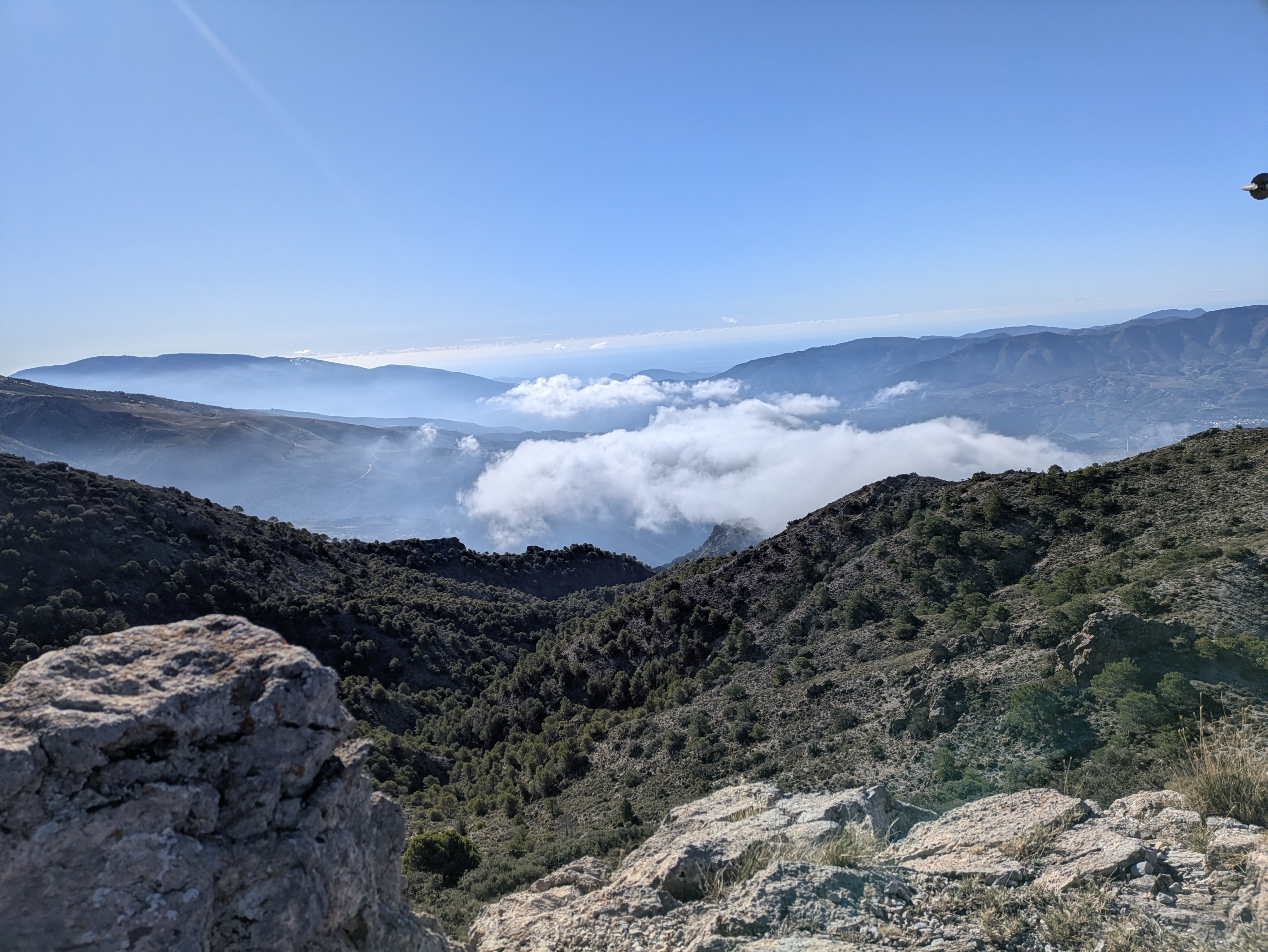
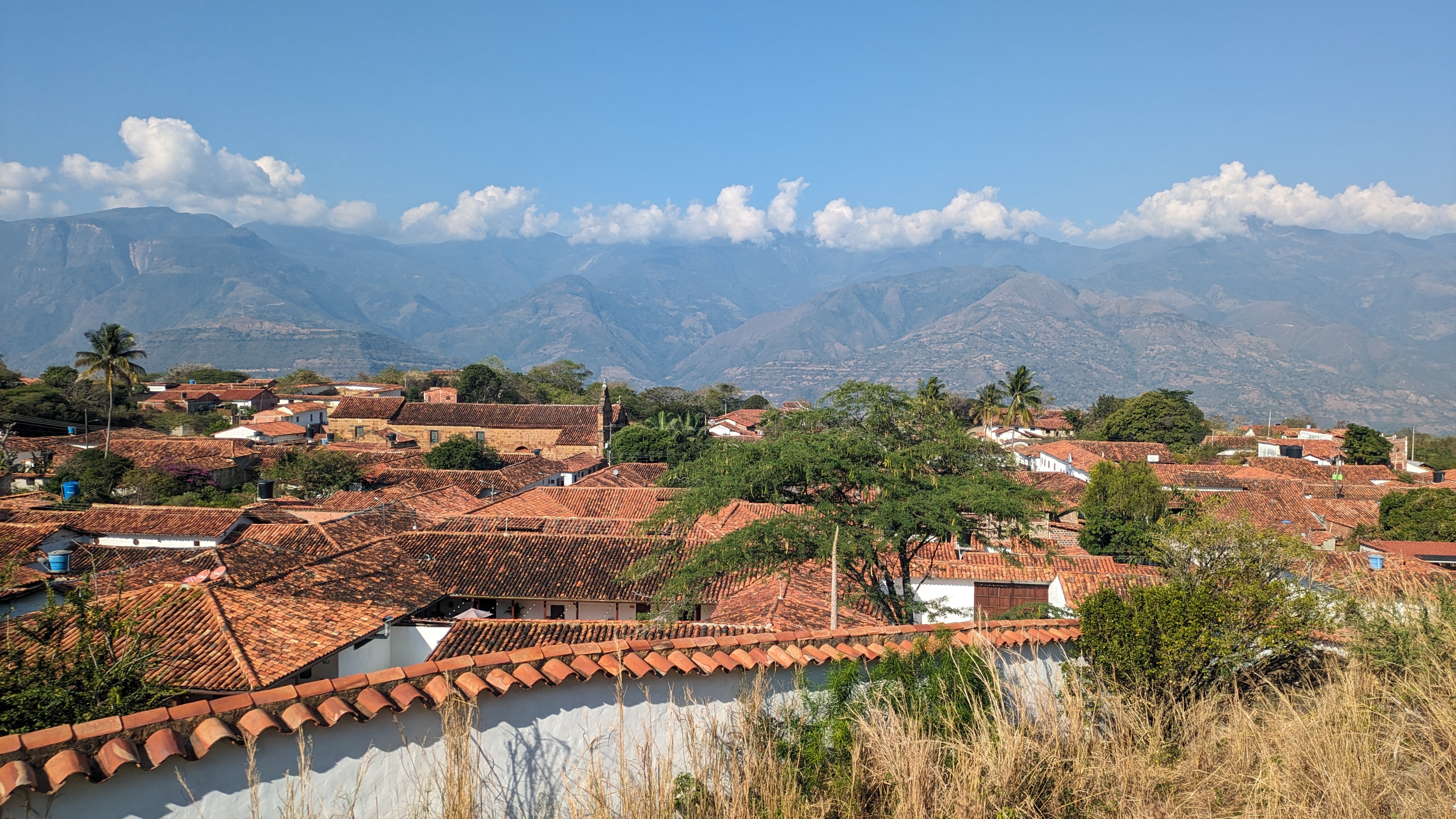
Most days, the air was crisp and clear…except when the locals burnt their mounds of tree clipping , wafting plumes of smoke into the air. The sky was a blinding blue and we were surrounded by a craggy silhouette of mountains in almost every direction. In the distance was the glittering white of the first snows, which had fallen the day before we arrived.
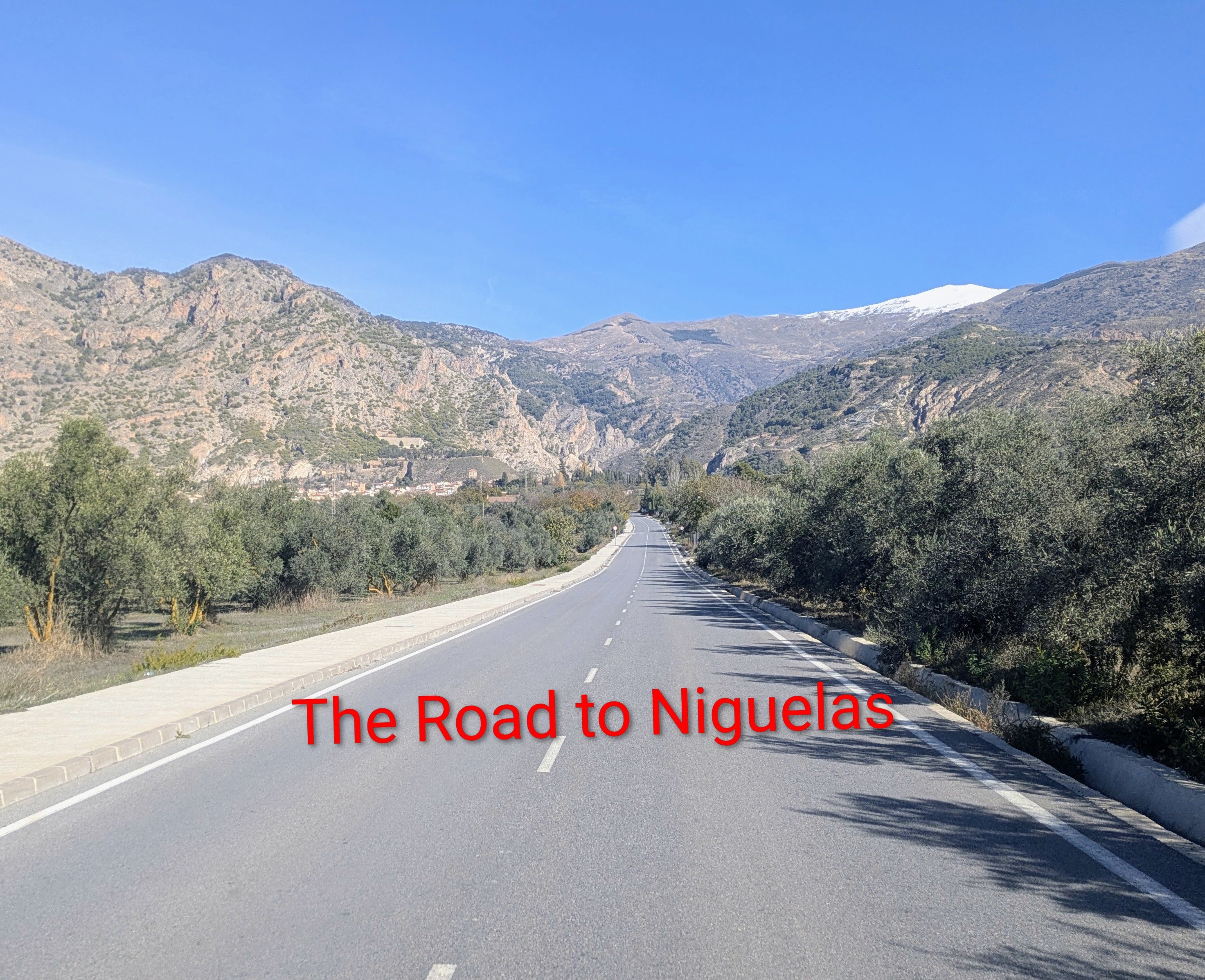
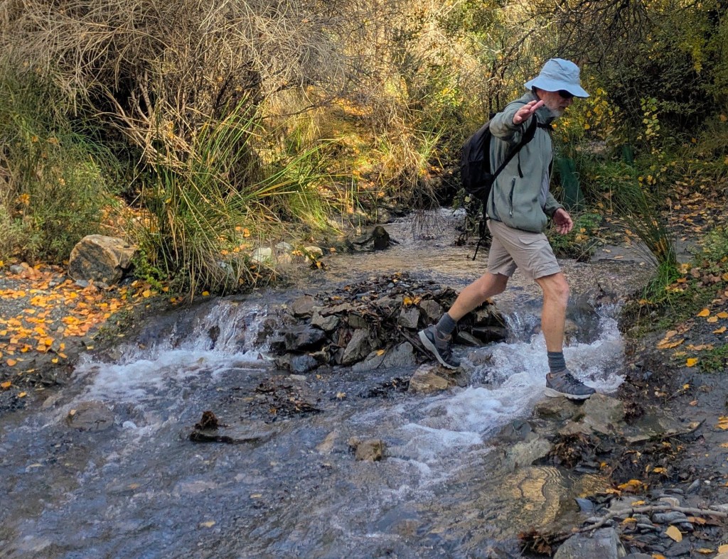
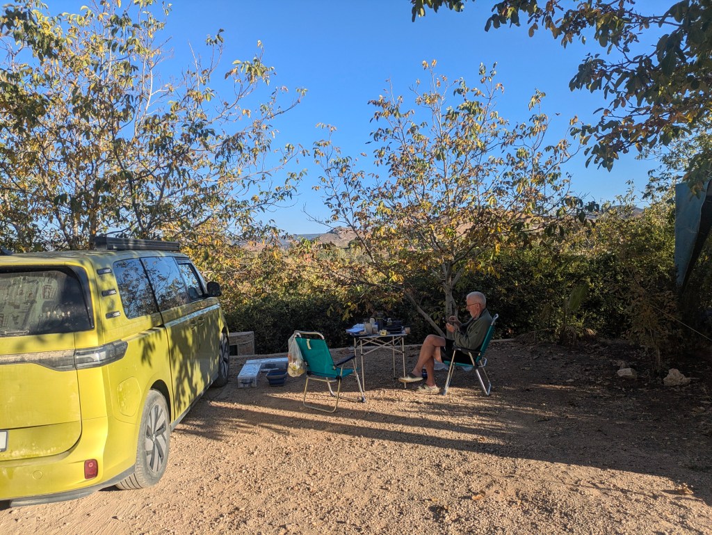
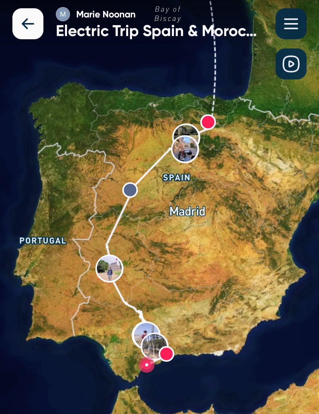
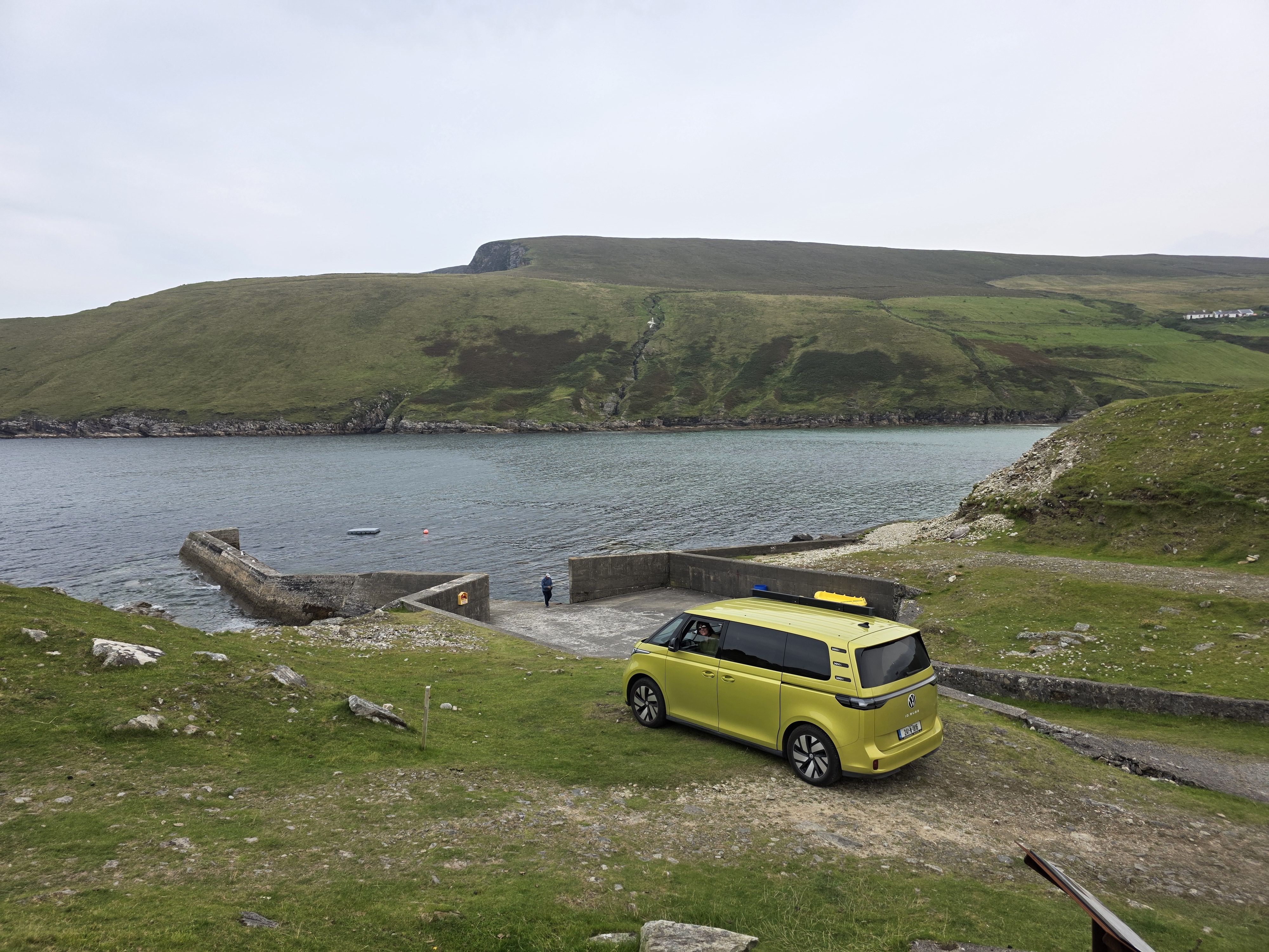
We spent eight days in Niguelas, a small village in the Sierra Nevada, about an half-hour drive outside the city of Granada, staying in a little Airbnb apartment on the edge of the village which we had booked two days in advance. After seven weeks of constantly moving through Spain and Morocco on this trip and sleeping (mainly) in the van, we wanted to pause and stay in one place. The Buzz spent the time parked under an olive tree.
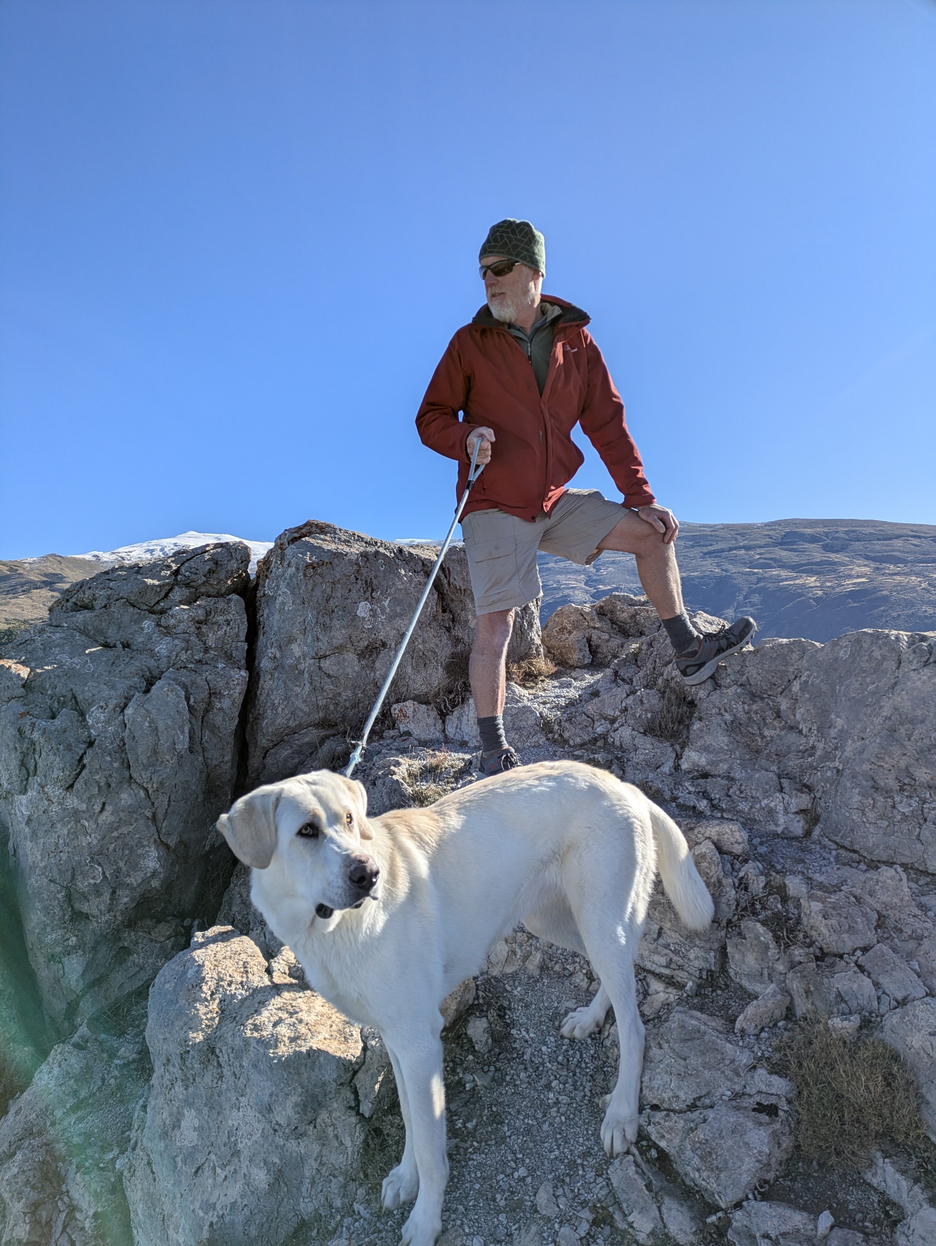
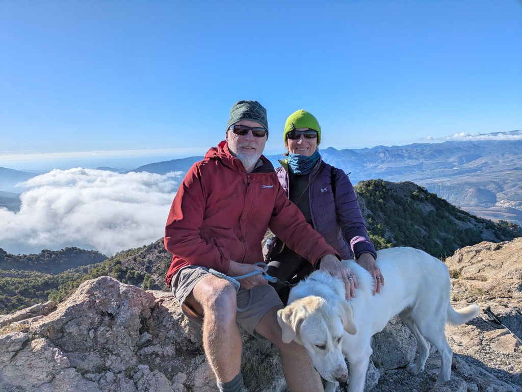
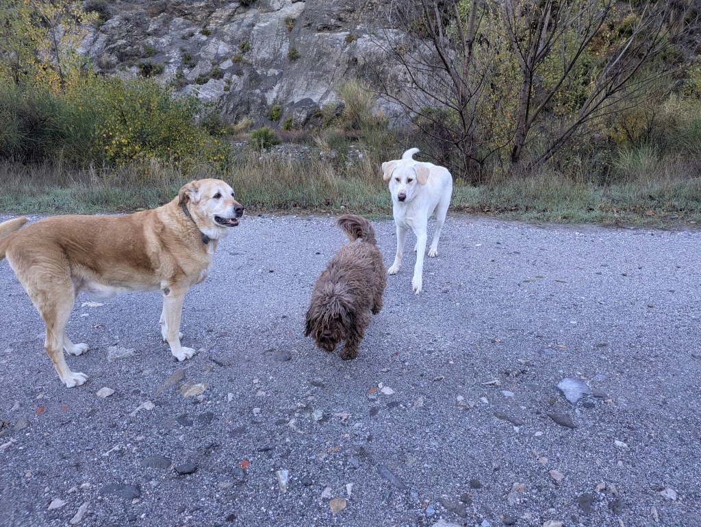
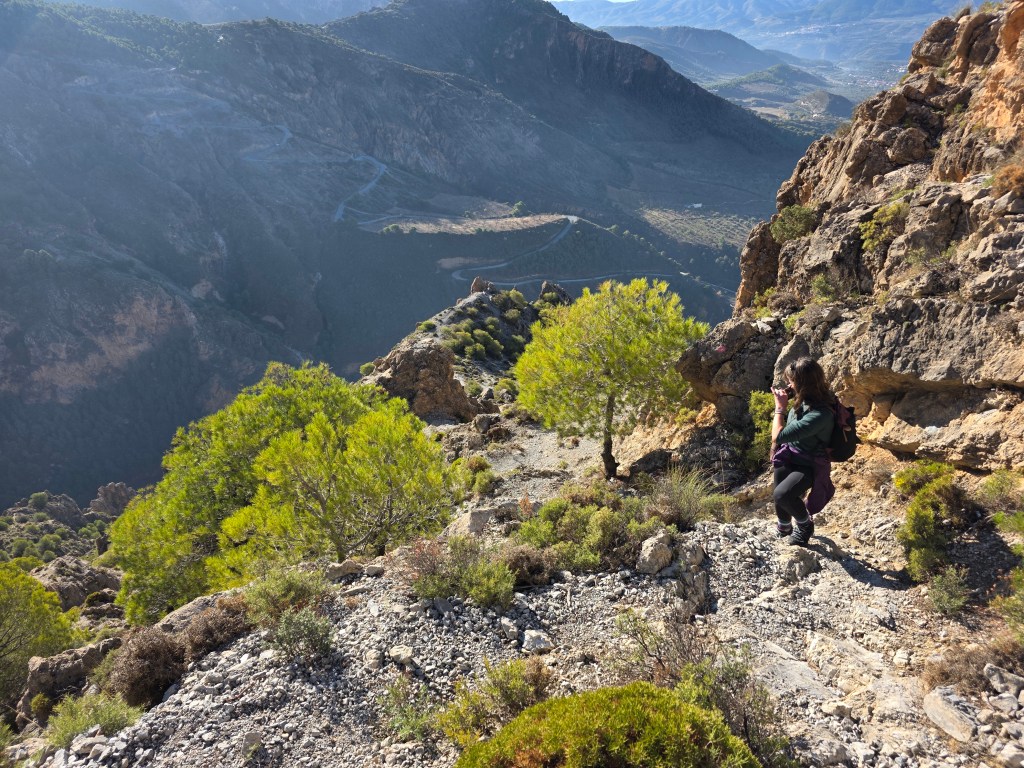
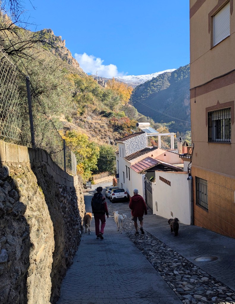
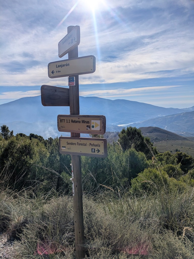
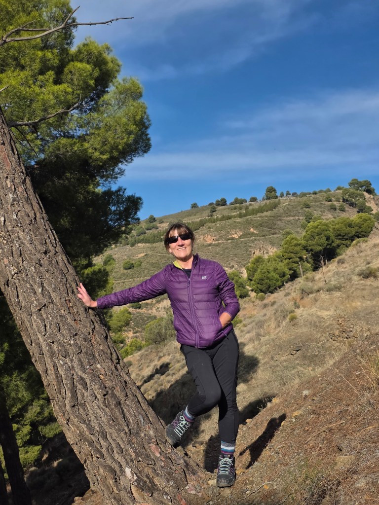
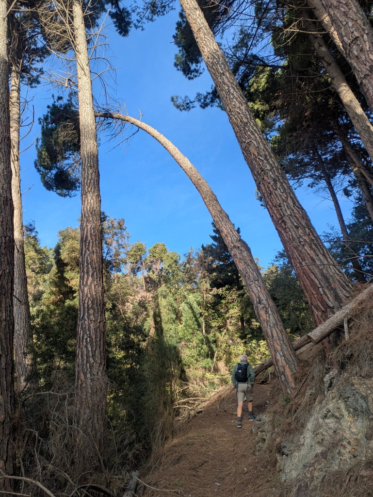
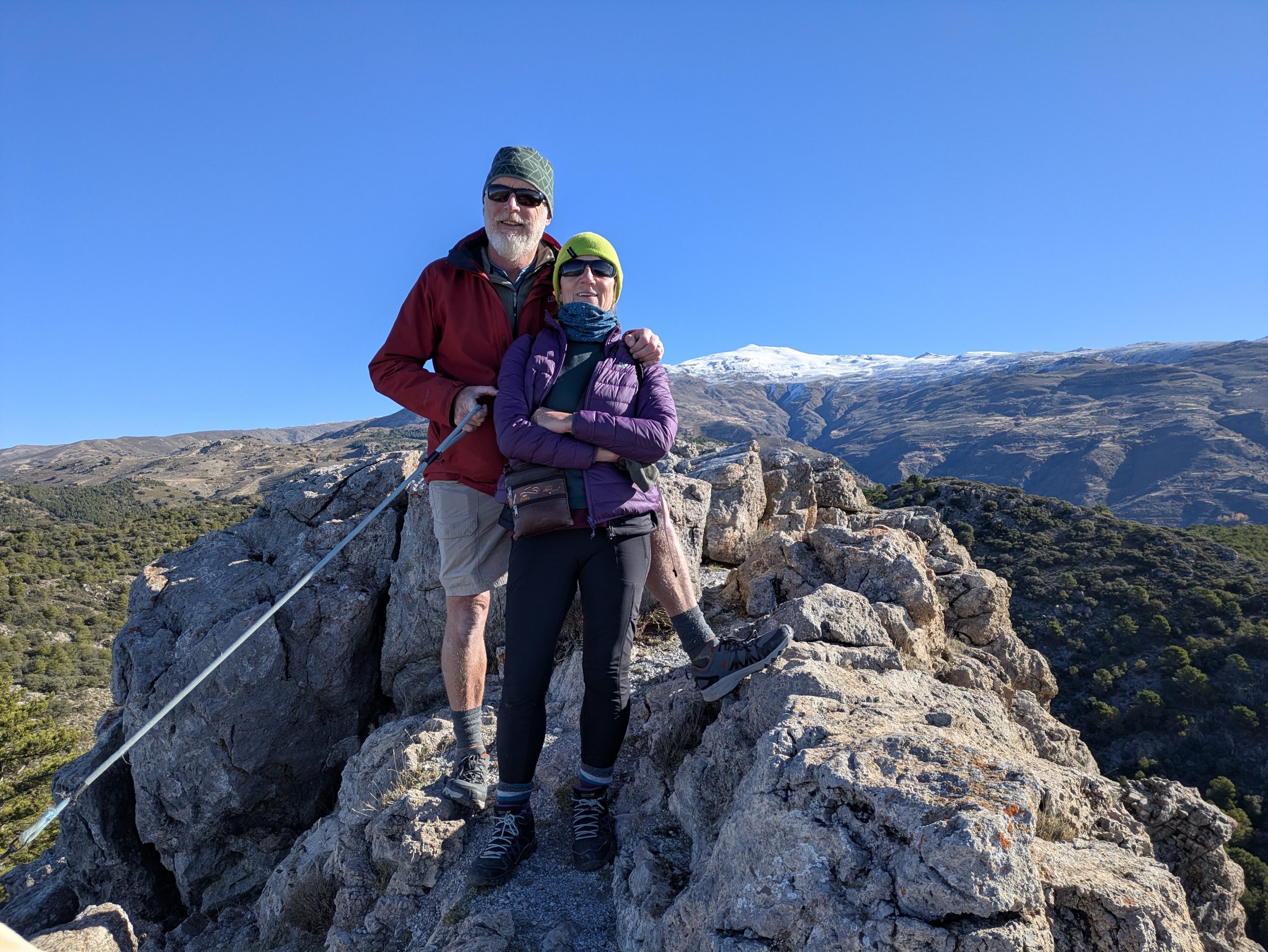
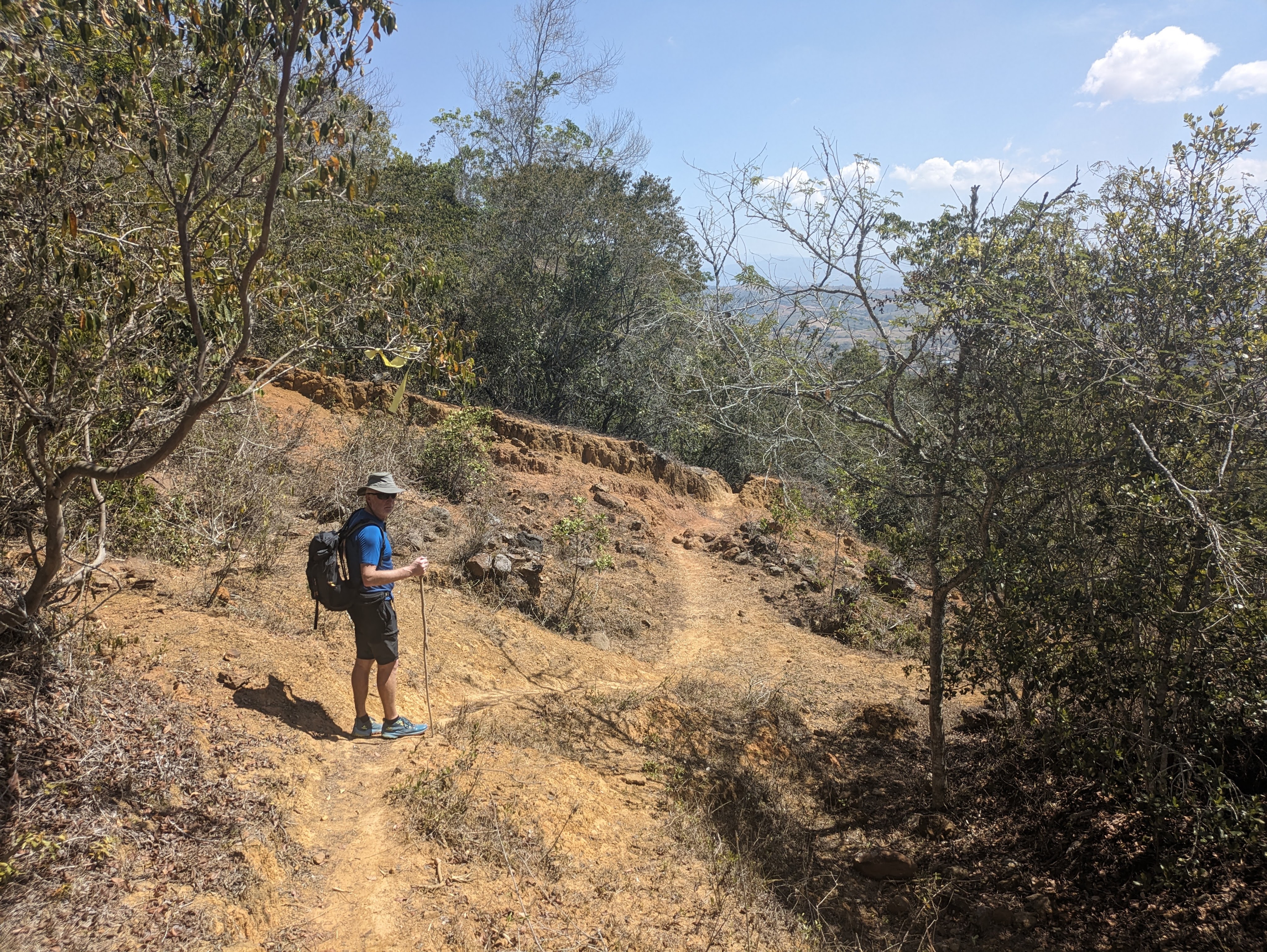
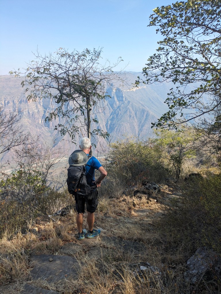
We couldn’t have picked a better spot. Our apartment (Aguas calmas) was warm and cosy, with views of the trees and mountains. It was set in a shady garden with a lovely pool, which would have been perfect in warmer weather. The location of Niguelas was jaw-droppingly beautiful with a huge selection of hikes of various lengths and difficulty, many directly from our door. Some were marked but a hiking app like All Trails was helpful to keep us on track. This was a week of super hiking and some morning dog walks with our Airbnb host, Tim and his dogs, a Spanish Mastiff called Leona, who had liver disease, a nervous rescue lab called Dora and a neighbour’s dog who liked to come along for the company.
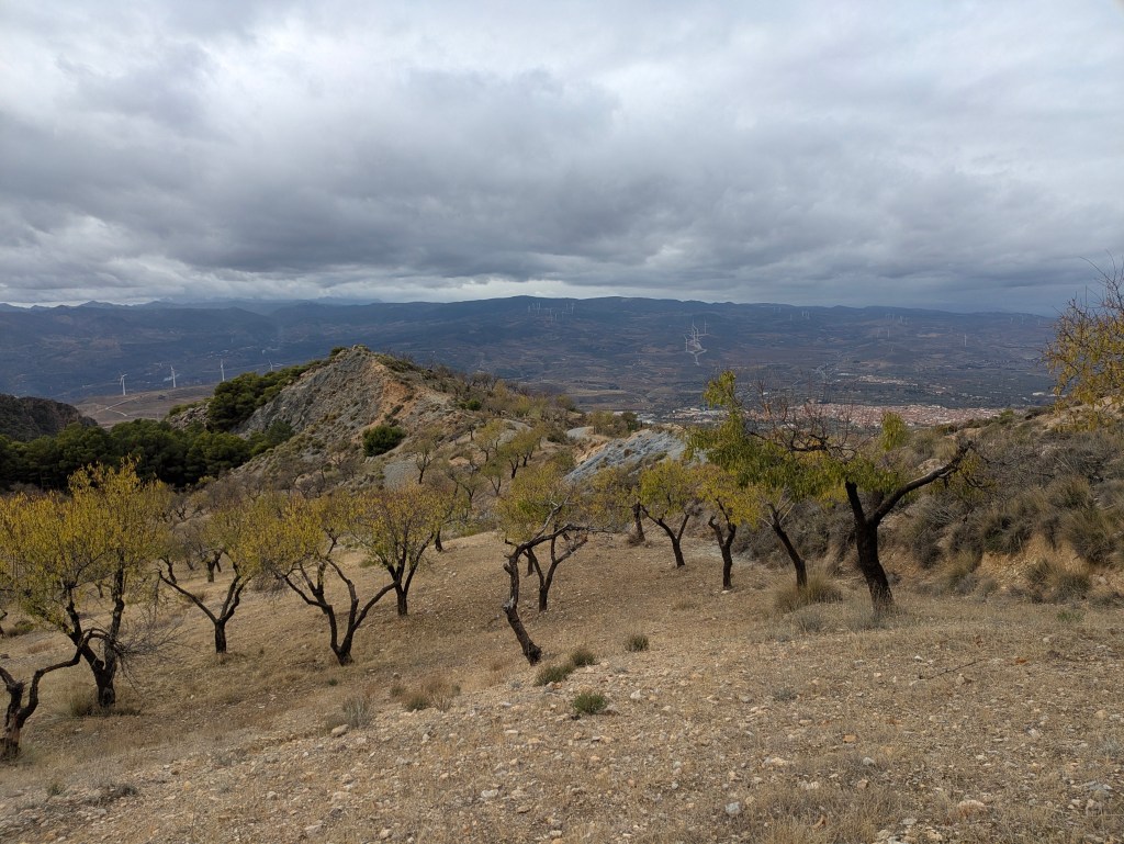
There were almond orchards, olive groves, Aleppo Pines bright green against the bare rock and the yellow foliage of the walnut trees and poplars. Niguelas is also on the GR7, the famous long distance hiking and cycling route which runs all the way from Tarifa, near Gibraltar, through Spain and France to Andorra.
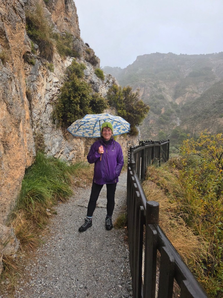
Our days were bright and sunny, with cold nights (sometimes as low as 1C) but there was torrential rain on our second evening, which flowed down the paved surfaces of the narrow streets like a river. We sloshed around in the dusk looking in vain for an open café or bar but all five of them seemed to be closed….probably because of the weather… but opening hours were ‘flexible’. The village streets were winding and so narrow that many of the walls on the tight corners showed evidence of close encounters with vehicles. Tim told us that some guests arrived shaking and traumatised after the ordeal of driving through the village…. but not Caoimhin.
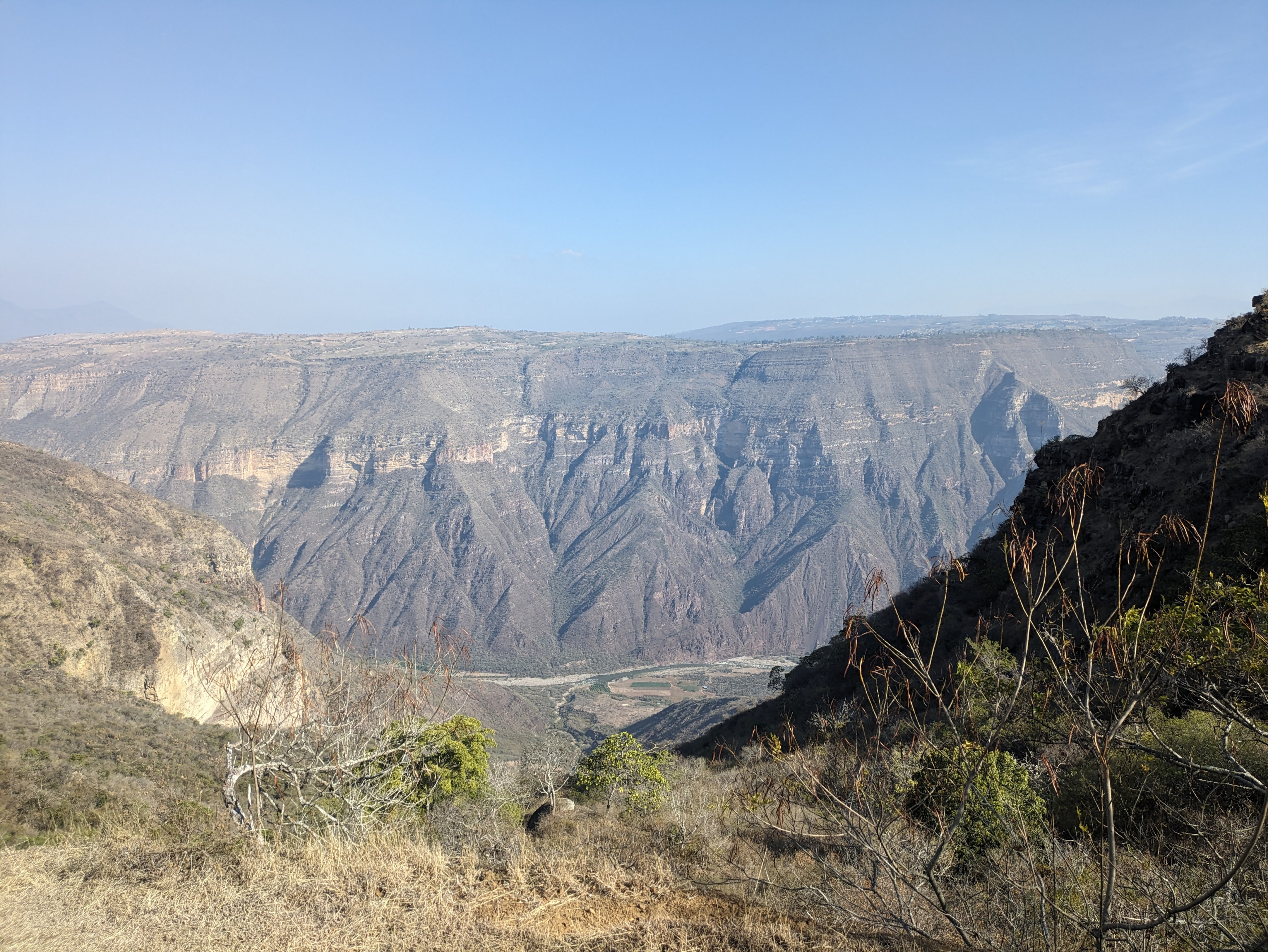
Despite the one evening of rain, water is rare and very precious here. The area can go months without a drop falling. In the mountains were ancient aquifer systems, which used a network of channels and pipes to divert snowmelt and rainfall, ensuring a water supply for downstream communities during dry months. Some of these originated in Arab times and are considered the oldest managed water recharge system in Europe.
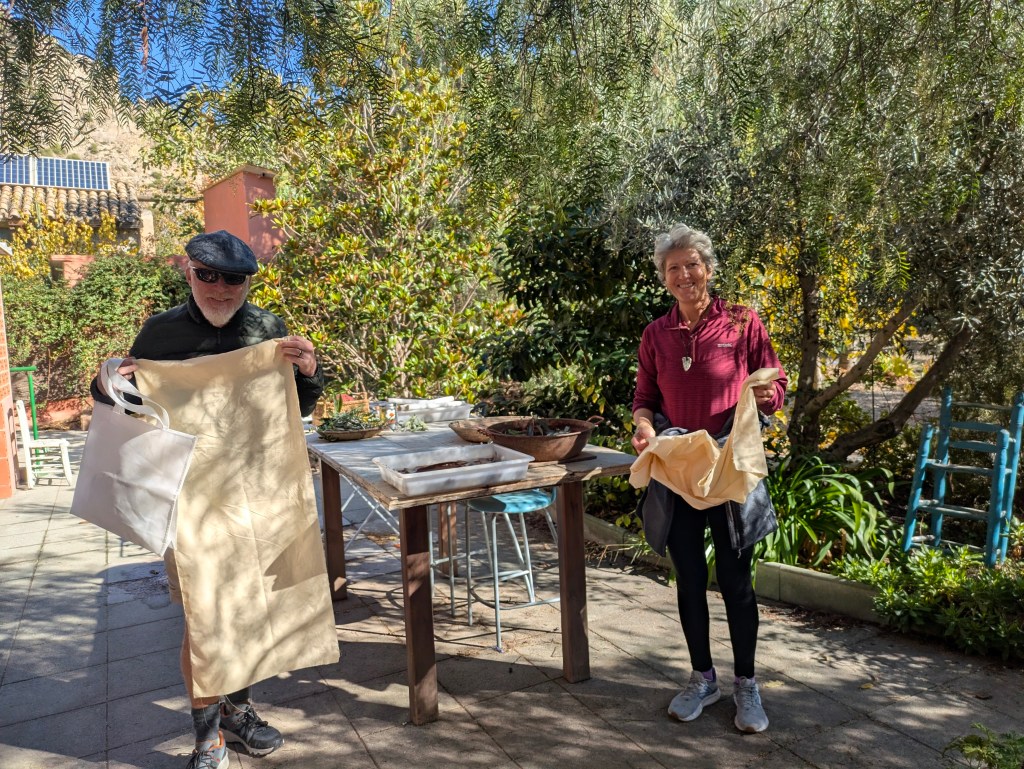
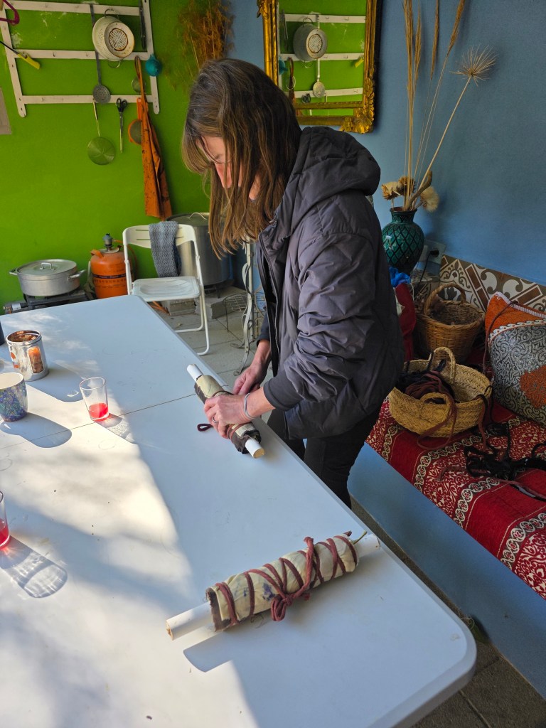
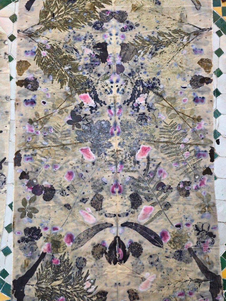
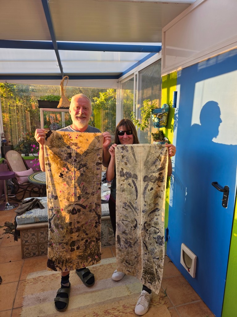
Helga, our Airbnb host, runs felting and eco printing courses so we both opted to try our hand at eco-printing. This involved picking plants and flowers from the huge selection in the garden and using Helga’s techniques to transfer the images to cloth. It was a really enjoyable experience and our results were satisfying and really much better than we would have hoped. The unrolling of the fabric after the steaming process was greeted by lots of ‘wow.’ It is certainly something that we will try at home.
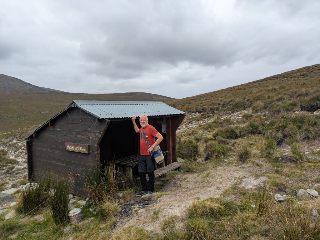
Being Creative with Helga
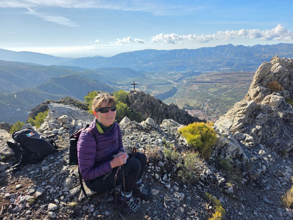
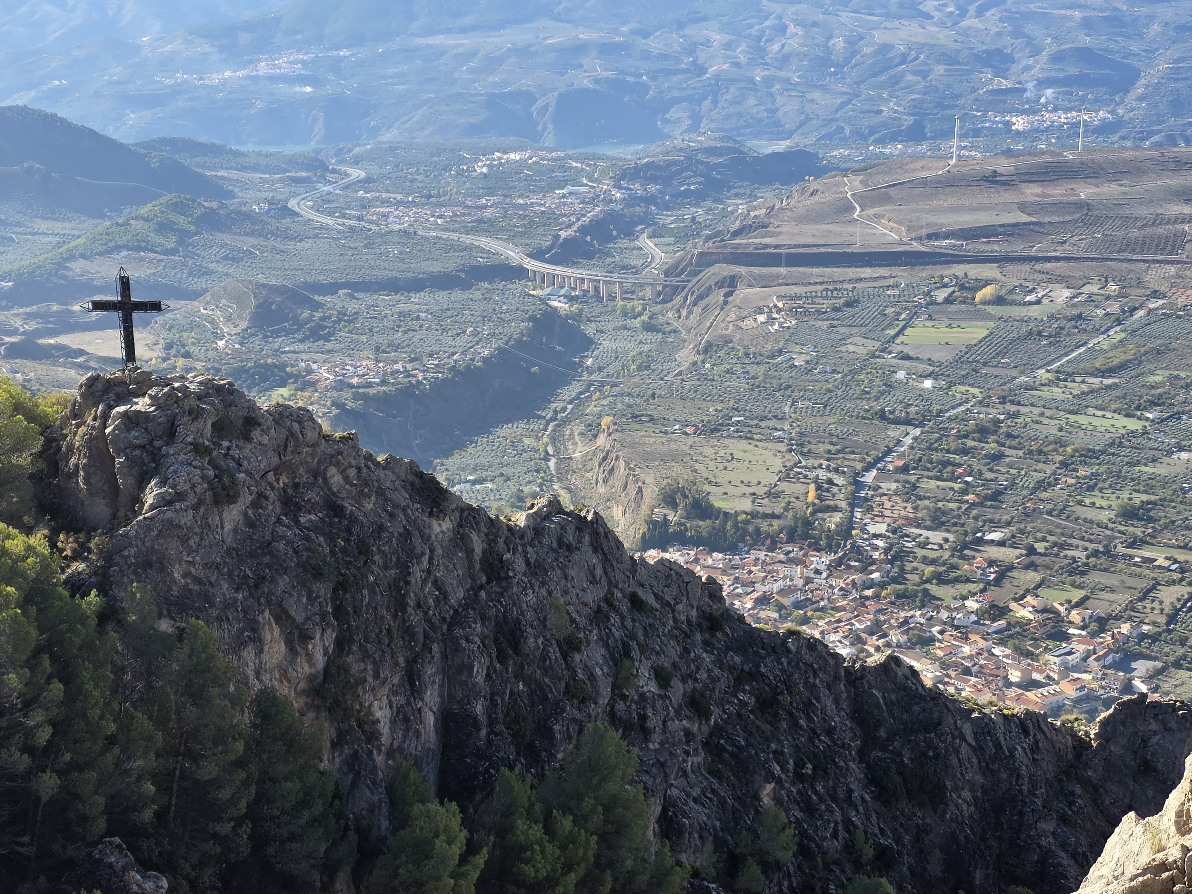
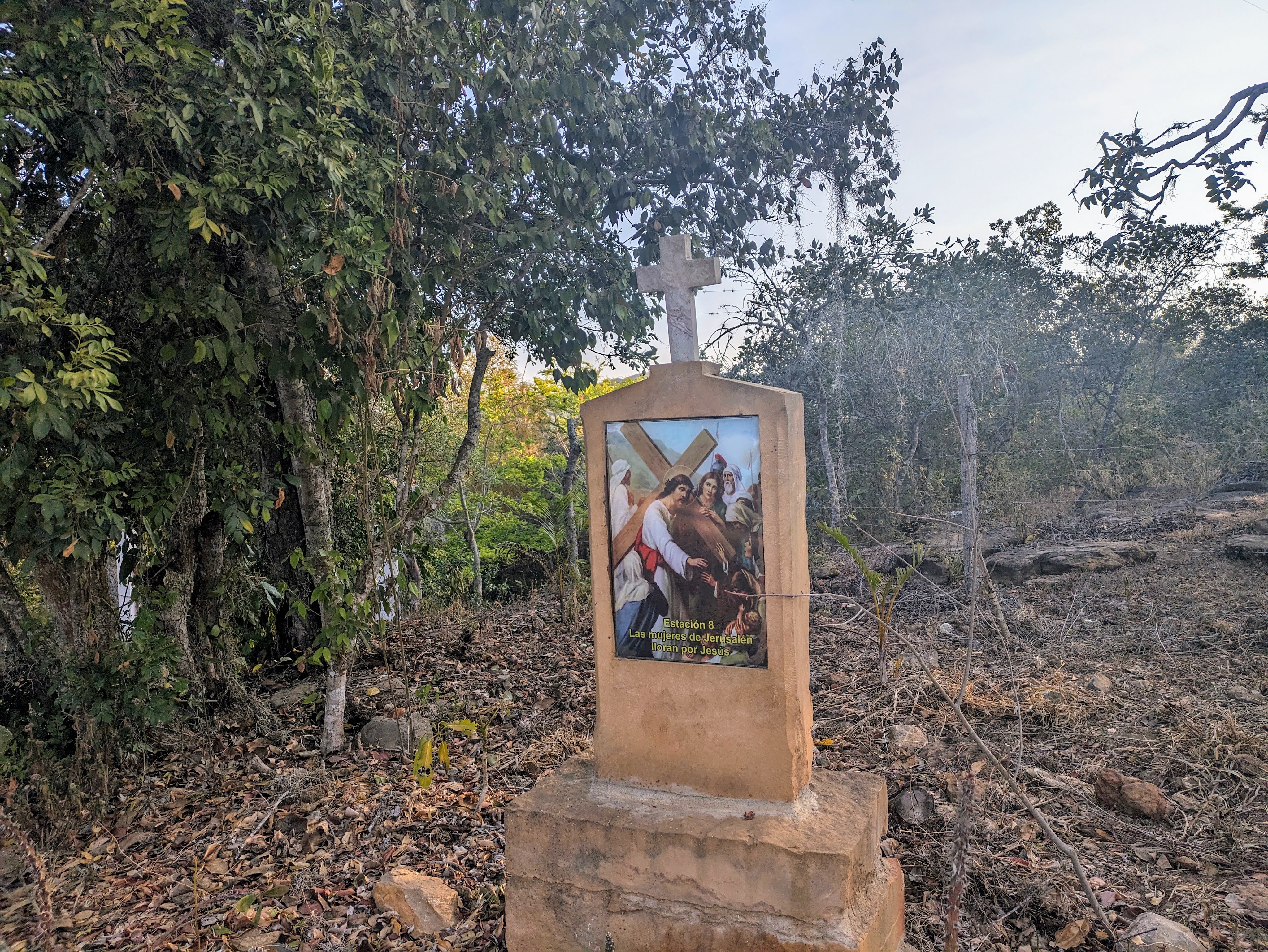
High above the village with a cross, silhouetted against the blue sky. Apparently the village women used to climb up to it on their knees, as a form of penance. We climbed up – not on our knees – and it was a pretty strenuous climb on rough stony surfaces. This is an area that has known conflict and poverty down the ages. It was a key battleground in the Spanish civil war with many atrocities committed against the civilian populations and summary executions in the mountains.
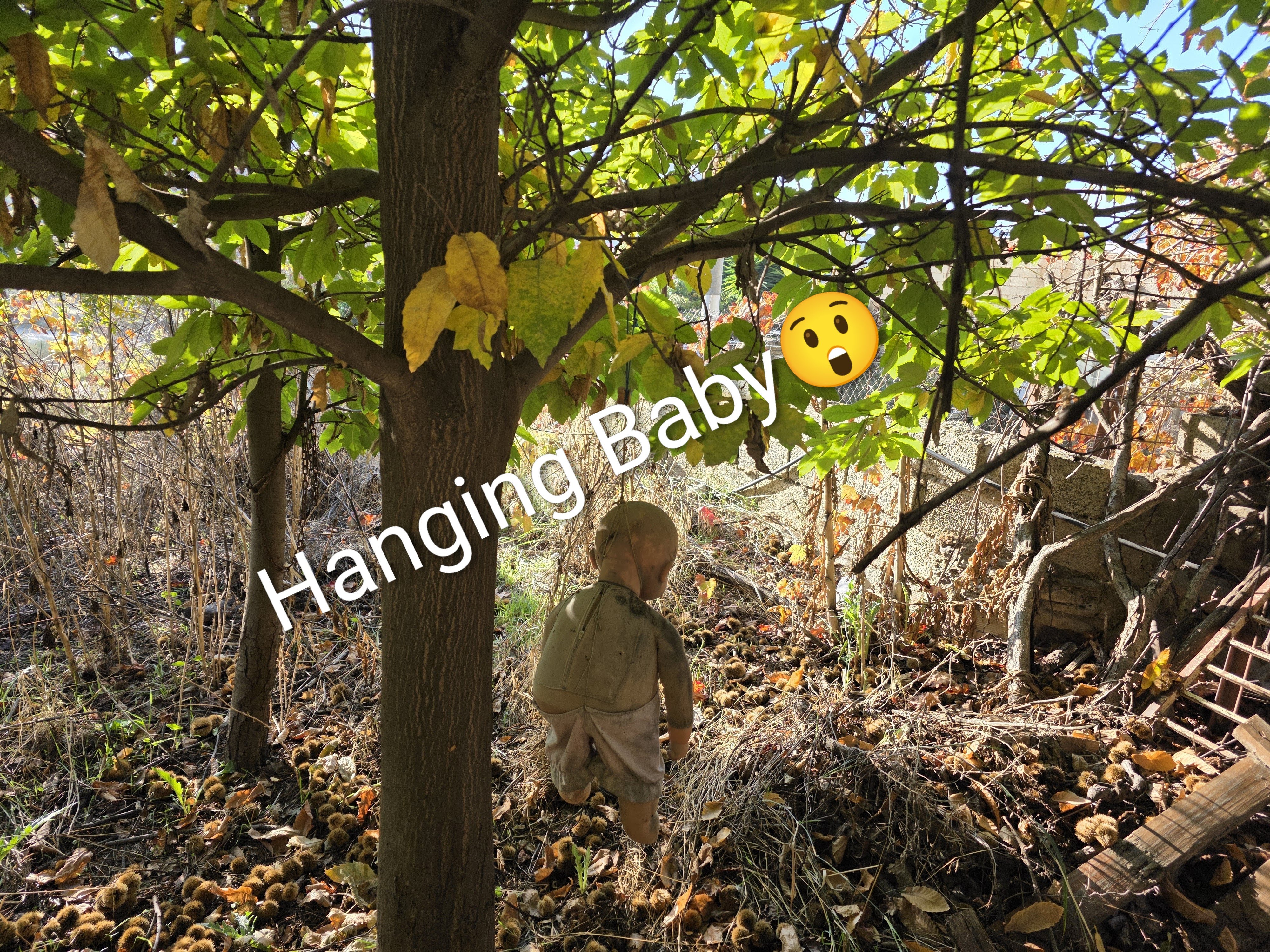
Maybe some of this unease lingers still among the dramatic landscape. In one of the village gardens, hanging from a tree by a noose was a baby doll (the ones that look like a human baby). It was very disturbing sight and had been hanging there for a year. Tim also told us of the local rivalries and neighbourly disputes, of outlaws living in luxurious houses and of a retired priest who set up a refuge for alcoholics, high in the mountains, away from temptation at 2000m……although some ‘escaped’ and made it to the village bars.
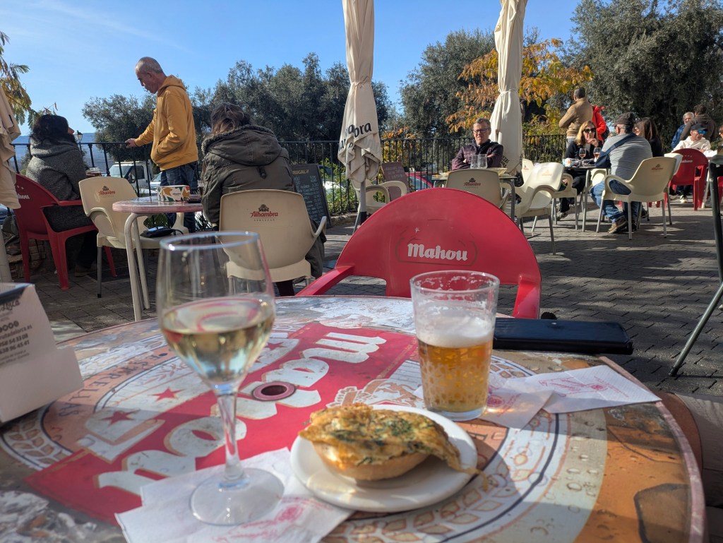
But sitting outside in the November sunshine, inhaling crisp mountain air and eating delicious tapas (that come free with a drink), all these simmering rivalries and tensions were completely invisible to us. We sipped our drinks and thought about how lucky we were, as we waited to attend a dramatization of some of Lorca’s work in the village casa de cultura.
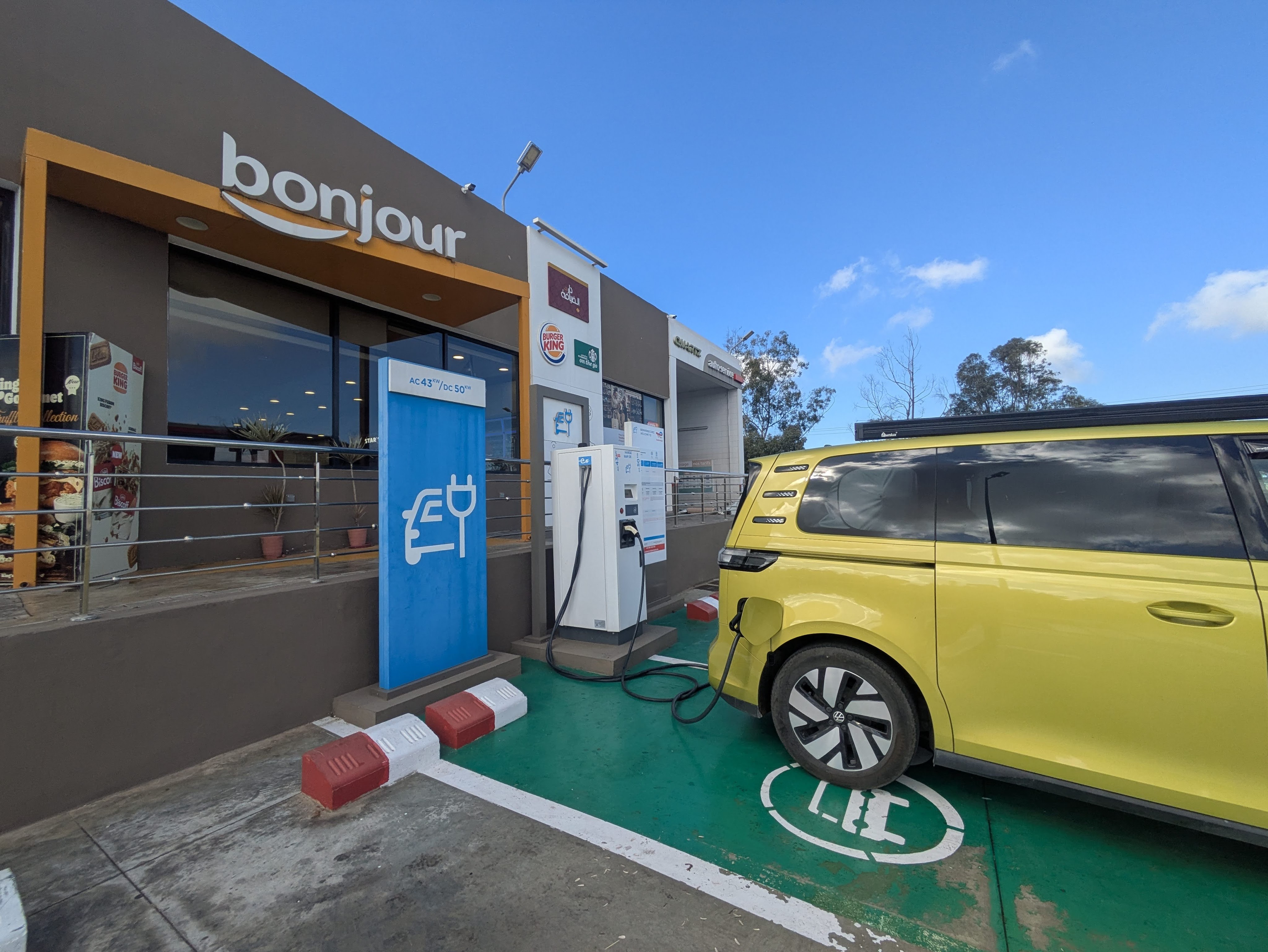
Leaving our camping cocoon in Tangier was hard but it had to be done. Waving goodbye to Said, the manager, we headed off in search of EV chargers, making a minor detour to Carrefour Supermarket (Socco Alto branch) to stock up on a few beers and a bottle of wine. Alcohol is not widely available in Morocco, but you can find it…. if you know where to look or have inside information from a walking tour guide. It’s relatively expensive, especially compared to Spain.
We stop at a fuel station which has Fast Volt Chargers, which again look well maintained. Caoimhin had contacted the company for help about our inability to download the app (essential for charging as there was no option to pay directly using a bank card) but we were still unable to download it despite following their instructions of using a VPN and selecting France.
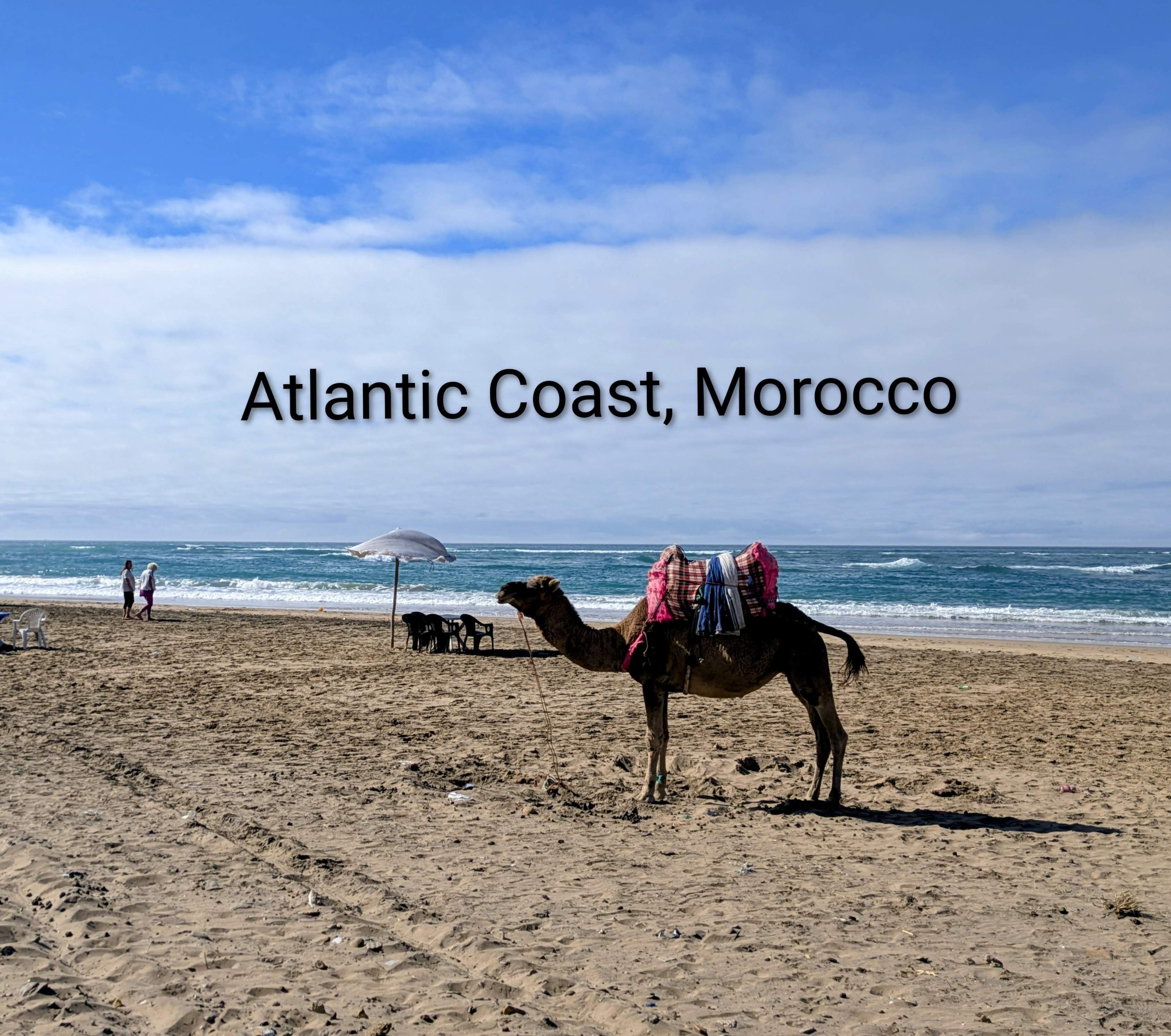
Google maps (but not Electro-maps) tells us that there’s an EV charger about 3 minutes away so we go in search but they aren’t there, and never were, according to a security guard who directs us back to the Fast Volt chargers. We continue down the coast towards some Tesla Super chargers which appear to be in the middle of nowhere,. When we get there, we discover that they are part of the high-end Hilton Golf Resort. The guys on the gates were friendly and helpful but the Tesla chargers were only compatible with Tesla cars. The guys were offering us cables to slow-charge off a wall socket but that would have taken hours so we pushed on down the coast where the sight of camels relaxing on the beach made us smile.
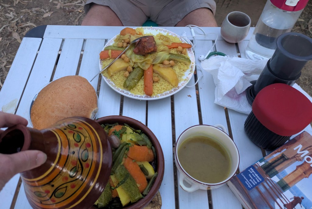
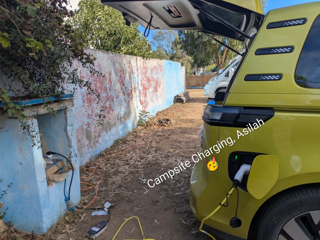
We continued to a dusty, dishevelled campsite in Asilah, a windy town of murals, artists with a long promenade by the Atlantic and an interesting walled medina. After checking in, we plugged into a socket with the blessing of the campsite owner who was saying Inshallah, and lo and behold, the charging light turned green and the Buzz slow-charged all night until it reached 100% by mid- morning the following day. Maybe it was the blessing – or the lack of safety features and circuit breakers – but we now had 450 kms to play around with. As well as that, the wife of the campsite owner made us a dinner of tagine and couscous/veg and delivered it to our van in the evening. Delicious. It rained heavily during the night, the first real rain that we have had since we left home on Oct 1, but there was little evidence the next morning as the thirsty ground had soaked it up.
Asilah, Atlantic Coast, Morocco
On down the Atlantic Coast, stopping at a Total Energies gas station in Lareche, we found two working chargers, that were also free to use. We didn’t really need to recharge but we couldn’t pass up the free offer. Things were definitely looking up.
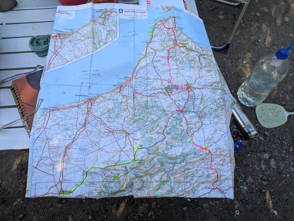
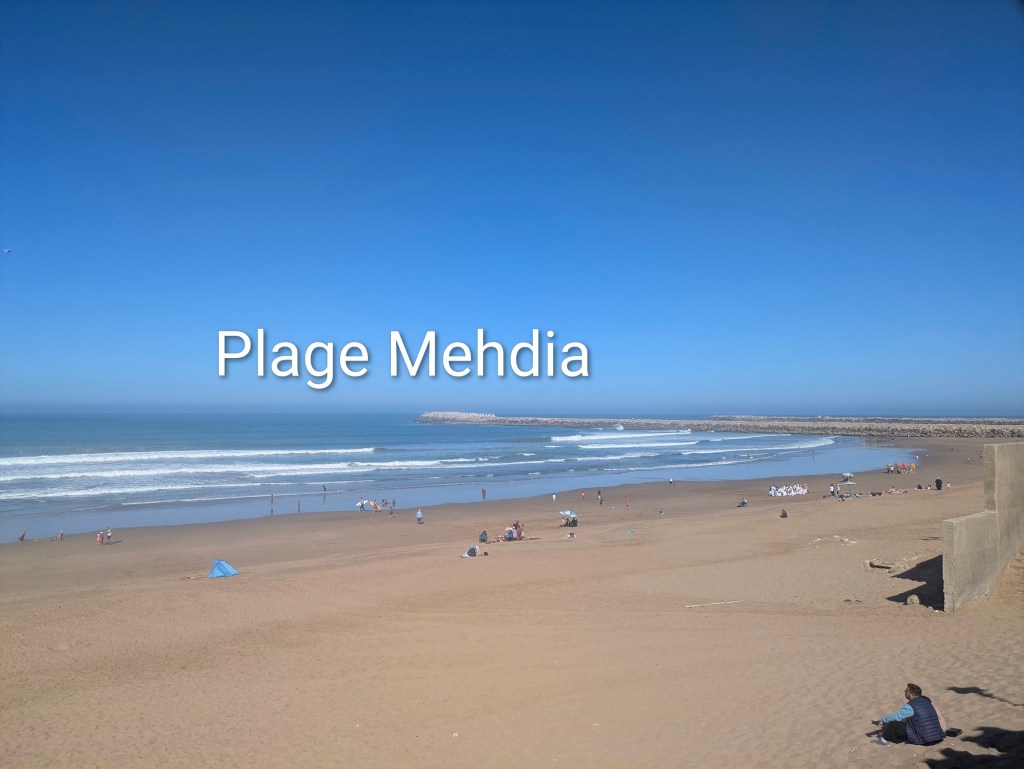
We continued past acres of polytunnels gleaming silver in the sunshine, roadsides strewn with rubbish and towns that slide into each other until we reached Mehdia Campsite, a large campsite near an impressively long beach. It also had a large swimming pool, much favoured by seagulls who used it as a playground and a toilet. Two British bikers pitched a tent beside us and through the hedge, we heard them mention their longing for a cold beer. As we had a couple of cans in our little fridge, we passed them through the hedge to our grateful neighbours. They were heading north towards Tangier on their way home after two weeks in Morocco and told us of their favourite scenic rides. One of them produced a paper map with highlighted lines, marking their trip. This made me realize how much I miss the feel of paper maps, grubby from use, creased from folding ‘the wrong way’ but so easy to get a proper overview. One of their routes looked suitable for us, provided we could charge (we were unable to charge at the seaside campsite although we tried).
So we changed direction, abandoned the coast which was mostly dismal and dirty and ditched our plan of heading to Casablanca – it sounded alluring but many people told us that it was bustling, modern and quite miss-able. We managed to charge fully (for free) at another Total Energies fuel station on the motorway outside Rabat. These motorway stations were similar to home with Burger King, and shops that sell pastries/sandwiches and Pringles – generic places that could be anywhere on the planet. We chatted to two Norwegians who were driving to Gambia from Norway and who thought we were very brave (and quite mad) to be driving an electric van in Morocco. They actually went in search of us, curious about who could be driving the all-electric van with an Irish registration in the charging bay.
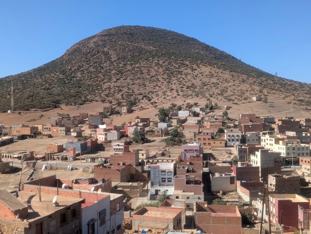
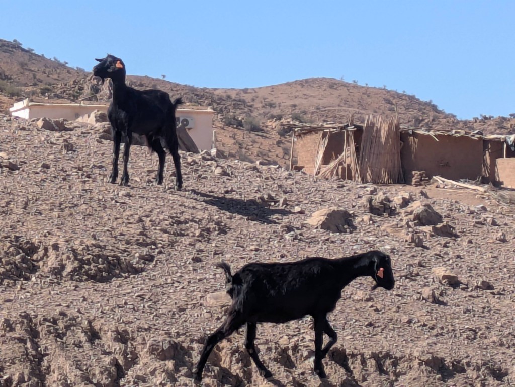
The inland journey was breathtaking, undulating and twisty, the countryside a palette of browns with the occasional green scrub, villages like mirages clung to hillsides and everywhere there were goats, mainly jet-black, like shadows. The temperature rose steadily until we hit 34 degrees. There was the bleating of the goats and the ‘call to prayer; from the village mosques but often there was miles of emptiness. We were in search of a farm campsite on Google maps which sounded like a place we might be able to charge the Buzz, plug it into a socket…..if there was a socket or even electricity. The trouble was that we couldn’t find the campsite. We left the tarmac and followed dusty tracks…. to nowhere. Eventually we turned around and tried to retrace our tyre tracks back to the ‘main’ road which was not an easy feat. A ragged boy appeared at our car window, offering us the bunch of grapes he held in his hand. He didn’t know anything about a campsite but knew the word for ‘money’ in several languages …and probably in a few more that we didn’t recognize. He wasn’t in the least bit aggressive but had a lovely charm about him.
Looking for a Campsite??
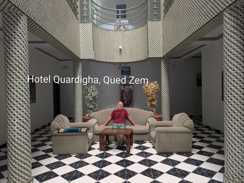
We pushed on to Qued Zem, a substantial town, which was once called ‘Little Paris,’ a title which left us scratching our heads. It was after six in the evening and still almost 30C so we went in search of a hotel. There weren’t many choices, the review for one read ‘don’t expect clean sheets’ so we went for the other, a fairly pricey option in a grand old mansion. This looked impressive but the bedroom aircon refused to go below 26C and the blocked shower tray flooded the bathroom but the sheets was clean and the breakfast on the veranda facing the street was delicious. The quality of bread and pastries in Morocco was surprisingly superb, probably the French legacy, and juices were almost always freshly squeezed.
Qued Zem
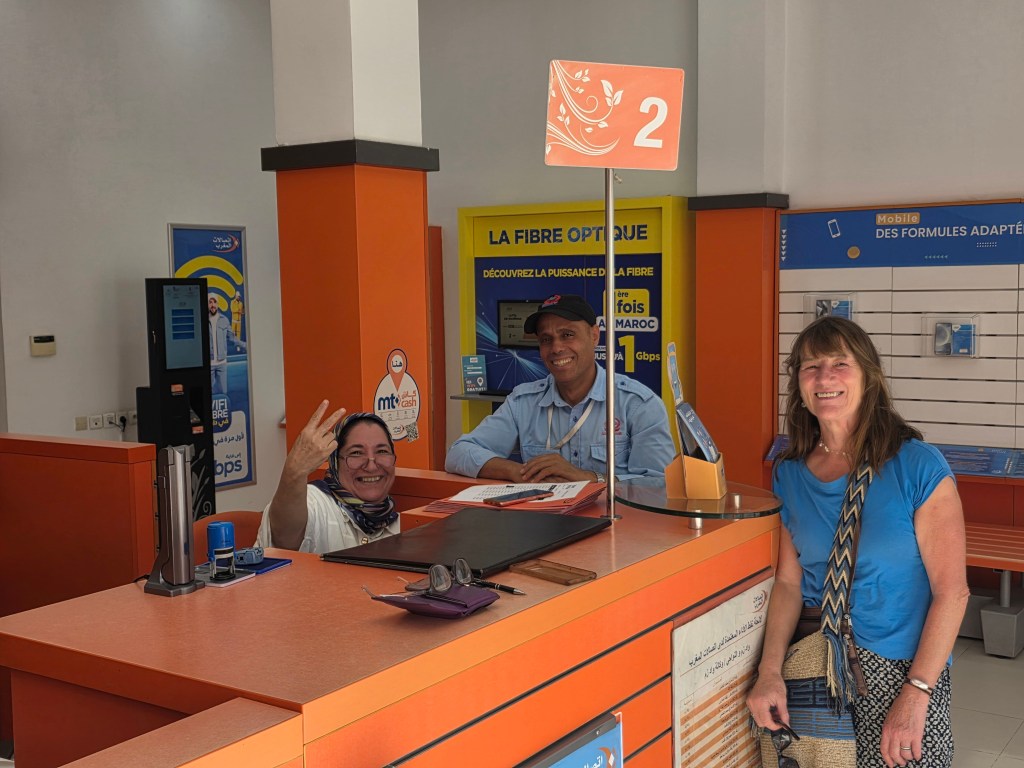
Although I had an e-sim from Revolut, I wanted to buy a Moroccan phone sim so we paid a visit to the Maroc Telecom office in the town where the lady behind the counter was extremely helpful but couldn’t understand why my Maroc Telecom sim in my phone worked for calls but not for mobile data. She eventually asked the doorman to take us to Hashim around the corner who was good at fixing things. Hashim was determined to find a solution but eventually had to give up….mainly because we wanted to get on the road. The Moroccan desire to help was truly amazing.
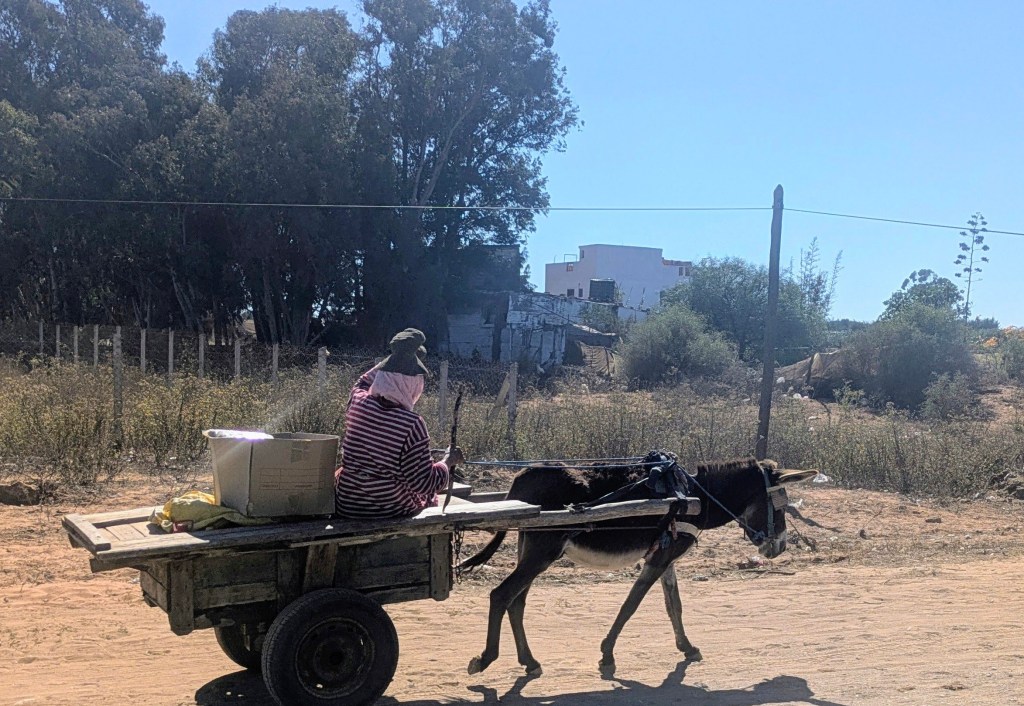
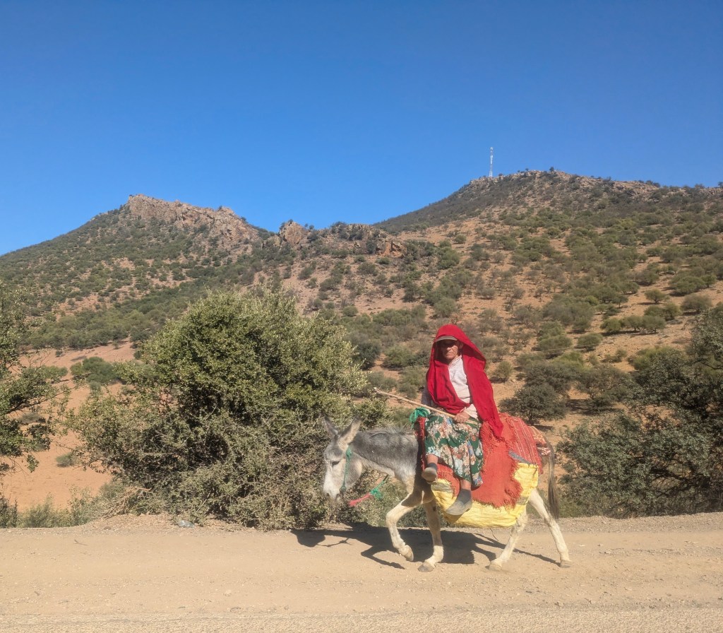
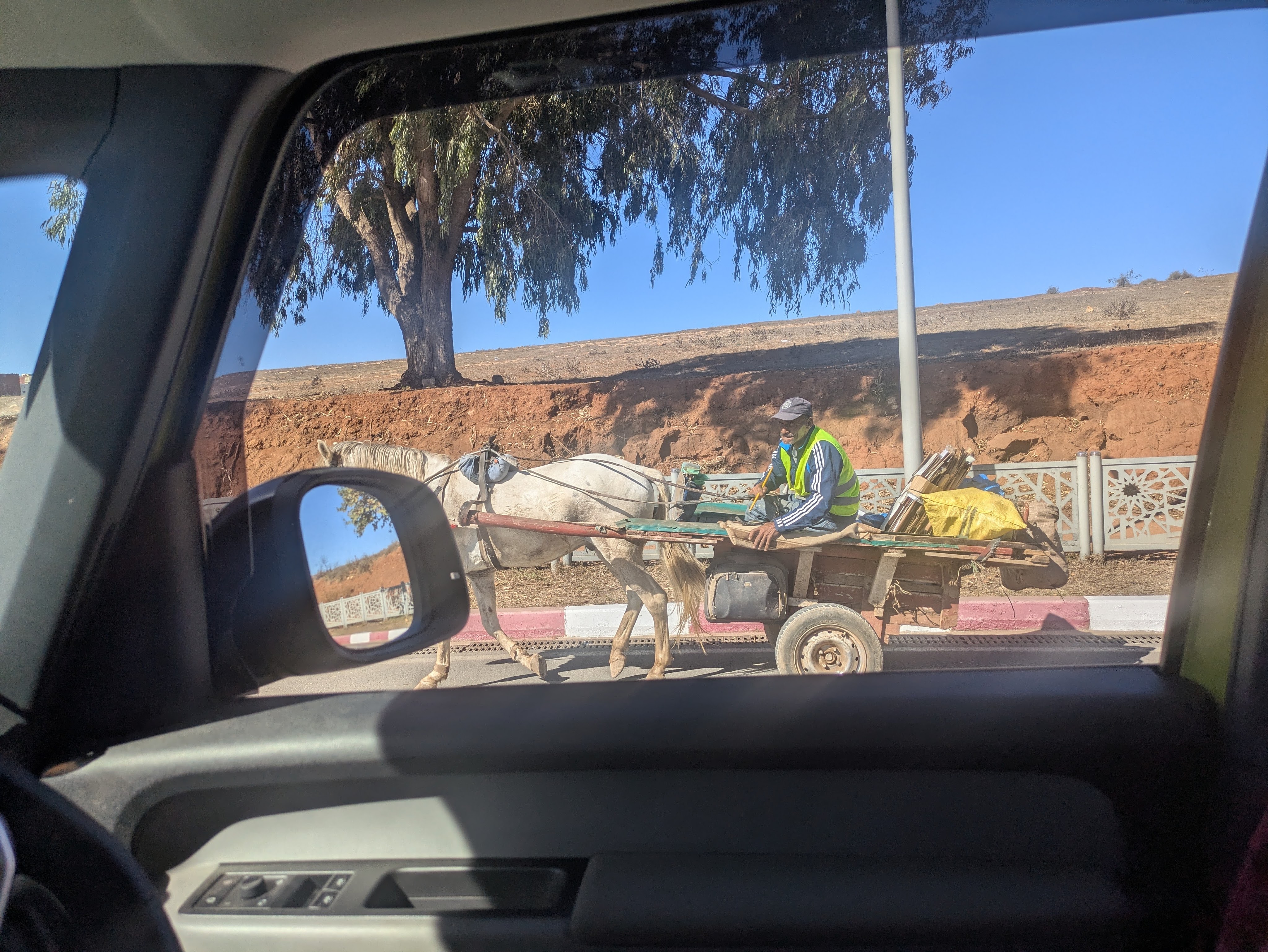
Although there were plenty of petrol stations in Qued Zem, there weren’t any EV-chargers -most people didn’t know what we were talking about. Although we would have preferred to continue south to the High Atlas, the difficulty with charging made us head north although in reality, chargers were scarce in every direction. The drive north through the Middle Atlas to Azrou was again spectacular with a timeless, almost biblical feel. It was Friday and in many of the villages, our passing coincided with people spilling out of the mosques and hopping on donkeys carts or bicycles. In many cases, the only evidence of modern living was that the man on the donkey had a mobile phone in his hand.
Surprisingly, there were lots of speed checks with police hiding behind bushes with speed guns. The advantage of trying to conserve fuel was that we were always within the limit and were waved on. Our charging issue was becoming critical, the kilometres ticked down and we mentally calculated how many we have left versus how many we needed to get to our destination. Morocco is a big country, more than ten times the size of Ireland. There were supposed to be EV-chargers in Azrou but we couldn’t find them and nobody knew anything about them. By the time we reached the Azrou campsite, Euro Camping Emerites (at least that existed), we had 62 kms left and we desperately hoped that we would be able to charge using a granny cable in a socket.
Azrou was charming, a Berber town surrounded by cedar and pine forests with many walking trails and home to troupes of monkeys in the woods. At about 1300 m, the days were warm and the nights were cool. The campsite was also lovely with lots of trees, a place where Khalid, the friendly manager, delivered free baguettes to everyone in the morning. It was exactly the type of tranquil place we liked, surrounded by nature BUT we had a big problem, we couldn’t charge the Buzz, We tried several sockets, Khalid allowed us to plug into the kitchen, he called a friend, brought us to a garage but the Buzz wasn’t buzzing.
Khalid and the Azrou Campsite
According to various (unreliable) maps, we thought there were chargers in Fez, which we had intended visiting, or Meknes, which we had never heard of before. Fez was 89kms but Meknes was closer at 65kms but we had a mere 62 kms in the tank. Would either of them have chargers that worked……even if we got there? Our hope was that as we were in the Middle Atlas mountains, it should be all downhill to either destination. We decided on Meknes and drove slowly….Khalid gave us his phone number in case we got stuck and said that he would come and rescue us.
A wonderful thing happened. A few kms outside the town, our available kilometres rose to 90 with 60kms to go. I began to breathe again, my stomach unclenched. The Buzz kilometres changed according to the terrain – going downhill, they zoomed up, any uphill, they went decreased but by the time we arrived in Meknes, we had an unbelievable 109 kilometres to spare. We headed to Carrefour Shopping Mall where there were supposed to be Kilowatt chargers and we had already downloaded the Kilowatt app. The good news was that the two chargers were working but the bad news was that they were in use. The friendly doorman suggested that we go for coffee and he would call us…which he did after about thirty minutes. Thankfully, the Buzz charging light turned green. As it was only a medium charger, we were only 50% charged after about three hours but we hated shopping centres and couldn’t bear to spend any more time there.
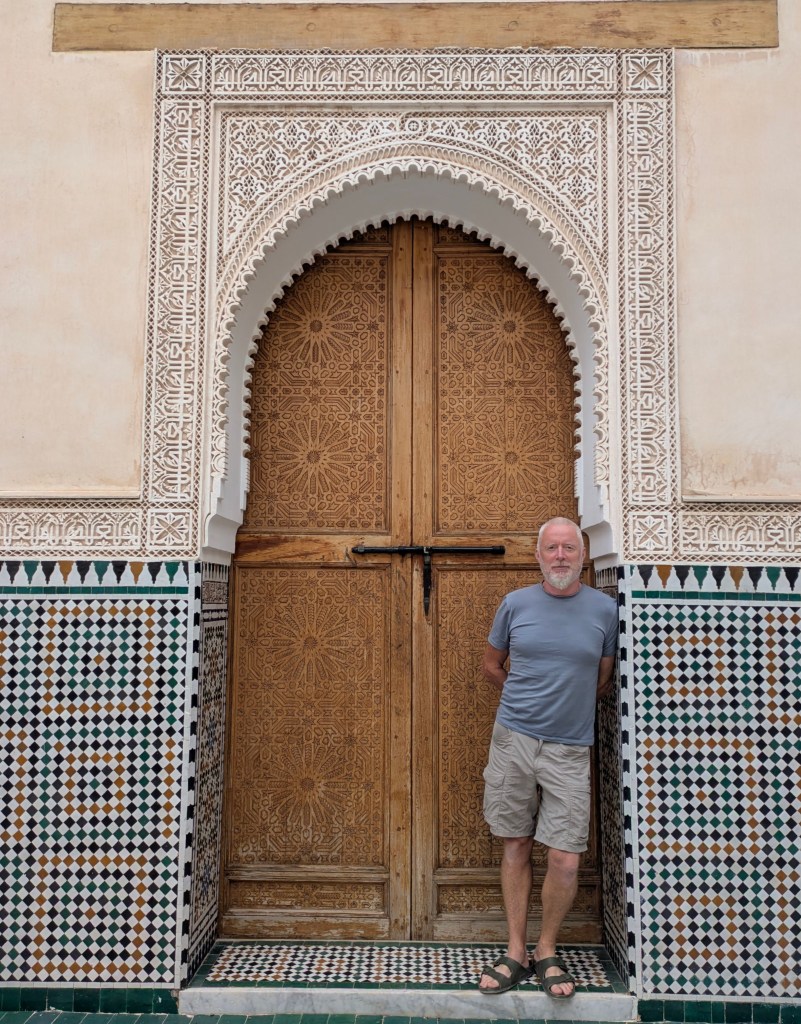
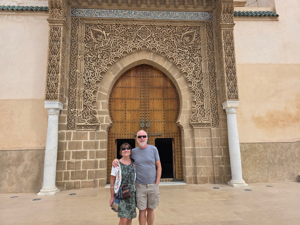
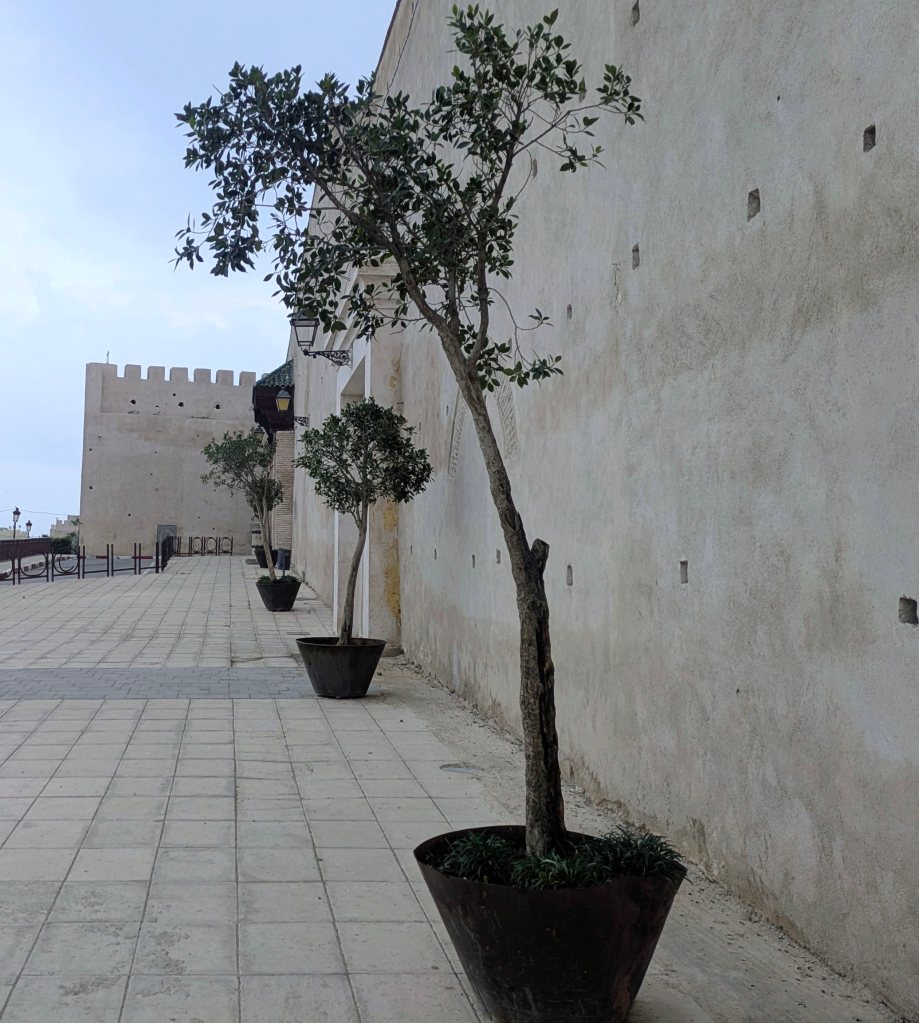
Maybe our diversion to Meknes was meant to happen. It was a lovely city with impressive architecture, and although it was one of the four imperial cities of Morocco (the others are Fez, Marrakesh and Rabat), it wasn’t very touristy. Driving from the Carrefour Mall, we were wowed by the beauty of the old walls, built by Sultan Moulay Ismail in the mid seventeenth century. These impressive mud walls encircled the palace and old town and were home to hundreds of stocks nesting in the turrets. Sultan Moulay Ismail began the first day of his reign by murdering any of his 83 brothers and half-brothers who refused to bow to him. Despite that – or maybe because of it, he is much revered even to the present day. We visited his lavish mausoleum with a stunning mix of exquisite tiling and simple design.
Meknes, Morocco
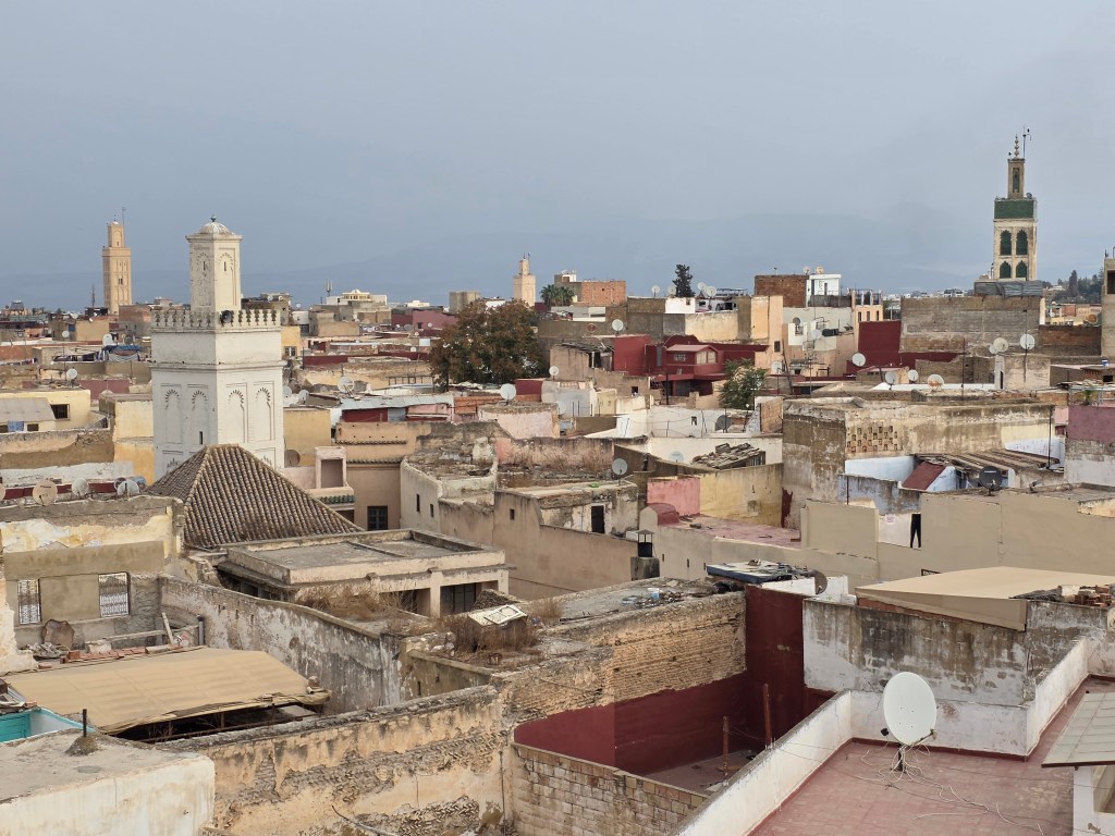
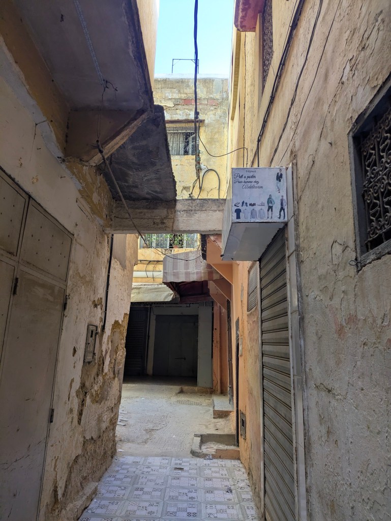
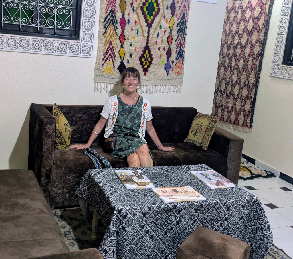
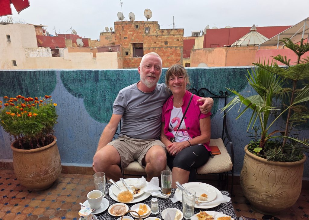
We stayed in a fabulous riad (Riad Andalous), hidden away in one of the alleys of the medina warren for two nights. Finding it was difficult, we walked in baffling circles through stalls selling shoes, scarfs and food. Riads are traditional Moroccan houses and what a revelation when we climbed the stairs to enter Riad Andalous after a maze of dirty alleys. Secreted away high above the clamour of the medina stalls, it was an oasis of calm with tapestries on the walls, ornate ceilings, rug-strewn floors and a sunny rooftop terrace for relaxing breakfasts. It even had a little resident tortoise, who slowly followed the sun around the terrace.
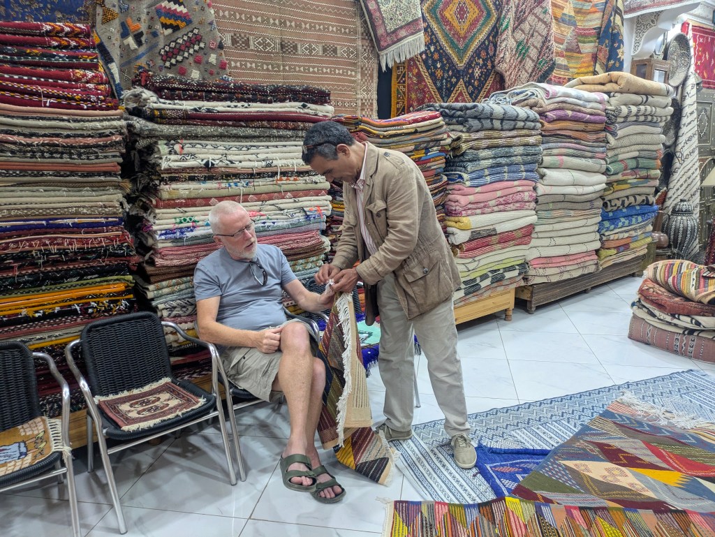
We visited a few carpet shops where eager salesmen pulled out rugs until the floor was strewn with them and our heads were swimming, so overwhelmed that we no longer knew what we liked. On the last morning, leaving our gorgeous accommodation, we turned into the alleyway to have one final look and this time we purchased after some hard bargaining.
It was time to head to Fes but as the Buzz tank was at 50%, we diverted by a motorway fuel station on the outskirts of Meknes that according to our maps had fast EV chargers but we were again disappointed. It will be absolutely essential that we charge in Fes which according to our (unreliable) maps has three chargers, one of which is a Tesla and so wont work for us (In Morocco, Tesla superchargers are only compatible with Tesla cars), so that leaves two medium chargers. Yikes!!!
On the bright side, we have really enjoyed our visit to Meknes, a city we would never have visited without charging issues.
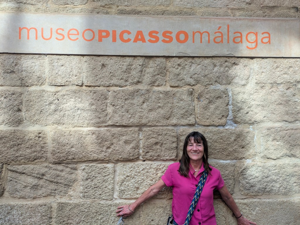
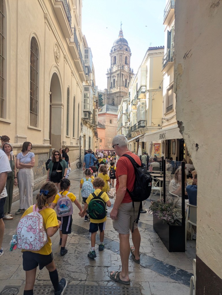
When I left you last, we were waiting to enter the Picasso Museum in Malaga. Picasso was truly a genius, could turn his hand at anything from pottery to sculpture to iron works and was constantly working. I love his quote ‘Everyone knows that art is not truth. Art is a lie that allows us to realize the truth. Definitely worth a visit.
Malaga, birthplace of Picasso
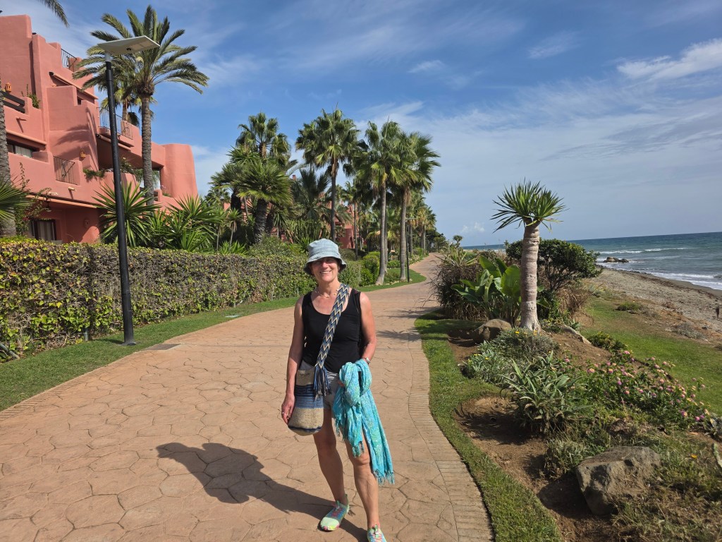
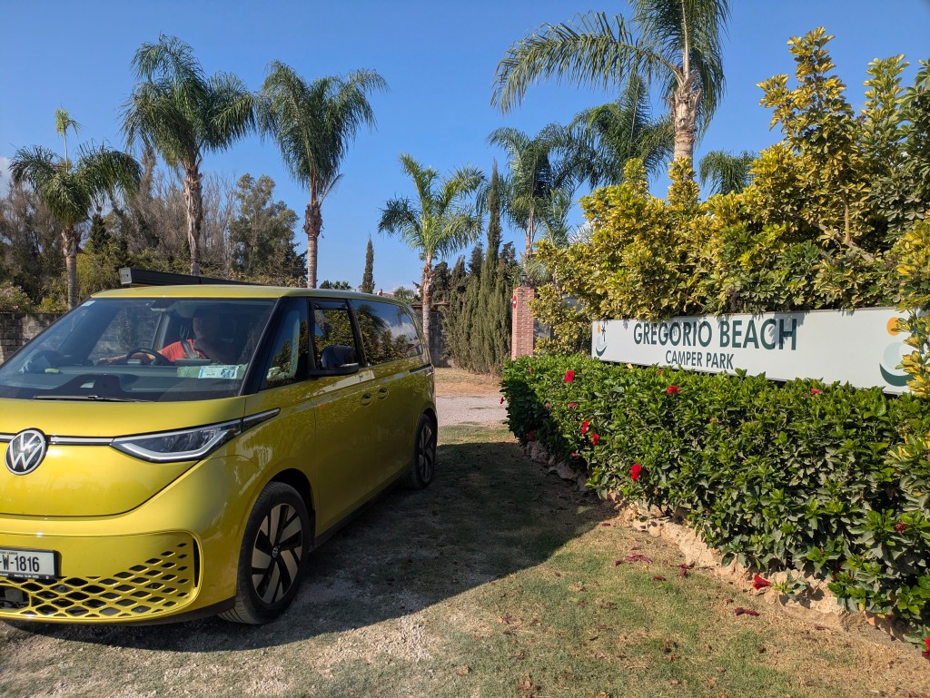
Malaga was gorgeous but too crowded and hectic for us so we continued along the Costa del Sol, past the high-rise holiday complexes to the western side of Marbella where we found a lovely campsite with good facilities, Gregorio Beach Camper Park , about a hundred meters from a quiet beach. The Wi-Fi was strong enough to upload photos and blog and it was cheaper, at €21 a night, than our hellish stay in the hills above Malaga the night before. We have never visited the Costa del Sol before but the beaches were not what we expected- no fine golden sand, just long stretches of dun-beige but the sun shone and the October temperatures were a comfortable 24C, Ireland has far better beaches…..but maybe not the sun. Spain was fabulous but Morocco was calling so we drove towards Algeciras, a port town with lots of ferries across the Strait of Gibraltar.
Costa del Sol
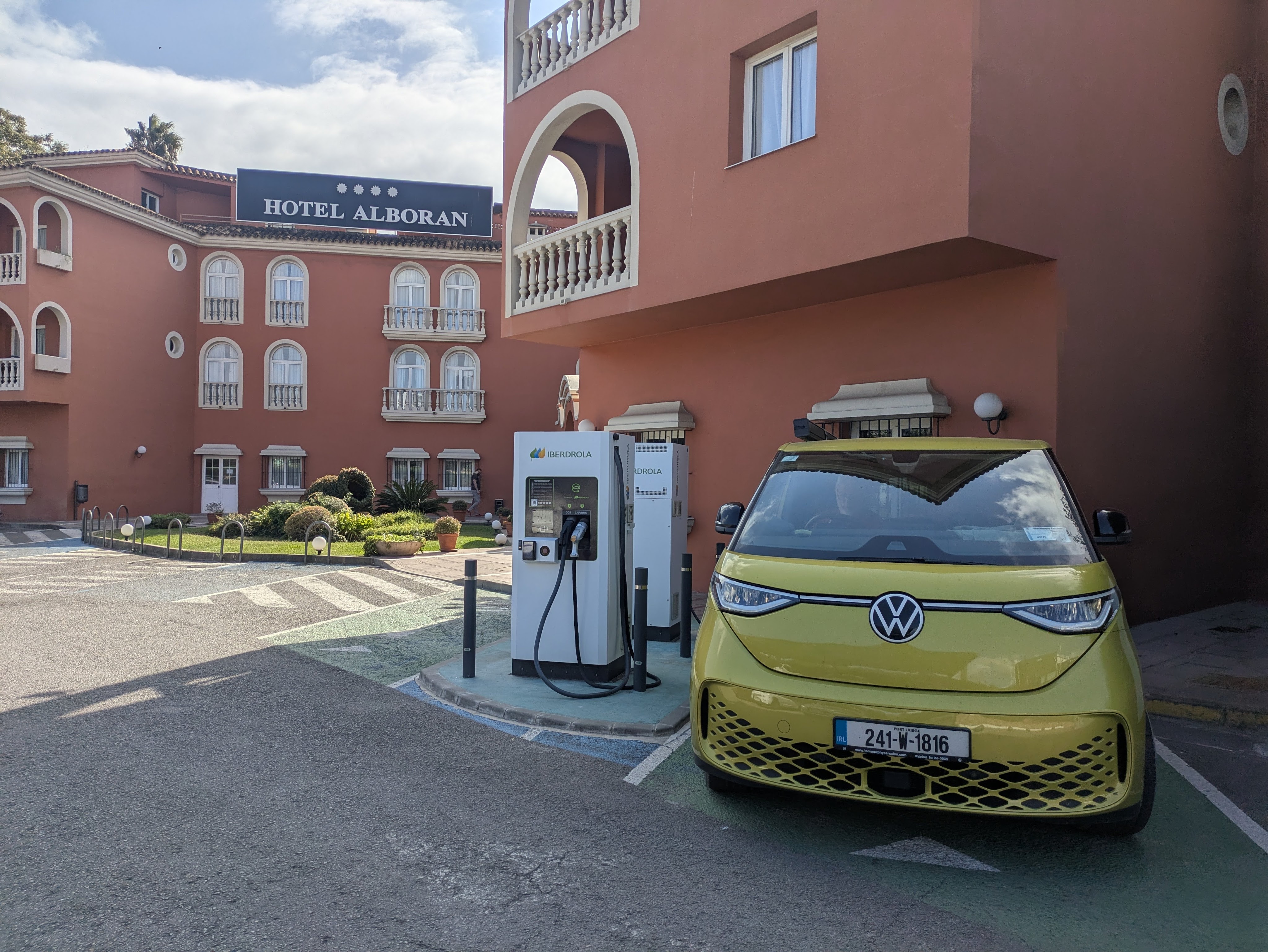
We tried to charge (Cepsa Chargers) in a garage forecourt near a Chino Shop where we bought camping gas canisters but the chargers were powered down and covered in dust. Then on to Ionity chargers down the road. Sun blazed on the screens making them opaque and impossible to read. Sweat dribbled off us and I searched for my umbrella to provide some shade and maybe make the instructions on the charger screen legible. Although €40 was taken from Caoimhin’s bank card to validate it, we couldn’t get them to work. We next stopped along the road at a casino which had two Tesla chargers…these might have worked but they were only slow chargers so we pushed on and stopped at an Iberdrola charger outside a hotel on the outskirts of Algeciras. The Buzz charged to 100% here without issue and….best of all, the charging seemed to be free (the cost hasn’t been deducted from my bank card…yet)
‘Free’ Charging, Algeciras, Spain
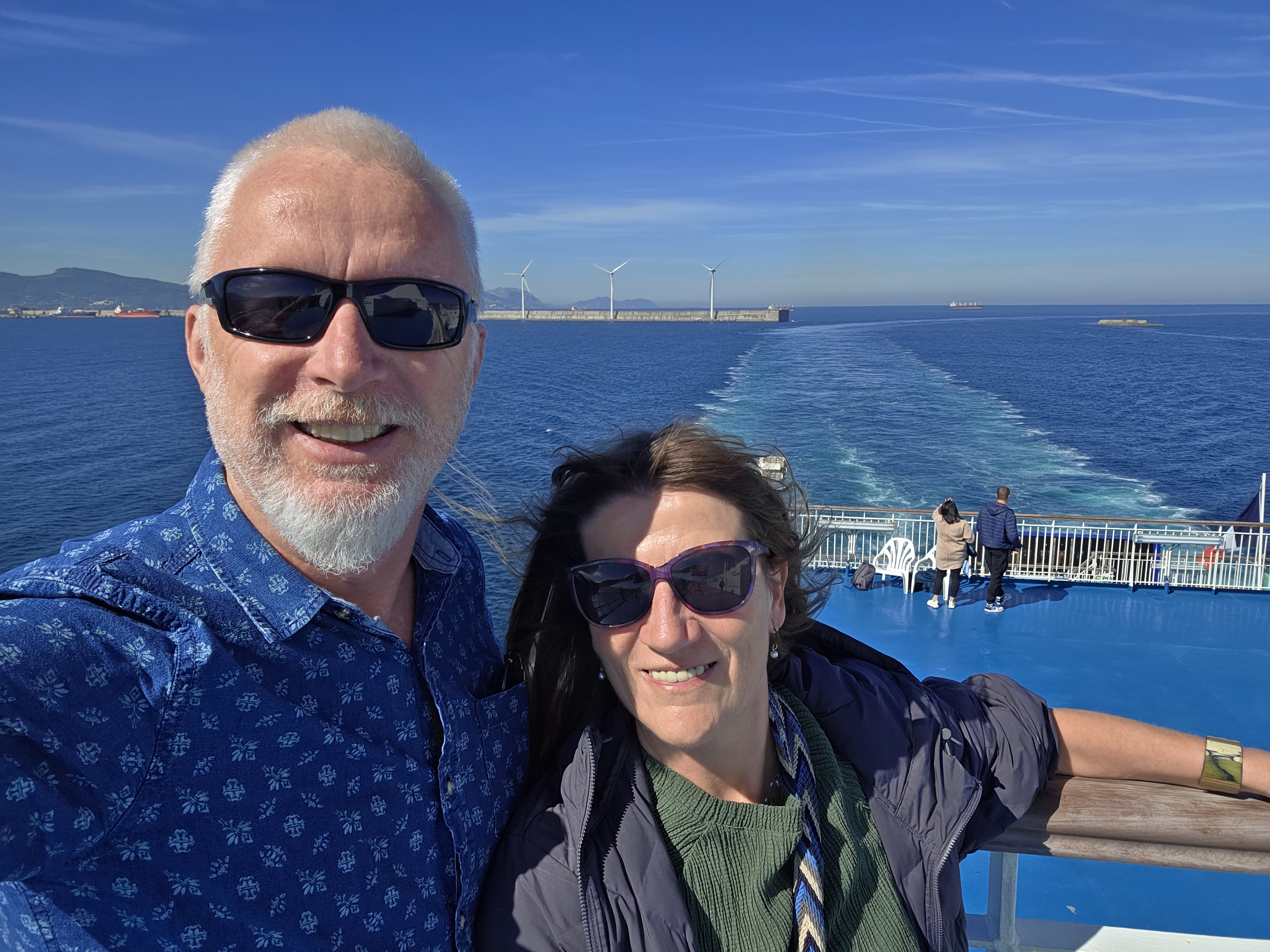
While we were charging, we booked the ferry to Morocco for the following morning. It was a little bit disquieting that the first time we had any charging issue in Spain (which has loads of EV chargers was the day before going to Morocco which has very few (41 chargers in the whole country according to one source and Morocco is about ten times larger than Ireland). Would our travels there be severely curtailed?
We could have sailed from Algeciras–Tangier (Morocco) but Algeciras–Ceuta was cheaper and sounded interesting. Ceuta is not part of Morocco but is a Spanish coastal city on the African continent. A one-way ticket for two passengers and the van cost €183.
Then we checked into a hotel as there weren’t any campsites nearby– really splashing out at €60 a night. We read our guidebook on Morocco, feeling excited, until we made the disturbing discovery that we had forgotten to bring the Van Registration Documents with us! This hadn’t been a problem in Europe but it would likely be a real issue leaving Europe
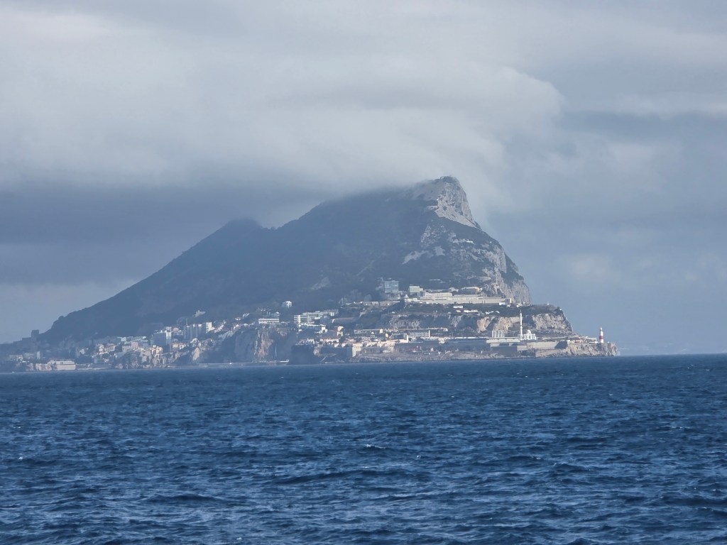
We were early. The woman in the ferry queue in front of us wore a black burka and a beggar wandered down the row of cars with outstretched hand. The Med glittered in the morning light, although cloud obscured the Rock of Gibraltar The African continent was tantalizingly close, …a mere 17 kms to Ceuta across the Strait.
The Journey so far …..and a View of the Rock
There was a brief custom check in Algeciras port, just a cursory look in the back seats and in the booth, for everyone except for us. We were waved onto the ferry with a smile. I guess the rationale was that nobody in such a neon-coloured van could possibly be smuggling anything. The crossing was smooth and shorter than expected, about an hour. The time difference gained us an hour so we arrived in Ceuta, at the same time we had left Algeciras. It felt as if we had departed Spain, crossed the water, only to arrive back in Spain. The city has been ruled by Spanish princes, Moroccan sultans and Portuguese kings down the centuries. Now it is surrounded by high-security barricades to prevent smuggling and illegal immigration to Europe.
Corralled in Ceuta….border waiting
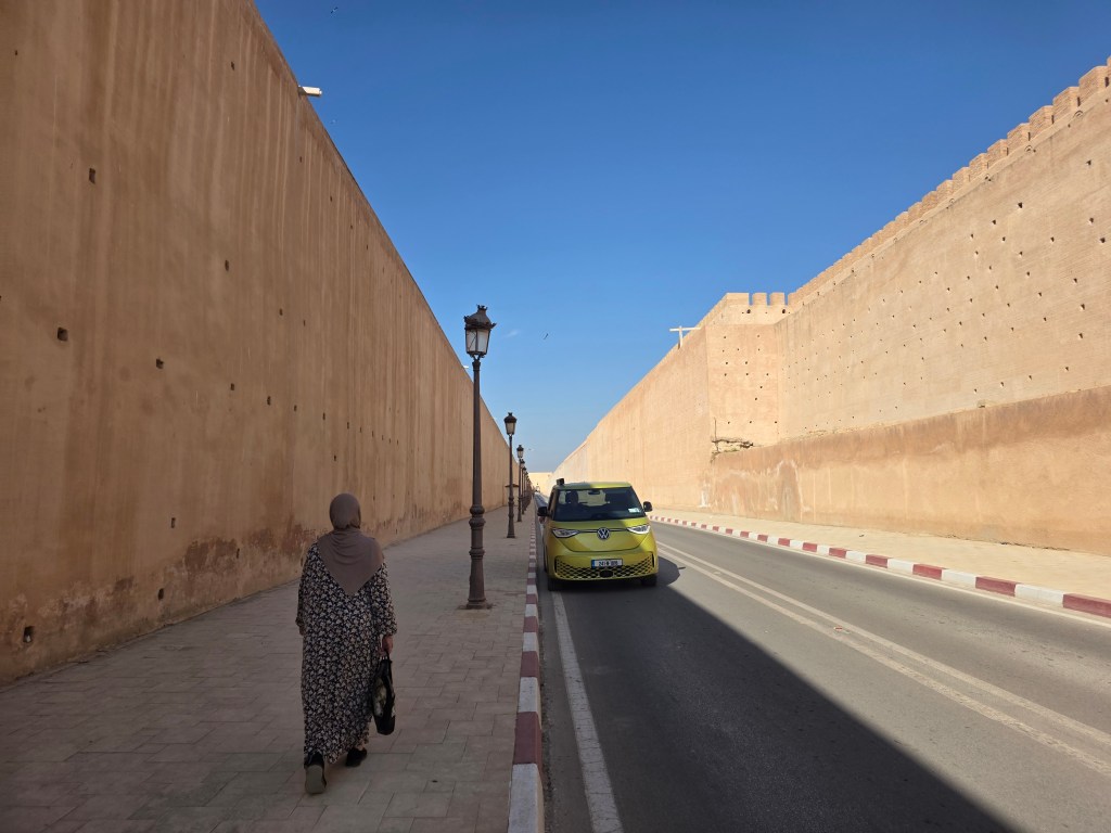
Ceuta was a handsome town with Spanish architecture, plazas, old city walls and sunshine, we didn’t stop, anxious to get to the border (La Frontera) and discover our fate. An official demanded to see our ‘ticket,’ we didn’t know what he meant but he directed us back into town and uphill to a huge parking lot, where cars wishing to cross into Morocco were corralled before being released in rows to prevent border congestion…..in theory at least. While waiting, we phoned our great neighbours, who hurried over to our house, photographed our van documents (thanks Donal and Anita) and Whatsapp’ed them to us. After an hour of waiting in the carpark, we approached the border a second time to join snail-like queues of cars, vans and motorbikes. A further two hours went by before we were at the top of the queue. Our passports were stamped without issue, we were welcomed to Morocco and proceeded to the vehicle window. Like all the vans (no exceptions for the Buzz this time), we were asked to drive to one side where it was searched and then we were asked for the van registration form …and the trouble really began. They needed paper documents, it wasn’t the right document, we wouldn’t be allowed in.
Alternative itineraries were dancing around my head, if we had to return to Spain, we could wander around Southern Portugal….it would be very disappointing but not a calamity. Eventually a senior official was called, an older man, slightly stooped but mild mannered. He agreed to give us a waiver and signed a piece of paper, necessary to enter Morocco. Four and a half hours after disembarking from the ferry, we were in Morocco….by the skin of our teeth.
A row of white taxis hovered around the border gates, a couple of dogs barked and ran uphill after the van, while several head-scarfed women sold fruit, laid out on the ground on colourful blankets. We kept going, wanting to get away from the border as quickly as possible. Thankfully, the e-sim we purchased from Revolut for Morocco activated, so we had mobile data on our phones without the hassle of haggling for a physical sim.
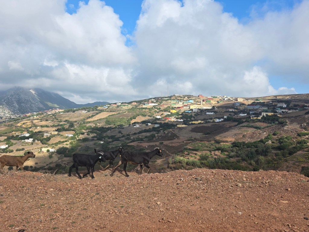
The road surface was excellent and the scenery was ruggedly beautiful with brightly painted, flat-roofed houses with mountains casting light and shadows. Although we were fully charged, we wanted to check out the Moroccan EV chargers, just to see if charging would be an issue so we headed in the direction of Tangier. The drive from Ceuta to Tangier was spectacular with the backdrop of the Rif mountains with small towns and some beautiful white-sandy beaches.
Can you spot the goats?
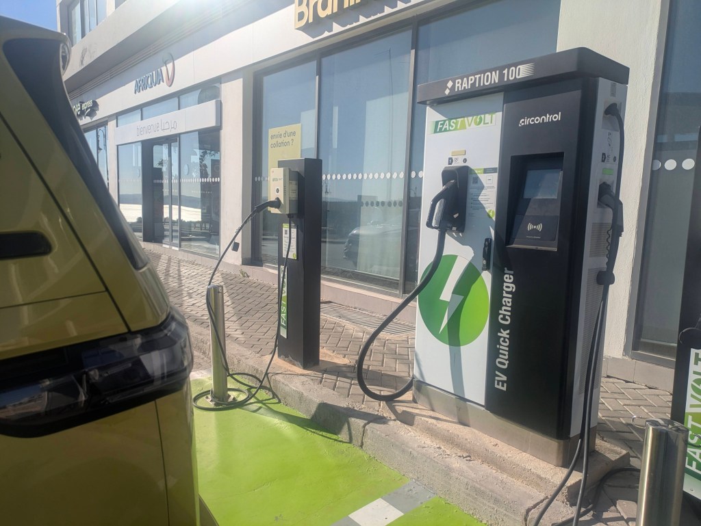
The first chargers that showed up on our map were Fast Volt, the chargers were in a gleaming forecourt and looked impressive. We were hopeful. The instructions, in French, required us to download the Fast Volt App as charging was only available through the app (and not directly using a bank card). No problem, we thought, until we attempted to download the app and kept getting the message ‘Unable to download as app not available in your region.’ Catch 22. The next chargers on our map were part of a Casino Hotel and their use (behind a manned barrier) was for hotel guests only and we were refused entry Tangier seemed a modern city with palm lined boulevards, a wide esplanade along the sea-front and buildings on the steep slopes, a city of hills and hollows.
We headed to a Google campsite, Miramonte Camping, in need of a lie-down after the stress of the day and were welcomed by Said, in perfect English The campsite in a hilly location was really a resort complex with three swimming pools and stunning views of the Med. We feared it might be way above our budget but it was about €19,50 a night, which, although expensive for Morocco ,was excellent value for us.
Camping Miramonte, Tangier
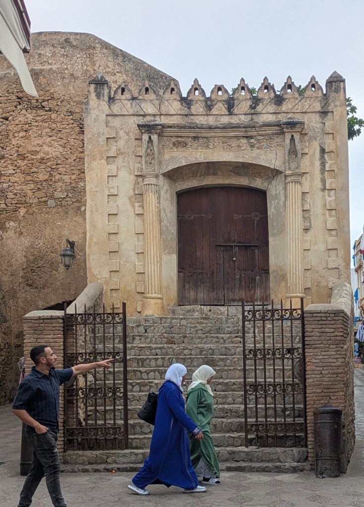
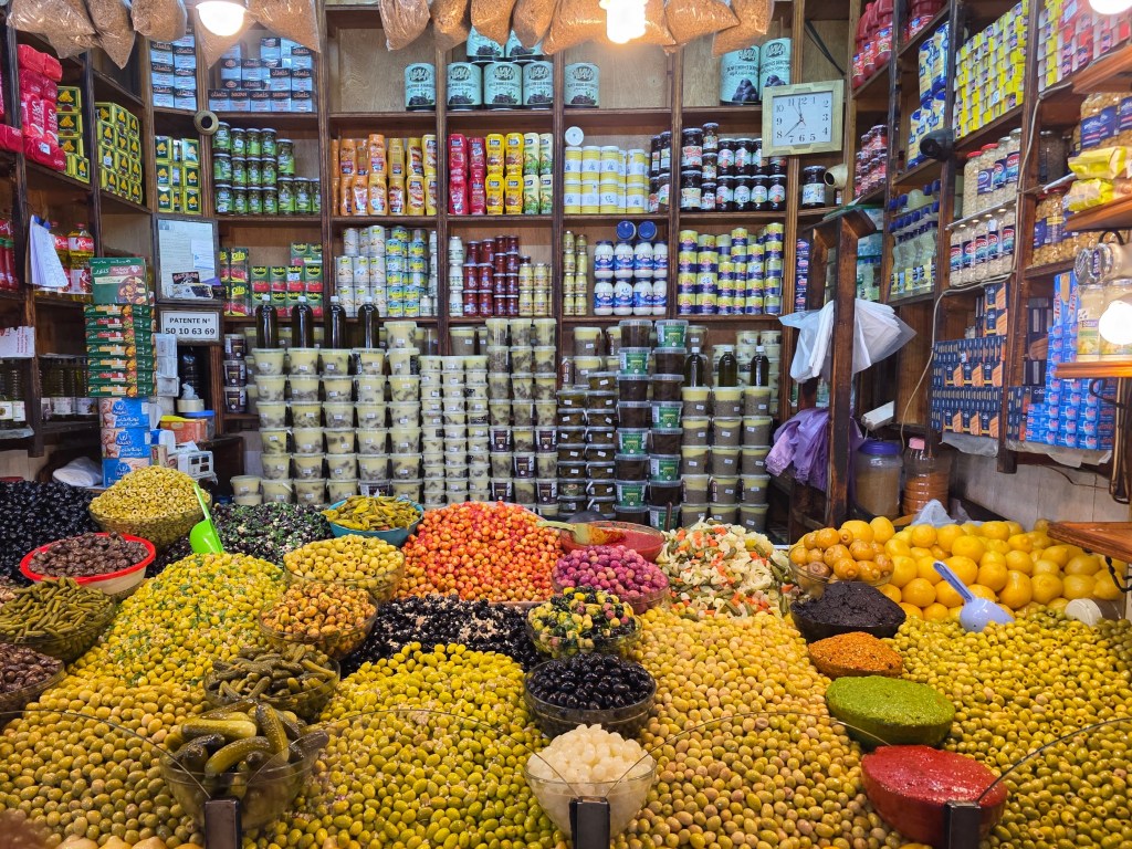
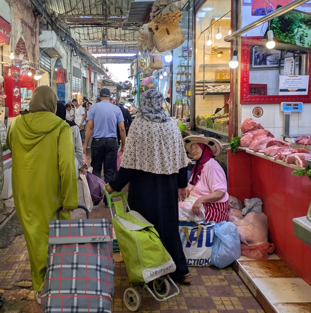
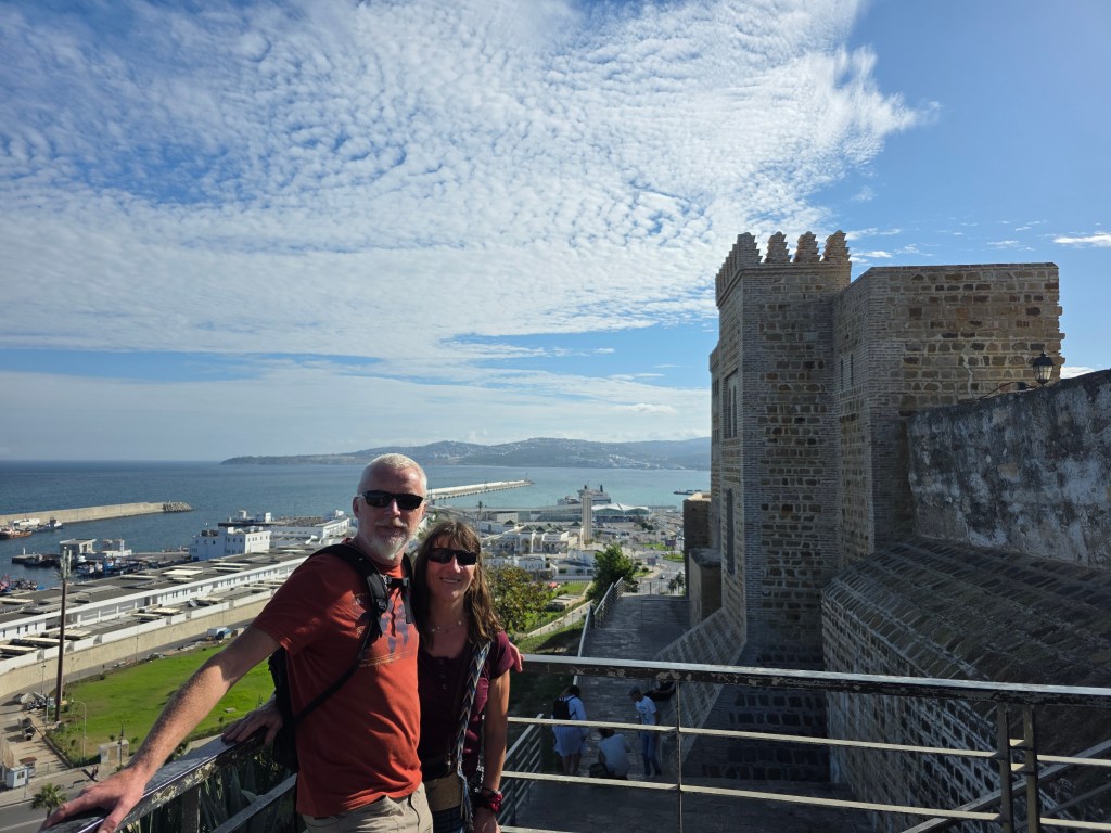
A walking tour of the medina and souk in the old town gave us a flavour of the city, a place where mosques became churches before changing back again, where being the ‘Gateway to the Mediterranean’ was both a blessing and a curse, a pawn and a prize, a strategic position to be coveted and fought over down the centuries.
Tangier, Morocco
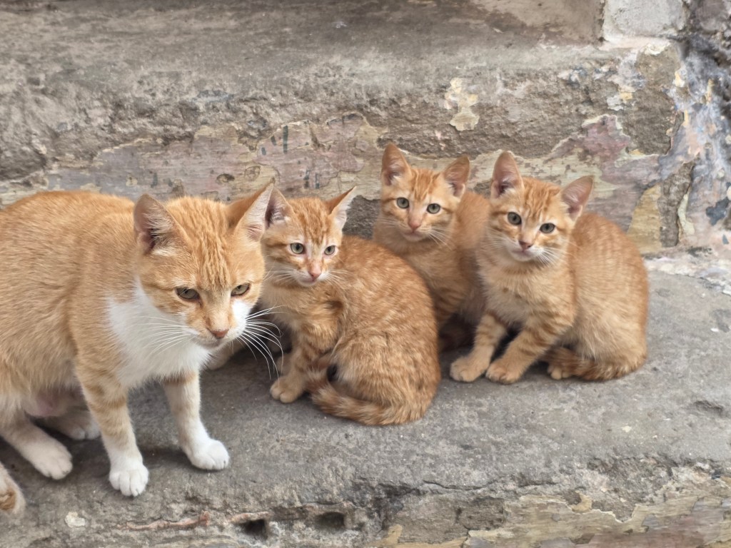
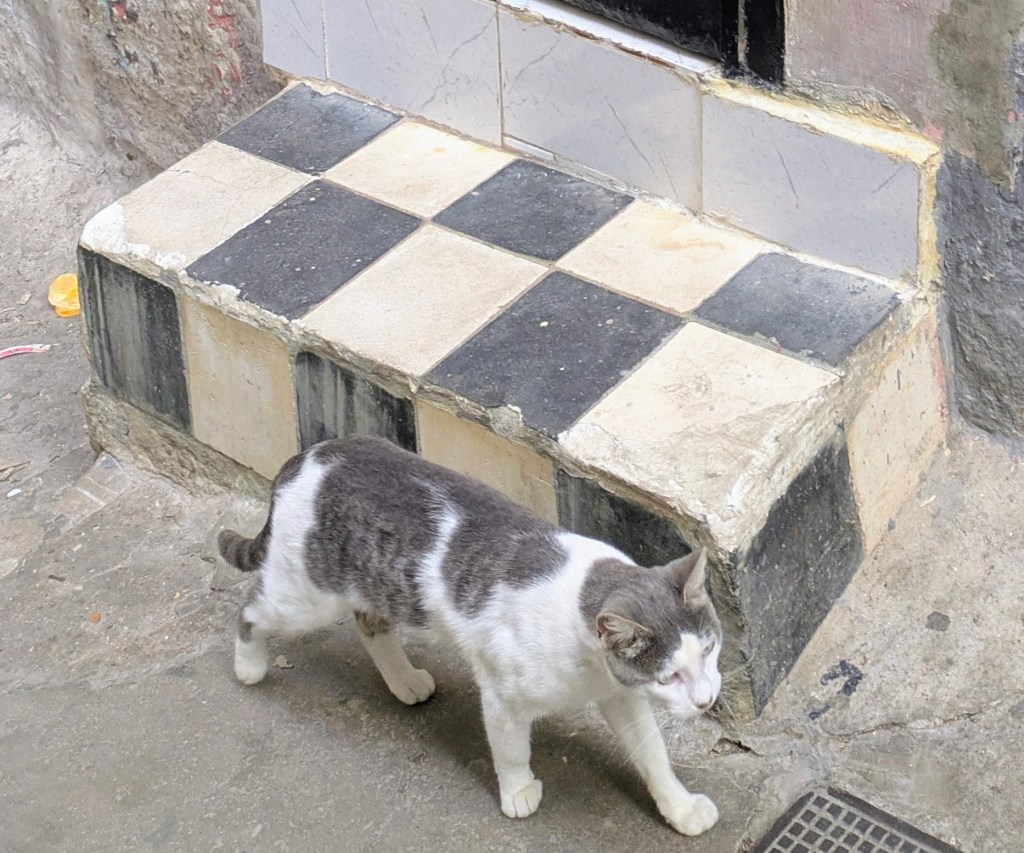
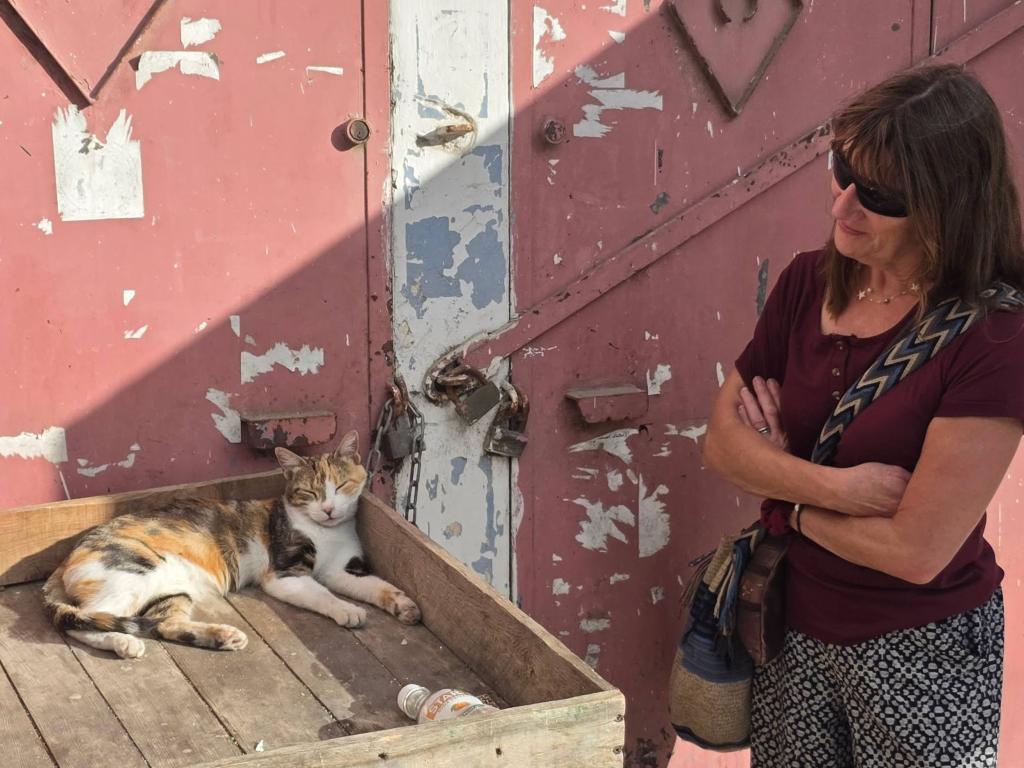
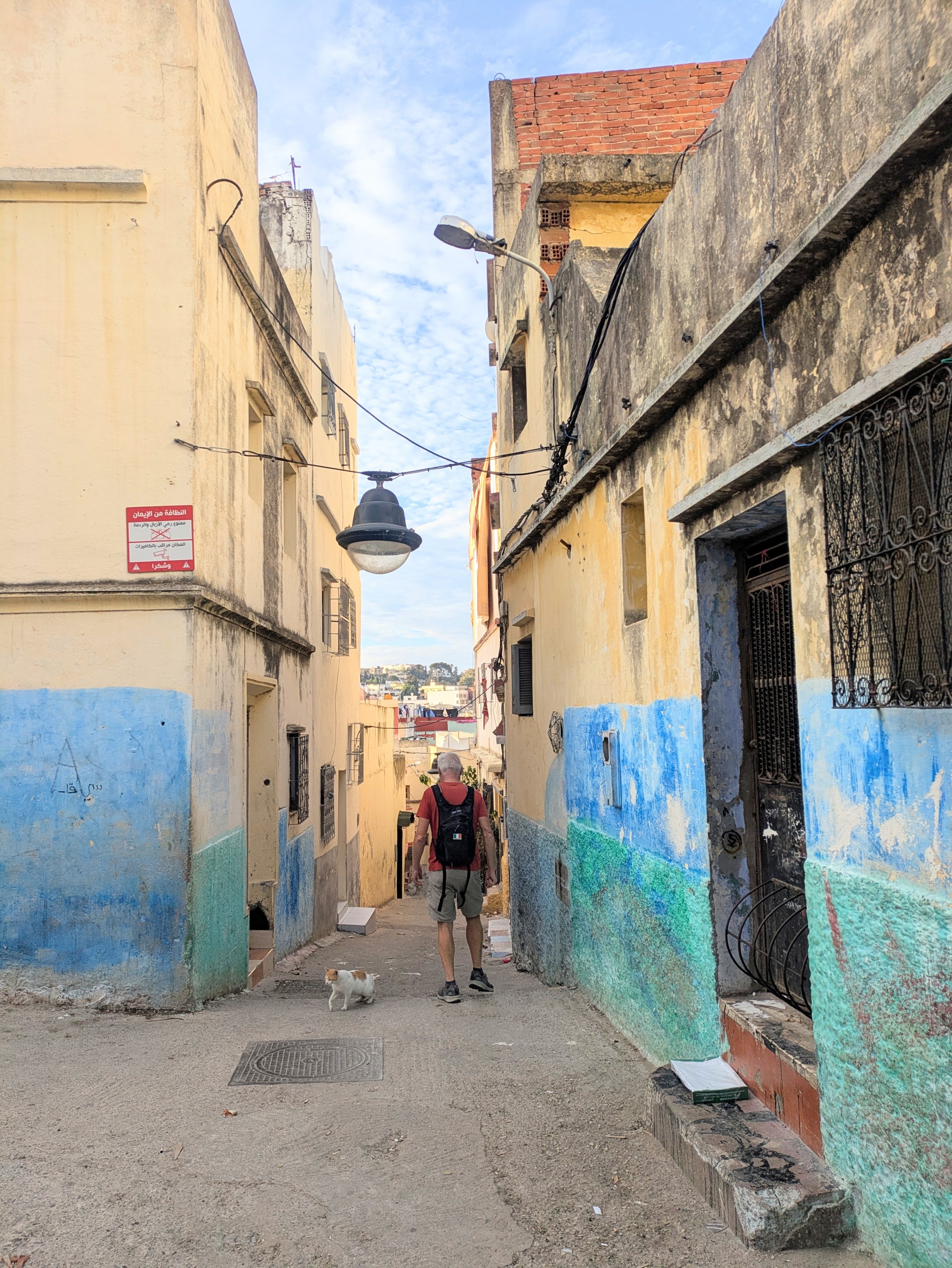
The sleepy back alleys were full of cats, all seemingly related, except for one tabby who blended so perfectly with the black and white tiled step.
Cats, cats, everywhere
We lingered at our luxury campsite for a couple of days. We still haven’t managed to charge the van……but as we have almost 400kms in the tank, we can always drive 200kms and then return if all else fails.
The days flew by, sun-drowsy, as we made our way south through Spain.
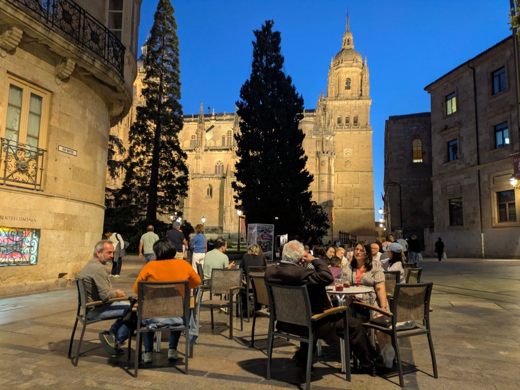
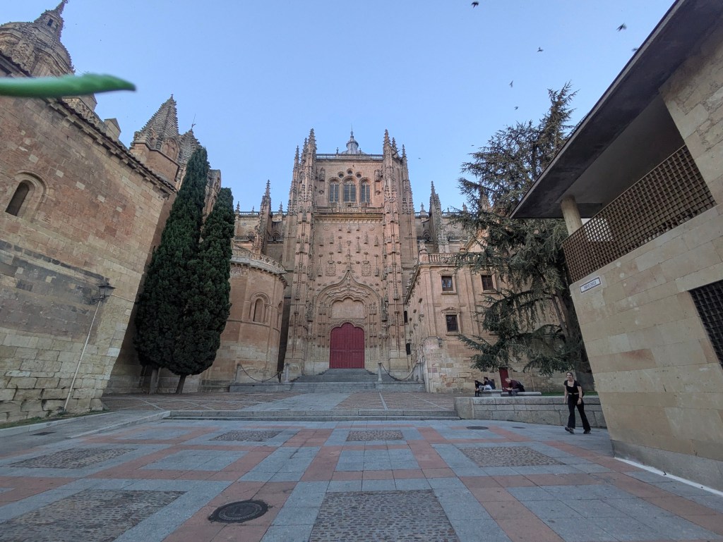
After leaving Salamanca, where we were dazzled by the town’s beauty, not just in the famed main plaza, regarded as the most magnificent in all of Spain, where visitors and locals alike burst into spontaneous applause at dusk when the lights were turned on. Although the city was full of visitors, it was still possible to find shady corners and quiet courtyards where there was only the chirping of birds, which nested in the nooks and crannies of the sandstone facades of old buildings.
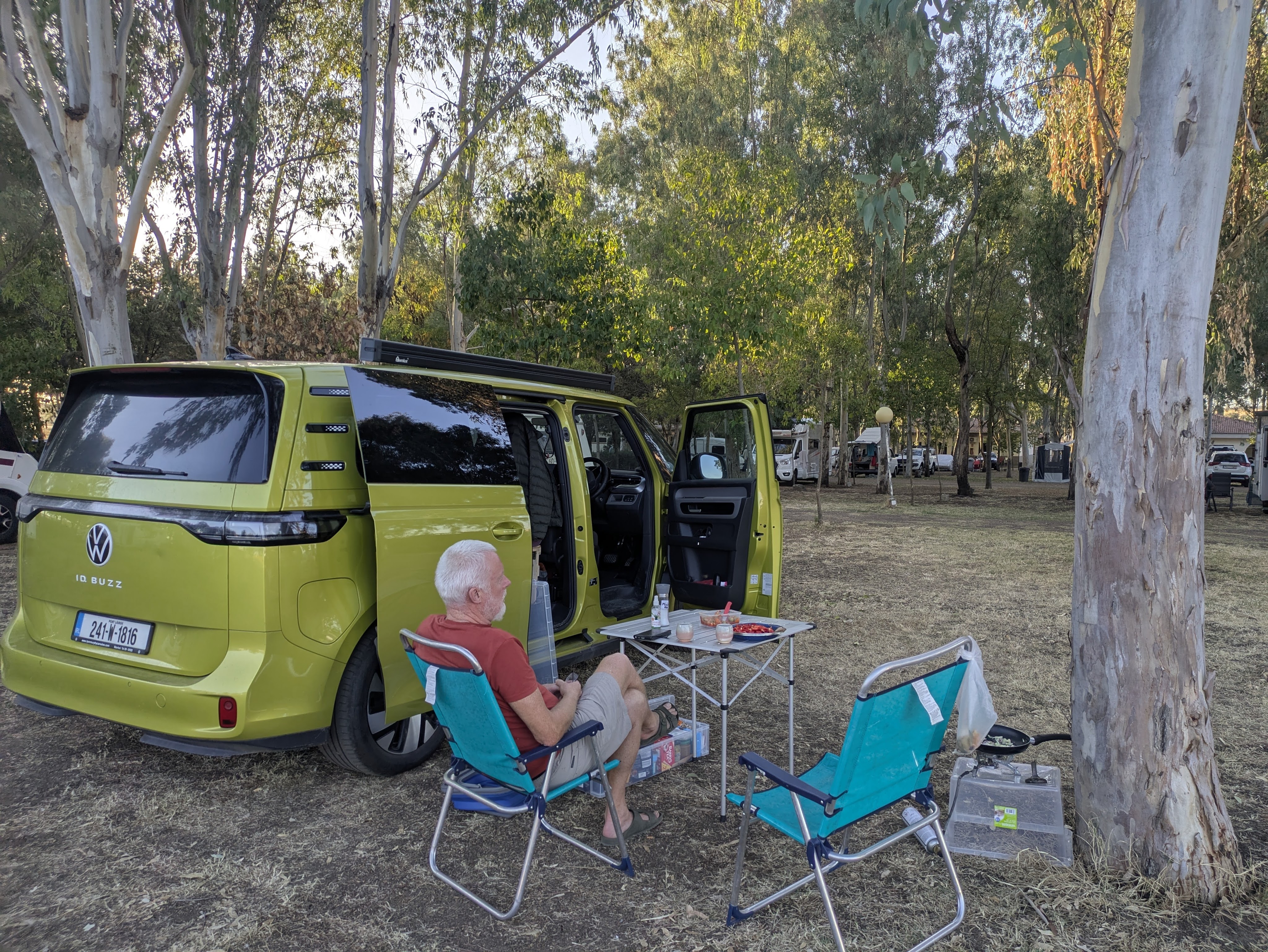
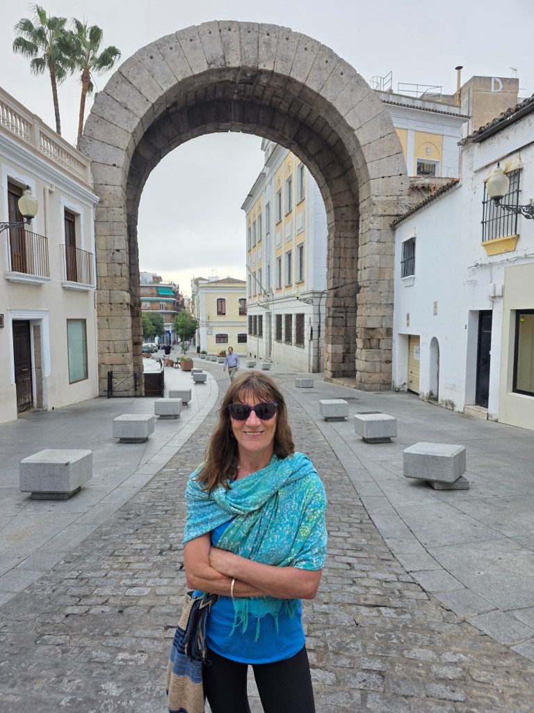
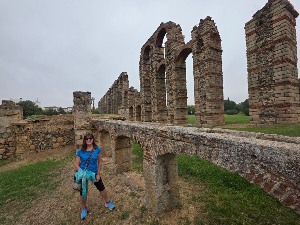
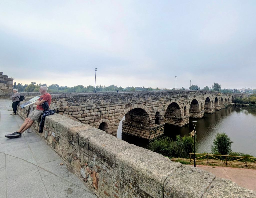
Driving through the Extramadura Region, with views of valleys and mountains, we reached the outskirts of Merida, which was founded by the Romans, two thousand years ago. We set up in the Merida Campsite about four kilometres outside town. It was a bit ramshackle, outdated and cheap (but that’s the way we like it, especially €15/night). There were stables next door with white horses and a yard with all sorts of fowl, hissing geese, chickens, ducks and a raucous rooster who only crowed during the day. Occasionally all hell broke loose until the pecking order was re-established. There were falling leaves and shade under eucalyptus trees. The only downside was the flies. There weren’t that many but they were really attracted to the Buzz as if it was emitting some fly pheromone.
A friendly British couple with a motorbike camped in a tiny tent beside us. They were heading to Morocco, planning to do a huge loop of the country in just fifteen days and then a hurried ride back to Santander for a ferry home. Thankfully, we’re in no such hurry.
Merida town was also a little ramshackle but its Roman origins were evident in the arches, aqueducts and amphitheatre. Many of the ancient structures incorporated into modern living – cars drove on paved roads under ancient arches and people strolled over the old Roman Bridge which linked the old town with the new. We found a packed café (Joplin Cafe), whose specially was ‘tostada,’ huge hunks of bread plastered with a savoury tomato paste, topped with thin slices of cured ham, or grilled aubergine, cheese and a fried egg. Two coffees, a tea and two enormous tostadas came to €8.40…no wonder it was packed.
Merida, a Roman Town
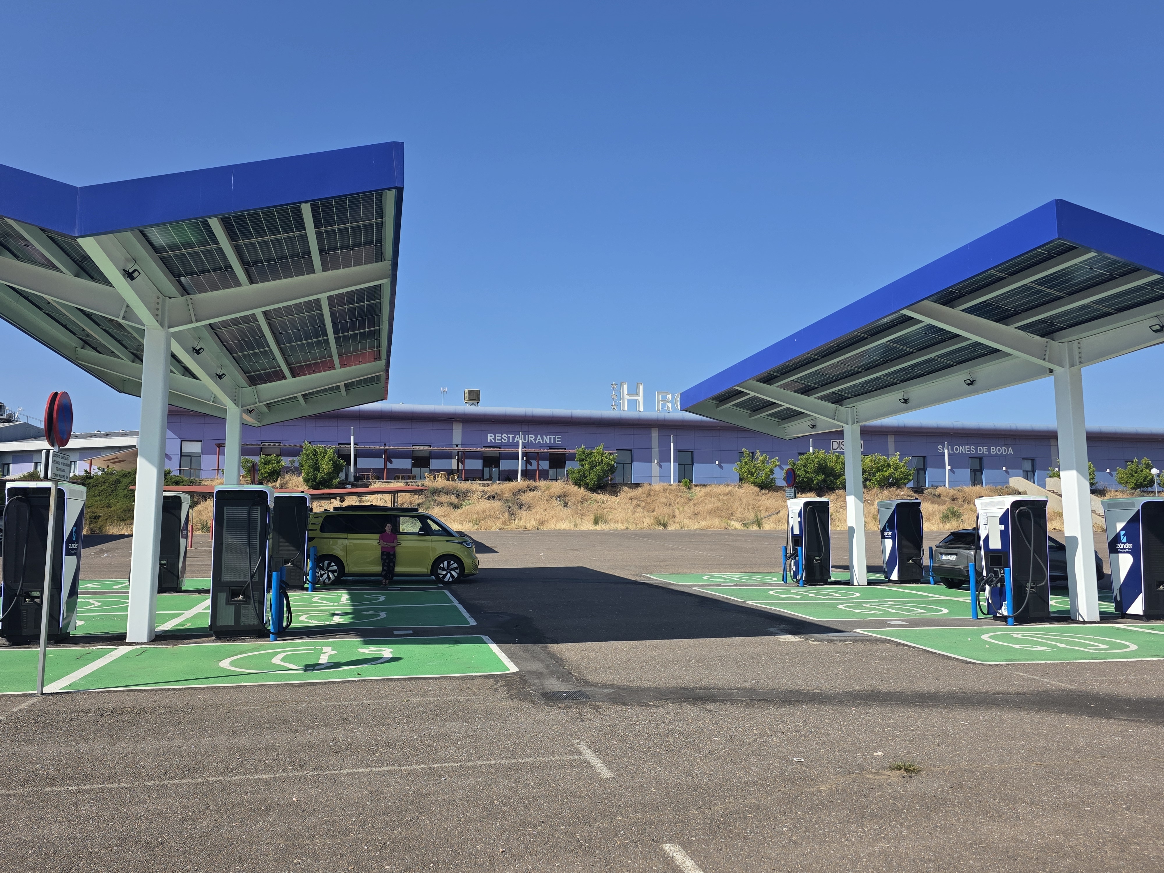
After charging the van at a Zunder EV charging station, where only one other of the sixteen spots available was occupied, we were on our way again. The huge number of charging stations and the lack of queues makes charging in Spain much easier and quicker than in Ireland.
EV Charging Station….no queues, no hassle.
We selected ‘no highways’ in Google maps so we drove through villages and small roads lined with vineyards and olive groves. The hills were topped by ruined castles or villages of red-tiled white houses as we crossed into Andalusia.
In Alanis, a pretty whitewashed village in the Sierra Norte, surrounded by rivers and pine forests, a crowd of teenagers, disembarking from a school bus, were as mesmerised by the Buzz as the campsite flies.
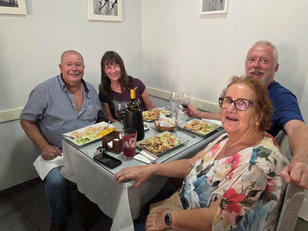
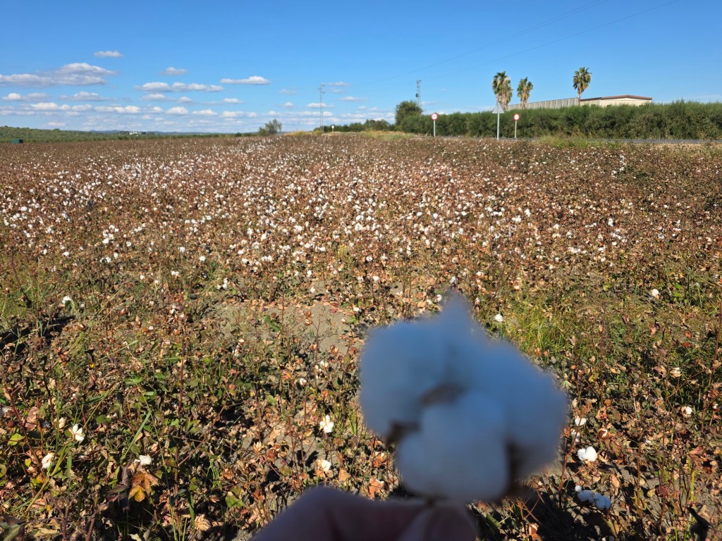
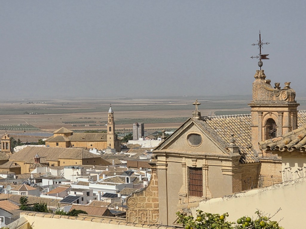
Our next stop was Hornocuelas, a small town in the Sierra Morena in the province of Cordoba where we were welcomed by Luz, my brother in law’s mother and her partner, Andres. We loved staying for a couple of nights in their comfortable, typically-Spanish townhouse with tiled floors throughout a shuttered windows to keep out the light because here, the sun is the enemy. Although, it was a pleasant 26C in October , the temperatures hit a melting 46 C last August. The town is surrounded by olives groves because olive oil is big business as well as almonds and fields of cotton, full of soft white balls, almost ready for harvesting.
Plates of Food, Fields of Cotton
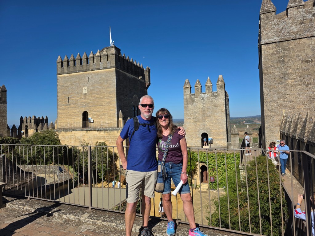
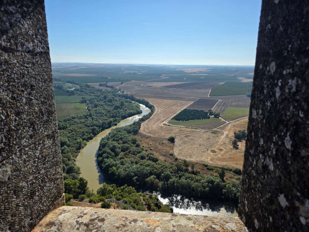
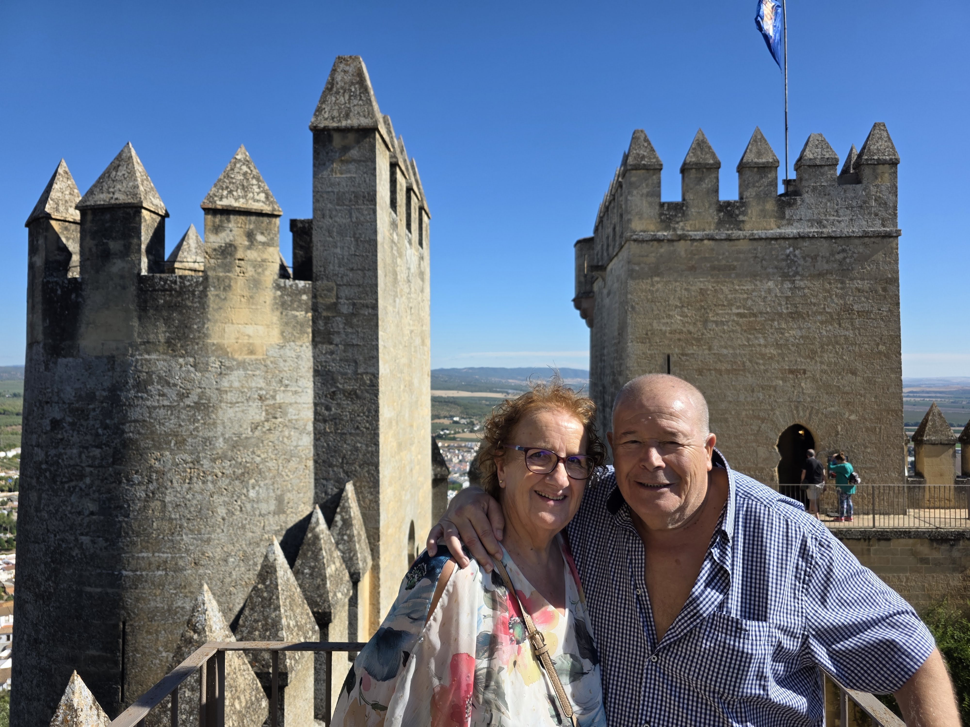
A visit to Almodovar Castle, setting for many Game of Thrones scenes, was a walk through the centuries. Originally the site of a Roman fort, a Moorish fortress was built here in the eight century, overlooking the Guadalquivir River, before being taken over by the Christians. It was extended and remodelled over the years with stories lingering between the cracks in the many towers, torture chambers and courtyards. It’s well worth a visit with an excellent audio-guide.
Almodovar Castle
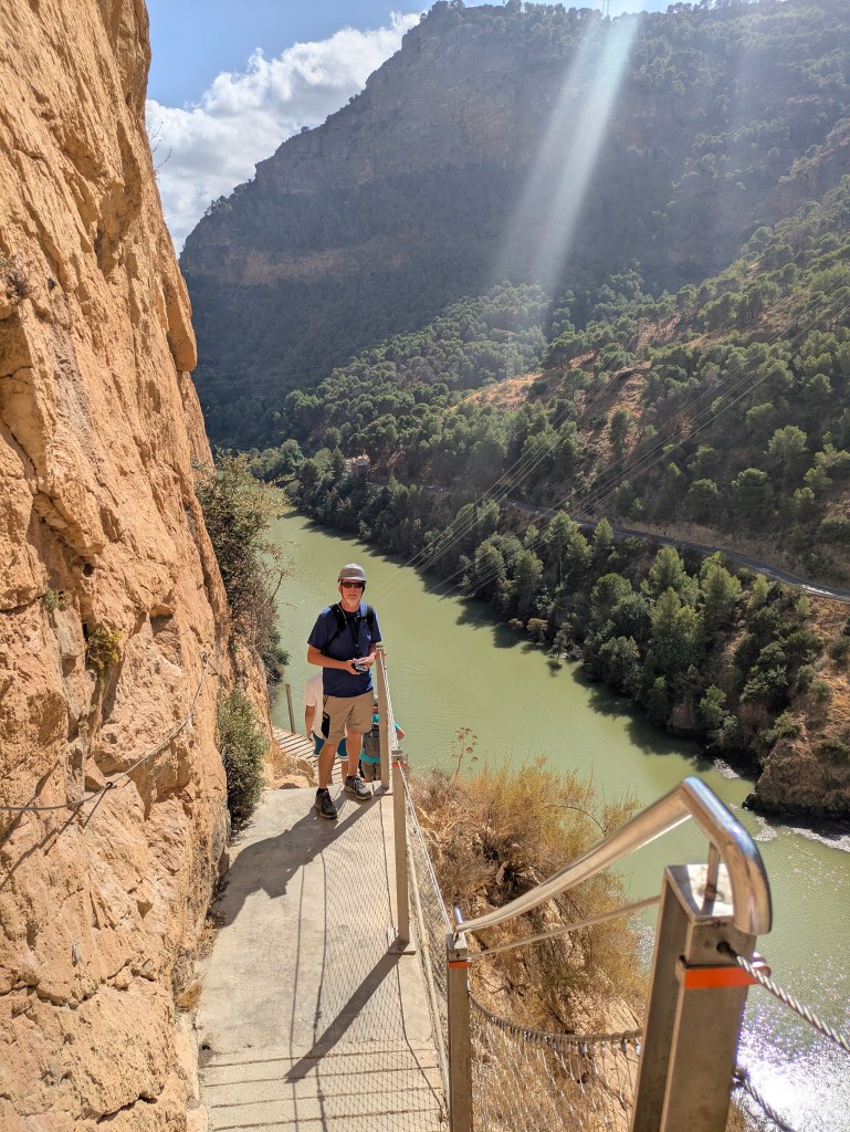
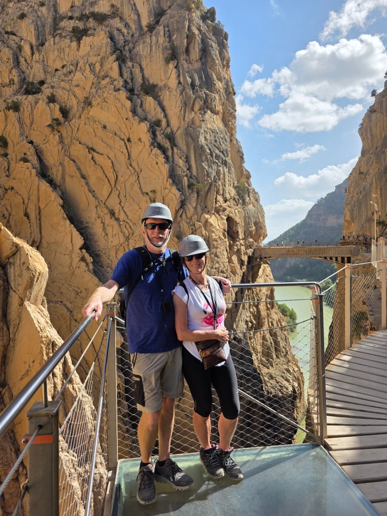
Saying ‘Adios‘ to Luz and Andres, we left loaded with gifts of cheese, honey, wine and homemade ‘angel hair’ pastries (muchas gracias🥰 ) and headed in the direction of the Caminita del Rey, which is a hike near Ardales in the province of Malaga. Numbers are restricted and it’s so popular that it has to be booked in advance. We reserved a spot two weeks ago (before we left home) and were fortunate to get a spot so soon, as it can be booked out months in advance.
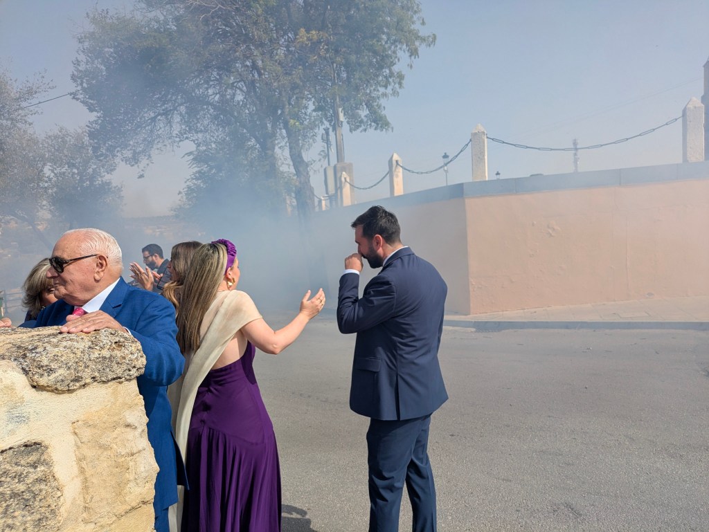
The two hour and a quarter journey from Hornocuelas was mainly through flat, empty countryside. Driving through Osuna, we spotted a large number of cars parked outside the hilltop church overlooking the town. Curiosity made us stop for a look. The church doors opened and wedding guests, as colourful as butterflies, spilled out. When a vintage car carrying the bride and groom drove up the little side road, there was a lot of yelling before a series of ‘bangers,’ arranged in a long row by the edge of the pavement, detonated in sequence sending black smoke everywhere. This custom certainly starts married life with a bang.
Osuna, province of Seville
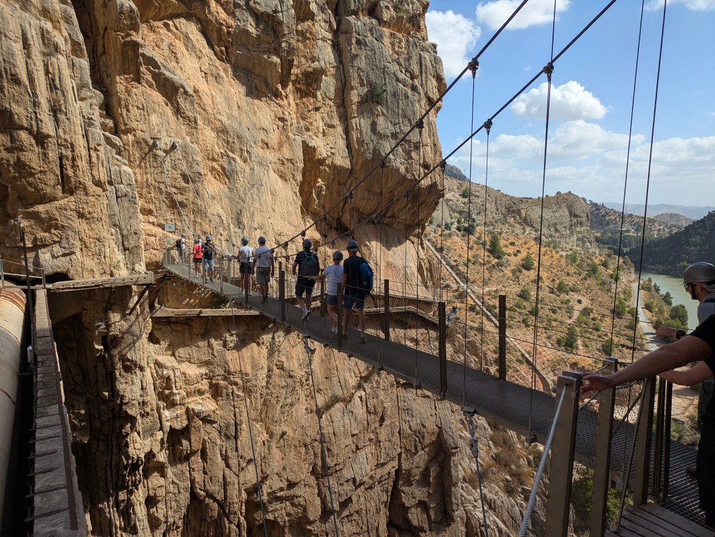
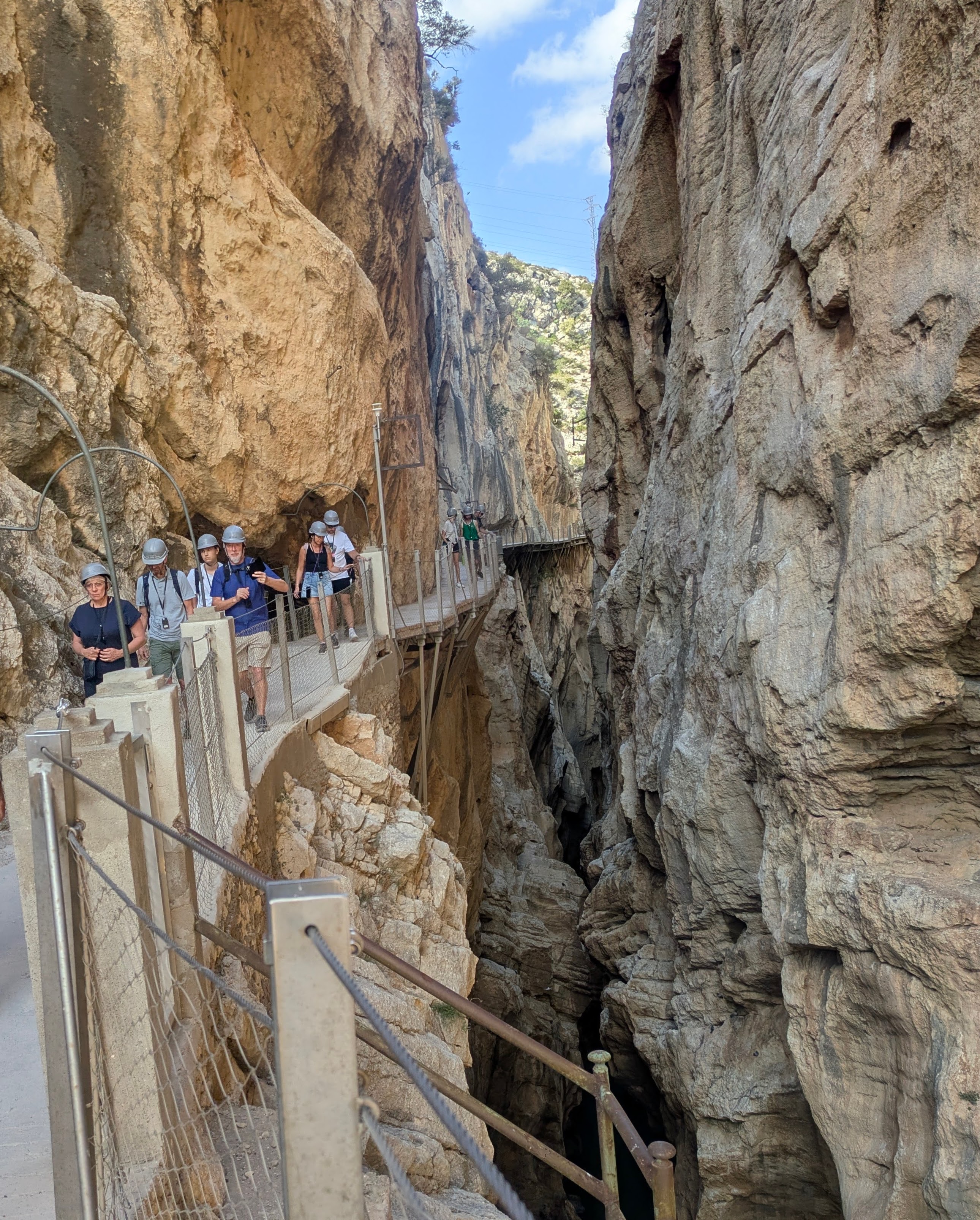
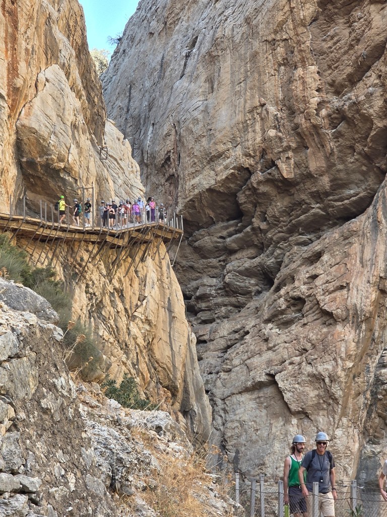
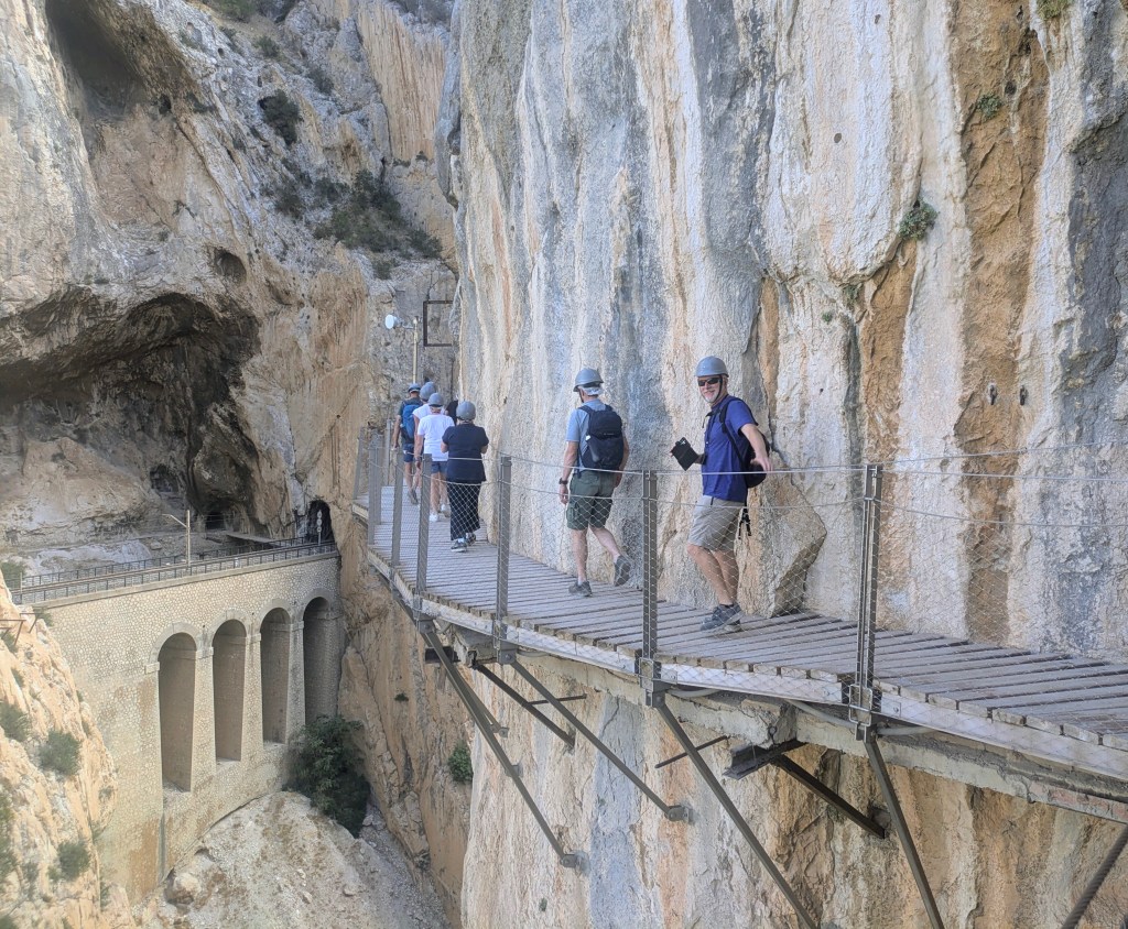
The Caminita del Rey is a trek along narrow walkways that are pinned along the steep walls of a spectacular gorge. These walkways were originally used by the workers in the construction of a hydroelectric power station about a hundred years ago. The company employed quite a few sailors with a head for heights from climbing ship’s masts. This is a spectacular walk with stunning views…..and not as scary as the photos might indicate as new reinforced walkways have replaced the original rickety ones….although not for anyone with vertigo. The actual portion of the hike along the gorge is quite short, about 3.5 kms with a couple of kilometres at either end to make up the total kilometres. Although there is no need for a guide (the path is self-evident), the number of unguided slots is very limited. The advantage of being in a guided group was the people we met, some Aussies and a lovely couple from Oregan, who we shared a cold drink with at the end.
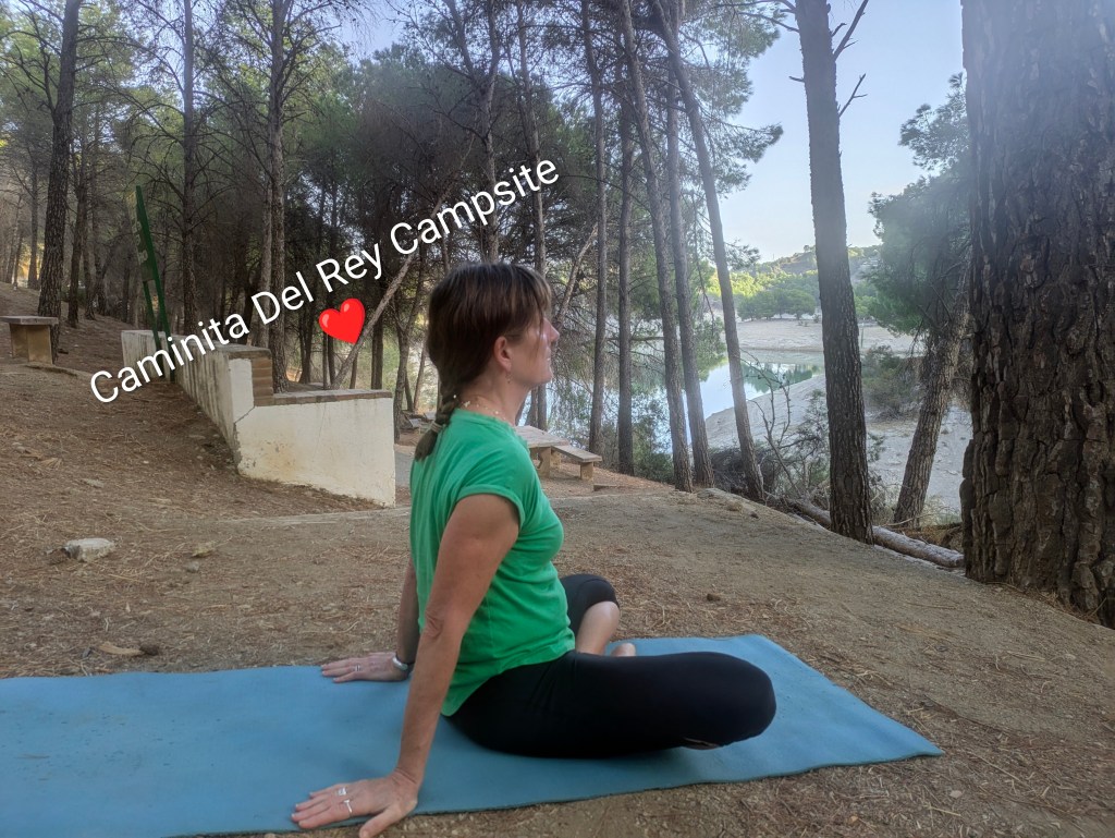
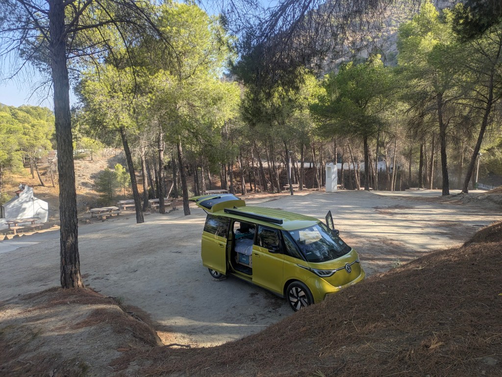
We stayed in a campsite at the northern end of the gorge (€19/night), which was a convenient 500 metres from the tunnel entrance to the starting point. The 7.8kms hike is one-directional but there are buses at the El Chorro end (finishing point) to drop hikers back to the starting point or to one of the carparks along the route. This all sounds very logical but the website is quite poor and potential hikers found themselves at the wrong end without enough time to get to the start or at the starting end but thinking they should be at the other end. A lesson in confusion! If you are in the area and haven’t made a reservation, at 9am each morning, the first 150 people in the queue are allowed in without a booking…..or so we heard.
Shady Camping at Caminita del Rey, Malaga Province Countryside, north of Malaga, Sun-bleached and dusty, but not barren.
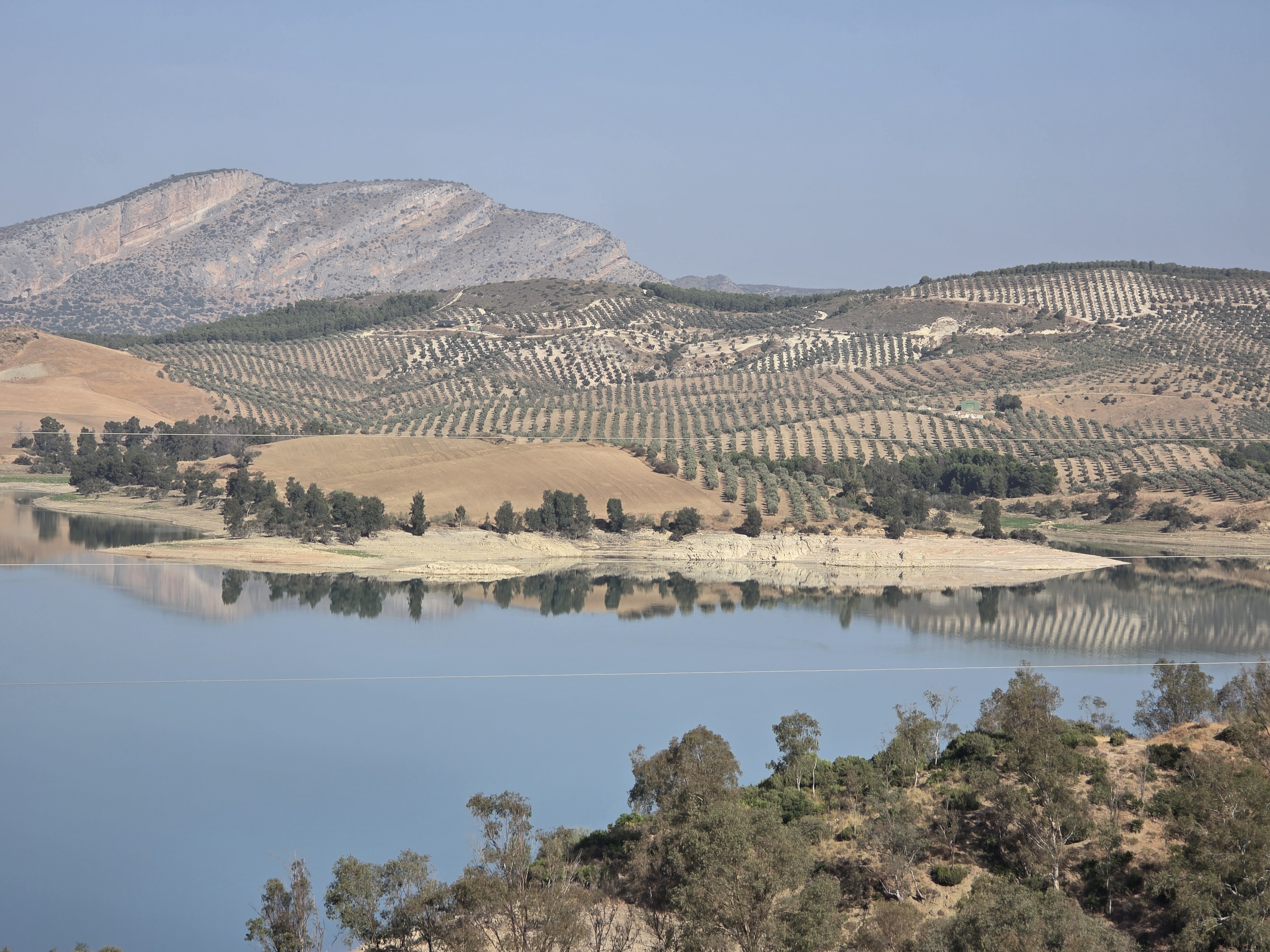
After relaxing in our shady hillside campsite, we journeyed to the city of Malaga through mountains and windmills, reservoirs and dry river beds. Traffic snarled around the city, all roads heading into town were so choked that we headed for a campsite in the hills which had good reviews, and arrived to a dustbowl with no shade, relentless sun, poor facilities (one women’s toilet and one men’s toilet for about forty camping cars) plus an occasional whiff of sewerage. The surprising thing was that it was full, we barely got a spot and it was relatively expensive (€25)….not a promising start to camping along the Costa del Sol.
The following morning, we were up and gone by sunrise……not very early as its dark here until about 8.15 am. We parked in an underground carpark on the edge of the Centro Historico which also had ten EV charging points, convenient for topping up the Buzz although we just made it under the 1.9m barrier, with barely a whisper to spare.
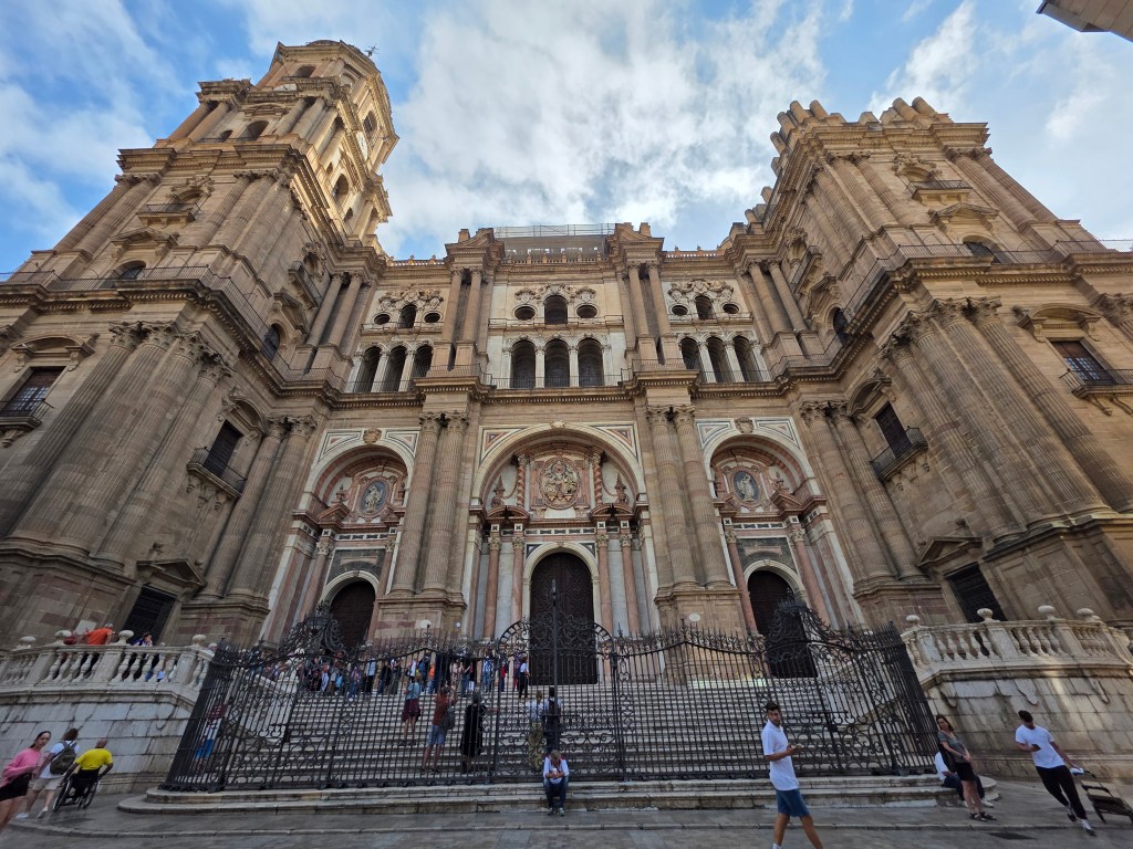
Malaga City
Malaga is truly a gorgeous city, teeming with tourists and with enough museums to rival Waterford. Deciding to go to the Picasso Museum, we discovered that the earliest slot we could get was at midday so we ate breakfast at one of the many cafes, people watching, enjoying the vibrant atmosphere and listening to the squeal of the tyres of delivery vans on the ceramic tiled streets.
Morocco is now firmly in our sights, just a few more hops.
The night before we left home for our nine-week roadtrip from Ireland to Morocco in our all-electric van, I dreamt that camels were towing us through the desert because we had run out of charge. Range anxiety in my dreams…..hopefully not an omen.
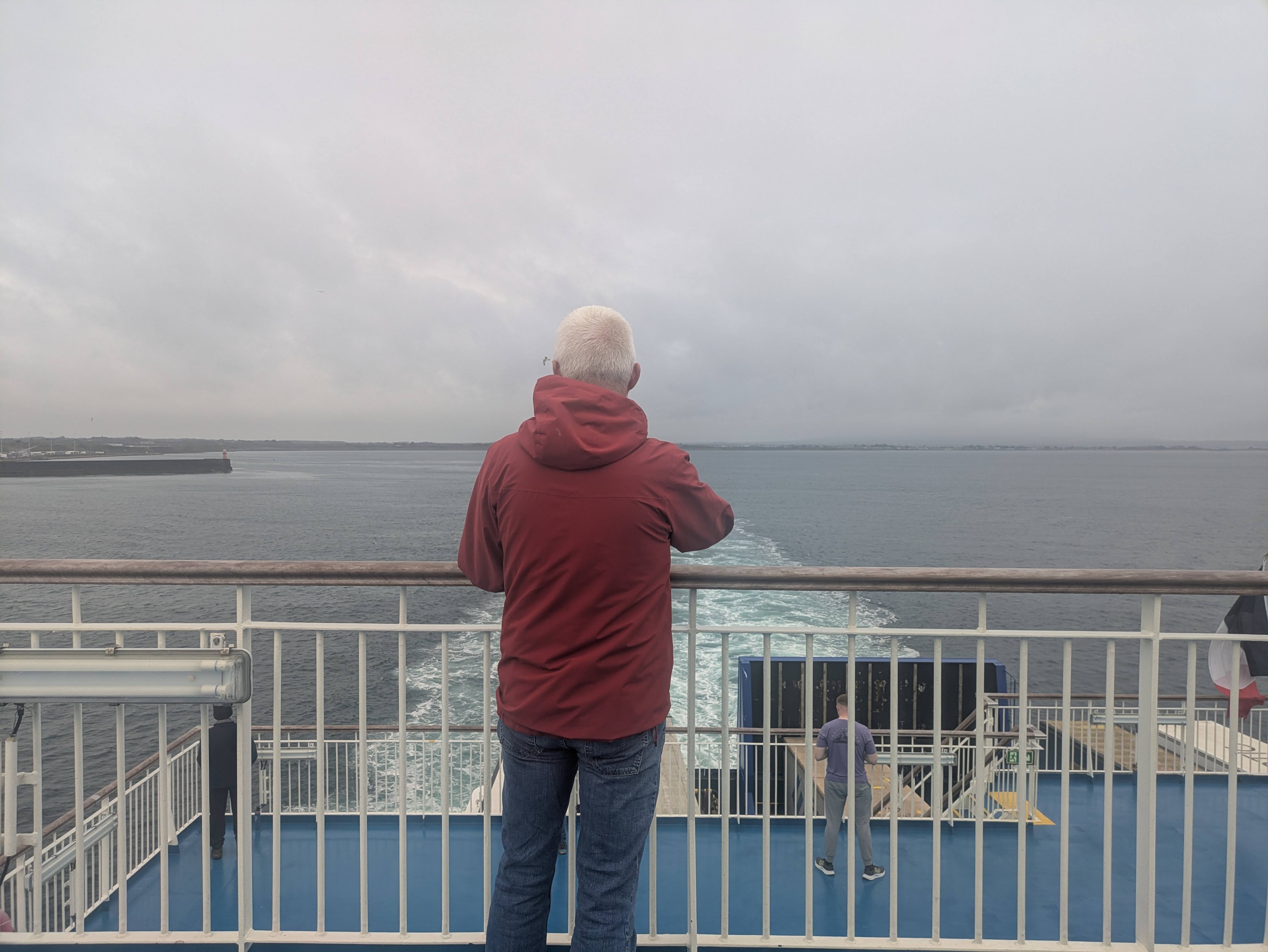
Leaving Rosslare
The journey to the ferry port in Rosslare was short and the crossing to Bilbao was smooth. Taking the ferry was such a comfortable, relaxing way to travel, a slow transitioning to holiday mode. Wi-Fi was only available for a fee and our mobile data only kicked in briefly when we sailed near the tip of England and the French coast with a fleeting flurry of What’s App messages. We were in a floating cocoon, out of contact with the world.
We were fortunate to sail on Wednesday morning (Oct1), well ahead of Storm Amy. Our original preference was for the Friday crossing but it was full when we tried to book it the previous week, so we opted for the earlier sailing. Sometimes it pays off to be ‘last-minute’ because that Friday evening sailing was cancelled due to the adverse weather conditions.
The thirty-hour journey flew by. The talk given by the resident on-board conservationist (from the Ocra Charity) about whale identification was really informative and a good initiative on the part of Brittany Ferries. The breeze on deck was brisk for the whale-watching session, and as the whales refused to turn up, we went down to the bar and marine-watched in comfort through the large windows, accompanied by live music followed by a quiz about French food and drink. It was multiple choice so we guessed most of the answers….. wrongly. (Sample question: What is Roscoff famous for? Onions apparently.)
There was plenty of other entertainment, Caoimhin did a short course on rope-knots and the whiskey & chocolate tasting in the shop was very popular. There was bingo, more quizzes and dolphins appeared at dusk for a little sunset somersault.
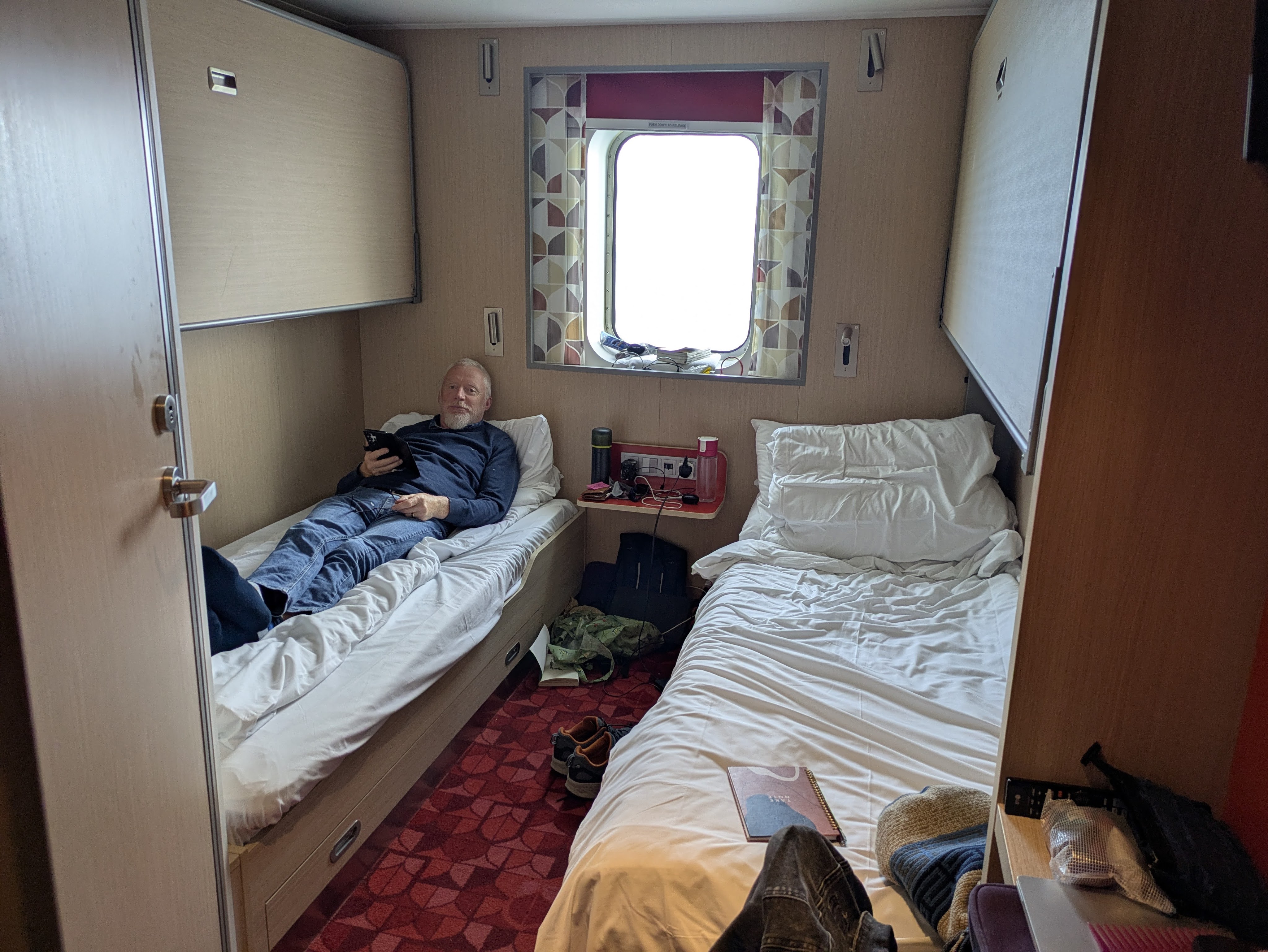
In the cabin, Caoimhin cut my hair, lopped off a couple of inches…. we had been so busy in the run up to our departure that I didn’t have time to visit a hairdresser… and did a good job. Our ensuite cabin was comfortable, the shower was hot and the hum of the engine was so soporific that I slept for ten hours straight, lulled by the gentle swaying motion.
It was a sunny 25C at 2pm in Bilbao when we emerged from our cocoon. There’s always a bit of tension when driving on the ‘wrong’ side of the road in a new place and trying to figure out Google’s instructions. Taking a wrong roundabout turning, we ended up back in the port where the officials looked at our Irish reg, and sighed before raising the barriers to let us loose …again. But soon we were driving south towards Haro and the Rioja region….this destination was only decided on the ferry when looking at the guidebook. We had never heard of Haro but we like wine and we wanted to head south.
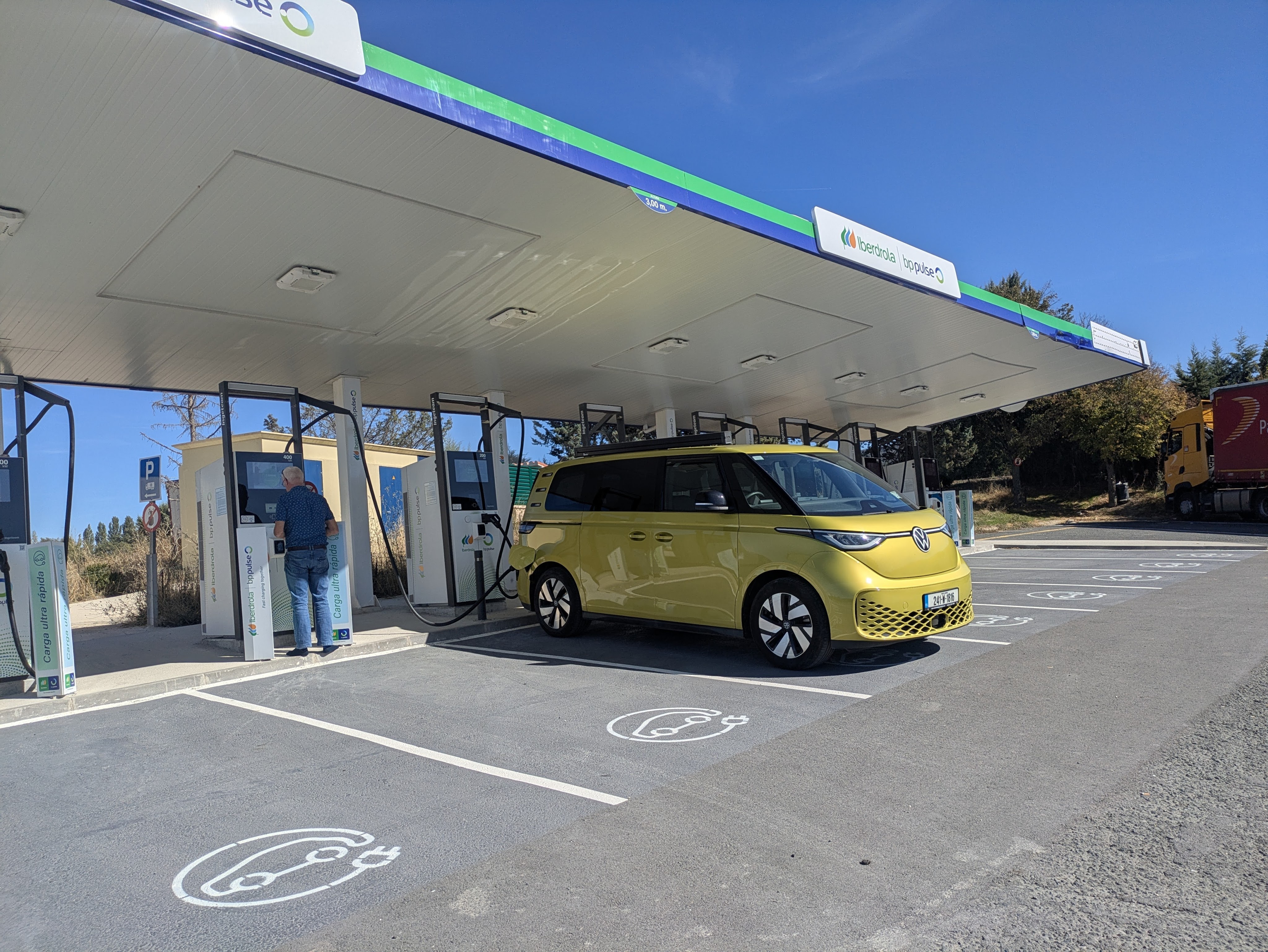
Our next task was to figure out EV charging in Spain before we reached the ‘range anxiety’ stage. Our maps indicated that EV charging stations were plentiful. Although we had 50% in the tank, we stopped at an Iberdrola charging area before any topping-up became critical. Our Buzz was the only vehicle charging at a whole bank of chargers, all fast chargers with a couple of ultra-fast. It was possible to get instructions in English and pay by bankcard. It was relatively expensive at 0.70 a Kw, more than we have paid at public chargers in Ireland but at least we know that charging is easy, at least with Iberdrola.
No Queues
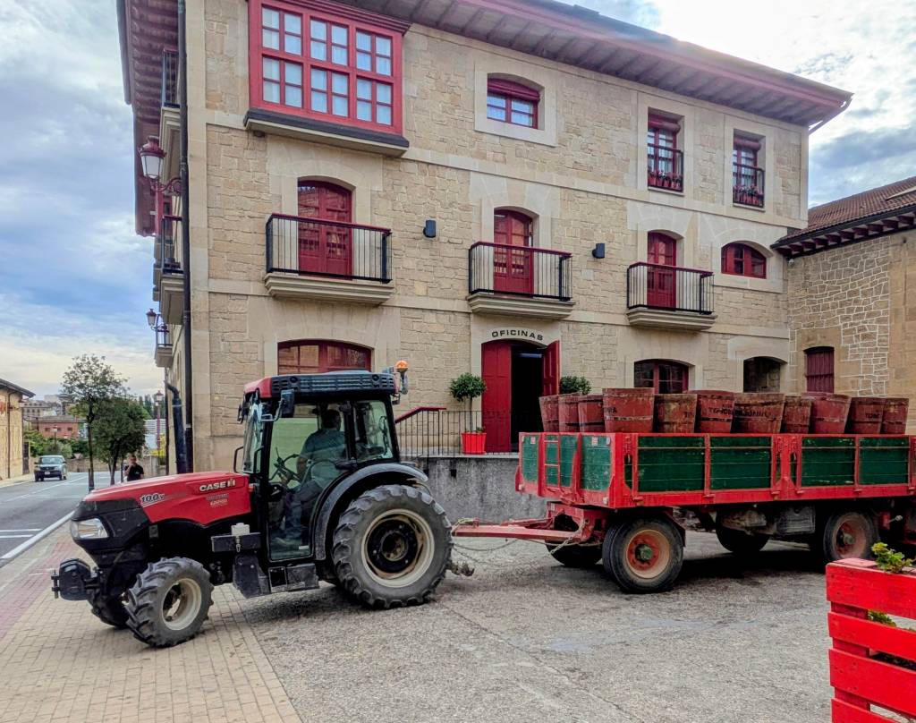
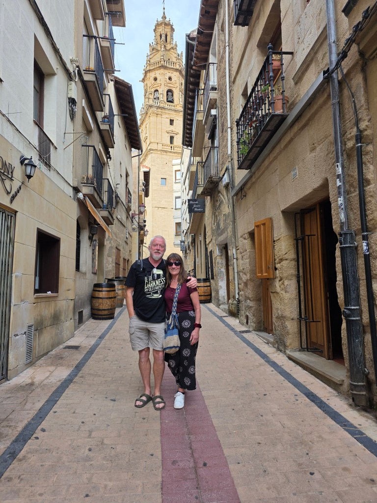
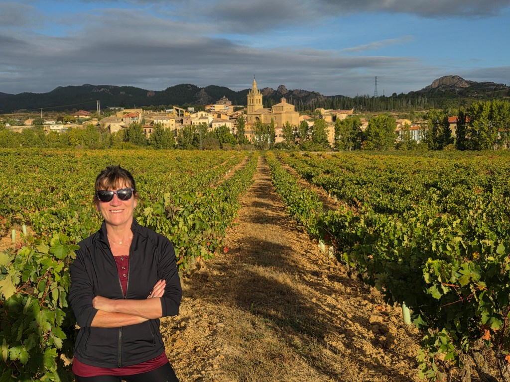
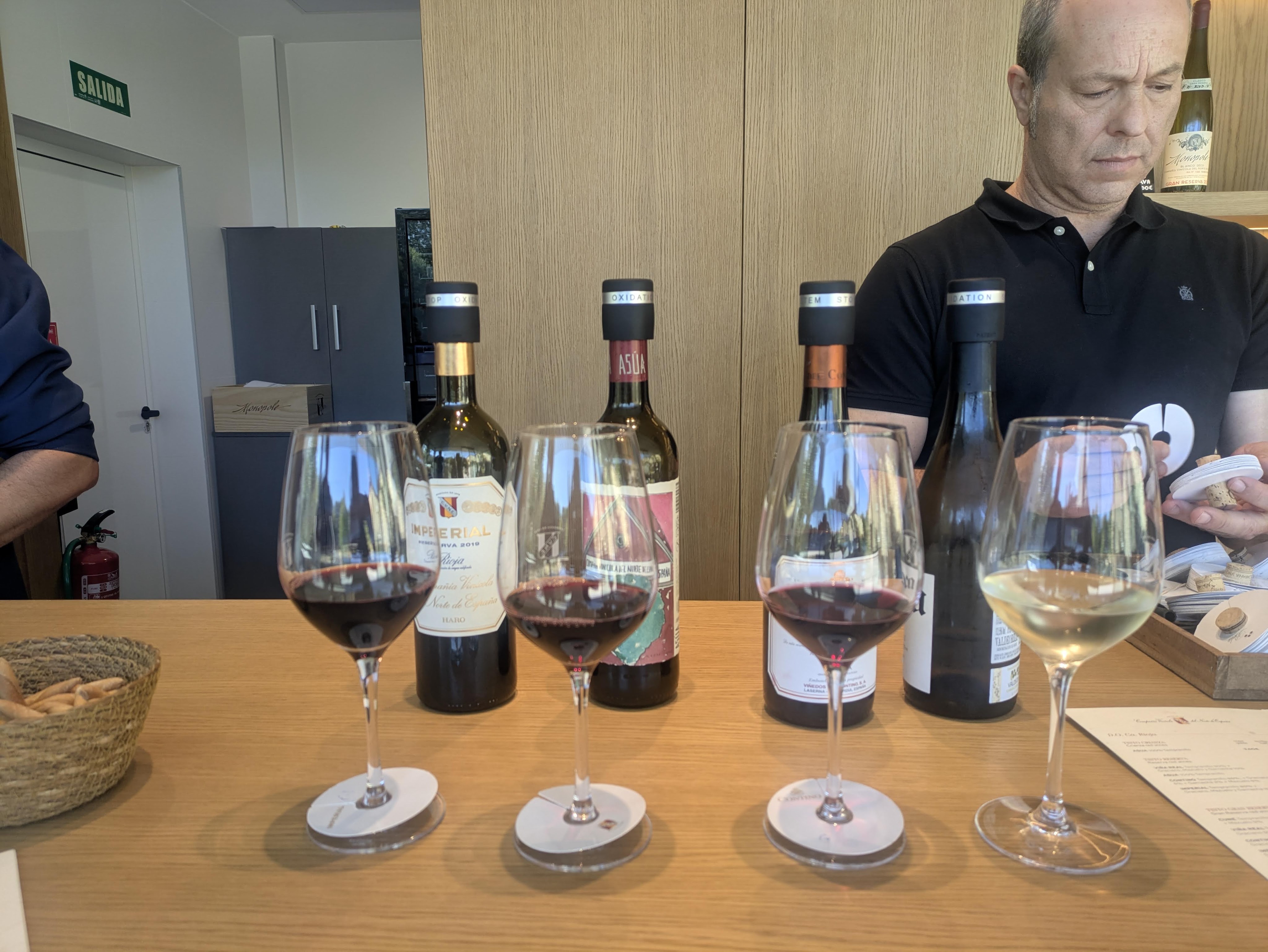
Haro proved to be a good choice. It was a town with the tang of fermenting grapes in the air and the hum of tractors pulling trailer-loads of grapes to the wineries; the building were old and made of a golden-yellow stone that glowed in the late afternoon….and the wine was cheap (starting from less than €2 a glass). A perfect combination.
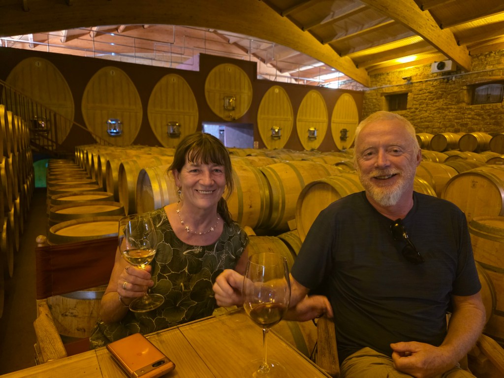
The bodegas opened at 10am, or before, for wine-tasting and closed in the early-afternoon. Sipping wine in a two hundred year old cellar, surrounded by hundreds of wooden casks which were slowly seeping alcohol into the dim air, was a wonderful way to enjoy a tipple even if it was barely midday. This activity also meant that most of the visitors to this gorgeous little town were never entirely sober. Early morning walks along by the Rio Ebro and through the vineyards went some way to clearing our heads. The mornings were cool – about 10C- but by midday it was a gorgeous sunny 26C until the evenings required a light jacket.
Haro holds an annual festival in late June, Batalla de Vino (Battle of the Wine) where the attendees dress in white tunics and throw thousands of litres of wine at each other, staining their clothes red. A clock in the main plaza was already counting down the days and minutes to next year’s event.
Haro owes its wine success to a plague (phylloxera) in France which ruined the French vineyards in 1863. French wine producers set up storehouse in La Rioja and began to produce Riojan wine with their own techniques which the locals adopted and adapted. Never an ill wind and all that…
As we stayed in a campsite by the river (€28 a night with electricity), Caoimhin had high hopes that we might be able to slow-charge the van onsite using a ‘granny cable.’ When that wasn’t compatible, we dispensed with electricity, and the nightly charge dropped to €21. The campsite was very social and we met several Irish people who were having an unplanned extra week in Spain due to the ferry cancellations and disruptions.
After three days, we felt that we should depart Haro for our livers’ sake. The ‘Haro Effect,’ that continuous hazy, slightly inebriated state, was becoming too seductive so we packed up, with some regret.
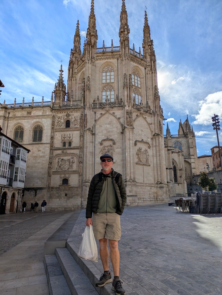
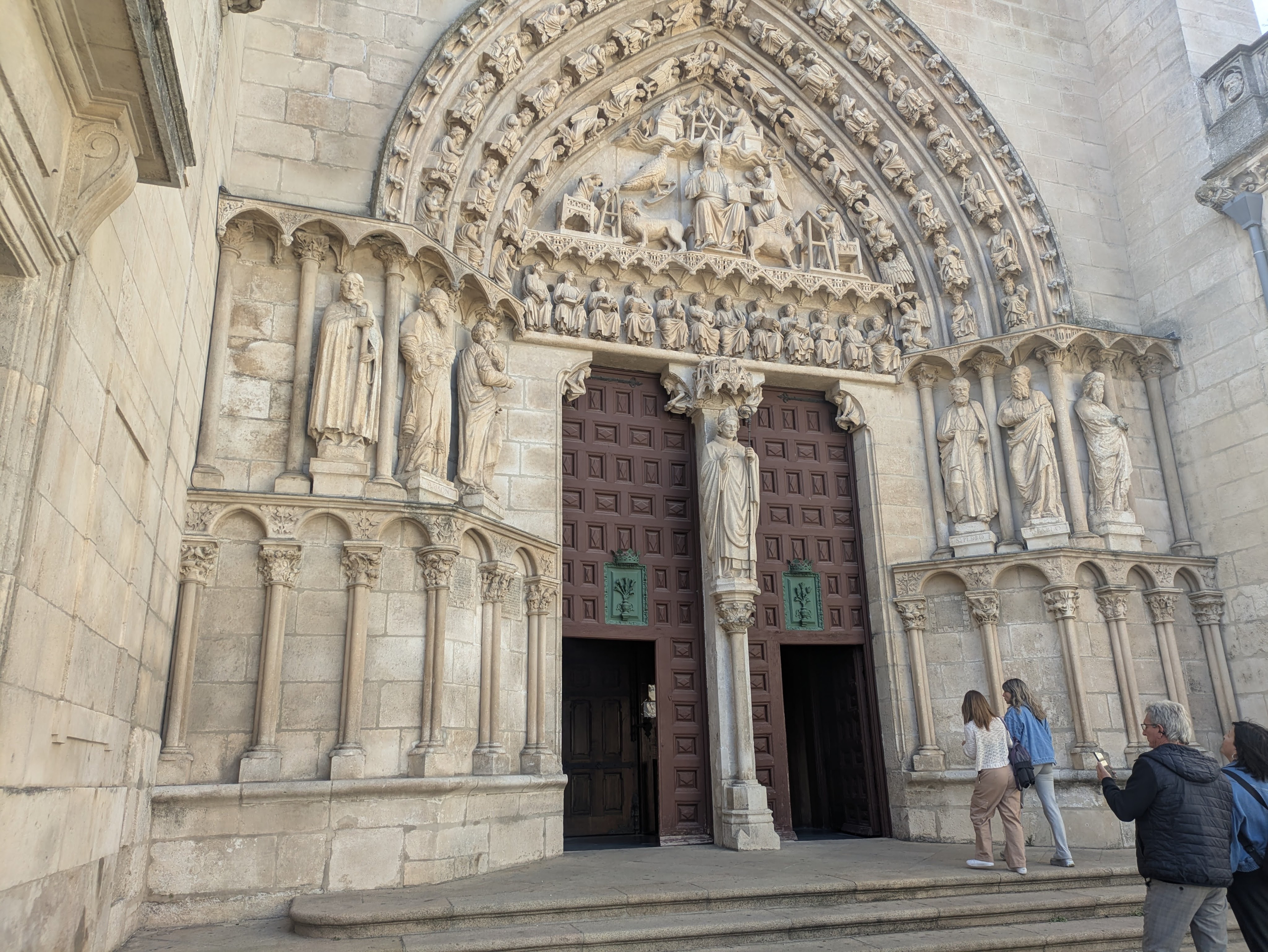
Heading south in the direction of Burgos, the weather turned cool and cloudy with even a slight hint of rain. We drove by bare fields, shorn of corn and bleached white from the sun and fields of blackened sunflowers, withering on the stalk with drooping heads. The climate in Burgos, like most of central Spain, has been described as ‘nine months of winter and three months of hell(summer).’ It was sunny when we arrived with a stiff easterly breeze keeping the temperature a chilly 13 degrees although the streets were full with lots of people going around in medieval costume. The Cathedral was jaw-dropping, a Gothic Treasure where the concept of ‘Less is More’ was never considered, every available surface was crammed with ornate carvings. After charging in Burgos (Zunder Chargers@ €0.58/kW) and wandering around the Sunday market, we pushed on to Lerma, a pretty town, with a castle, convents and a big Plaza Mayor. We parked in a picnic area on the outskirts of town and settled for the night.
Burgos
The cold woke us. The temperature had dipped to 1.5 degrees which was unexpected and the coldest it’s been so far. By 9am the following morning, the sun was shining but temperatures were still hovering about 2 degrees. We moved on, before we had to invest in blankets and woolly jumpers.
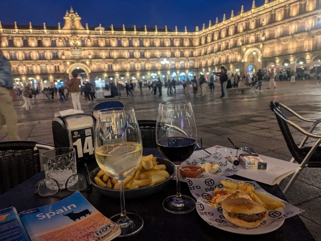
We are now in Salamanca, staying in a cheap guesthouse (Hispanica Hostal €38 a night) in a basic ensuite- room but it is clean, light-filled, central with free parking. The Plaza Mayor in Salamanca is considered the most beautiful in all of Spain and we believe that claim, having been in the Plaza last night when the lights came to spontaneous clapping. The plaza which was already gorgeous became even more magical when lit up and with a full moon rising over the splendid architecture.
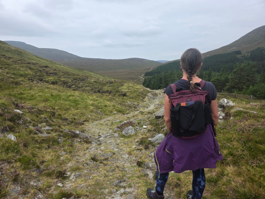
It was a week to remember, a week in late August, spent campervanning around Mayo, a week of spectacular walking on stunning coastal paths, pristine white-sand beaches, lonely bogs and remote mountains and even a pilgrimage route, Tóchar Phádraig, an ancient druidic path to reach Croagh Patrick.
We started at Portocloy Beach on the far North-West Mayo Coast in a Gaeltacht area. If ever the phrase ‘off the beaten track’ was appropriate, it was here. We watched a lone gull, the only sign of life, gliding and swooping over the calm harbour waters. There were no crowds, cafes, shops or bars, just a picture-perfect beach, isolated by miles of blanket bog and nestled deep into a natural harbour, Carrowteige Cove, a safe haven for swimming or snorkelling and a little pier for fishing boats. There were temporary toilets in place for the summer months which was good news for us as we were sleeping in the van (the ID Buzz).
Parked up at Portacloy Harbour
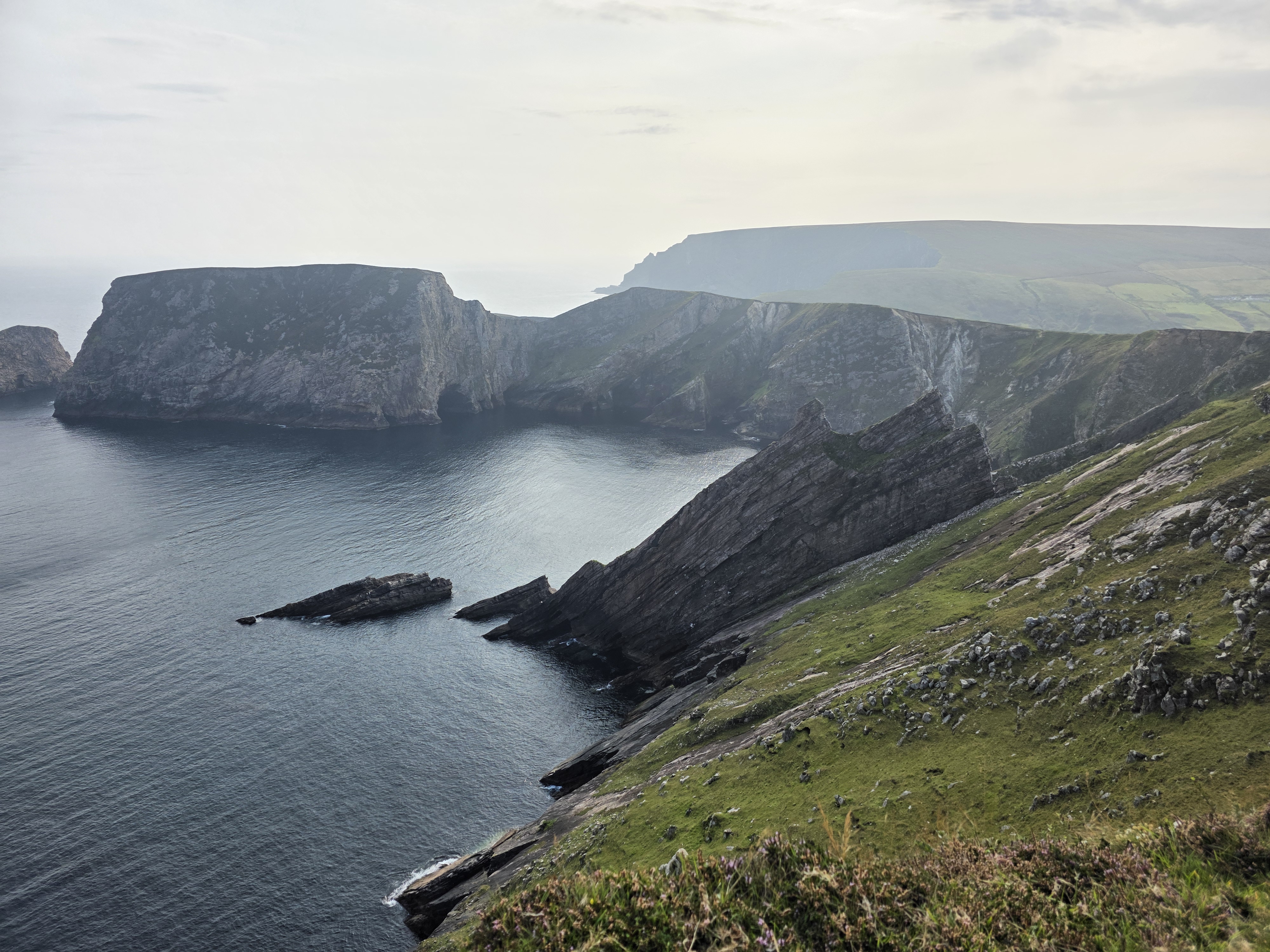
Portocloy Beach is also the start point for a truly spectacular cliff walk along the sea edge all the way to the extraordinary cliff views of Benwee Head (Binn Bhuí). This walk has a combination of rolling hills, expansive bog views, dramatic cliffs, jaw-dropping ocean and sea stack views, and more sheep than we could count. It is a well-marked trail with black poles and purple arrows, clearly visible on a beautiful cloudless day. The weather was perfect for us, blue skies with a light breeze, perfumed from the heathers, but on gusty days, care would be required because of the trail’s proximity to steep cliffs. We hiked an out and back route (about 13kms) but it is also possible to do the Carrowteige Loop Walk, which covers much of the same trail but is looped.
Rincoe Strand was only a ten-minute drive from Portocloy. It looks out across Broadhaven Bay towards the Mullet peninsula with a sandy beach on either side of a small peninsula. There were far more sheep than humans with the sound of bleating mingling with the lapping waves……until two busloads of Irish language students arrived for a swim in the crystal- clear waters… but peace came ebbing back when they scrambled onto their buses after about an hour, leaving a few campervans and the sheep. We walked uphill past the walled graveyard to Connolly’s Pub (Teach Conghóile), a cosy place with spectacular sea views where a couple of locals were sipping pints. The whole area had a desolate beauty with hardly a tree or bush…it almost felt like we were on an island with the sea and water in every direction. A local man, who now lives in Wexford, told us with nostalgia of the ‘good times’ growing up here, when children ran wild and free, and fishermen travelled to England to find work during the winter months and boys, as young as thirteen, went to Scotland to pick potatoes, known as the tattie hokers.
Rincoe Beach
After Rincoe, we headed south along the coast, stopping for lunch in Belmullet before continuing to Claggan Island, Mayo’s newest island, having only being officially declared an island in 1991. The tiny island is situated on the northeastern corner of Blacksod Bay, about 12km from Belmullet. It is linked to the mainland by a narrow, sandy causeway that divides Tramore Bay from Blacksod Bay and it is circled by beautiful sandy beaches in every direction you look with some amazing views of Achill and the Mullet Peninsula. It was easy to spot the first-time visitors…they were the ones driving on the rough sandy road while the locals used the beach.
Driving around the roads of North Mayo, we kept seeing signs for Tír Sáile without knowing what it was. By the time it registered that this was a Sculpture Trail, we had passed most of them. Tír Sáile originated in 1993 when fourteen site-specific sculptures were installed in spectacular locations around the coast (sáile is seawater). One of the sculpture was on Claggan island, titled ‘Acknowledgment’, a 50m long sculpture of stone and earth, a tribute to the anonymous dead, whose memories have been lost in time.
Claggan Causeway
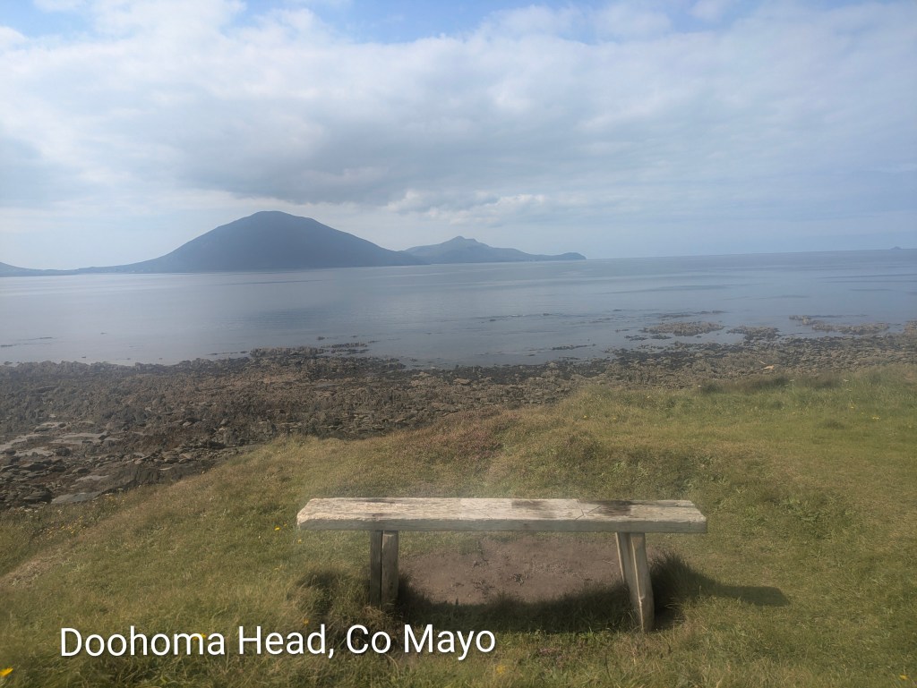
South of Claggan Island, there seemed to be an unending supply of more white-sand beaches with the distinctive silhouette of Achill Island on the horizon in the distance. Doolough Beach was empty apart from a man walking five dogs who told us that whales were spotted in the area the day before. Doohoma Head had a wooden seat with a dreamy Achill view but it was time for us to turn inland towards the mountains.
Doolough Beach
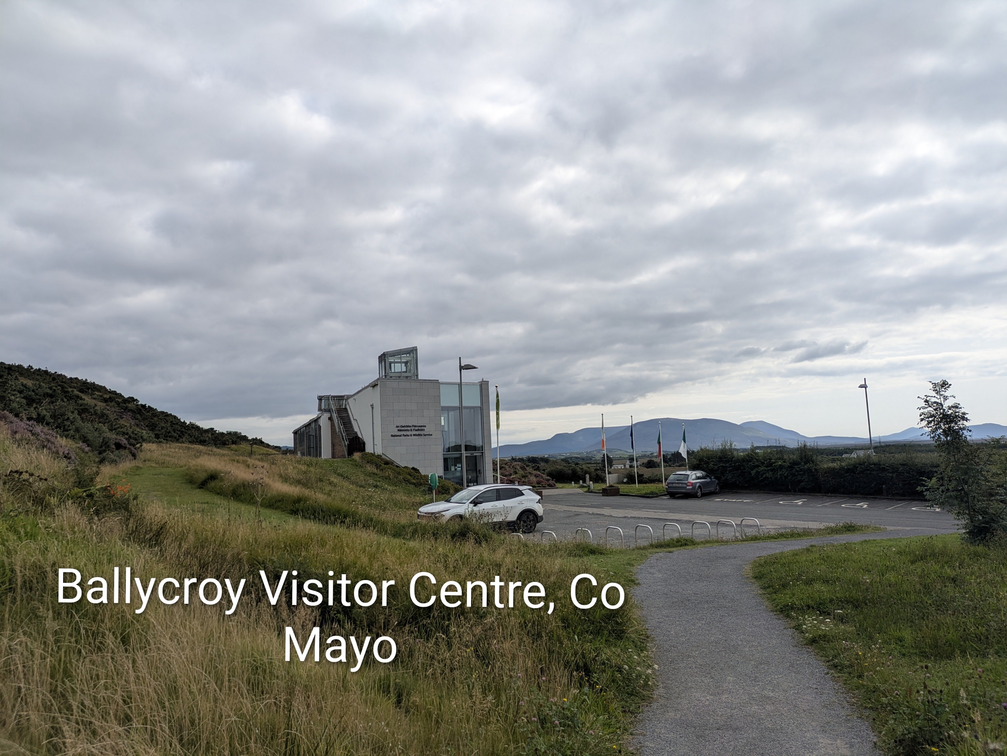
We stopped at the Ballycroy Visitor Centre in Wild Nephin National Park, a modern building full of light and clean lines with knowledgeable, enthusiastic staff and a lovely café. Wild Nephin National Park is huge – a vast 15,000 hectares of uninhabited and unspoilt wilderness, dominated by the Nephin Beg mountain range and the Owenduff Bog, one of the last intact active blanket bog systems in Western Europe. Martin, who worked in the centre, explained the vision for the future with conservation plans for reforesting the park with native species and a focus on education.
Just inside the visitor centre was a huge star-studded poster with the caption ‘The darkest skies reveal the brightest stars’ because Nephin has some of the darkest, most pristine night skies in the world and is officially certified as a Gold Tier standard International Dark Sky Park. The Mayo Dark Sky Park extends across the entire National Park….there was even a viewing platform on the grounds of the visitor centre. The best time for star-gazing is the clear crisp winter months but it is possible on any night for visitors to see with the naked eye thousands of twinkling stars, other planets in our solar system, the Milky Way and even meteor showers…if they are lucky.
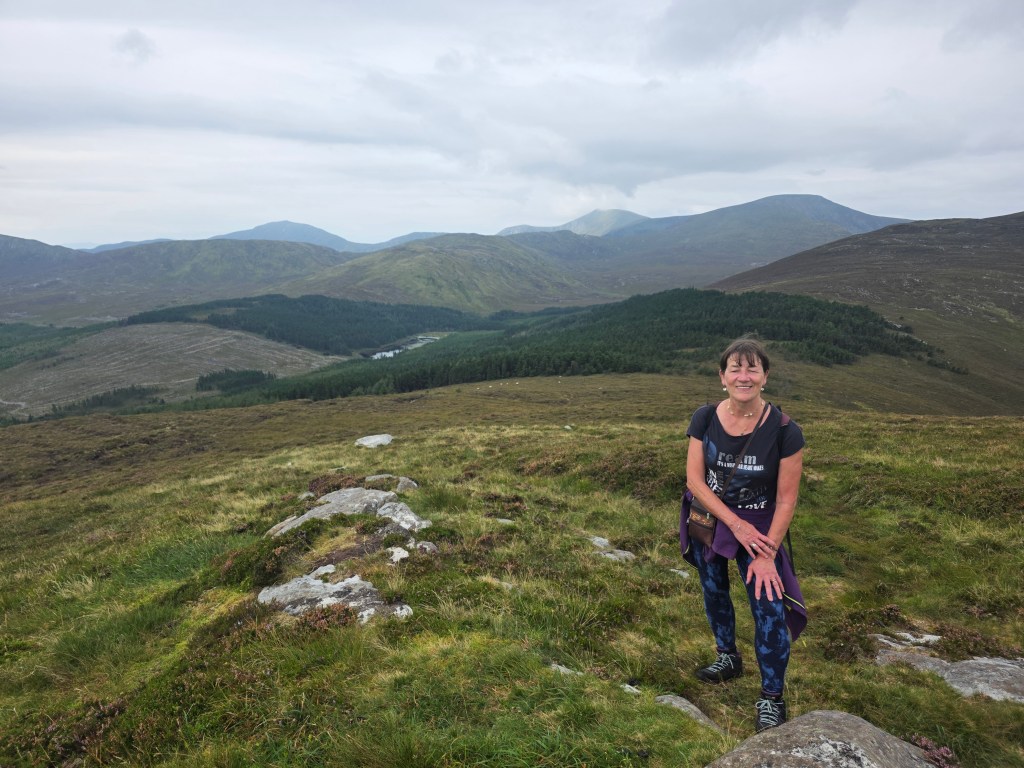
On Martin’s advice we headed to the Letterkeen Trailhead, about a forty minute drive, northeast from the centre, a trip into wilderness and blizzards of midges at dusk. Unfortunately the skies remained cloudy for us that night with only a smattering of stars but the Letterkeen Loop walk the following morning was gorgeous, with different terrain from stony sheep paths, forest trails to sucking boggy paths where we almost lost a boot. Although the air was thick with moisture, it didn’t actually rain. We enjoyed panoramic views of inky-black lakes, brown streams and a feeling of deep isolation and silence. Nephin has been called ‘the loneliest place in the whole country’ because of the absence of human habitation and mobile coverage is patchy. We didn’t meet a single person on the trail although there were a few cars parked at the trailhead, which also had spotless port-a-loos.
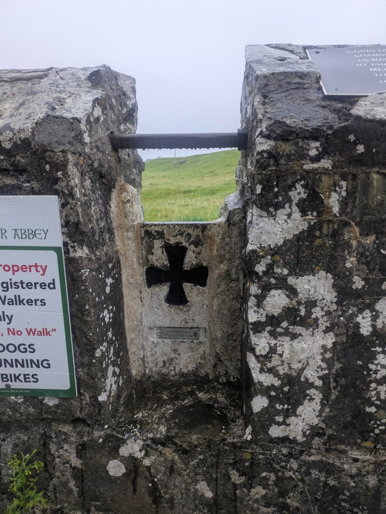
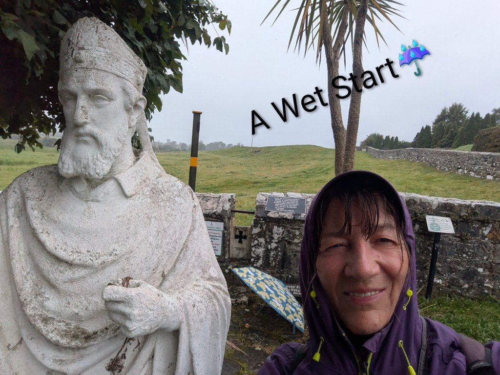
Our next stop was Ballintubber Abbey, founded in 1216 and one of Ireland’s oldest surviving abbeys and the hub of the ‘Irish Camino,’ and one of the five medieval pilgrim paths of Ireland. It is the starting point for Tóchar Phádraig, an ancient pilgrim path that stretches to Crough Patrick.
Tóchar Phádraig predates St. Patrick, originally built about 350AD as a chariot route from Rathcruachan, the seat of the kings and queens of Connacht, to Cruachan Aille, as Crough Patrick was called in Pre-Christian times, a mountain sacred to our pagan ancestors.
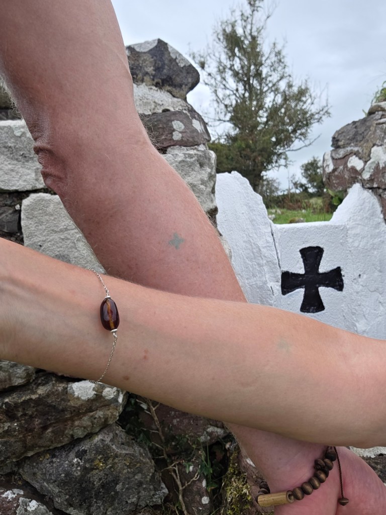
Pilgrims must register in the Abbey before setting out, where they will receive maps, advice and a booklet which gives some information on the many points of interest along the way. We registered on Friday afternoon so that we could get an early start on the 35kms route the following morning as the office opened at 9.30am. The walk can be broken into two parts, the first section to Aghagower with its round tower, and the second section to Crough Patrick but we hoped to complete it in one go. We were branded on the back of each forearm with a small green cross, evidence that we had registered and paid our dues should any farmer or landowner request proof.
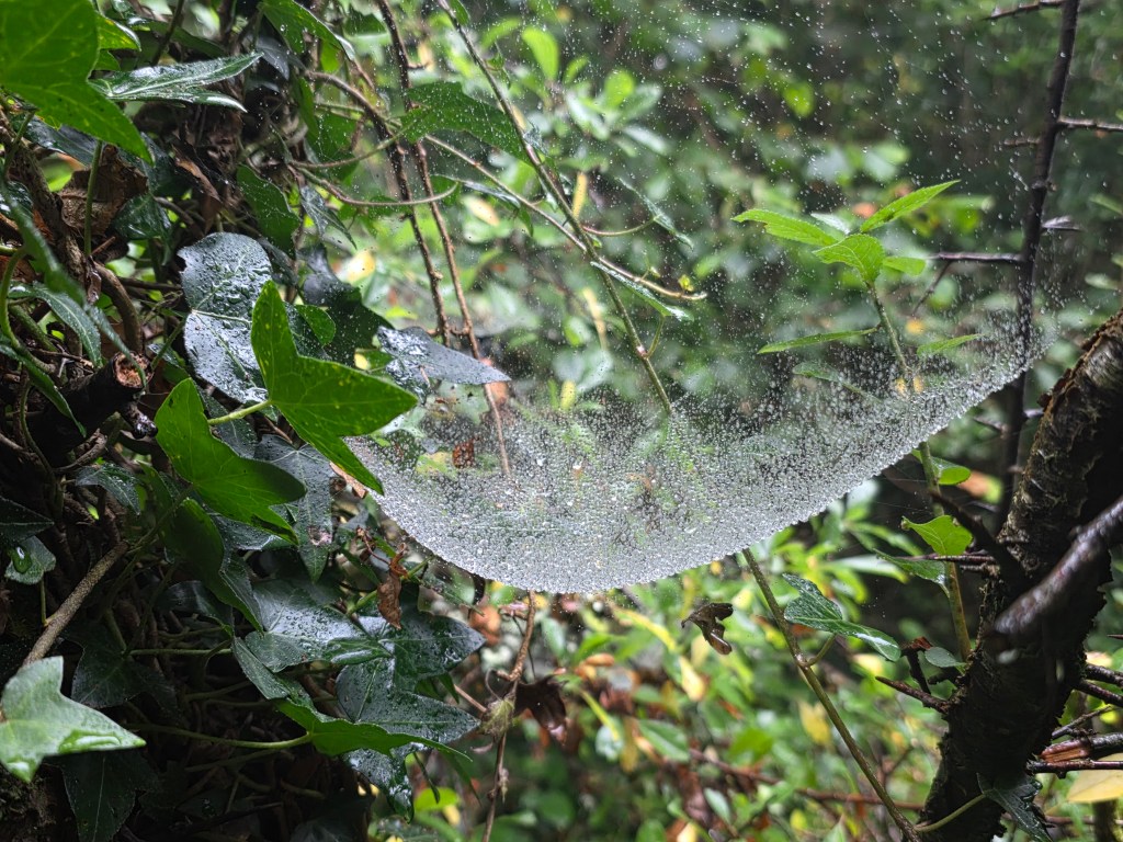
The morning started grey, in a light drizzle, the type of West of Ireland rain that was very wetting but the day cleared after an hour or two. The camino wound its way through open farmland, fields of grazing cattle, sheep and a few horses. We trekked through woodland and forests, stepped over countless stiles with the Tóchar cross sign etched into the stone and tramped along country lanes past hedgerows laden with abundant bounty – blackberries, sloes and haws and moisture drizzled cobwebs.
Spot the Green Crosses?
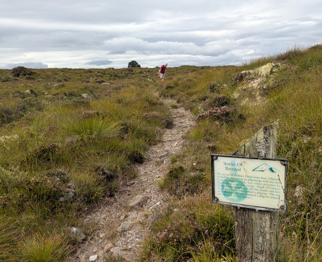
There were numerous storyboards, highlighting points of interest, a welcome opportunity to stop and read. This was not only a spiritual pilgrimage but also a cultural and historical journey through the ages, a fascinating blend of pagan and Christianity, a place of history and pre-history where every tree, stone and rock had a story to tell – mainly of famine, hardship and betrayal but also of healing and goodness. Sometimes in the silence, all I could hear was the beating of my heart and the sound of my boots on the earth. While the first section was predominantly off-road, the second section was mainly on paved country roads and laneways.
With our damp start and the high wet grass, our feet were wet from the very beginning and we contemplated giving up at the halfway point but we persevered. Crough Patrick loomed out of the landscape, a focal point since ancient times, and seemed to beckon us forward although for long sections, it didn’t seem like we were getting any closer as we plodded along. There were signs saying ‘No complaining’ in several places which we tried to obey.
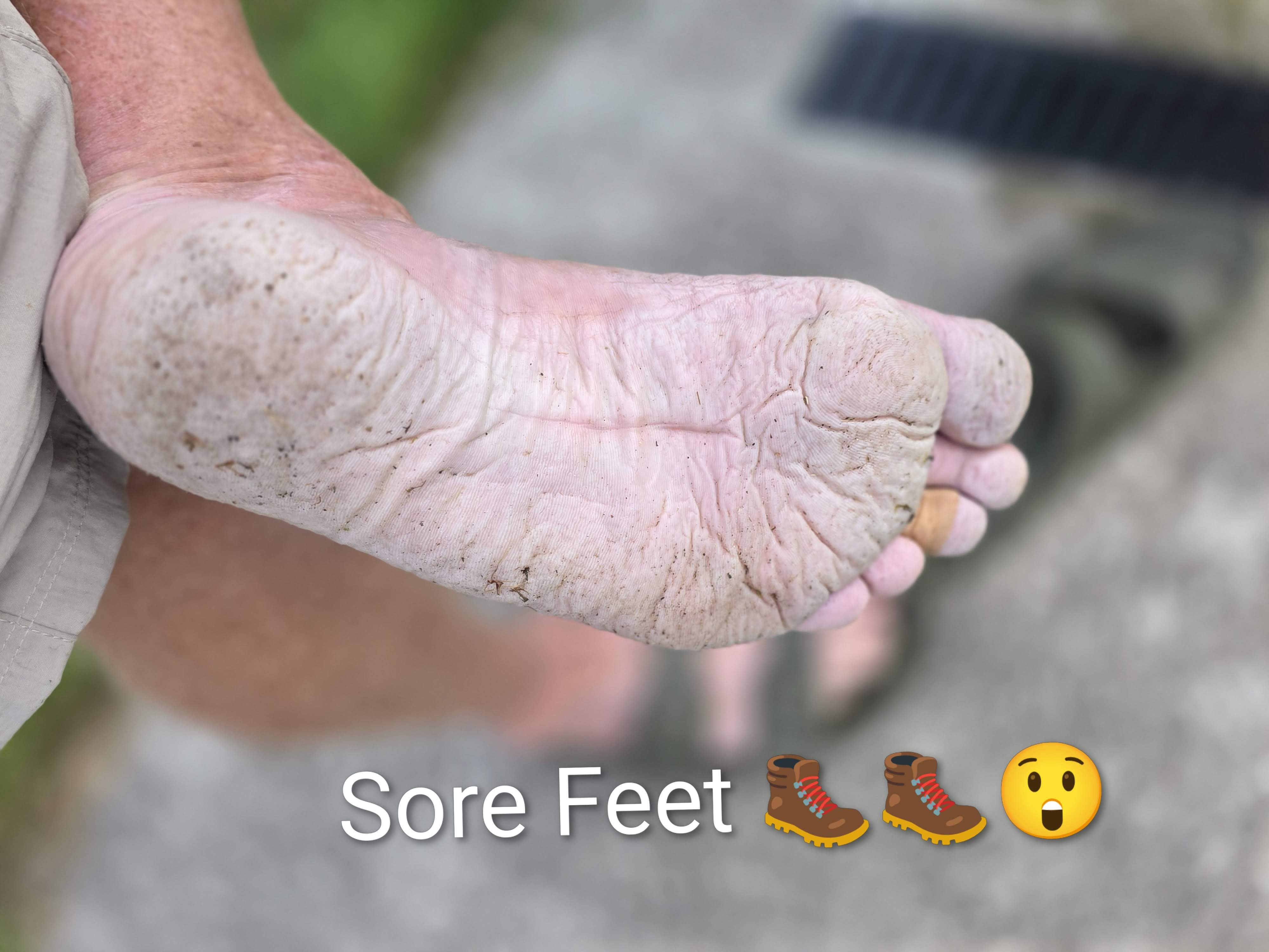
Although the trail was well-marked, we managed to lose it several times, back-tracking until we picked it up again. There are several guided walks each year, organised by the Abbey, which would be easier as we wouldn’t have to concentrate on finding the markers ourselves but we were a week too early for the August guided pilgramage. We finished with a sense of achievement…. and exhaustion with shrivelled feet… after a long day of blisters and contemplation.
We barely scratched the surface of what North Mayo has to offer but one thing is certain, we will certainly return if we can. If stunning scenery, amazing deserted beaches, superb hiking and starry skies are your thing, then Mayo is definitely the place to go. The locals are an added bonus, probably the friendliest people in the whole country and certainly the most talkative.
We had no problem with the electric van, charging it in Ballina and in Westport. This van trip was so successful that we are considering going further afield. Might it be possible to drive to Istanbul or Casablanca…..and back?
There’s something appealing about visiting islands. Maybe it’s the isolation, the idea of ‘getting away from it all’, the rugged beauty of most islands or the desire to experience a simpler rhythm of life based on sea and tide. Ireland has a plethora of islands scattered about its coast, more than eighty in total with about twenty of them inhabited.
A few years ago, we pledged to visit all of them, or at least the inhabited ones, and we have been slowly ticking them off our list. Last year, we visited Tory, Ireland’s most northerly, inhabited island and last week, we went in the opposite direction towards Sherkin Island and Cape Clear, Ireland’s southernmost inhabited island.
The carpark near the pier in Baltimore was surprisingly full, mainly of small elderly cars. The crew member on the Ferry to Sherkin explained that many islanders keep a car on the pier so that the car park is packed even in the depths of winter when there isn’t a visitor to be seen. The ferries to both islands depart from Baltimore (and during the summer months, there are also sailings from Schull to Cape Clear).
Baltimore is a picturesque village facing a sheltered harbour with pubs, a grocery store, a Michelin restaurant, spotless public toilets and shower facilities but it has a terrifying history. In 1631, Algerian pirates raided this quiet village and carried off about one hundred and forty inhabitants, dragging them from their beds. These poor unfortunates were sold into slavery in the Ottoman Empire. The survivors were so traumatized and frightened that they fled upriver to establish the town of Skibbereen. ( Rte did a fabulous radio documentary on this years ago, From Baltimore to Barbary: The Village that Disappeared). Sipping drinks in glorious sunshine outside Bushe’s pub, this event seems unimaginable.
The roll on, roll off cargo ferry to Sherkin was old and rusty but the journey wasn’t long, merely a ten minute trip from Baltimore. The cost was relatively expensive at €15 a head for a return journey and we discovered later that the price of ferrying a vehicle was an eye-watering €100 with prior booking essential as there is only space for one vehicle at a time. Apart from us, there was three British sisters and a brother (all in their sixties) who were holidaying in Ireland and visiting a friend on the island for the day, a few other day trippers and two island women with bulging shopping bags, obviously returning from a grocery shop on the mainland as there’s no shops on the island.
The Sherkin Ferry
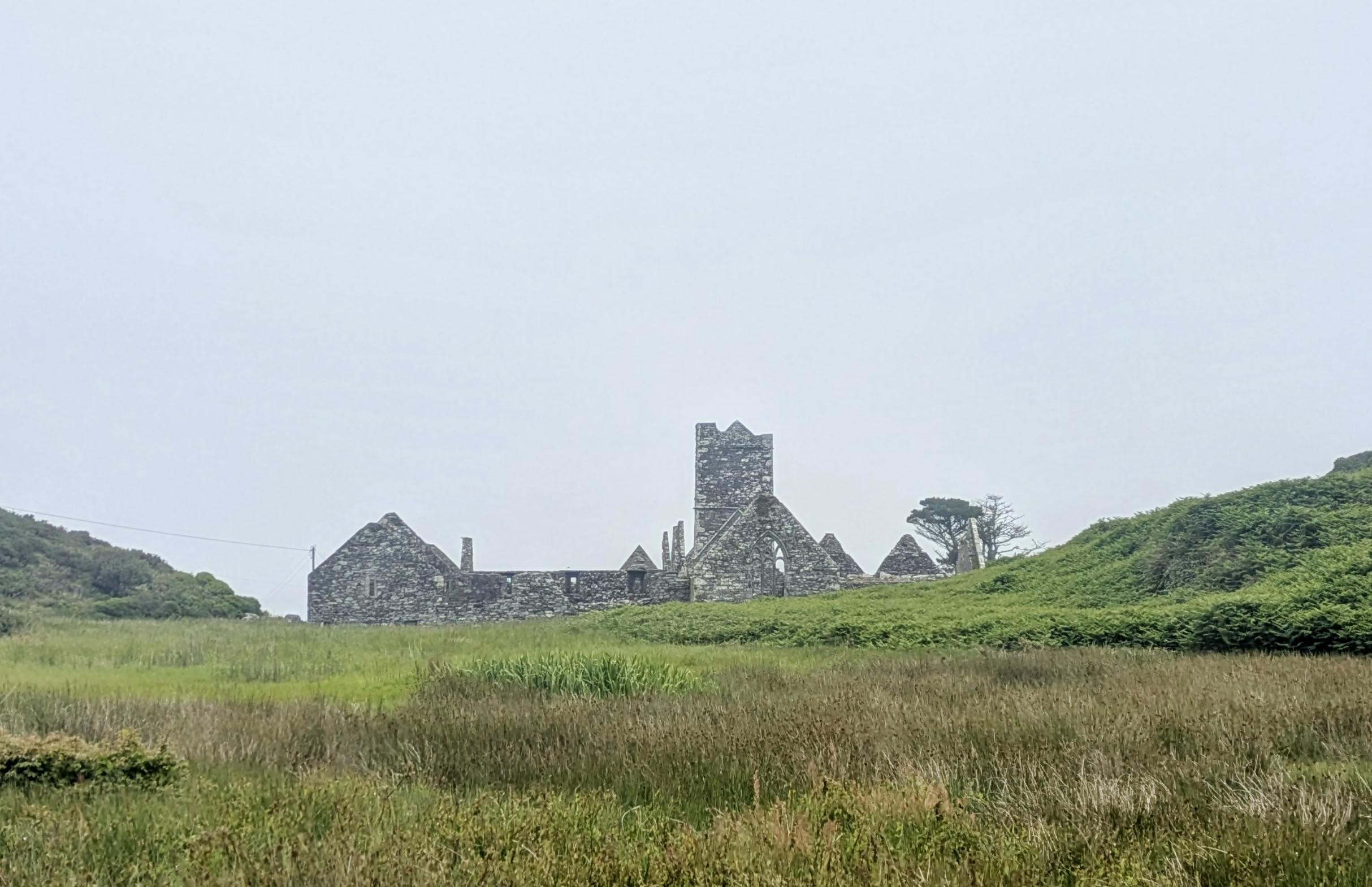
Arriving in Sherkin, we were met by the imposing landmark of the well-preserved ruins of the Franciscan Friary rising out of the mists. It sits on a slight incline overlooking the harbour and was built back in 1460 by local chieftain Fineen (Florence) O’Driscoll and seems to whisper tales of a bygone era of prayers and bloodshed. In 1537 the citizens of Waterford burned the building in retaliation for acts of piracy (intercepting and stealing boatloads of wine) by the O’Driscolls. Despite the damage, it continued to function until 1650, when it was confiscated by Cromwellian soldiers. The friary then passed into the hands of the Beecher family, prominent landlords of the island until it was handed over to the OPW in 1895. But the graveyard has remained the traditional burial ground of the island with recent additions among the moss-covered headstones. Quite a few Florence O’Driscoll’s, descendants of the original chieftain, have found their resting place here.
Franciscan Friary
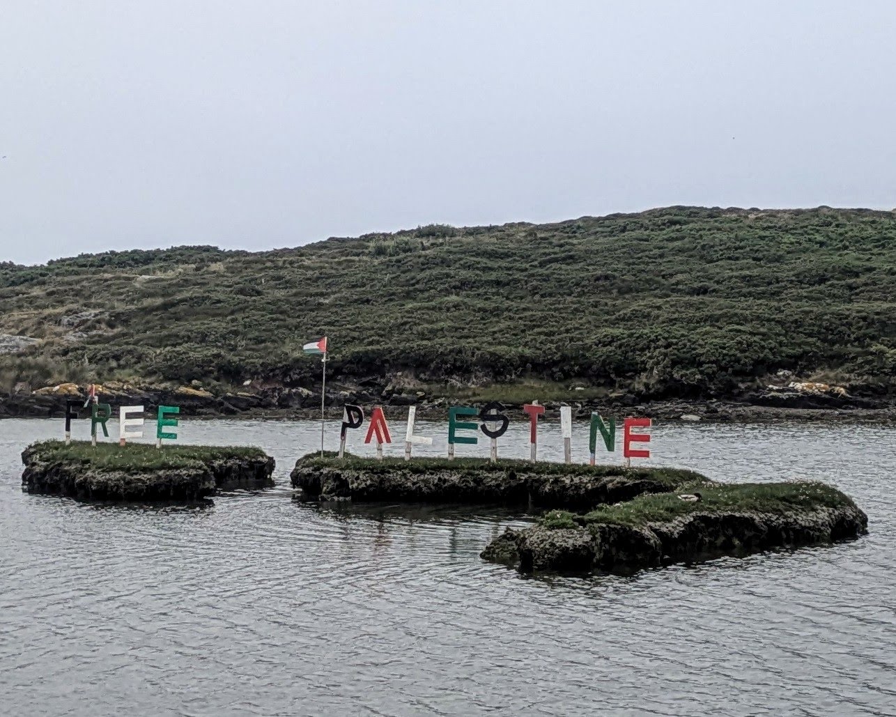
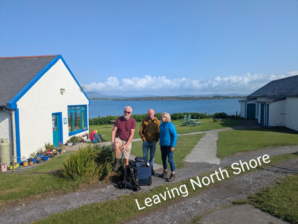
A small bus meets all the ferries at the pier and we availed of it to take us to our accommodation in North Shore which was only about a forty minute walk away but we were carrying bags for our two-night stay. Sherkin is a small, relatively flat island of narrow, winding roads with verges filled with colourful wildflowers, foxglove, ferns, purple loosestrife and fuchsia. We drove past isolated houses dotted along the landscape, a few herds of cows, a tidal lake with a ‘Free Palestine’ banner, fluttering in the middle and a community centre which housed an impressive art exhibition.
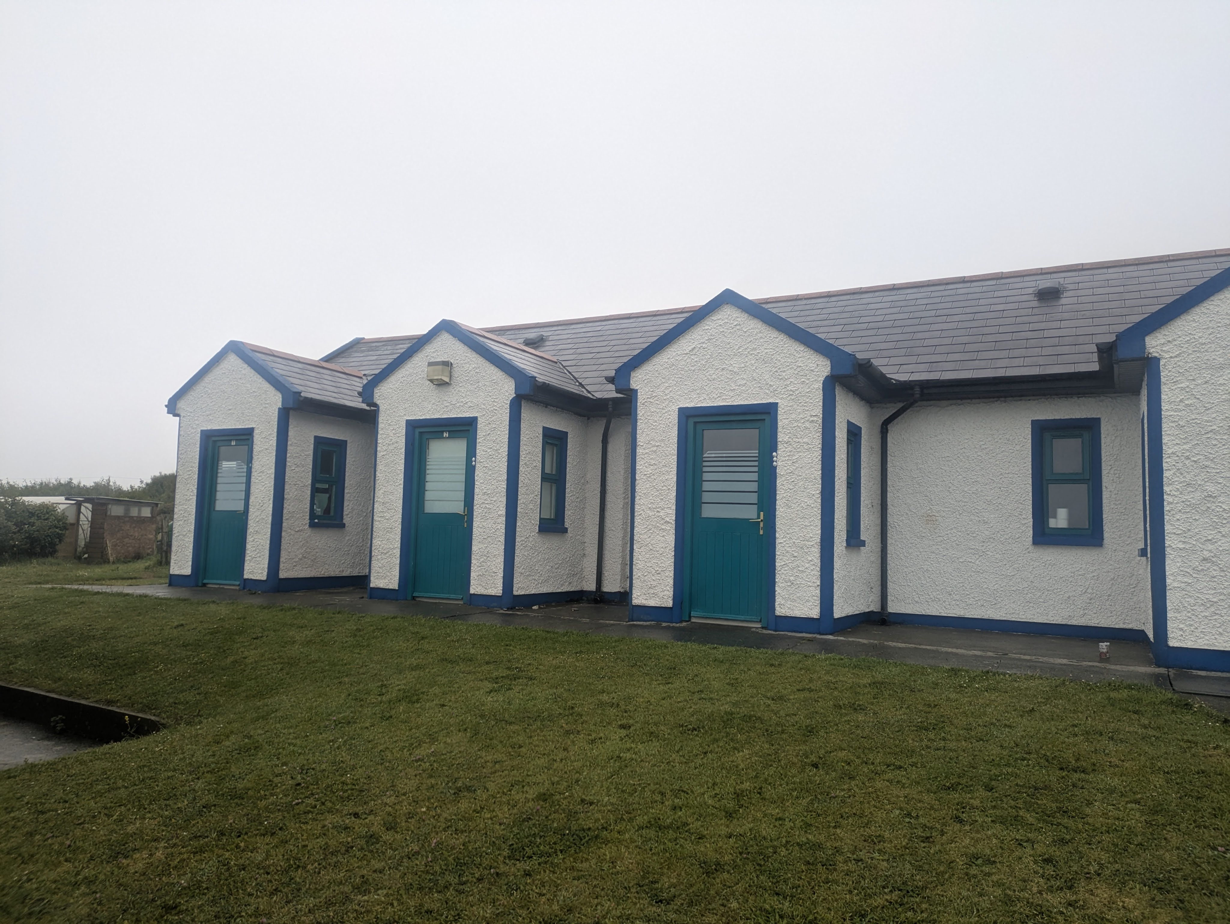
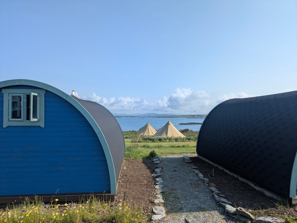
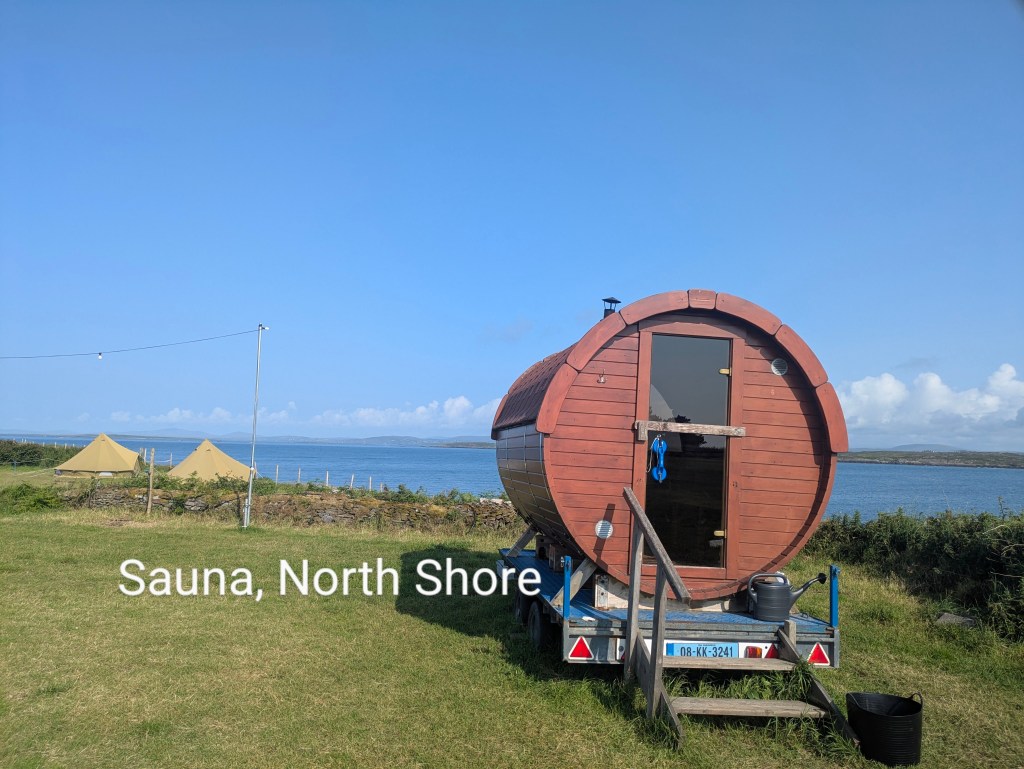
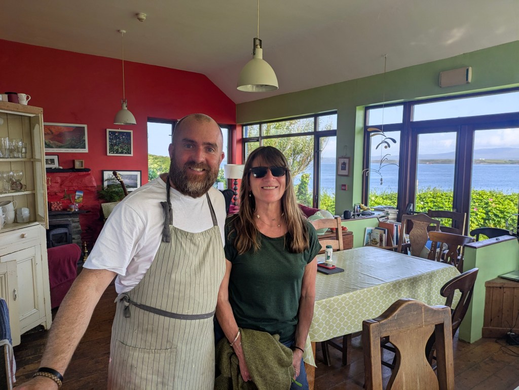
We were welcomed in North Shore with gorgeous sea-views, coffee and delicious homemade brownies by Daniel. The North Shore complex has a huge variety of accommodation – camping, bell tents, glamping pods and cabins. There’s a sauna and a well-equipped communal kitchen. We stayed in an ensuite room with a bunk bed and a single bed which was quite basic and a shower with scalding hot water, so hot it was almost impossible to stand under. Apart from a few Airbnb, North Shore is the main place to stay on the island and is the venue for an annual Electronic music festival. For the last few years, the island hotel has been occupied by Ukrainians who have been welcomed into the community, swelling the island population from about 110 to 165.
Our Accommodation, North Shore
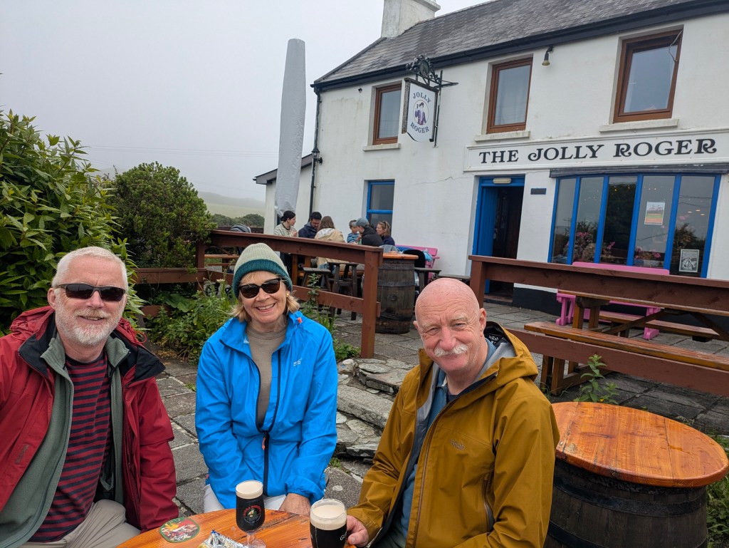
As we hadn’t brought any food supplies with us and there was nowhere to buy anything on the island, we ate our evening meals in North Shore on both evenings. These homecooked meals were generous, plentiful and delicious. Heaped platters of food were passed around a table we shared with an American woman travelling around Ireland and a couple of tradesmen from Cork who were doing insulation work on an old island house. Desserts were made by a Ukrainian pastry chef , mouth-watering lemon drizzle cake and baked cheesecake. North Shore does not sell alcohol and as the only pub on the island called the Jolly Rodger, was closed on Tuesdays and Wednesdays, we watched in envy as the Cork tradesmen drank beer with their dinner. They had gone over to Baltimore for some cans having endured a ‘dry’ night the evening before. So take note if you like to have a drink and bring your own.
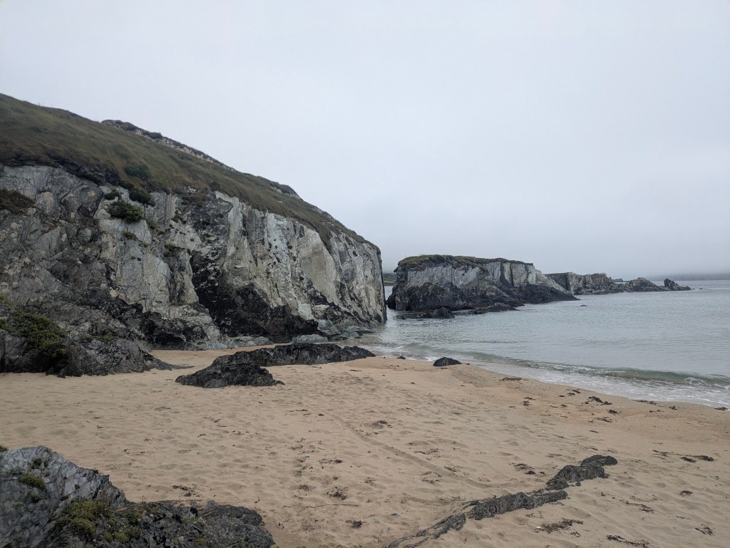
Breakfast was equally enjoyable – bowls of fruit, yogurt, smoothies, pancakes, homemade bread and sausages and rashers, enough to fuel us until dinner time. We spent our days on the island walking and wandering in mild misty conditions, sometimes the sea disappeared completely, hiding in the greyness. The beaches on Sherkin were gorgeous, especially Silver Strand which was sandy, clear-watered and completely deserted. Everywhere there was the sound of lapping of water and occasionally the hum of the ferry in the distance. A dog on a little rocky inlet wanted us to throw stones into the water for him to fetch. In some ways, it was not really like being on an island because the mainland was so near and there was a myriad of small islands in every direction.
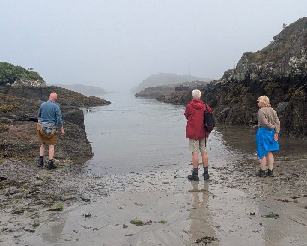
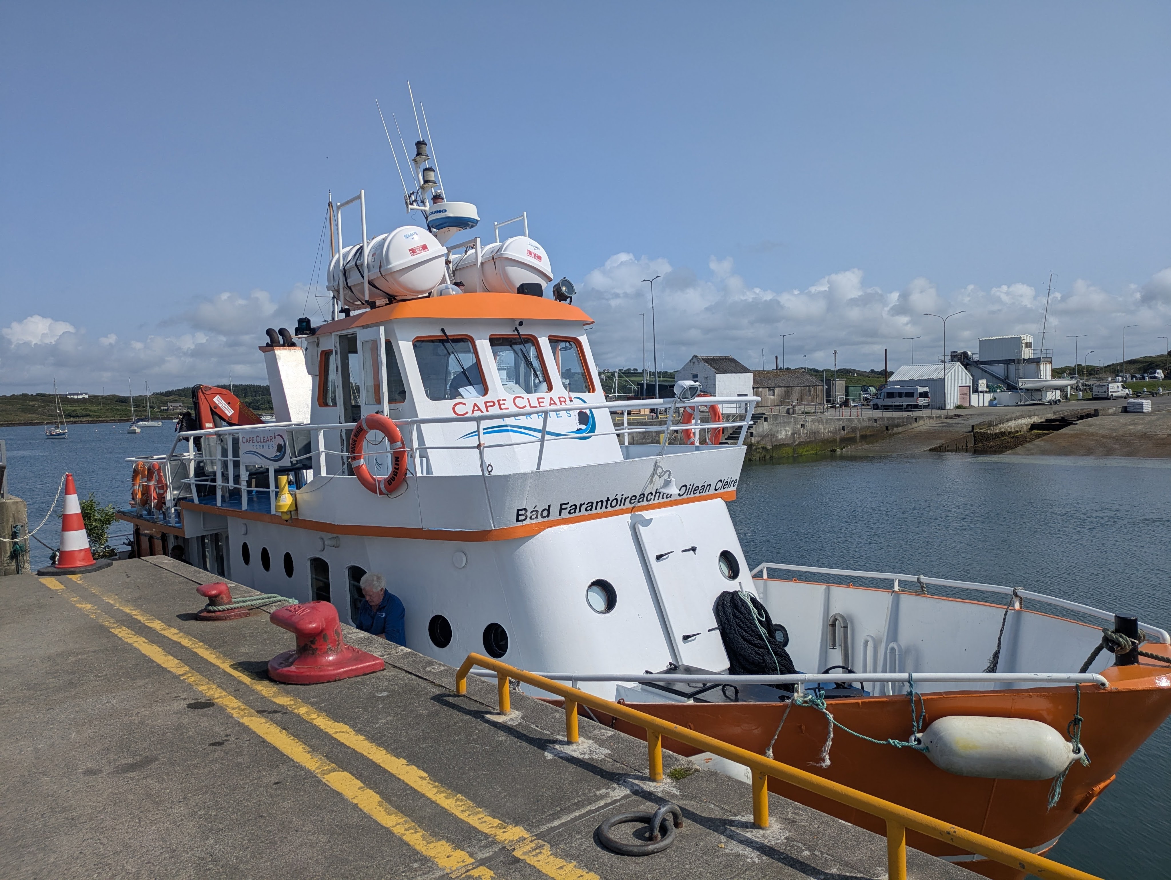
On our third morning, we awoke to blue skies, birdsong and sunshine. All the greys of the previous days had transformed to bright blues. The waters of Roaring Water Bay were tranquil and quiet as we travelled back to Baltimore to catch a ferry to Cape Clear Island. It isn’t possible to travel directly from Sherkin to Cape Clear.
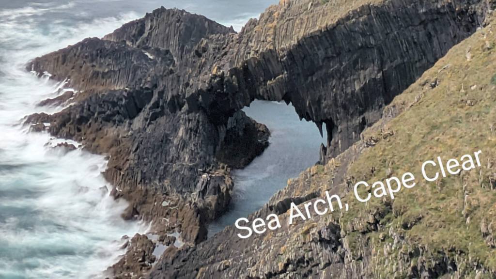
The Cape Clear boat was bigger, newer and shinier than the Sherkin ferry. The thirteen kilometer journey takes about 45 minutes, depending on weather and tide and costs €20 return. Cape Clear Island is slightly larger than Sherkin and although they are alike in many respects and have a similar population, they are also very different – more like cousins than sisters. Cape Clear, or Oileán Chléire is a Gaeltacht area with an Irish College which brings lots of young students during the summer months. It is mountainous with dramatic cliffs and walks that wind through hillsides of gorse and bracken, giving dramatic views of the rocky coastline and the seemingly unending and restless sea. We could see the white surf swirling around the iconic Fastnet Rock in the distance and would have liked to take a Fastnet Tour but there is a restricted schedule in operation in June and the times didn’t suit us. A little away from the harbour on Cape Clear stood a stone memorial, etched with eighteen names, the victims of the Fastnet Yacht Race in 1979 which ended in such tragic loss of life.
Cape Clear Ferry
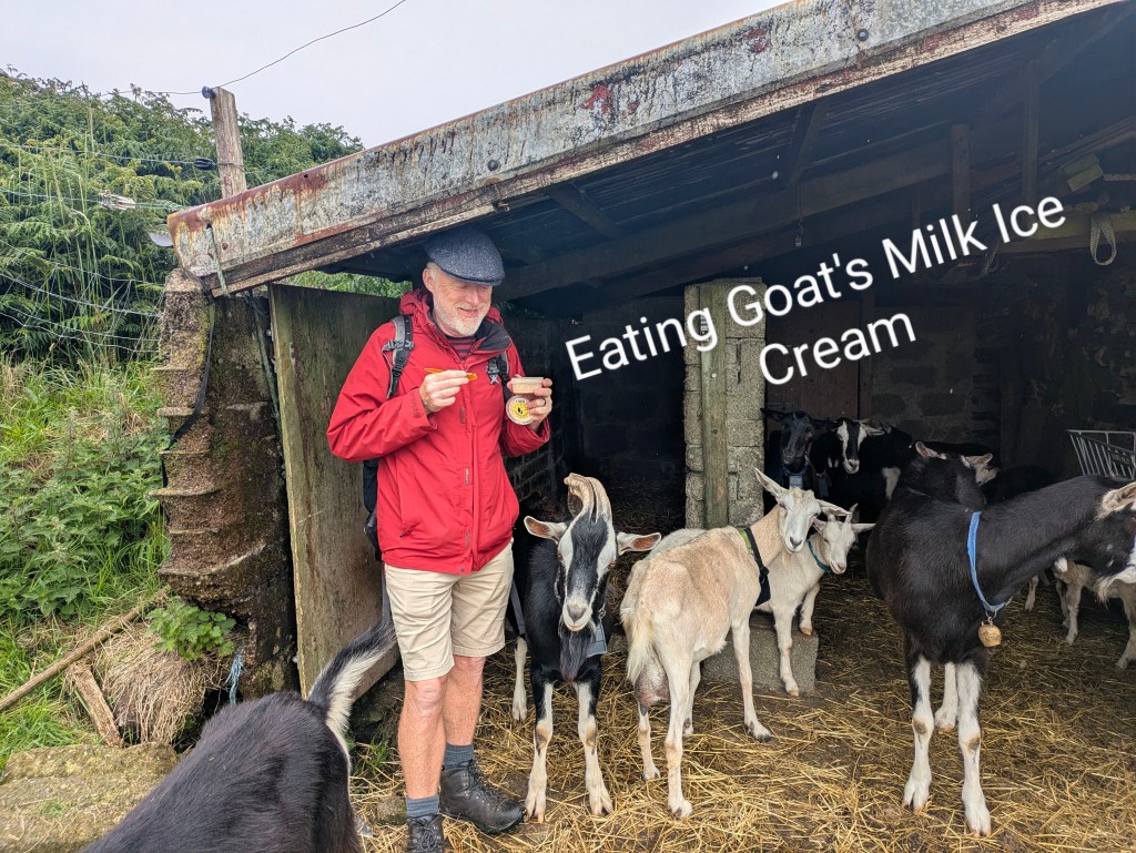
There’s more industry on Cape Clear with three pubs, a grocery shop, a gift shop and a gin factory. A goat farm on an almost vertical hillside sells ice cream and goat burgers while a herd of goats and kids scampered into an open sided shed when the sunshine disappeared and it started to rain.
Our visit to Cape Clear was short, only a day-trip so we didn’t experience any of the accommodation but there were signs for BnB’s, the pub advertised rooms and a hillside was dotted with yurts. We met a retired British couple who were spending their summers sailing around Europe and a weathered Scottish man from the Hebrides who was sailing a tiny boat. Apparently there is no charge for mooring craft on the island which naturally attracts sailors.
We have really enjoyed ‘our few days of getting away from it all’ and would love to return and do a Fastnet tour sometime. It really was a gorgeous experience, exploring both islands.
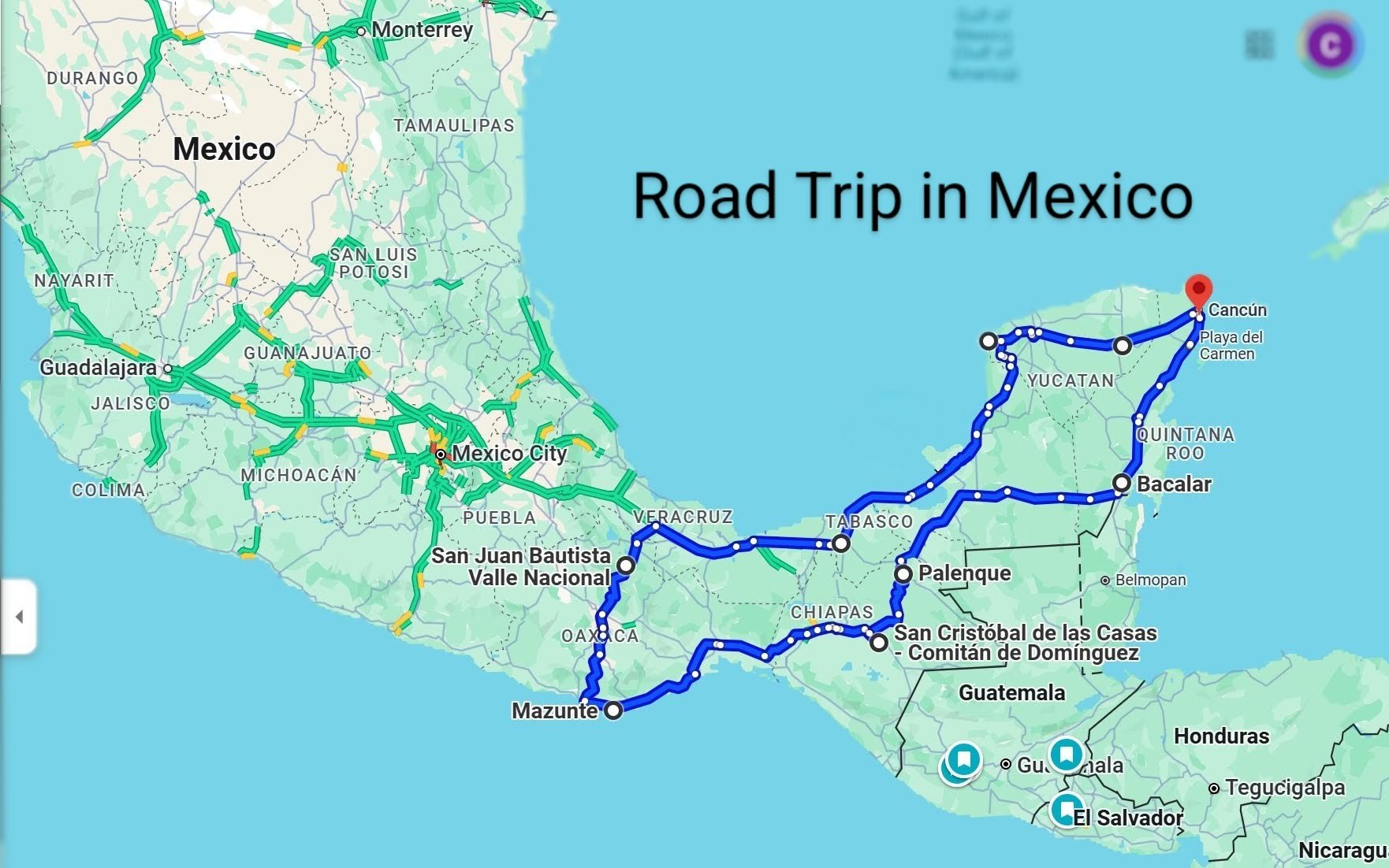
Mexico is beautiful, an enormous country (about 23 times the size of Ireland) with something to enchant every visitor – palm-fringed beaches, red-sand deserts, lush jungles, mountain ranges, coastlines along the turquoise Caribbean Sea, the blue Pacific Ocean and of course the Gulf of Mexico as well as a plethora of archaeological ruins, colourful colonial towns and world-renowned holiday resorts.
Despite all that, the question that we were asked most often about Mexico, and especially when we said that we were hiring a car and driving around was ‘Is it safe?’
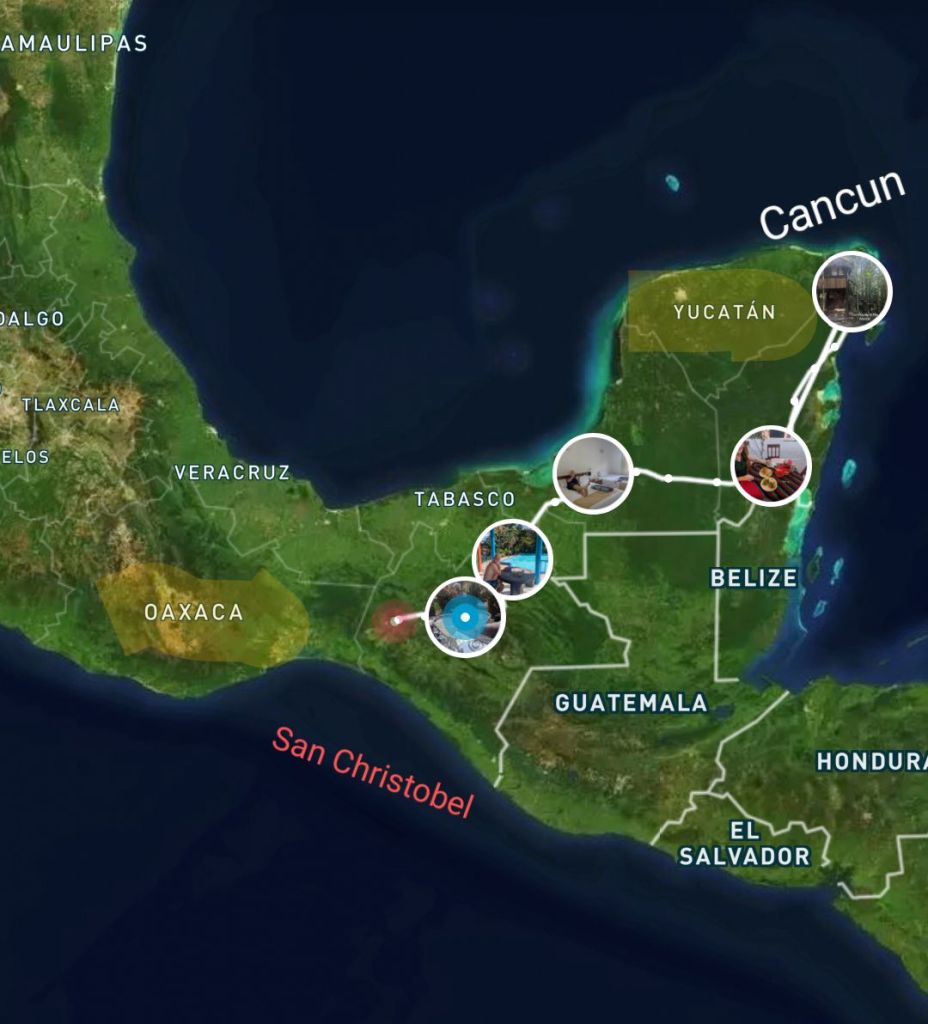
In our five weeks of meandering around the Southern part of Mexico in a big loop through the flat Yucatan Peninsula, mountainous Chiapas and Oaxaca and back along the Gulf Of Mexico to return to Cancun, we never felt unsafe. Along the way, we met three German woman in their seventies who were driving around and their only ‘trouble’ was a puncture when they hit a speed bump. We chatted to a Dutch retired couple, who were doing a similar loop to ourselves, who told us that one late afternoon, just before dark, their car broke down on a lonely road. They had run out of petrol but they didn’t realise that at first because the petrol gauge was faulty. Locals stopped to help them, figured out what was wrong and refused to take the money as payment for their help.
Mexico was such a riot of colour, sounds and smells that we came away with a dizzying kaleidoscope of images and memories. It’s difficult to whittle down our experiences to a few highlights but here is a selection of the highs…… and lows.
Colour in Oaxaca
Hiking in the Villages above the Clouds. This was our stand-out experience, partly because of the stunning, high-altitude scenery in the Sierra Norte with caves, canyons and forests of fragrant pine but also because of the friendliness and enterprising nature of the Zapotec, an indigenous people who live there. The villagers came together to form a successful eco-tourism company, Expediciones Sierra Norte, which specialises in guiding visitors along the trails that link these mountain villages. It was a true lesson on the power of community. The villages, although remote, were more prosperous than many others that we have seen in Mexico.
Above the Clouds, Sierra Norte, Oaxaca
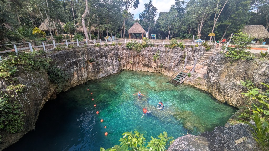
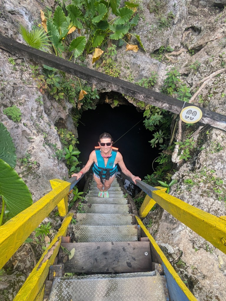
Swimming in Cenotes in the Yucatan. We had never heard of cenotes until we arrived in Mexico. They are natural pools formed by the dissolving of the limestone bedrock over time to form a series of caves and sinkholes. The ancient Maya regarded them not only as a source of water but as sacred portals to the underworld. There was certainly something otherworldly about Cenote 7 Bocas (The Seven Mouths) which was our first experience of a cenote. This cenote was a series of underground pools with seven different access points. We swam from cave to cave as the first five caves were connected by tunnels. The water was the most mesmerising shades of jade and turquoise, especially when the sunshine poured in from above, creating rippling shadows on the surface of the water, the roofs of the caves and the many stalagmites and stalactites. Magical.
Down into the Cenote
The Warmth of the Weather in February and the first week of March in Southern Mexico was glorious. We got one heavy thunderstorm that lasted about 30 minutes in our first week but apart from that it was wall-to-wall sunshine with daytime temperature of between 30 and 35C and nighttime temperature between 22C and 29C (cooler in the mountains). These are ‘wintertime’ temperatures in Mexico which can begin to climb in April to 40C or more. The rain during the summer months usually increases the humidity making it feel hot, sticky and uncomfortable. Flying to Mexico via Toronto, we went from cool drizzle at home to a snowy, freezing Toronto onto ‘shorts and T-shirts’ Mexico with blindingly blue skies, lush jungle and the warm turquoise waters of the Caribbean.
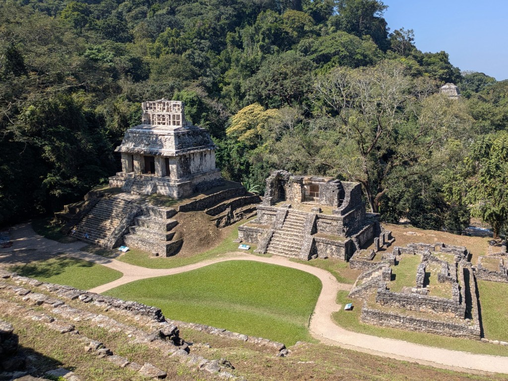
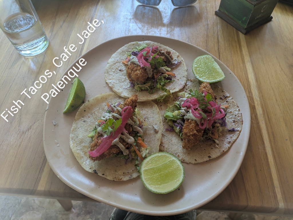
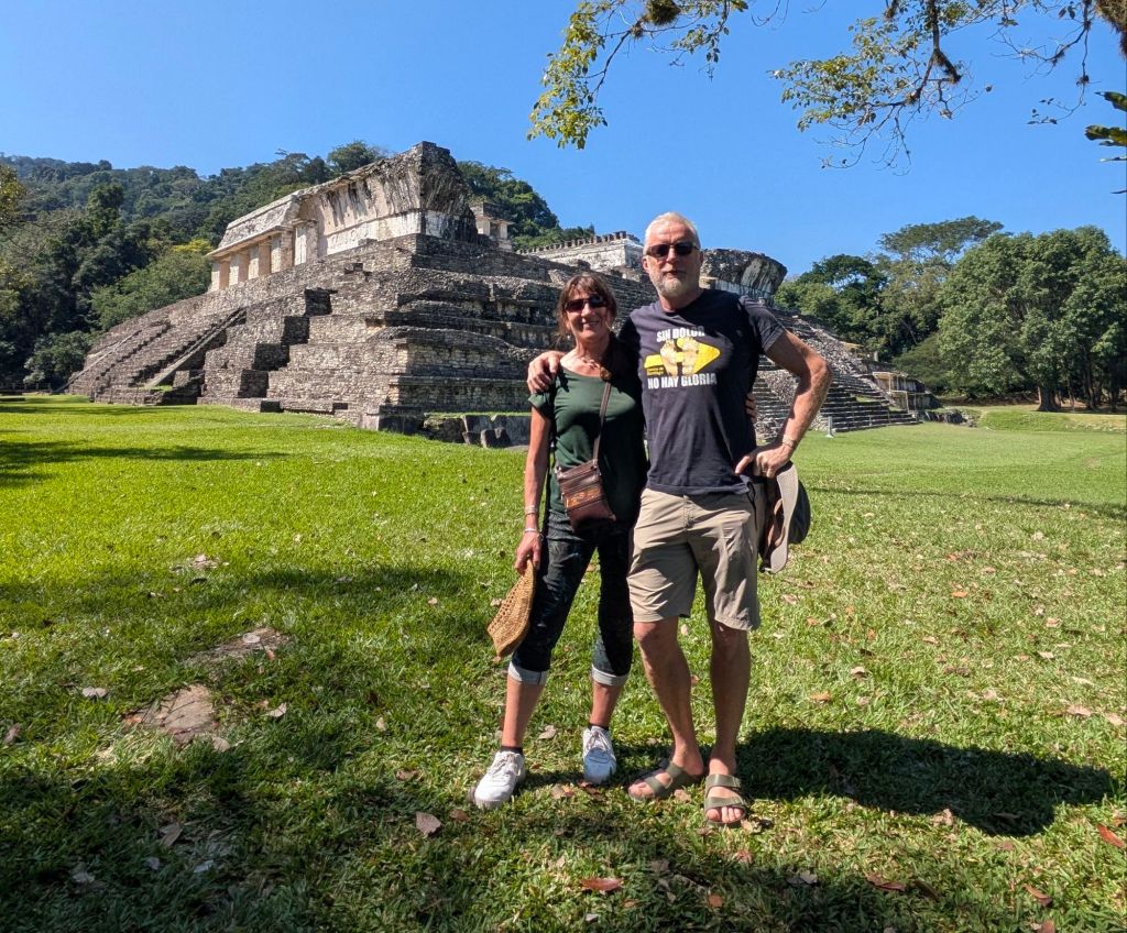
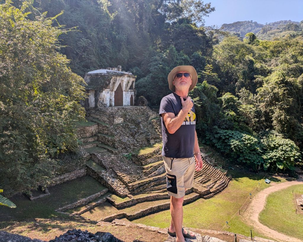
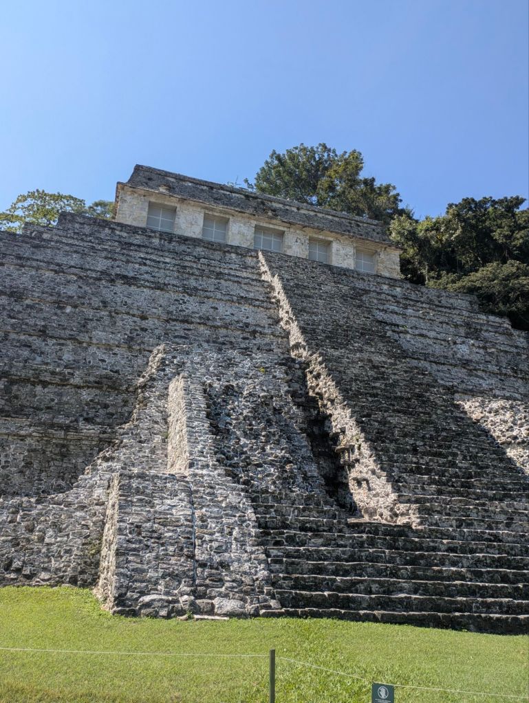
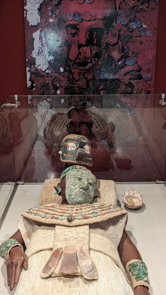
Palenque. In a country where all roads lead to ruin, at least to archaeological ruins, Palenque was our favourite. We walked around the Mayan site in sunshine listening to the howler monkeys (living up to their name in the surrounding jungle), and tried to imagine the building complexes as they would have been fifteen hundred years ago when they were painted a blood-red colour with elaborate red and blue stucco details.
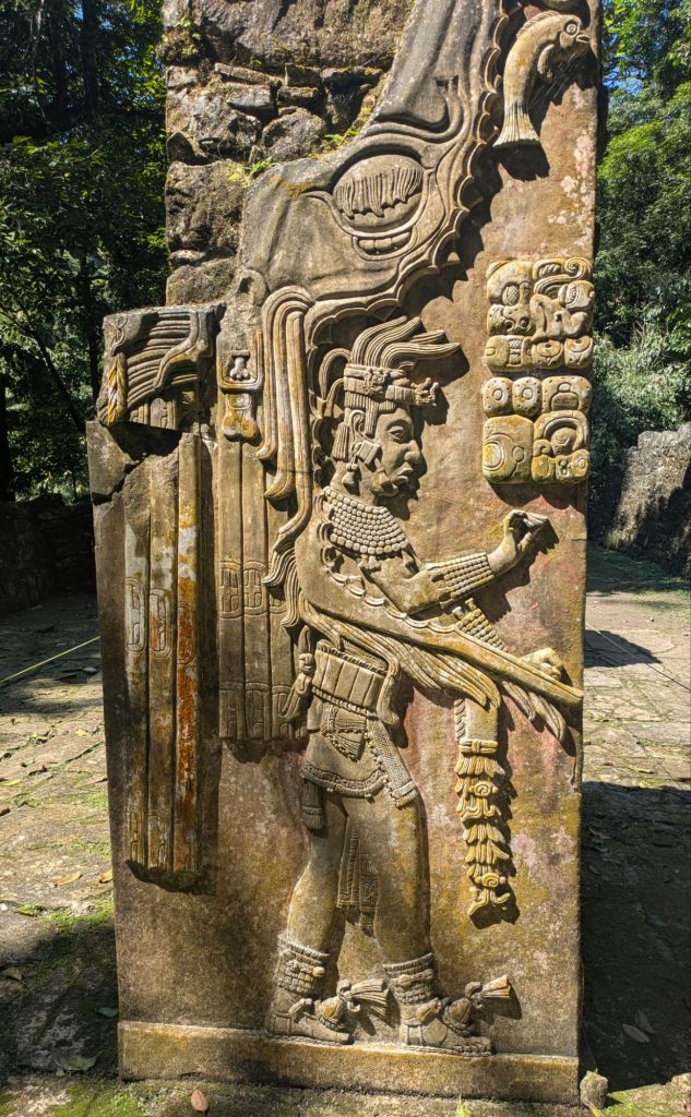
In the excellent museum, we saw a replica of the sarcophagus of the Red Queen which was only discovered in 1994. The Red Queen got her name because of the bright red dust made of cinnabar (a red mineral made of mercury and sulphur) that covered her skeleton when she was discovered. She was also buried with two servants and copious amounts of jade and pearls.
Despite all the grandeur, the site was abandoned, possibly due to deforestation and feuds with neighbouring tribes, and soon swallowed by the jungle and concealed for centuries.
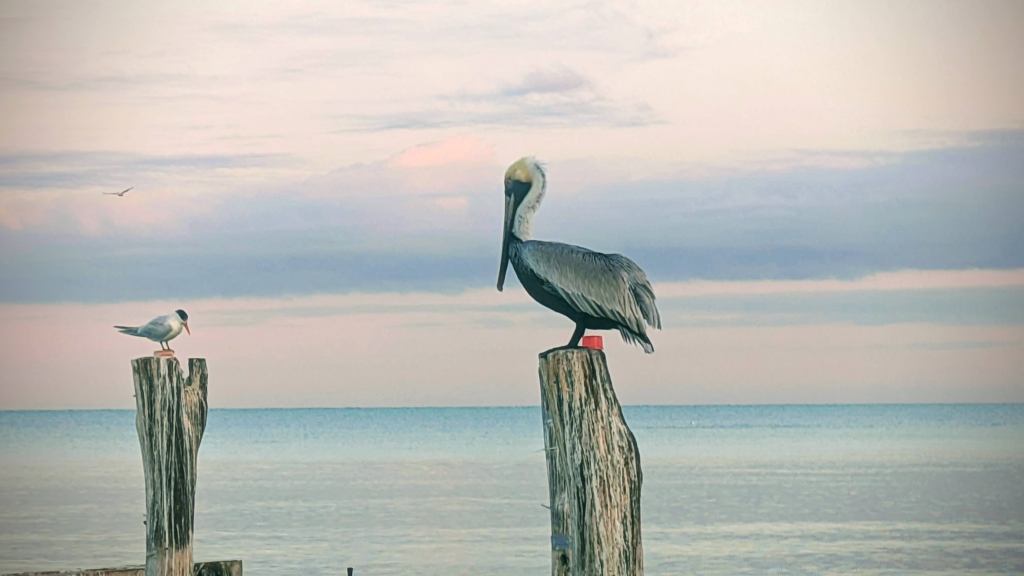
The Birds along the Gulf of Mexico. Driving along by the Gulf, we were accompanied by flocks of pelicans, ducking and diving or sometimes just sitting on the timber poles of jetties, their wings folded and their eyes never still or flying in formation at dusk.
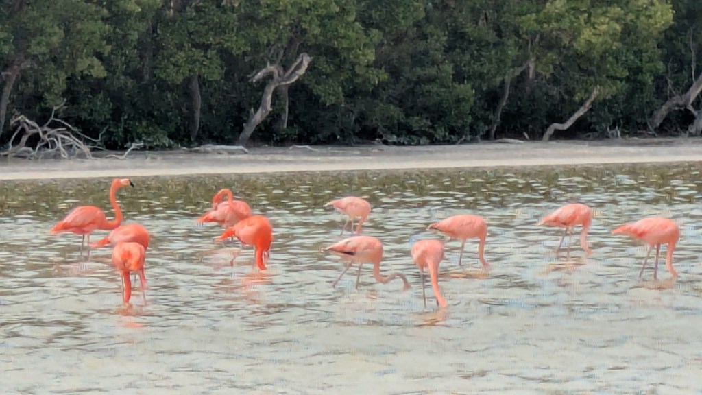
Celestun was mainly a sleepy, sunbaked fishing village, sandwiched between a large lagoon and the turquoise waters of the Gulf of Mexico but it had one great attraction. The combination of salt water from the Gulf and fresh water from the estuary made it a perfect habitat for flamingos and waterfowl. The flamingos were beautiful blobs of colour, wadding and feeding in the shallow waters. The birds get pinker with age as their plumage turned a bright rose-orange colour from their diet of shrimp, tiny crustaceans and seeds. Their only predators were the alligators which were plentiful, snoozing at the water’s edge near the mangroves and doing a great imitation of fallen logs.
The Food especially the Tacos. Mexico’s cuisine is as vibrant as its scenery, with bold and spicy flavours, the use of fresh ingredients such as avocado, tomatoes, chillies and corn. There was liberal garnishes of coriander (cilantro) and wedges of lime came with everything. We loved the tacos which were cheap , plentiful and widely available and the black bean pastes which were usually accompanied by a crumbly white cheese. In Oaxaca, baskets of roasted grasshoppers were for sale on every street corner, a source of protein since the time of the Aztecs.
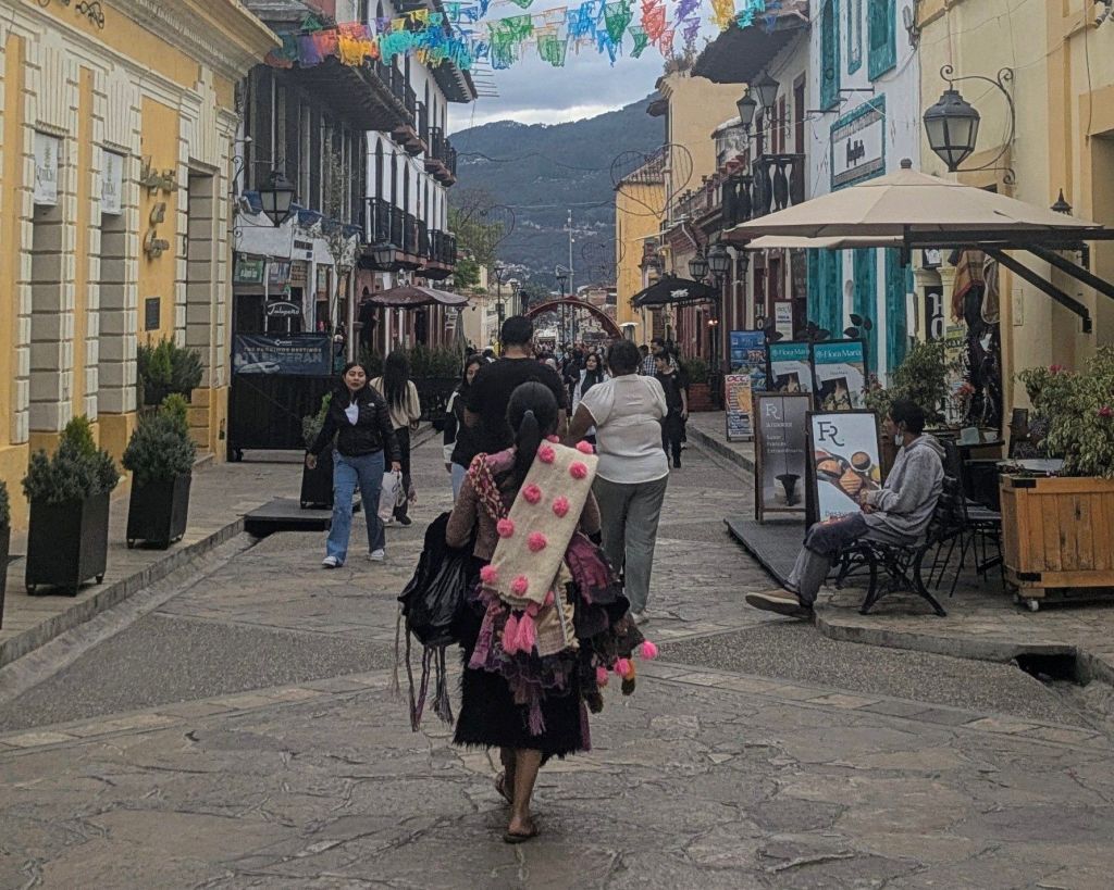
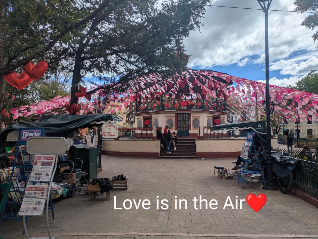
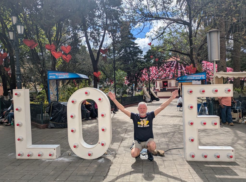
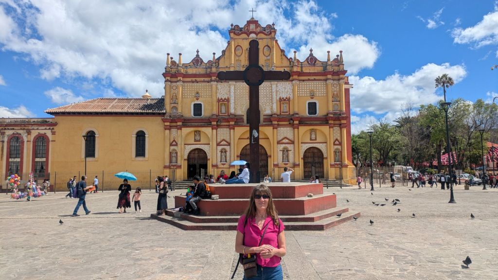
San Christobel de Las Casas (San Chris) The drive from Palenque was only about five and a half hours but there were worrying reports online about the safety of the roads leading to the town. The main risk was road closures because the Zapatistas, an indigenous political activist group in the state of Chiapas, sometimes blocked roads to highlight their grievances to the government. Locals reassured us that the journey was quite safe as long as we drove during daylight hours and we gave ourselves plenty of time. It was a beautiful drive with stupendous vistas of mountains, houses dotted in the valleys and pretty villages. Soon we were smelling the pine from the towering forests surrounding San Chris, which sits at an altitude of 2200 metres in the Los Altos region of Chiapas. It was a colonial town of cobbled streets, fresh mountain air, church bells and good restaurants….and it was also festooned with hearts and ribbons for Valentine’s Day. We arrived, entirely by accident, in the most romantic town in the whole of Mexico
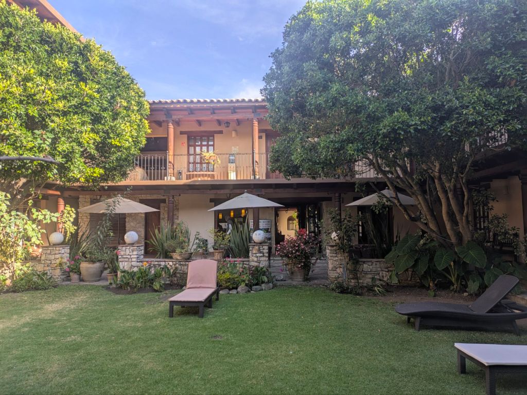
Celebration Margaritas. Mexico is also the salty taste of a margarita cocktail. We drank quite a few but the best was in La Estancia, a hotel in San Chris which had a relaxed elegance and was easily the best ‘value for money’ accommodation on our entire trip. We had to celebrate Valentine’s Day with a margarita toast in one of the hotel’s enclosed courtyards, full of flowering plants and fountains.
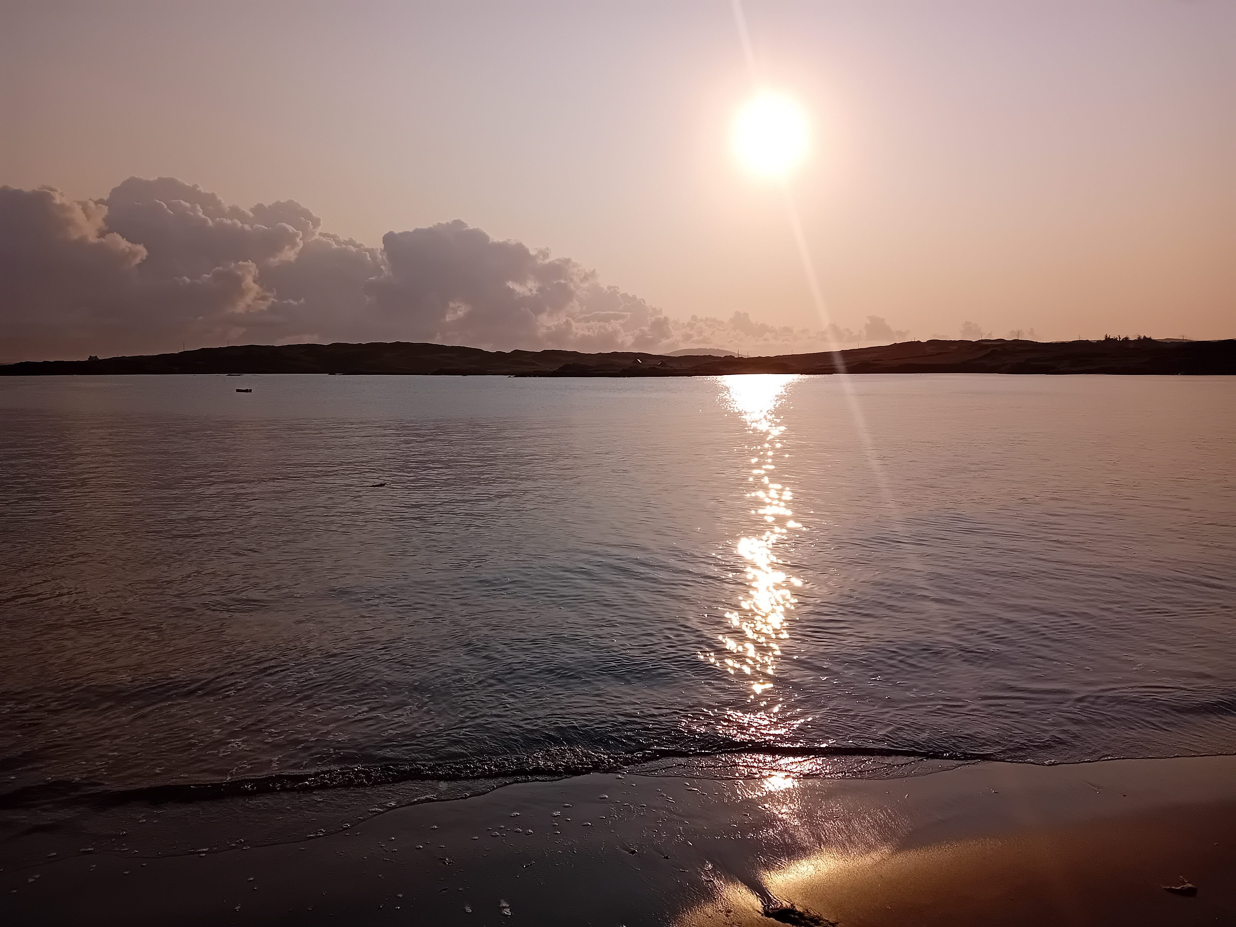
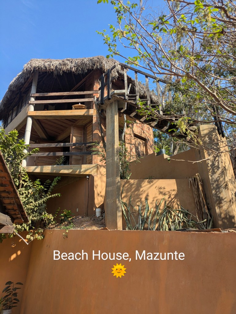
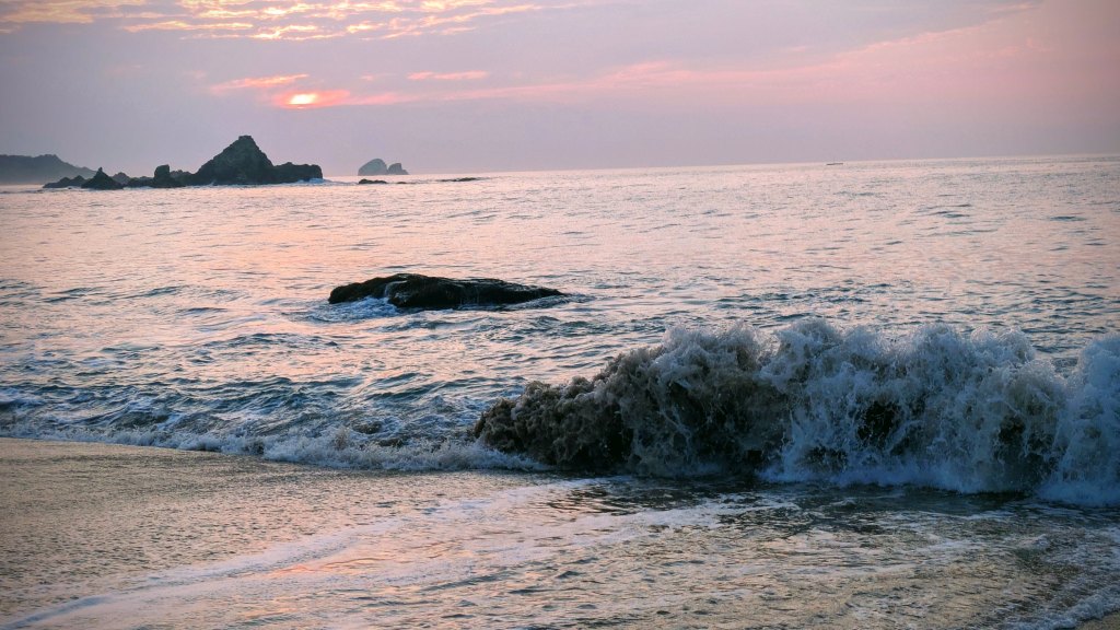
Sunrise Swims in Mazunte. Mazunte was a small seaside town on the Pacific Coast between two beaches, an east facing one for sunrise and the other with spectacular sunsets. Small hotels, bungalows and thatched cabanas stretched up into the hills, half-hidden among the coconut trees and the flowering shrubs.. We stayed in a very unusual place, an architecturally designed cabana, angled to catch the breeze and stay cool without air-con. It had a series of sliding shutters but was open on all sides so we could hear the squirrels scampering in the trees outside and the sound on the waves breaking on the beach down the road. Usually people ambled around in a heat haze but early morning was the special time when the beach was empty except for a few stray dogs, the air was warm, the water turned rose-gold and whales swam past on the horizon.
Fiesta Time. Although our time in Mexico didn’t coincide with any major festival, there always seemed to be a celebration going on somewhere, usually with drumming bands, car horns blaring, sequined dancers, clapping and shouting. During the parades, many of the people squashed into the back of jeeps, threw sweets, lollipops and fluorescent crisps to the clapping crowds. Mexicans loved to party and the noisier the better.
And for a few lows……
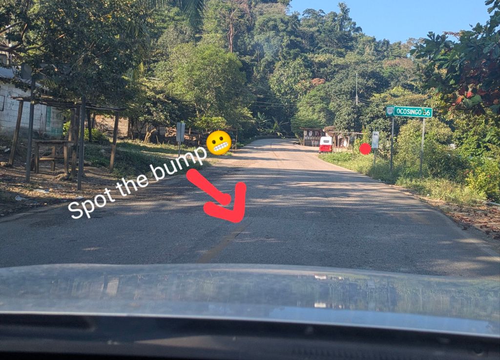
The Roads. Although many roads in the southern part of Mexico were quite good and there was a phenomenal number of roadworks in progress, there were also pot-holes big enough to swallow a car. The biggest danger was the huge number of speed bumps on a lot of roads. Dappled sunlight and shadows made them almost impossible to see during the day and we were airborne a few times. Between the potholes and the speed bumps, driving at night in Mexico is not recommended. In some areas, there can be also at risk of robbery after dark although we did not meet anyone who had been robbed or harmed in any way.
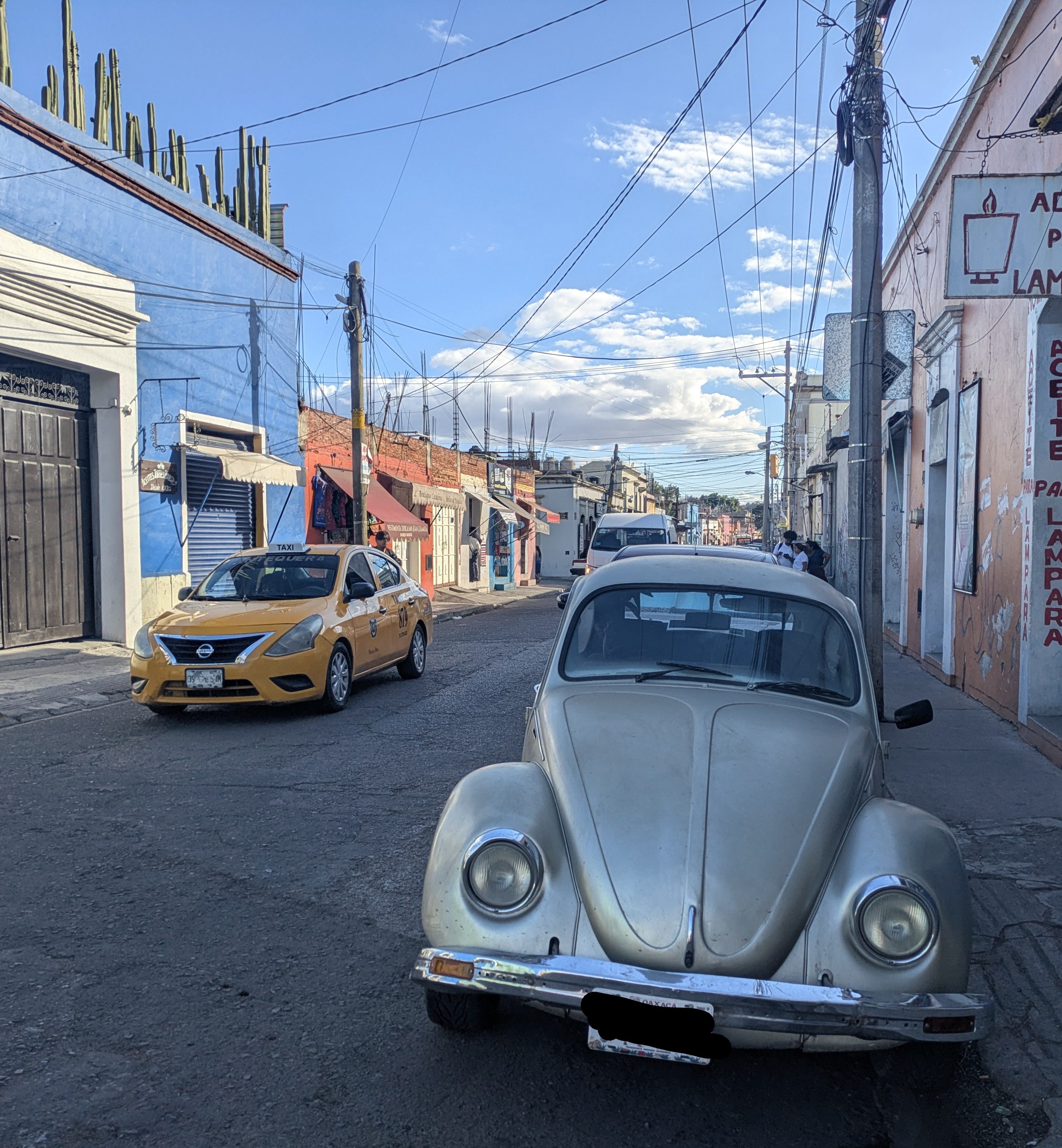
Although there were lots of different cars in Mexico, Volkswagens Beetles were a common sight……the genuinely old ones in all colours and states of repair.
The Snake. Caoimhin had a close encounter with a snake while we were walking in the Sierra Norte. He actually stepped on the snake and I’m not sure which of them got the biggest fright. The snake jumped into the air and disappeared in the scrub, while Caoimhin yelped and also leapt in the air.
The Obesity Problem
It was obvious that Mexico has a severe obesity problem. Ireland has the same issue but it was much worse in Mexico, based on empirical evidence. I don’t know the statistics nor the cause but some parts of Mexico have the distinction of drinking more Cola than anywhere else in the world. It has become so much part of the culture that many life events are celebrated by toasting with Coke Cola and in some of the indigenous ceremonies, it has replaced the original ‘moonshine’ drinks.
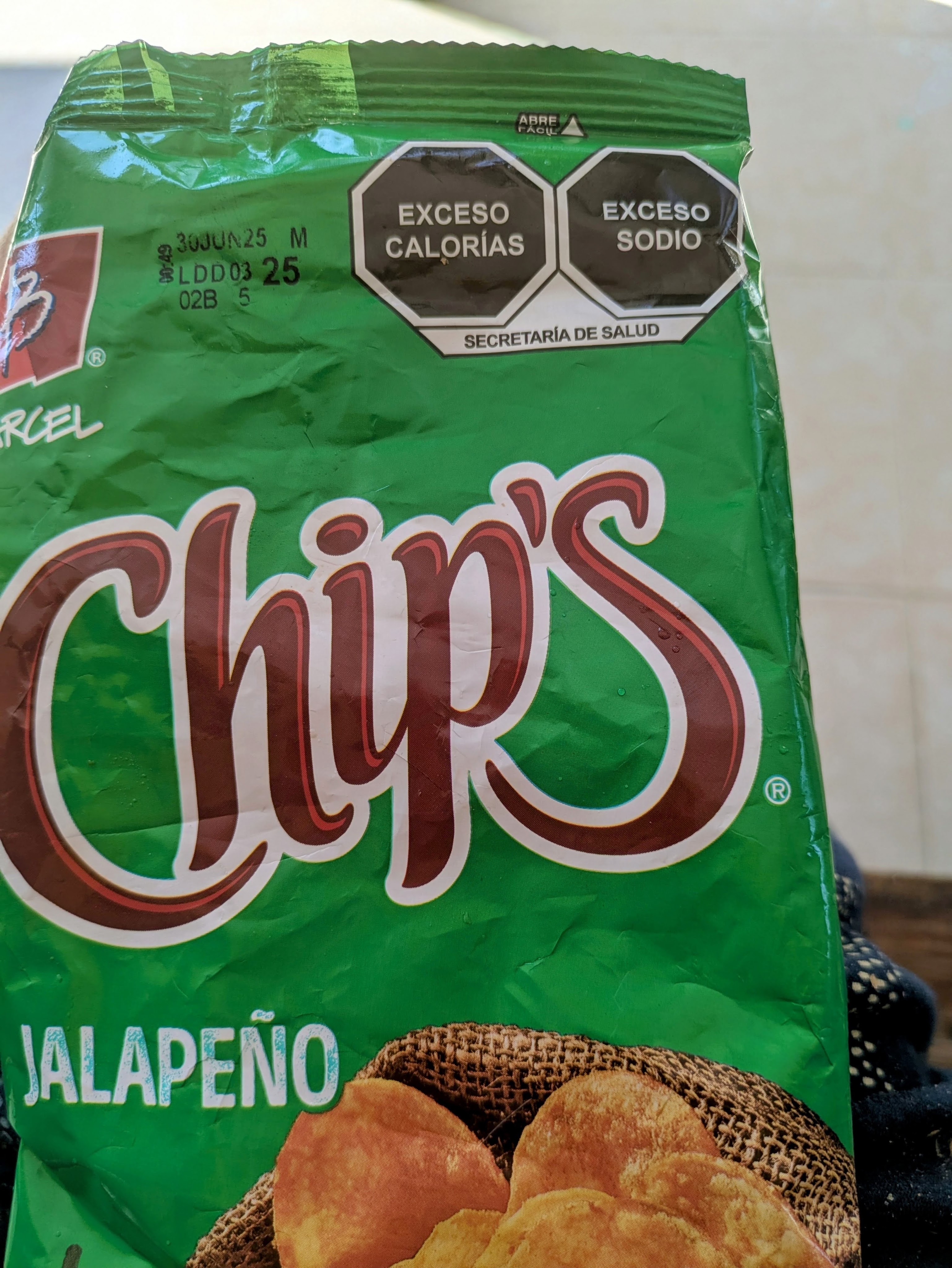
There is an attempt to tackle the problem with food labelling, with crisps and sweets carrying nutritional warnings on the front of the packets.
Mexico pulled us in as soon as we arrived with its vibrant intensity, a place with a zest for life and a celebration of death, a place where even the cemeteries are brightly painted and often decorated with flashing fairy lights.
The first rain came in a violent downpour just after Ireland had beaten Scotland in the rugby match which we watched on the laptop in our little apartment in Bacalar, a little town just shy of the Belize border. It was still midmorning as Mexico is five hours behind Ireland. The morning had been warm, about 28odegrees, but cloudier than usual so we weren’t too surprised when the heavens opened. The rain didn’t last long but increased the humidity.
We love the temperatures here in the Southern Yucatan. Although it can get a little uncomfortable in the afternoon especially if the sun is out, the evenings are gorgeous, long, balmy and perfect for eating outside. Most of the Mexicans especially in the ‘local’ area away from the lake where we were staying, had hammocks, plastic tables and chairs outside their houses, where they socialised in the evenings, usually with a few beers and some music….loud vibrant tunes.
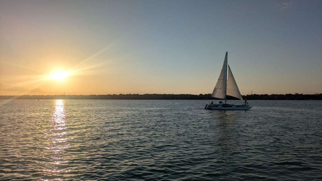
Bacalar Lake is known as the Lagoon of Seven Colours (La Laguna de Los Siete Colores). It’s almost mandatory to take a boat trip out on the lake to fully appreciate it. We chose the sunset tour which was 3 hours on the lake visiting the pirates path, the island of the birds, and cenotes (underwater sinkholes that dramatically changed the colour of the water depending on the depth.) The sun slipped down behind the town, turning the lake-water golden. On the tour, we met three German women in their early seventies who were driving around Mexico for a couple of weeks and having a ball. The only problem they had encountered was a puncture which they acquired when they hit one of those invisible speed bumps. They spent their time on the boat, giggling and trying to get the perfect photos of each other, almost like far younger Instagram influencers.
Although our apartment was in the non-touristy ‘local’ area and a twenty minute walk away from the lake, it included free access to the Bacalar Tropic Beach Club which was one of a series of lakefront hotels and houses on the southern end of town. There was no ‘beach’ but there was a grassy area in front of the hotel with loungers, hammocks, swings and a multicoloured boardwalk – a great place to enjoy the lake.
Lounging by Lake Bacalar
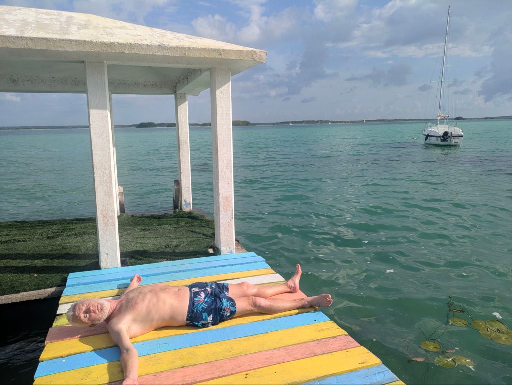
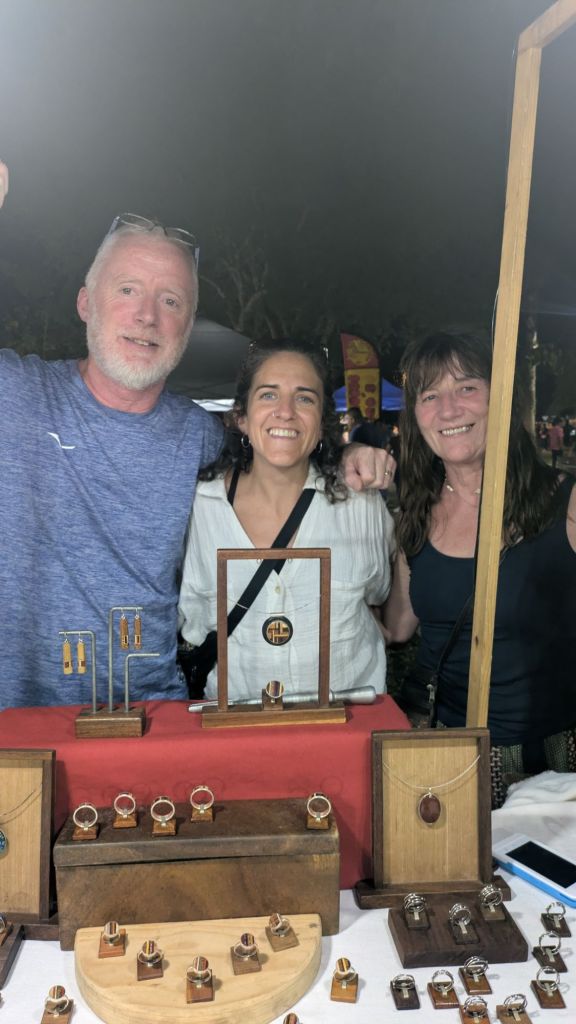
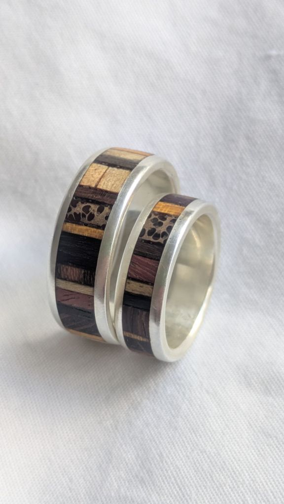
Both of us lost our wedding rings years ago, Caoimhin’s in a swimming pool in Peru and mine in the sea in Tramore. We kept meaning to replace them but never got around to it. Wandering around the night market in Bacalar, we spotted rings that appealed to both of us, bands of various woods encased in silver. Although they weren’t typical wedding rings and we bought them from a market stall, Caoimhin says that he feels ‘really’ married again after more than thirty years of married life!!!. Our jeweller who was from Uruguay, but living in Mexico, recommended that we go to Palenque in Chiapas State for the scenery and the archaeological ruins. Our trip seemed to be evolving, based on recommendations from people along the way.
Buying Rings
So we travelled across the Yucatan Province almost from coast to coast passing numerous roadworks and not much else. Again the road was long, straight in almost completely flat terrain. It was strange to see so many cherry blossom trees in flower especially as it is so much hotter than home. We stopped for an ice-cream at a garage shop but it melted almost before we could eat it.
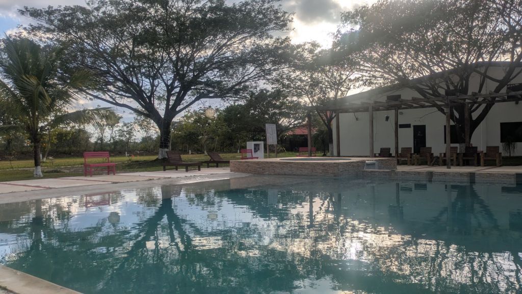
Hotel Real Primavera Campeste was relatively expensive (€49 for the night) for a hotel that was really in the middle of nowhere but we needed somewhere to break the journey to Palenque. The hotel avenue was long and lined with trees, the gardens were landscaped and the rooms were spotlessly clean. It was a place that could accommodate a crowd but the only other residents were three men driving from Monterey in California to their home to Belize. They were also breaking their journey at the hotel. Apart from us, a flock of long-tailed Grackles made good use of the pool, dipping and diving at dusk
.
Swimming Pool, Hotel Real Primavera
The countryside was still really flat the following morning until we reached Palenque, with its backdrop of mountains and its hilly streets. This time we booked into a hostel, which had a large pool, an outdoor kitchen and a ramshackle garden. Although everything was a little shabby, Alex, the proprietor and his father were friendly and welcomed us to Villas del Carmen Hostal. It was also pretty cheap at €22 a night for an ensuite room. Security seemed to be an issue in the area. We were a bit perplexed when the shop across the road, one of the Six convenience stores that were so common in Mexico, only served customers through shutters passing out the goods through vertical bars. We walked into town at dusk but the lighting was so bad and the pavements so cracked that we got a taxi back to prevent us from falling down a hole by the side of the road.
The Palenque Ruins opened at 8am and we were in the queue shortly afterwards. We paid a fee for the ruins and another to enter the National Park where the ruins were located. English speaking guides were available, most vying for our attention, especially as the number of visitors was quite low. The prices were fluid and bargaining was expected. We settled on Tito, a young Mayan who had good English and a nice manner teamed up with a French mother and son duo who were also looking for an English speaking tour.
This was our first Mayan site in Mexico and it was really impressive, with several clusters of enormous buildings, most of them with almost vertical stairways. The complex was surrounded by cedar, mahogany and sapodilla trees which provided shade for visitors, the locals selling crafts and the many birds. In the jungle beyond, howler monkeys were living up to their names and creating a racket. The site was all the more impressive because all the structures were built about one thousand, five hundred years ago with human sweat alone and without the use of the wheel or with machinery at all. The settlement flourished in the seventh century under the rule of Pakal, who lived until he was eighty years old which was a phenomenal age at the time. We walked around in sunshine listening to the monkeys, and tried to imagine the buildings as they would have been in Pakal’s time when they were painted a blood-red colour with elaborate red and blue stucco details. Magic mushrooms were reserved for the noble classes and we’re used in many Maya ceremonies as a means of communing with the gods and ‘waking up the mind.’ Mayan idea of beauty was totally different to ours, they favoured an elongated head and cross-eyes.
In the excellent museum, we saw a replica of the sarcophagus of the Red Queen which was only discovered in 1994 in a temple beside the large Temple of the Inscriptions where Pakal was laid to rest. The Red Queen is believed to be Pakal’s wife and she got her name because of the bright red dust made of cinnabar (a red mineral made of mercury and sulphur) that covered her skeleton when she was discovered. She was also buried with two servants and copious amounts of jade and pearls.
The Red Queen
Despite all the grandeur, the site was abandoned, possibly due to deforestation and feuds with neighbouring tribes, and soon swallowed by the jungle and concealed for centuries. It is entirely probable that many more buildings are still hidden under the rampant growth. In some places away from the main clusters, fallen walls were covered in moss, just like any abandoned cottage in Ireland.
Our next stop was problematic. We wanted to visit Saint Christobel de las Casas, a beautiful colonial town in the mountains about a five and a half hour drive from Palenque but there were worrying reports about the safety of the roads leading to the town especially the Ruta 199 from Palenque. At the ruins, we met a young German couple who travelled in the opposite direction the day before without any hold-ups. Locals also said that the journey was quite safe as long as we drove during daylight hours and we gave ourselves plenty of time. The main risk was road closures. the Zapatistas, an indigenous political activist group in the state of Chiapas sometimes blocked roads to highlight their grievances to the government.
It was a beautiful, sunny morning as we packed up in Palenque and headed for the hills, feeling a little apprehensive. The distance between the towns of Palenque and San Christobell was only 210kms but Goggle Maps was giving us an estimated time of five hours and twenty minutes. At first traffic was heavy and soon we were climbing along winding steeps roads with curving bends in a convoy of trucks, minibuses and motorbikes. There were small herds of cattle grazing in the fields, maize growing everywhere, at the sides of the road and crawling up the vertical mountain sides. Children walked to school and women sat at roadside stalls, selling drums of diesel and petrol as there seemed to be no gas stations. It all seemed very normal, a beautiful drive with stupendous vistas of mountains, houses dotted in the valleys and pretty villages. Soon we relaxed although it was impossible to relax completely…but not because of bandits or protesters.
The biggest danger was the huge number of speed bumps on the roads. The dappled sunlight through the trees cast shadows on the road making it almost impossible to see them and there were very frequent and sometimes on blind bends. It was easier when we were travelling behind a vehicle as we had some warning as they braked.
Beware of the hidden Speed BumpsHard working Women on the Road
Soon there was the smell of pine in the air from the towering forests as we approached San Christobel de las Casas. The town sits in a valley in the highlands of Chiapas in the Los Altos region at an altitude of 2200 metres. It was sunny but there was a tinge of coolness in the breeze even in the mid-afternoon which soon had us reaching for our jackets which we haven’t needed since we arrived in Mexico.
San Christobel was entirely different to any other Mexican town we have visited so far with its cobbled streets, pastel coloured houses and refreshing mountain air. There were churches on every corner, a baroque cathedral that was damaged by flood and earthquake, (the most recent earthquake was in 2017). Several long pedestrianised street were full of cafes, restaurants and high-end shops with hardly a broken pavement or litter anywhere.
Chiapas is one of the poorest state in Mexico with the highest concentration of indigenous people, about 40 % of the population being indigenous. Despite their high numbers, they feel marginalized The protests were about inequalities, discriminations, land rights and destruction of the environment . Like most disputes, it was complicated. For example, Coca Cola have a large factory on the outskirts of town but some believe that the production is detrimental to the environment and uses so much water that it changes the natural landscape. But the state of Chiapas drinks more coke than anywhere else on the planet. It is even incorporated into many of the ceremonies and rituals of the indigenous people, taking the place of the local moonshine, a drink called pox (pronounced ‘push’ which means ‘medicine’ in the local language.)
There was no sign of unrest or political activism on Valentine’s day. Love was in the air in the Central Plaza which was festooned with ribbons and hearts to celebrate the day.
We booked into La Estancia, a hotel in a central location. It didn’t look much from the outside, a green door in a low single story building but inside, it opened up into a series of courtyards full of plants, shady sitting areas and lots of rooms with balconies overlooking the courtyards. We were delighted with the luxury, 5 star accommodation at 2 star prices (€40 a night). They also had an offer of 2 cocktails for 140 pesos (about€7) which was something we availed of seeing as it was Valentines Day and we were now wearing matching wedding rings. There are tourists here but many are scared away by the simmering political tensions which probably explains the low prices.
Our Hotel, San Cristobal de Las Casas
Our next step will be to the neighbouring region of Oaxaca with beaches, another colonial city and trekking between villages in the mountains, But that’s for tomorrow. In the meantime we are enjoying luxury in the romantic city of San Christobel de las Casas, or San Chris as it’s known locally.
Till next time, thanks for reading.
Our Journey so farSan ChrisCathedral , San Christobel de Las Casas
Leaving Bogota, we headed for the hills – literally.
Bogota is a huge city, the Uber taking us from the historic district of Candelaria drove nineteen kilometres in relatively heavy traffic to the bus station, Terminal del Norte. The bus to the little town of Ville de Leyva was surprisingly comfortable with assigned seats, plenty of legroom, air-con and phone charging points. Time is elastic here in Colombia – the bus journey was supposed to take a very precise two hours and twenty two minutes, but it was well over three hours before we reached our destination.
Strong sunshine and mountain air greeted us in Ville de Leyne, reputed to be the oldest colonial town in the country with low whitewashed buildings decorated with wooden balconies against a backdrop of brown hills. Its claim to fame is a really enormous, cobbled plaza. The local native Indian communities used to gather there in the plaza to gaze at the heavens, a natural astronomical observatory since pre-Columban times.
Central Plaza, Ville de Leyva
We took a journey back further in time when we visited the Palaeontology Museum because Ville de Leyva also has a rich pre-human heritage. The museum recreated a very different world where giant dinosaurs roamed the land, extraordinary sea-going reptiles dominated the sea and the whole area was submerged in a shallow sea. Fossils dating back more than a hundred million years adorned the walls of many houses in the town.
After the damp coolness of Bogota we were sweating in the afternoon heat (about 24C) but many of the locals were dressed in cowboy hats, blue jeans and padded jackets. In the evening, colourful handcrafted ponchos were the clothing of choice…we weren’t temped to buy any as they wouldn’t fit into our small backpacks😁. We stayed in a family-run hostel (Hostel El Pina), great value at less than €10 a night for a room with our own wooden balcony and private bathroom.
In the coolness of the morning, we wandered around dusty roads with fields of goats, sheep, cattle and horses and also large polytunnels growing vegetables for this is agricultural country. We saw the Blue Pools(Pozos Azules)in the distance, blue because of the mineral content of copper and selenium and although not as blue as on Instagram, they were quite striking against the brown-green mountainy landscape. We clambered over barbed wire to get a closer look and after a while, we were accosted by a dodgy man looking for entrance money, Caoimhin requested he show us proof of ID which he didn’t have. A woman in the tourist office had told us that it was free to view the pools – no swimming allowed – but we had jumped over two lots of barbed wire. We turned and ran, back the way we had come, looking over our shoulders to see that he wasn’t following us.
Many of the Bus Terminals in Colombia are large modern buildings that feel like airports with rows of ticket desks, digital displays, cafes and numbered departure gates. There are many different companies with fleets of buses servicing different areas but it can be confusing to know which desk to buy the ticket for your particular destination. Some Spanish is essential as virtually no-one speaks or understands English. It is SO easy to mispronounce the place names so even though people want to help, nobody knows where you even want to go 😲so make sure you write down the placename.
The Camino Real de Santander was on our radar before we left home. This camino is a network of stone paths, originally built by the indigenous people of the area, the Guane, to link rural villages. Winding through six remote towns & villages, across relatively untouched landscape past cactus groves, tobacco plantations and majestic mountains, it sounded just ‘our cup of tea’, a hike without the need for a guide.
We first made our way north to San Gil, known as the adventure capital of Colombia because of its extreme sports, many based around the rivers that flow both through and around the town. Walking from the bus terminal outside the town to our accommodation (Real Dreams Hostal) felt like an extreme adventure in itself. Trucks roared by in clouds of dust, buses passed within inches of us, the smell of diesel and engine oil from the garages lining the road was nauseating. In town, the footpaths were high, narrow and crowded and although there were some pedestrian crossings, cars and motorbikes didn’t stop at them. The river, Rio Fonce, with steep sides looked dirty with rubbish and very uninviting.
We left the next morning for Barichara, one of the towns on the Camino Real, and often called a filmmaker’s dream with its cobbled sloping streets, whitewashed houses with distinctive burnt orange tiles and tree and flower-filled plaza. It was declared a national monument in 1976 and we instantly loved the bustling but atmospheric feel of the place with the scent of bougainvillea wafting around.
Barichara
Creeping out of our hotel in Barichara at 6am to start our hike, we were bleary eyed and cranky after a restless night due in part to the monumental snoring of someone who wasn’t even in a room near us….he/she was across the courtyard and on a different floor. I come from a family of snorers, but this was snoring on an epic level, sounding like a mixture of cats wailing , buildings collapsing and waves crashing. We would have felt sorry for him except we were fighting the urge to throttle him. And we had splashed out on a relatively pricey hotel (Hotel Casablanca at €27 for the night including breakfast which we didn’t eat as we left so early.)
Village of Guane
The first stage of our hike on the Camino Real from Barichara to the village of Guane, was gorgeous in soft light and birdsong, walking on a cobbled path, lined with low stone walls and with cattle grazing among the scrub, a gentle up and down walk of about 6 kms. Guane was another picture-postcard place with a central square, lots of trees, benches and sculptures and dominated by the Catholic church. After a breakfast of crispy fried eggs, sweet bread and strong black coffee, potent enough to produce palpitations, we hiked up a steep hill to begin our next leg to the town of Villenueva, past small houses with barking dogs of all shapes and sizes, who announced our presence. At the Mirador de la Virgen there were hazy views over the surrounding countryside but also a welcome breeze. Continuing uphill on dusty roads, we reached a point where we could see the welcome sight of Villanueva spread below us, about 2 kilometres away through a narrow winding path, partially through shaded wood.
Villanueva, as the name suggests, was a relatively new town and lacked the charm of the older towns of Guane and Barichara but we found accommodation in the centre of town, a cheap hotel with a friendly owner. It lacked frills and hot water, but a refreshing cool shower was just what we needed and we were the only guests so no surprise snorers. Villanueva had the usual central plaza with church and cafes and although it was well past the middle of January, the square was festooned with Christmas lights, blinking reindeers and Santa Claus. We were surprised by the number of panderias (bakeries selling breads and cakes) and also by the number of pharmacies…we wondered if there was a correlation. Half the town seemed to be having lunch in a restaurant serving the menu del dia, the usual cheap and copious amounts of food – generally soup (mainly lentil and veg) followed by a plate of rice, beans, fried vegetables and accompanied by a flattened lump of chicken or pork and a jug of juice for about €3 to €4. We joined the locals and tucked in, there was no point in saying that we didn’t want the meat, it always arrived on the plate but there was usually a friendly dog that benefitted🦮
On our second morning, our genial hotel owner was at the door at 6am to wave us off and make sure we took the right track to take us to Jordan, our next overnight stop. Walking east on red and mustard dusty roads towards the rising sun, we were accompanied by a trio of dogs for a couple of kilometres. Music blared from a small house with a couple of cattle in the field outside and a few hens pecking in the dust. In this deeply religious country, sculptures for the stations of the Cross adorned the side of the track to the first mirador. The countryside gradually opened up when we reached the third mirador overlooking the Chicamocha Canyon, formed 46 million years ago. We were wowed by the sheer majesty and the harsh beauty surrounding us.
The path from here to the small town of Jordan was all downhill but very steep. We thought that this would be easy but with heat radiating from every stone, and without a scrap of shade or the hint of a breeze, it was quite challenging. The surface was slippery with shale and stones and it got hotter with every step we descended until it was a baking 38C degrees on the canyon floor. We trudged on to the tiny town where workmen laying paving stones in the dense heat, were drinking Aquila beer, the same local brand that we like. The thought of cold beer enticed us to a little restaurant with an awning where we watched a talented little girl draw on a white board and wipe away her masterpiece. The second day was only 17 kilometres, but the heat made it feel like more, much more. Our accommodation was in a small room with a fan swirling hot air all night. A Belgian couple in the hotal were also hiking the camino, the only other walkers that we met over the three days.
Chicamocha Canyon
The third and last stretch of our hike meant crossing the bridge over the Chicamocha river and climbing up the other steep side of the canyon. It was a mere 5.5 kms but after the day before, we were determined to climb before the heat and were on the trail by 5.30am. It was much easier that expected, it was a well-established and well-maintained track and the only way of getting between the two towns as there are no roads. We entered Los Santos, our final destination, after a couple of hours. Los Santos was buzzing at that early hour on a Sunday morning, all shops were open, the streets were crowded and people were hanging around, drinking coffee and beer (mainly beer).
Colombia has the feel of a modern, relatively prosperous country but in one respect, it is still in the Middle Ages. People, particularly men, drink beer instead of water, copious amounts of it at all hours of the day. Beer bottles were even lined up beside workmen, working on the roads. Most of the drinking establishments are groceries as well as bars, selling everything from deodorant to cured ham. Only bottled beer is available with no draft beer, and they often have a urinal in the corner, just a cupboard without a door. I don’t know what the women are supposed to do but I’ll let you know when the need arises.
Geography dictated that the best way to get back from Los Santos to San Gil where we had left our backpacks, was to get a bus to Mesa de Los Santos where a cablecar crossed the canyon to the other side and where we could catch a direct bus to San Gil.
The cable-car ride was amazing. Everything was clearer when seen from above, the perspective of river and rock, land and bush, houses clinging like insects in impossible places, the inter-relationship of everything. The Chicamocha River wound it’s way like a velvet green ribbon below us and the canyon sides looked so sheer and stratified. We had been in that landscape, almost part of it, hiked down one side of the canyon, felt the stones and gravel move under our feet, watched lizards and snakes (just one) slither across our path, felt the heat radiating from each stone, sweated each step. We had walked along the bottom in airless heavy heat, scaled the far side of the canyon at dawn. But seeing it from above, swaying in a cable car, we were truly awestruck by the grandeur of it all.
The span from one side of the canyon to the other was too wide to go directly across so the cablecars went down one side and then climbed up the other side.
I would really recommend this hike but if hiking isn’t your thing and you ever find yourself in Colombia, take the cablecar ride from Mesa de los Santos to Parque National de Chicamocha for an amazing experience…without the sweat 🤩
The Caribbean Coast is calling us now so we have booked an overnight bus tonight to Santa Marta on the coast – supposed to be a 15 hour journey but time will tell.